TROPICAL WEATHER DISCUSSION
NWS TPC/NATIONAL HURRICANE CENTER MIAMI FL
805 AM EDT WED AUG 26 2009
...SPECIAL FEATURES...
A SURFACE TROUGH IS ALONG 27N67W 24N69W 21N69W...MOVING
WESTWARD ABOUT 15 KT. GALE FORCE WINDS ARE WITHIN 150 NM OF
24N69W IN THE NORTHEASTERN SEMICIRCLE. THE DATA FROM THE AIR
FORCE RESERVE RECONNAISSANCE PLANE THAT FLEW THROUGH THIS AREA
DURING THE TIMES FROM 25/1900 UTC UNTIL 25/2100 UTC DID NOT
SHOW A CLOSED CYCLONIC CIRCULATION AT THE SURFACE, BUT THE
27N67W 21N69W SURFACE TROUGH. A MIDDLE LEVEL TO UPPER
LEVEL TROUGH ALSO JUST HAPPENS TO BE IN THE SAME NEIGHBORHOOD
AS THE SURFACE TROUGH AND THE AREA OF GALE-FORCE WINDS.
SCATTERED STRONG SHOWERS AND THUNDERSTORMS COVER THE ATLANTIC
OCEAN FROM 23N TO 26N BETWEEN 64W AND 69W. SHOWERS ALSO COVER
THE REST OF THE AREA FROM HAITI TO 32N BETWEEN 63W AND 75W.
IT IS POSSIBLE THAT A TROPICAL CYCLONE MAY FORM IN THIS AREA
DURING THE NEXT 48 HOURS.
ATL: TROPICAL DEPRESSION DANNY (05L)
Moderator: S2k Moderators
-
HURAKAN

- Professional-Met

- Posts: 46084
- Age: 39
- Joined: Thu May 20, 2004 4:34 pm
- Location: Key West, FL
- Contact:
Re: ATL: Invest 92L
0 likes

Re: ATL: Invest 92L
Need VIS SAT but a clear center seems to have formed at 24.5N-69W. Still highly sheared with most of the convection blown off to the east. Movement is slightly north of west now.
http://www.ssd.noaa.gov/goes/flt/t1/sloop-avn.html
http://www.ssd.noaa.gov/goes/flt/t1/sloop-avn.html
0 likes
-
HURAKAN
- Professional-Met
- Posts: 46084
- Age: 39
- Joined: Thu May 20, 2004 4:34 pm
- Location: Key West, FL
- Contact:
WEST WINDS!
URNT15 KWBC 261057
NOAA3 WXWXA AL92 HDOB 17 20090826
104730 2243N 07051W 5831 04651 0062 +026 -056 095004 004 999 999 03
104800 2241N 07048W 5985 04440 0070 +034 -037 056003 004 999 999 03
104830 2240N 07046W 6139 04234 0077 +042 -017 004004 005 999 999 03
104900 2239N 07044W 6295 04030 0084 +051 -006 318004 006 999 999 03
104930 2238N 07042W 6418 03871 0089 +058 +002 290007 008 999 999 03
105000 2236N 07040W 6443 03840 0089 +061 +003 289007 008 999 999 03
105030 2235N 07038W 6450 03831 0088 +062 +005 281007 007 004 000 03
105100 2234N 07036W 6463 03815 0084 +065 +009 275006 007 003 000 03
105130 2233N 07034W 6463 03815 0080 +068 +009 265005 005 999 999 03
105200 2232N 07032W 6445 03838 0082 +066 +007 262005 005 999 999 03
105230 2230N 07031W 6444 03841 0079 +068 +008 244004 005 999 999 03
105300 2230N 07028W 6431 03858 0080 +066 +007 231004 005 999 999 03
105330 2230N 07026W 6432 03857 0084 +065 +008 235005 005 999 999 03
105400 2230N 07024W 6432 03858 0090 +061 +017 245005 006 999 999 03
105430 2230N 07021W 6433 03858 0092 +059 +026 256006 006 002 000 03
105500 2230N 07019W 6432 03859 0089 +061 +023 267004 004 999 999 03
105530 2230N 07017W 6434 03854 0091 +061 +010 262006 006 999 999 03
105600 2230N 07014W 6433 03857 0096 +058 +012 260008 008 999 999 03
105630 2230N 07012W 6433 03858 0095 +059 +011 262008 009 999 999 03
105700 2230N 07009W 6432 03857 0090 +061 +009 249007 008 999 999 03
0 likes

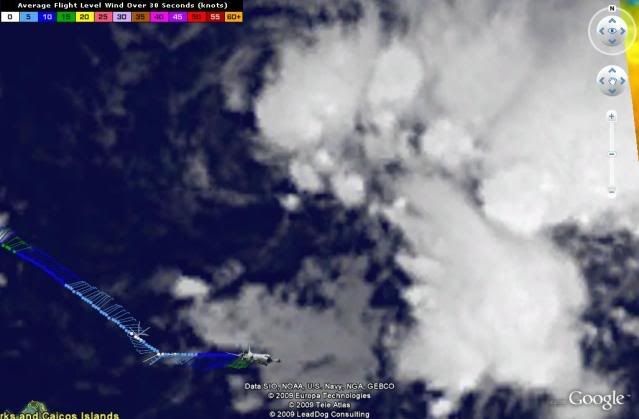
Re: ATL : Invest 92L - Recon Thread
Nowhere near the surface. They are still at nearly 4,000 meters.
Tho given the satellite imagery, I'm sure there is a closed circulation now.
Tho given the satellite imagery, I'm sure there is a closed circulation now.
0 likes

-
deltadog03

- Professional-Met
- Posts: 3580
- Joined: Tue Jul 05, 2005 6:16 pm
- Location: Macon, GA
-
deltadog03
- Professional-Met
- Posts: 3580
- Joined: Tue Jul 05, 2005 6:16 pm
- Location: Macon, GA
Re:
Aric Dunn wrote:Surface circ very evident... at
24.67° N 70.36W moving probably 265 to 270
about what I get as well.
0 likes
-
HURAKAN
- Professional-Met
- Posts: 46084
- Age: 39
- Joined: Thu May 20, 2004 4:34 pm
- Location: Key West, FL
- Contact:
URNT15 KWBC 261107
NOAA3 WXWXA AL92 HDOB 18 20090826
105730 2230N 07007W 6433 03857 0088 +062 +006 239008 008 999 999 03
105800 2230N 07004W 6433 03857 0087 +063 +005 237009 010 999 999 03
105830 2230N 07002W 6434 03857 0093 +060 +007 238010 010 999 999 03
105900 2230N 07000W 6433 03858 0091 +062 +009 225011 011 999 999 03
105930 2230N 06957W 6432 03858 0090 +062 +011 216012 012 999 999 03
110000 2230N 06955W 6435 03855 0089 +062 +012 218013 013 003 000 03
110030 2230N 06952W 6433 03857 0092 +061 +012 210011 012 006 000 03
110100 2230N 06950W 6434 03855 0091 +060 +011 206010 010 999 999 03
110130 2230N 06948W 6435 03853 0089 +061 +013 210010 010 004 000 03
110200 2230N 06945W 6435 03852 0089 +061 +010 218011 011 003 000 03
110230 2230N 06943W 6435 03853 0091 +060 +011 221012 012 004 000 03
110300 2230N 06940W 6434 03854 0093 +059 +011 220013 013 004 000 03
110330 2230N 06938W 6435 03854 0094 +059 +012 228013 013 004 000 03
110400 2230N 06936W 6434 03855 0095 +058 +012 233013 013 999 999 03
110430 2230N 06933W 6436 03853 0094 +059 +011 231014 015 005 000 03
110500 2230N 06931W 6436 03853 0091 +061 +006 226017 017 004 000 03
110530 2230N 06928W 6434 03855 0090 +062 +007 222017 018 006 000 03
110600 2230N 06926W 6434 03854 0088 +062 +008 217018 018 999 999 03
110630 2230N 06924W 6437 03852 0087 +063 +008 220019 019 006 000 03
110700 2230N 06921W 6434 03855 0086 +065 +007 222019 019 005 000 03
0 likes
-
Aric Dunn
- Category 5

- Posts: 21238
- Age: 43
- Joined: Sun Sep 19, 2004 9:58 pm
- Location: Ready for the Chase.
- Contact:
Re: Re:
deltadog03 wrote:Aric Dunn wrote:Surface circ very evident... at
24.67° N 70.36W moving probably 265 to 270
about what I get as well.
and according to a bouy nearly right under the circ with a north wind and pressure 1010mb
http://www.ndbc.noaa.gov/station_page.php?station=41046
also racing at about 20mph still with a ridge well in place... watches going out at 11am
in my opinion.
Last edited by Aric Dunn on Wed Aug 26, 2009 6:21 am, edited 1 time in total.
0 likes
Re: ATL: Invest 92L
Wind at the best positioned (23.867 N 70.870 W) buoy has backed from NE to N (350) so far, as of 0650.
0 likes
-
HURAKAN
- Professional-Met
- Posts: 46084
- Age: 39
- Joined: Thu May 20, 2004 4:34 pm
- Location: Key West, FL
- Contact:
URNT15 KWBC 261117
NOAA3 WXWXA AL92 HDOB 19 20090826
110730 2230N 06919W 6435 03857 0089 +064 +007 226018 018 004 000 03
110800 2230N 06916W 6436 03855 0090 +063 +007 232018 018 004 000 03
110830 2230N 06914W 6436 03855 0090 +063 +007 233017 018 005 000 03
110900 2230N 06911W 6436 03857 0093 +063 +006 231017 017 999 999 03
110930 2230N 06909W 6436 03857 0093 +063 +007 232015 016 005 000 03
111000 2230N 06906W 6436 03855 0092 +062 +008 235015 015 003 000 03
111030 2230N 06904W 6436 03857 0095 +060 +009 237014 015 004 000 03
111100 2230N 06901W 6436 03855 0093 +061 +009 236013 014 999 999 03
111130 2230N 06859W 6435 03857 0096 +060 +009 238012 013 005 000 03
111200 2230N 06856W 6436 03857 0097 +059 +012 235011 012 004 000 03
111230 2230N 06854W 6436 03857 0099 +058 +014 233012 013 006 000 03
111300 2230N 06851W 6436 03855 0098 +058 +012 226015 016 004 000 00
111330 2230N 06849W 6436 03856 0105 +054 +013 220017 017 006 000 03
111400 2231N 06846W 6436 03858 0104 +055 +013 218016 017 999 999 03
111430 2230N 06844W 6438 03853 0107 +053 +013 213017 018 005 000 03
111500 2230N 06841W 6435 03857 0108 +052 +014 217019 020 006 000 03
111530 2230N 06839W 6435 03857 0105 +054 +013 216018 018 005 000 03
111600 2230N 06836W 6434 03858 0106 +053 +014 215019 019 999 999 03
111630 2230N 06834W 6434 03855 0106 +051 +016 214020 020 006 000 03
111700 2230N 06831W 6436 03854 0106 +051 +017 212019 020 004 000 03
0 likes

No doubt about this having an LLC now, classic sheared presentation mind you with the convection lumped on the eastern side.
Now will be just a case of how strong the winds are aloft, are they still close to where they were yesterday?
Actually I wonder if this is another closed off eddy, looking at the position the winds turn back WSW very rapidly after the west wind was found, which would suggest the circulation was very close by?
I suppose we will know for sure when it gets closer to the main circulation.
Last edited by KWT on Wed Aug 26, 2009 6:31 am, edited 1 time in total.
0 likes

-
sfwx

- Category 1

- Posts: 371
- Age: 60
- Joined: Thu Sep 04, 2003 1:53 pm
- Location: Rural St. Lucie County, Fl
Re: ATL: Invest 92L
AREA FORECAST DISCUSSION
NATIONAL WEATHER SERVICE MELBOURNE FL
328 AM EDT WED AUG 26 2009
.DISCUSSION...
T
THU-FRI...PENINSULA WL BE IN THE MIDDLE OF TWO SYNOPTIC FEATURES
WITH A WEAK UPR LOW JUST UPSTREAM OVER THE NORTHERN GULF COAST
DRIFTING EWD. BIGGER ATTENTION REMAINS TURNED TOWARD TROPICAL
SYSTEM EAST OF THE AREA. LTST GUIDANCE SUGGESTS TRACK OF SLOWLY
RECURVING FEATURE REMAINING ALONG OR JUST EAST OF 75W WHICH WOULD
PLACE CLOSEST POINT OF APPROACH OF CENTER AROUND 350 MILES FROM
THE FLORIDA EAST COAST THURSDAY. GIVEN INFLUENCE OF THE UPR LOW
NEAR AREA WL KEEP SCT PRECIP IN FCST THU DESPITE TYPICALLY
UNFAVORABLE NE LL FLOW. THE UPR LOW ACROSS SE WL OPEN UP AND MOVE
EAST OF AREA INTO THE WEEKEND. LINGERING DEEP MOISTURE AND SSW
STEERING WL LEAD TO HIGHER PRECIP COVERAGE ACROSS AREA FRI/FRI
EVENING.
SHORT TERM...WEITLICH
LONG TERM....PENDERGRAST
0 likes
Re: ATL : Invest 92L - Recon Thread
Does anyone know if this mission will investigate the lower levels?
0 likes
Who is online
Users browsing this forum: No registered users and 60 guests