Australia: DOMINIC - Ex. Tropical Cyclone

Moderator: S2k Moderators

Message
Author
User avatar
HURAKAN
Professional-Met
Professional-Met
Posts: 46086
Age: 37
Joined: Thu May 20, 2004 4:34 pm
Location: Key West, FL
Contact:

Australia: DOMINIC - Ex. Tropical Cyclone

#1 Postby HURAKAN » Sat Jan 24, 2009 9:24 am

Australian Government Bureau of Meteorology
Western Australia

TROPICAL CYCLONE OUTLOOK FOR NORTHWESTERN AUSTRALIA
Issued at 5:54pm WDT on Saturday the 24th of January 2009
For the area south of LATITUDE 10 SOUTH between LONGITUDES 110 - 125 EAST

A weak tropical low lies over land to the north of Broome and is likely to move
west over the next few days. The low will be monitored for subsequent
development potential as it moves west.
There are no other tropical lows of interest or areas of cyclogenesis in the
region.

The likelihood of a tropical cyclone developing in the next three days is:
Sunday : Low
Monday : Moderate
Tuesday : Moderate


** NOTE: Development potential is an estimate of the probability of **
** tropical cyclone development within a 24 hour period. **
** LOW = 10% or less MODERATE = 20-40% HIGH = 50% or more **

Image
0 likes   

User avatar
HURAKAN
Professional-Met
Professional-Met
Posts: 46086
Age: 37
Joined: Thu May 20, 2004 4:34 pm
Location: Key West, FL
Contact:

#2 Postby HURAKAN » Sat Jan 24, 2009 9:27 am

AN AREA OF CONVECTION HAS PERSISTED NEAR 20.5S 126.1E, APPROXIMATELY 230 NM SOUTHWEST OF LEARMONTH, AUSTRALIA. ANIMATED WATER VAPOR IMAGERY SHOWS AN AREA OF DEEP CONVECTION THAT MOVED OFF-SHORE JUST SOUTH OF BROOME, AUSTRALIA OVER THE PAST SIX HOURS. RECENT WEATHER RADAR COMPOSITE REFLECTIVITY LOOP FROM BROOME INDICATES A LOW LEVEL CIRCULATION CENTER (LLCC) FLANKED BY A BAND OF MODERATE TO HEAVY SHOWERS ON THE NORTHWEST QUADRANT. A 241134Z SSMI MICROWAVE PASS SHOWS A CURVED BAND OF BROAD CONVECTION BEGINNING TO WRAP INTO THE LLCC. ENVIRONMENTAL ANALYSIS INDICATES THE SYSTEM IS IN AN AREA OF WARM SEA SURFACE TEMPERATURES WITH WEAK TO MODERATE VERTICAL WIND SHEAR ALOFT. MAXIMUM SUSTAINED SURFACE WINDS ARE ESTIMATED AT 15 TO 20 KNOTS AND MINIMUM SEA LEVEL AT 1004 MB. THE POTENTIAL FOR THE DEVELOPMENT OF A SIGNIFICANT TROPICAL CYCLONE WITHIN THE NEXT 24 HOURS IS POOR.
0 likes   

User avatar
HURAKAN
Professional-Met
Professional-Met
Posts: 46086
Age: 37
Joined: Thu May 20, 2004 4:34 pm
Location: Key West, FL
Contact:

#3 Postby HURAKAN » Sat Jan 24, 2009 9:32 am

Image
0 likes   

User avatar
HURAKAN
Professional-Met
Professional-Met
Posts: 46086
Age: 37
Joined: Thu May 20, 2004 4:34 pm
Location: Key West, FL
Contact:

#4 Postby HURAKAN » Sat Jan 24, 2009 10:32 am

Image

Accuweather.
0 likes   

User avatar
HURAKAN
Professional-Met
Professional-Met
Posts: 46086
Age: 37
Joined: Thu May 20, 2004 4:34 pm
Location: Key West, FL
Contact:

#5 Postby HURAKAN » Sat Jan 24, 2009 10:23 pm

Image

Image
0 likes   

User avatar
HURAKAN
Professional-Met
Professional-Met
Posts: 46086
Age: 37
Joined: Thu May 20, 2004 4:34 pm
Location: Key West, FL
Contact:

Re: NW Australia: Invest 90S - Discussion

#6 Postby HURAKAN » Sat Jan 24, 2009 10:44 pm

Image

WTXS21 PGTW 250330
MSGID/GENADMIN/NAVMARFCSTCEN PEARL HARBOR HI/JTWC//
SUBJ/TROPICAL CYCLONE FORMATION ALERT//
RMKS/
1. FORMATION OF A SIGNIFICANT TROPICAL CYCLONE IS POSSIBLE WITHIN
095 NM EITHER SIDE OF A LINE FROM 18.5S 119.1E TO 19.9S 114.9E
WITHIN THE NEXT 06 TO 24 HOURS. AVAILABLE DATA DOES NOT JUSTIFY
ISSUANCE OF NUMBERED TROPICAL CYCLONE WARNINGS AT THIS TIME.
WINDS IN THE AREA ARE ESTIMATED TO BE 27 TO 32 KNOTS. METSAT IM-
AGERY AT 242330Z INDICATES THAT A CIRCULATION CENTER IS LOCATED
NEAR 18.6S 118.8E. THE SYSTEM IS MOVING WEST-SOUTHWESTWARD AT 14
KNOTS.
2. REMARKS: THE AREA OF CONVECTION PREVIOUSLY LOCATED NEAR 18.0S
114.9E, IS NOW LOCATED NEAR 18.6S 118.8E, APPROXIMATELY 340 NM
NORTHEAST OF LEARMONTH, AUSTRALIA. ANIMATED WATER VAPOR IMAGERY
SHOWS AN AREA OF DEEP CONVECTION WITH GOOD EQUATORWARD OUTFLOW
AND A DEVELOPING POLAR OUTFLOW CHANNEL OFF-SHORE OF PORT HEDLAND,
AUSTRALIA. A RECENT WEATHER RADAR COMPOSITE REFLECTIVITY LOOP
FROM PORT HEDLAND INDICATES A WELL FORMED LOW LEVEL CIRCULATION
CENTER (LLCC) WITH TIGHT CONVECTIVE BANDING WRAPPING INTO THE
CENTER. UPPER LEVEL ANALYSIS INDICATES THE SYSTEM IS IN AN AREA OF
FAVORABLE VERTICAL WIND SHEAR. MAXIMUM SUSTAINED SURFACE WINDS ARE
ESTIMATED AT 27 TO 32 KNOTS. MINIMUM SEA LEVEL PRESSURE IS ESTIMATED
TO BE NEAR 1002 MB. DUE TO THE RAPID DEVELOPMENT OF THE LLCC, THE
POTENTIAL FOR THE DEVELOPMENT OF A SIGNIFICANT TROPICAL CYCLONE
WITHIN THE NEXT 24 HOURS IS GOOD.
3. THIS ALERT WILL BE REISSUED, UPGRADED TO WARNING OR CANCELLED BY
260330Z.
//
NNNN
0 likes   

User avatar
Chacor
Category 5
Category 5
Posts: 10229
Joined: Mon Oct 02, 2006 10:43 pm
Location: Singapore

#7 Postby Chacor » Sat Jan 24, 2009 11:07 pm

AXAU01 APRF 250306
IDW27600
TROPICAL CYCLONE TECHNICAL BULLETIN: AUSTRALIA - WESTERN REGION
Issued by PERTH TROPICAL CYCLONE WARNING CENTRE
at: 0306 UTC 25/01/2009
Name: Tropical Low
Data At: 0000 UTC
Latitude: 18.4S
Longitude: 118.9E
Location Accuracy: within 30 nm [55 km]
Movement Towards: west [260 deg]
Speed of Movement: 13 knots [23 km/h]
Maximum 10-Minute Wind: 25 knots [45 km/h]
Maximum 3-Second Wind Gust: 45 knots [85 km/h]
Central Pressure: 1000 hPa
Radius of 34-knot winds NE quadrant:
Radius of 34-knot winds SE quadrant:
Radius of 34-knot winds SW quadrant:
Radius of 34-knot winds NW quadrant:
Radius of 48-knot winds NE quadrant:
Radius of 48-knot winds SE quadrant:
Radius of 48-knot winds SW quadrant:
Radius of 48-knot winds NW quadrant:
Radius of 64-knot winds:
Radius of Maximum Winds: N/A
Dvorak Intensity Code:
Pressure of outermost isobar: 1002 hPa
Radius of outermost closed isobar: 45 nm [85 km]
Storm Depth: Deep
FORECAST DATA
Date/Time : Location : Loc. Accuracy: Max Wind : Central Pressure
[UTC] : degrees : nm [km]: knots[km/h]: hPa
+12: 25/1200: 18.9S 116.9E: 060 [110]: 030 [055]: 998
+24: 26/0000: 19.6S 115.4E: 090 [165]: 045 [085]: 987
+36: 26/1200: 20.1S 114.2E: 120 [225]: 055 [100]: 979
+48: 27/0000: 20.2S 114.0E: 155 [285]: 070 [130]: 965
+60: 27/1200: 21.0S 114.2E: 200 [375]: 070 [130]: 967
+72: 28/0000: 21.8S 114.6E: 250 [465]: 060 [110]: 974
REMARKS:
Shear over the system dropped rapidly between 25/1200UTC and 25/1800UTC and
system organisation has improved markedly. It is developing as a midget system
which is relatively common for systems developing in this region in an inactive
phase of the MJO.

Dvorak T1.0 was assigned at 24/0600UTC and is assigned at 1.5 at present though
2.0 could be argued for if it could be established that the low level
circulation is well defined with circular parallel low level cloud lines.
Although ambiguous there is some evidence of this in the microwave passes.

Since the system is so small and is currently in a very favourable environment
it is likely to develop rapidly. The steering pattern is relatively clear cut
with the mid-level ridge to the south expected to maintain westerly motion over
the next 24-36 hours before a weakness develops in the ridge as a shortwave
trough approaches, captures the system and moves it toward the west Pilbara
coast on Tuesday.

Copyright Commonwealth of Australia
==
The next bulletin for this system will be issued by: 25/0700 UTC by Perth TCWC.
0 likes   

User avatar
Chacor
Category 5
Category 5
Posts: 10229
Joined: Mon Oct 02, 2006 10:43 pm
Location: Singapore

#8 Postby Chacor » Sat Jan 24, 2009 11:11 pm

WTAU05 APRF 250230
IDW23100
40:3:1:24:18S119E999:11:00
SECURITE

HIGH SEAS WEATHER WARNING FOR METAREA 10 ISSUED BY THE
AUSTRALIAN BUREAU OF METEOROLOGY TROPICAL CYCLONE WARNING CENTRE PERTH
AT 0230UTC 25 JANUARY 2009

GALE WARNING

Please be aware, wind gusts can be a further 40 percent stronger than the
averages given here, and maximum waves may be up to twice the height.

SITUATION
At 0000 UTC a Tropical Low was centred within 30 nautical miles of
latitude eighteen decimal four south (18.4S)
longitude one hundred and eighteen decimal nine east (118.9E)
Recent movement : west at 13 knots
Maximum winds : 25 knots
Central pressure: 1000 hPa
The low is expected to develop into a tropical cyclone in the next 12 to 24
hours.

AREA AFFECTED
Within 60 nautical miles of the centre.

FORECAST

Maximum winds to 25 knots near the centre increasing to 45 knots by 0000 UTC 26
January.
From 1800 UTC 25 January winds above 34 knots within 60 nautical miles of
centre, with rough to very rough seas and moderate swell.
Forecast positions
At 1200 UTC 25 January: Within 60 nautical miles of 18.9 south 116.9 east
Central pressure 998 hPa.
Winds to 30 knots.
At 0000 UTC 26 January: Within 90 nautical miles of 19.6 south 115.4 east
Central pressure 987 hPa.
Winds to 45 knots near centre.

REMARKS
All ships in the area please send weather reports every three hours.
Regular weather observing ships use normal channels.
Other ships please use either email to tcwcwa@bom.gov.au or fax to +61892632261
or satellite to SAC 1241 through Land Earth Station Perth 312.

Next warning will be issued by 0700 UTC 25 January 2009.

WEATHER PERTH
0 likes   

User avatar
Crostorm
Category 5
Category 5
Posts: 2060
Age: 49
Joined: Mon Dec 25, 2006 3:51 pm
Location: Croatia-Europe
Contact:

Re: NW Australia: Invest 90S - Discussion - TCFA

#9 Postby Crostorm » Sun Jan 25, 2009 1:37 am

IDW24100
Australian Government Bureau of Meteorology
Western Australia

Media: The Standard Emergency Warning Signal should NOT be used with this
warning.

TOP PRIORITY FOR IMMEDIATE BROADCAST

TROPICAL CYCLONE ADVICE NUMBER 2
Issued at 1:00 pm WDT on Sunday, 25 January 2009
BY THE BUREAU OF METEOROLOGY
TROPICAL CYCLONE WARNING CENTRE PERTH

A Cyclone WARNING has been declared for coastal areas from Wickham to Exmouth.

At midday a developing tropical low was estimated to be
195 kilometres north of Port Hedland and
425 kilometres west of Broome and
moving west southwest at 23 kilometres per hour parallel to the Pilbara coast.

The low may develop into a tropical cyclone overnight as it continues moving
west southwest parallel to the coast. It is not expected to cause gales in
coastal areas today but gales could develop during Monday or Tuesday.

Details of Tropical Low at midday WDT:
.Centre located near...... 18.6 degrees South 118.2 degrees East
.Location accuracy........ within 46 kilometres
.Recent movement.......... towards the west southwest at 23 kilometres per hour
.Wind gusts near centre... 85 kilometres per hour
.Severity category........ below cyclone intensity
.Central pressure......... 1000 hectoPascals

FESA-State Emergency Service advises that there are no community alerts at
present.
Communities between Wickham and Exmouth should listen for the next advice.

The next advice will be issued by 4:00 pm WDT Sunday 25 January.
Cyclone advices and State Emergency Service Community Alerts are available by
dialling 1300 659 210


A map showing the track of the cyclone is available at:
http://www.bom.gov.au/weather/cyclone

Image
0 likes   

User avatar
Crostorm
Category 5
Category 5
Posts: 2060
Age: 49
Joined: Mon Dec 25, 2006 3:51 pm
Location: Croatia-Europe
Contact:

#10 Postby Crostorm » Sun Jan 25, 2009 1:44 am

Image
Image
0 likes   

User avatar
Chacor
Category 5
Category 5
Posts: 10229
Joined: Mon Oct 02, 2006 10:43 pm
Location: Singapore

#11 Postby Chacor » Sun Jan 25, 2009 2:14 am

AXAU01 APRF 250645
IDW27600
TROPICAL CYCLONE TECHNICAL BULLETIN: AUSTRALIA - WESTERN REGION
Issued by PERTH TROPICAL CYCLONE WARNING CENTRE
at: 0644 UTC 25/01/2009
Name: Tropical Low
Data At: 0600 UTC
Latitude: 18.7S
Longitude: 117.7E
Location Accuracy: within 25 nm [46 km]
Movement Towards: west southwest [255 deg]
Speed of Movement: 12 knots [22 km/h]
Maximum 10-Minute Wind: 30 knots [55 km/h]
Maximum 3-Second Wind Gust: 45 knots [85 km/h]
Central Pressure: 1000 hPa
Radius of 34-knot winds NE quadrant:
Radius of 34-knot winds SE quadrant:
Radius of 34-knot winds SW quadrant:
Radius of 34-knot winds NW quadrant:
Radius of 48-knot winds NE quadrant:
Radius of 48-knot winds SE quadrant:
Radius of 48-knot winds SW quadrant:
Radius of 48-knot winds NW quadrant:
Radius of 64-knot winds:
Radius of Maximum Winds:
Dvorak Intensity Code: T2.0/2.0/D1.0/24HRS
Pressure of outermost isobar: 1004 hPa
Radius of outermost closed isobar: 60 nm [110 km]
Storm Depth: Deep
FORECAST DATA
Date/Time : Location : Loc. Accuracy: Max Wind : Central Pressure
[UTC] : degrees : nm [km]: knots[km/h]: hPa
+12: 25/1800: 19.4S 115.9E: 060 [110]: 040 [075]: 991
+24: 26/0600: 19.9S 114.6E: 090 [165]: 050 [095]: 983
+36: 26/1800: 20.1S 114.0E: 120 [225]: 060 [110]: 973
+48: 27/0600: 20.4S 113.7E: 155 [285]: 070 [130]: 965
+60: 27/1800: 21.3S 114.1E: 200 [375]: 060 [110]: 973
+72: 28/0600: 22.2S 114.5E: 250 [465]: 050 [095]: 981
REMARKS:
Shear over the system dropped rapidly between 25/1200UTC and 25/1800UTC and
system organisation improved markedly. It is developing as a midget system which
is relatively common for systems developing in this region in an inactive phase
of the MJO.

Dvorak T1.0 was assigned at 24/0600UTC and DT/FT/CI is assigned at 2.0 at 0600
UTC based on a n average wrap of 0.3 evident in VIS imagery during the previous
3 hours.

Since the system is so small and is currently in a very favourable environment
it has potential to develop rapidly. The steering pattern is relatively clear
cut with the mid-level ridge to the south expected to maintain west southwest
motion over the next 24 hours before a weakness develops in the ridge as a
shortwave trough approaches, which should capture the system and move it toward
the west Pilbara coast on Tuesday. However, given its small size, it is also
possible that the system will rapidly shear apart under the influence of that
trough and weaken significantly before it can reach the coast.

Copyright Commonwealth of Australia
==
The next bulletin for this system will be issued by: 25/1300 UTC by Perth TCWC.
0 likes   

User avatar
Crostorm
Category 5
Category 5
Posts: 2060
Age: 49
Joined: Mon Dec 25, 2006 3:51 pm
Location: Croatia-Europe
Contact:

#12 Postby Crostorm » Sun Jan 25, 2009 2:25 am

IDW24100
Australian Government Bureau of Meteorology
Western Australia

Media: The Standard Emergency Warning Signal should NOT be used with this
warning.

TOP PRIORITY FOR IMMEDIATE BROADCAST

TROPICAL CYCLONE ADVICE NUMBER 3
Issued at 3:45 pm WDT on Sunday, 25 January 2009
BY THE BUREAU OF METEOROLOGY
TROPICAL CYCLONE WARNING CENTRE PERTH

A Cyclone WARNING has been declared for coastal areas from Wickham to Exmouth.

At 3:00 pm WDT a developing tropical low was estimated to be
205 kilometres north northwest of Port Hedland and
245 kilometres north northeast of Karratha and
moving west southwest at 22 kilometres per hour parallel to the Pilbara coast.

The low may develop into a tropical cyclone overnight as it continues moving
west southwest parallel to the coast. It is not expected to cause gales in
coastal areas this evening but gales could develop on Monday or Tuesday.

Details of Tropical Low at 3:00 pm WDT:
.Centre located near...... 18.7 degrees South 117.7 degrees East
.Location accuracy........ within 40 kilometres
.Recent movement.......... towards the west southwest at 22 kilometres per hour
.Wind gusts near centre... 85 kilometres per hour
.Severity category........ below cyclone intensity
.Central pressure......... 1000 hectoPascals

FESA-State Emergency Service advises that there are no community alerts at
present.
Communities between Wickham and Exmouth should listen for the next advice.
The next advice will be issued by 7:00 pm WDT Sunday 25 January.
Cyclone advices and State Emergency Service Community Alerts are available by
dialling 1300 659 210


A map showing the track of the cyclone is available at:
http://www.bom.gov.au/weather/cyclone
0 likes   

User avatar
Crostorm
Category 5
Category 5
Posts: 2060
Age: 49
Joined: Mon Dec 25, 2006 3:51 pm
Location: Croatia-Europe
Contact:

#13 Postby Crostorm » Sun Jan 25, 2009 5:51 am

IDW24100
Australian Government Bureau of Meteorology
Western Australia

Media: The Standard Emergency Warning Signal should NOT be used with this
warning.

TOP PRIORITY FOR IMMEDIATE BROADCAST

TROPICAL CYCLONE ADVICE NUMBER 4
Issued at 6:50 pm WDT on Sunday, 25 January 2009
BY THE BUREAU OF METEOROLOGY
TROPICAL CYCLONE WARNING CENTRE PERTH

A Cyclone WARNING has been declared for coastal areas from Wickham to Exmouth.

At 6:00 pm WDT a developing tropical low was estimated to be
215 kilometres northwest of Port Hedland and
205 kilometres north of Karratha and
moving west southwest at 21 kilometres per hour parallel to the Pilbara coast.

The low may develop into a tropical cyclone overnight as it continues moving
west southwest parallel to the coast. It is not expected to cause gales in
coastal areas on Sunday evening but gales could develop on Monday or Tuesday.

Details of Tropical Low at 6:00 pm WDT:
.Centre located near...... 18.9 degrees South 117.2 degrees East
.Location accuracy........ within 40 kilometres
.Recent movement.......... towards the west southwest at 21 kilometres per hour
.Wind gusts near centre... 85 kilometres per hour
.Severity category........ below cyclone intensity
.Central pressure......... 1000 hectoPascals

FESA-State Emergency Service advises of the following community alerts:
BLUE ALERT: People in or near the communities of Roebourne, Wickham, Point
Samson, Karratha, Dampier and surrounding communities should start taking
precautions.
Remaining communities between Wickham and Exmouth should listen for the next
advice.

The next advice will be issued by 10:00 pm WDT Sunday 25 January.
Cyclone advices and State Emergency Service Community Alerts are available by
dialling 1300 659 210


A map showing the track of the cyclone is available at:
http://www.bom.gov.au/weather/cyclone
0 likes   

User avatar
HURAKAN
Professional-Met
Professional-Met
Posts: 46086
Age: 37
Joined: Thu May 20, 2004 4:34 pm
Location: Key West, FL
Contact:

#14 Postby HURAKAN » Sun Jan 25, 2009 10:05 am

Image

Image

SUBJ: TROPICAL CYCLONE 10S (TEN) WARNING NR 001
REF/A/NAVMARFCSTCEN PEARL HARBOR HI/250321Z JAN 09//
AMPN/TROPICAL CYCLONE FORMATION ALERT//
WTXS31 PGTW 251500
1. TROPICAL CYCLONE 10S (TEN) WARNING NR 001
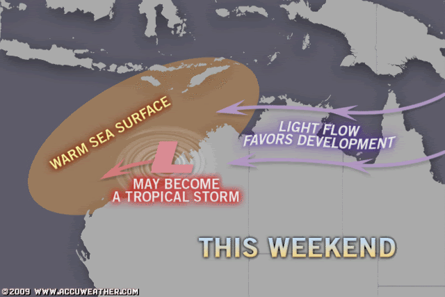
01 ACTIVE TROPICAL CYCLONE IN SOUTHIO
MAX SUSTAINED WINDS BASED ON ONE-MINUTE AVERAGE
---
WARNING POSITION:
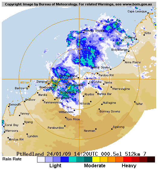
251200Z --- NEAR 19.3S 117.0E
MOVEMENT PAST SIX HOURS - 245 DEGREES AT 10 KTS
POSITION ACCURATE TO WITHIN 060 NM
POSITION BASED ON CENTER LOCATED BY A COMBINATION OF
SATELLITE AND RADAR
PRESENT WIND DISTRIBUTION:
MAX SUSTAINED WINDS - 025 KT, GUSTS 035 KT
WIND RADII VALID OVER OPEN WATER ONLY
REPEAT POSIT: 19.3S 117.0E
---
FORECASTS:
12 HRS, VALID AT:
260000Z --- 19.6S 115.6E
MAX SUSTAINED WINDS - 030 KT, GUSTS 040 KT
WIND RADII VALID OVER OPEN WATER ONLY
VECTOR TO 24 HR POSIT: 255 DEG/ 07 KTS
---
24 HRS, VALID AT:
261200Z --- 20.0S 114.2E
MAX SUSTAINED WINDS - 035 KT, GUSTS 045 KT
WIND RADII VALID OVER OPEN WATER ONLY
VECTOR TO 36 HR POSIT: 255 DEG/ 03 KTS
---
36 HRS, VALID AT:
270000Z --- 20.2S 113.5E
MAX SUSTAINED WINDS - 045 KT, GUSTS 055 KT
WIND RADII VALID OVER OPEN WATER ONLY
RADIUS OF 034 KT WINDS - 030 NM NORTHEAST QUADRANT
030 NM SOUTHEAST QUADRANT
040 NM SOUTHWEST QUADRANT
025 NM NORTHWEST QUADRANT
VECTOR TO 48 HR POSIT: 225 DEG/ 04 KTS
---
EXTENDED OUTLOOK:
48 HRS, VALID AT:
271200Z --- 20.8S 112.9E
MAX SUSTAINED WINDS - 055 KT, GUSTS 070 KT
WIND RADII VALID OVER OPEN WATER ONLY
RADIUS OF 034 KT WINDS - 035 NM NORTHEAST QUADRANT
035 NM SOUTHEAST QUADRANT
045 NM SOUTHWEST QUADRANT
030 NM NORTHWEST QUADRANT
VECTOR TO 72 HR POSIT: 095 DEG/ 04 KTS
---
72 HRS, VALID AT:
281200Z --- 21.0S 114.7E
MAX SUSTAINED WINDS - 065 KT, GUSTS 080 KT
WIND RADII VALID OVER OPEN WATER ONLY
RADIUS OF 050 KT WINDS - 020 NM NORTHEAST QUADRANT
020 NM SOUTHEAST QUADRANT
030 NM SOUTHWEST QUADRANT
015 NM NORTHWEST QUADRANT
RADIUS OF 034 KT WINDS - 045 NM NORTHEAST QUADRANT
045 NM SOUTHEAST QUADRANT
055 NM SOUTHWEST QUADRANT
040 NM NORTHWEST QUADRANT
---
REMARKS:
251500Z POSITION NEAR 19.4S 116.6E.

THIS WARNING SUPERSEDES AND CANCELS REF A, NAVMARFCSTCEN 250321Z
JAN 09 TROPICAL CYCLONE FORMATION ALERT (WTXS21 PGTW 250330 )
MAXIMUM SIGNIFICANT WAVE HEIGHT AT 251200Z IS 9 FEET.
NEXT WARNINGS AT 260300Z AND 261500Z.
0 likes   

User avatar
HURAKAN
Professional-Met
Professional-Met
Posts: 46086
Age: 37
Joined: Thu May 20, 2004 4:34 pm
Location: Key West, FL
Contact:

#15 Postby HURAKAN » Sun Jan 25, 2009 10:07 am

Australian Government Bureau of Meteorology
Western Australia

Media: The Standard Emergency Warning Signal should NOT be used with this
warning.

TOP PRIORITY FOR IMMEDIATE BROADCAST

TROPICAL CYCLONE ADVICE NUMBER 5
Issued at 9:40 pm WDT on Sunday, 25 January 2009
BY THE BUREAU OF METEOROLOGY
TROPICAL CYCLONE WARNING CENTRE PERTH

A Cyclone WARNING is current for coastal areas from Wickham to Exmouth.

At 9:00 pm WDT a developing tropical low was estimated to be
230 kilometres north of Karratha and
285 kilometres northwest of Port Hedland and
moving west at 21 kilometres per hour parallel to the Pilbara coast.

The low may develop into a tropical cyclone overnight as it moves west southwest
parallel to the coast. Gales may develop in coastal areas on Monday or Tuesday.

Details of Tropical Low at 9:00 pm WDT:
.Centre located near...... 18.7 degrees South 116.5 degrees East
.Location accuracy........ within 46 kilometres
.Recent movement.......... towards the west at 21 kilometres per hour
.Wind gusts near centre... 85 kilometres per hour
.Severity category........ below cyclone intensity
.Central pressure......... 999 hectoPascals

FESA-State Emergency Service advises of the following community alerts:
BLUE ALERT: People in or near the communities of Roebourne, Wickham, Point
Samson, Karratha, Dampier and surrounding communities should start taking
precautions.

The next advice will be issued by 1:00 am WDT Monday 26 January.
Cyclone advices and State Emergency Service Community Alerts are available by
dialling 1300 659 210


A map showing the track of the cyclone is available at:
http://www.bom.gov.au/weather/cyclone

Image
0 likes   

User avatar
HURAKAN
Professional-Met
Professional-Met
Posts: 46086
Age: 37
Joined: Thu May 20, 2004 4:34 pm
Location: Key West, FL
Contact:

#16 Postby HURAKAN » Sun Jan 25, 2009 10:20 am

Image
0 likes   

User avatar
HURAKAN
Professional-Met
Professional-Met
Posts: 46086
Age: 37
Joined: Thu May 20, 2004 4:34 pm
Location: Key West, FL
Contact:

#17 Postby HURAKAN » Sun Jan 25, 2009 12:04 pm

Australian Government Bureau of Meteorology
Western Australia

Media: The Standard Emergency Warning Signal should NOT be used with this
warning.

TOP PRIORITY FOR IMMEDIATE BROADCAST

TROPICAL CYCLONE ADVICE NUMBER 6
Issued at 1:05 am WDT on Monday, 26 January 2009
BY THE BUREAU OF METEOROLOGY
TROPICAL CYCLONE WARNING CENTRE PERTH

A Cyclone WARNING is current for coastal areas from Wickham to Exmouth.

At 12:00 am WDT a developing tropical low was estimated to be
235 kilometres north northwest of Karratha and
350 kilometres north northeast of Onslow and
moving west at 17 kilometres per hour parallel to the Pilbara coast.

The low may develop into a tropical cyclone later on Monday as it moves west
southwest parallel to the coast. Gales with wind gusts to 100 kilometres per
hour may develop in coastal areas on Tuesday if the cyclone takes a more
southerly track than expected.

Details of Tropical Low at 12:00 am WDT:
.Centre located near...... 18.7 degrees South 116.3 degrees East
.Location accuracy........ within 46 kilometres
.Recent movement.......... towards the west at 17 kilometres per hour
.Wind gusts near centre... 85 kilometres per hour
.Severity category........ below cyclone intensity
.Central pressure......... 998 hectoPascals

FESA-State Emergency Service advises of the following community alerts:
BLUE ALERT: People in or near the communities of Roebourne, Wickham, Point
Samson, Karratha, Dampier and surrounding communities should start taking
precautions.


The next advice will be issued by 4:00 am WDT Monday 26 January.
Cyclone advices and State Emergency Service Community Alerts are available by
dialling 1300 659 210


A map showing the track of the cyclone is available at:
http://www.bom.gov.au/weather/cyclone
0 likes   

CrazyC83
Professional-Met
Professional-Met
Posts: 33393
Joined: Tue Mar 07, 2006 11:57 pm
Location: Deep South, for the first time!

#18 Postby CrazyC83 » Sun Jan 25, 2009 1:44 pm

Looks to still be somewhat sheared, but probably a weak tropical storm of around 35 kt (per our standards).
0 likes   

User avatar
HURAKAN
Professional-Met
Professional-Met
Posts: 46086
Age: 37
Joined: Thu May 20, 2004 4:34 pm
Location: Key West, FL
Contact:

#19 Postby HURAKAN » Sun Jan 25, 2009 9:20 pm

Australian Government Bureau of Meteorology
Western Australia

Media: The Standard Emergency Warning Signal should NOT be used with this
warning.

TOP PRIORITY FOR IMMEDIATE BROADCAST

TROPICAL CYCLONE ADVICE NUMBER 9
Issued at 9:45 am WDT on Monday, 26 January 2009
BY THE BUREAU OF METEOROLOGY
TROPICAL CYCLONE WARNING CENTRE PERTH

A Cyclone WARNING is current for coastal areas from Whim Creek to Exmouth.

At 9:00 am WDT a developing tropical low was estimated to be
205 kilometres north northwest of Karratha and
315 kilometres north northeast of Onslow and
moving southwest at 5 kilometres per hour.

The low may develop into a tropical cyclone later today or tonight as it moves
closer to the west Pilbara coast. Gales with wind gusts to 100 kilometres per
hour may develop in coastal areas overnight tonight or during Tuesday.

Details of Tropical Low at 9:00 am WDT:
.Centre located near...... 19.0 degrees South 116.2 degrees East
.Location accuracy........ within 46 kilometres
.Recent movement.......... towards the southwest at 5 kilometres per hour
.Wind gusts near centre... 85 kilometres per hour
.Severity category........ below cyclone intensity
.Central pressure......... 996 hectoPascals

FESA-State Emergency Service advises of the following community alerts:
BLUE ALERT: People in or near the communities of Roebourne, Wickham, Point
Samson, Karratha, Dampier and surrounding communities should start taking
precautions.


The next advice will be issued by 1:00 pm WDT Monday 26 January.
Cyclone advices and State Emergency Service Community Alerts are available by
dialling 1300 659 210


A map showing the track of the cyclone is available at:
http://www.bom.gov.au/weather/cyclone
0 likes   

User avatar
Chacor
Category 5
Category 5
Posts: 10229
Joined: Mon Oct 02, 2006 10:43 pm
Location: Singapore

Re:

#20 Postby Chacor » Sun Jan 25, 2009 9:25 pm

CrazyC83 wrote:Looks to still be somewhat sheared, but probably a weak tropical storm of around 35 kt (per our standards).


Obviously not given it was 30 kt from the JTWC at 18z and still is at 00z.
0 likes   


Return to “2009”

Who is online

Users browsing this forum: No registered users and 70 guests