CPAC: TROPICAL DEPRESSION MAKA (01C)

Moderator: S2k Moderators

Message
Author
RL3AO
Moderator-Pro Met
Moderator-Pro Met
Posts: 16308
Joined: Thu Jun 14, 2007 10:03 pm
Location: NC

CPAC: TROPICAL DEPRESSION MAKA (01C)

#1 Postby RL3AO » Sat Aug 08, 2009 9:01 pm

Image

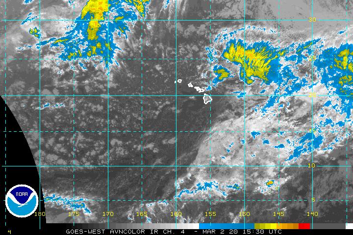
2. An area of thunderstorms centered about 625 miles south southwest of Hilo, Hawaii is moving west northwest around 15 mph. Slow development is possible over the next two days
0 likes   

User avatar
HURAKAN
Professional-Met
Professional-Met
Posts: 46086
Age: 37
Joined: Thu May 20, 2004 4:34 pm
Location: Key West, FL
Contact:

#2 Postby HURAKAN » Sat Aug 08, 2009 10:12 pm

Image

Looks like your El Niño at work
0 likes   

Cyclone1
Category 5
Category 5
Posts: 2739
Age: 32
Joined: Tue Jun 12, 2007 12:03 pm
Location: Florida

#3 Postby Cyclone1 » Sun Aug 09, 2009 10:44 am

Looks pretty decent. Wonder what reaction, if any, this will have with Felicia.
0 likes   

RL3AO
Moderator-Pro Met
Moderator-Pro Met
Posts: 16308
Joined: Thu Jun 14, 2007 10:03 pm
Location: NC

#4 Postby RL3AO » Sun Aug 09, 2009 2:52 pm

BEGIN
CPHC_ATCF
invest_DEACTIVATE_cp922009.ren
FSTDA
R
U
040
010
0000
200908090936
NONE
NOTIFY=ATRP
END
0 likes   

User avatar
cycloneye
Admin
Admin
Posts: 139141
Age: 67
Joined: Thu Oct 10, 2002 10:54 am
Location: San Juan, Puerto Rico

Re: CPAC: INVEST 92C

#5 Postby cycloneye » Sun Aug 09, 2009 2:59 pm

:uarrow: That was quick :)
0 likes   

User avatar
Kingarabian
S2K Supporter
S2K Supporter
Posts: 15437
Joined: Sat Aug 08, 2009 3:06 am
Location: Honolulu, Hawaii

#6 Postby Kingarabian » Sun Aug 09, 2009 5:20 pm

Image

Looks like it has a legit mite chance to make a turn back to the island's chain
0 likes   

User avatar
hawaiigirl
Tropical Depression
Tropical Depression
Posts: 51
Age: 39
Joined: Thu Aug 06, 2009 6:38 pm

Re: CPAC: INVEST 92C

#7 Postby hawaiigirl » Mon Aug 10, 2009 6:09 pm

looks like its a busy season for the islands...i wonder if this one will come close to us
0 likes   

RL3AO
Moderator-Pro Met
Moderator-Pro Met
Posts: 16308
Joined: Thu Jun 14, 2007 10:03 pm
Location: NC

#8 Postby RL3AO » Mon Aug 10, 2009 6:15 pm

Invest reactivated, special TWO issued.

2. Visible imagery indicates that an area of low pressure located about 925 miles southwest of the Hawaiian islands has become better organized during the past few hours. Conditions appear favorable for additional development, and this system could become a tropical depression later today or tonight as it moves westward at about 15 mph.
0 likes   

clfenwi
Category 5
Category 5
Posts: 3331
Joined: Thu Jun 09, 2005 12:54 pm

Re: CPAC: INVEST 92C

#9 Postby clfenwi » Mon Aug 10, 2009 6:16 pm

10/2100 UTC 13.2N 169.7W T1.5/1.5 92C -- Central Pacific
0 likes   

User avatar
Cookie
S2K Supporter
S2K Supporter
Posts: 477
Age: 36
Joined: Sun Dec 14, 2008 11:13 am
Location: Isle Of lewis scotland

Re:

#10 Postby Cookie » Mon Aug 10, 2009 6:19 pm

RL3AO wrote:Invest reactivated, special TWO issued.

2. Visible imagery indicates that an area of low pressure located about 925 miles southwest of the Hawaiian islands has become better organized during the past few hours. Conditions appear favorable for additional development, and this system could become a tropical depression later today or tonight as it moves westward at about 15 mph.


how do you mean reactivated?

their was nothing in here saying that it was taken off at any time?
0 likes   

RL3AO
Moderator-Pro Met
Moderator-Pro Met
Posts: 16308
Joined: Thu Jun 14, 2007 10:03 pm
Location: NC

Re: Re:

#11 Postby RL3AO » Mon Aug 10, 2009 6:21 pm

Cookie wrote:
RL3AO wrote:Invest reactivated, special TWO issued.

2. Visible imagery indicates that an area of low pressure located about 925 miles southwest of the Hawaiian islands has become better organized during the past few hours. Conditions appear favorable for additional development, and this system could become a tropical depression later today or tonight as it moves westward at about 15 mph.


how do you mean reactivated?

their was nothing in here saying that it was taken off at any time?


Six posts up.

http://www.storm2k.org/phpbb2/viewtopic.php?p=1899622#p1899622
0 likes   

User avatar
Cookie
S2K Supporter
S2K Supporter
Posts: 477
Age: 36
Joined: Sun Dec 14, 2008 11:13 am
Location: Isle Of lewis scotland

#12 Postby Cookie » Mon Aug 10, 2009 6:24 pm

man, sorry its late, I completely missed that, ( half asleep)
0 likes   

RL3AO
Moderator-Pro Met
Moderator-Pro Met
Posts: 16308
Joined: Thu Jun 14, 2007 10:03 pm
Location: NC

#13 Postby RL3AO » Mon Aug 10, 2009 7:32 pm

Prob of RI for 25 kt RI threshold= 75% is 6.6 times the sample mean(11.5%)
Prob of RI for 30 kt RI threshold= 52% is 6.7 times the sample mean( 7.7%)
Prob of RI for 35 kt RI threshold= 33% is 6.3 times the sample mean( 5.2%)


:eek: :eek: :eek:
0 likes   

User avatar
HURAKAN
Professional-Met
Professional-Met
Posts: 46086
Age: 37
Joined: Thu May 20, 2004 4:34 pm
Location: Key West, FL
Contact:

#14 Postby HURAKAN » Mon Aug 10, 2009 8:04 pm

11/0000 UTC 13.7N 170.3W T2.0/2.0 92C -- Central Pacific

Image

That was fast!
0 likes   

User avatar
HURAKAN
Professional-Met
Professional-Met
Posts: 46086
Age: 37
Joined: Thu May 20, 2004 4:34 pm
Location: Key West, FL
Contact:

Re: CPAC: INVEST 92C

#15 Postby HURAKAN » Mon Aug 10, 2009 8:06 pm

1200 PM HST MON AUG 10 2009

FOR THE CENTRAL NORTH PACIFIC...BETWEEN 140W AND 180

This special tropical weather outlook is being issued to provide updated information on the system located 925 miles southwest of the Hawaiian islands.

1. The Central Pacific Hurricane Center is issuing bulletins on tropical storm Felicia, currently about 270 miles east-northeast of Hilo, Hawaii and moving west about 10 mph. Public bulletins are being issued under AWIPS header TCPCP2 and WMO header WTPA32.

2. Visible imagery indicates that an area of low pressure located about 925 miles southwest of the Hawaiian islands has become better organized during the past few hours. Conditions appear favorable for additional development, and this system could become a tropical depression later today or tonight as it moves westward at about 15 mph.

Elsewhere, no tropical cyclones are expected through Wednesday morning.

Image
0 likes   

RL3AO
Moderator-Pro Met
Moderator-Pro Met
Posts: 16308
Joined: Thu Jun 14, 2007 10:03 pm
Location: NC

Re: CPAC: INVEST 92C

#16 Postby RL3AO » Mon Aug 10, 2009 8:13 pm

BEGIN
CPHC_ATCF
invest_RENUMBER_cp922009_cp022009.ren
FSTDA
R
U
040
010
0000
200908101444
NONE
NOTIFY=ATRP
END
0 likes   

User avatar
HURAKAN
Professional-Met
Professional-Met
Posts: 46086
Age: 37
Joined: Thu May 20, 2004 4:34 pm
Location: Key West, FL
Contact:

#17 Postby HURAKAN » Mon Aug 10, 2009 8:14 pm

Image

Image

Looking good in the visible but the convection is weak
0 likes   

User avatar
HURAKAN
Professional-Met
Professional-Met
Posts: 46086
Age: 37
Joined: Thu May 20, 2004 4:34 pm
Location: Key West, FL
Contact:

Re: CPAC: INVEST 92C

#18 Postby HURAKAN » Mon Aug 10, 2009 8:17 pm

RL3AO wrote:BEGIN
CPHC_ATCF
invest_RENUMBER_cp922009_cp022009.ren
FSTDA
R
U
040
010
0000
200908101444
NONE
NOTIFY=ATRP
END


Why 02? Lana was a EPAC system that crossed into the CPAC.
0 likes   

User avatar
HURAKAN
Professional-Met
Professional-Met
Posts: 46086
Age: 37
Joined: Thu May 20, 2004 4:34 pm
Location: Key West, FL
Contact:

#19 Postby HURAKAN » Mon Aug 10, 2009 8:19 pm

BEGIN
CPHC_ATCF
invest_cp012009.invest
FSTDA
R
U
040
010
0000
200908101500
NONE
NOTIFY=ATRP
END
ONE, CP, C, , , , , 01, 2009, DB, O, 2009080818, 9999999999, , , , , , METWATCH, , CP012009
CP, 01, 2009080818, , BEST, 0, 100N, 1590W, 25, 1009, DB, 0, , 0, 0, 0, 0,
CP, 01, 2009080900, , BEST, 0, 107N, 1602W, 15, 1012, DB, 0, , 0, 0, 0, 0,
CP, 01, 2009080906, , BEST, 0, 112N, 1614W, 20, 1011, DB, 0, , 0, 0, 0, 0, 1012, 150, 0, 0, 0, C, 0, , 0, 0, INVEST, M,
CP, 01, 2009080912, , BEST, 0, 117N, 1625W, 20, 1011, DB, 0, , 0, 0, 0, 0, 1012, 50, 0, 0, 0, C, 0, , 0, 0, INVEST, M,
CP, 01, 2009080918, , BEST, 0, 120N, 1637W, 20, 1011, DB, 0, , 0, 0, 0, 0,
CP, 01, 2009081000, , BEST, 0, 123N, 1650W, 20, 1011, DB, 0, , 0, 0, 0, 0,
CP, 01, 2009081006, , BEST, 0, 125N, 1663W, 20, 1011, DB, 0, , 0, 0, 0, 0,
CP, 01, 2009081012, , BEST, 0, 128N, 1676W, 20, 1010, DB, 0, , 0, 0, 0, 0,
CP, 01, 2009081018, , BEST, 0, 131N, 1688W, 25, 1009, DB, 0, , 0, 0, 0, 0, 1012, 120, 25, 0, 0, C, 0, , 0, 0, INVEST, M,
CP, 01, 2009081100, , BEST, 0, 135N, 1700W, 30, 1007, TD, 34, NEQ, 0, 0, 0, 0, 1012, 120, 25, 0, 0, C, 0, , 0, 0, ONE, D,


CP 01. It makes more sense now.
0 likes   

User avatar
Kingarabian
S2K Supporter
S2K Supporter
Posts: 15437
Joined: Sat Aug 08, 2009 3:06 am
Location: Honolulu, Hawaii

#20 Postby Kingarabian » Mon Aug 10, 2009 8:38 pm

Image It looks like it will turn back to the states... Why is this?

Edit: Also looks like it will be a pretty powerful storm.

Image
0 likes   


Return to “2009”

Who is online

Users browsing this forum: No registered users and 68 guests