ATL: LISA - Ex-Hurricane - Discussion

Moderator: S2k Moderators

Message
Author
Florida1118
Category 5
Category 5
Posts: 1805
Age: 27
Joined: Sat Jun 19, 2010 12:57 pm
Location: Tampa, Florida

Re: ATL : INVEST 94L - Discussion

#21 Postby Florida1118 » Sat Sep 18, 2010 12:53 pm

SHOWERS AND THUNDERSTORMS ASSOCIATED WITH A BROAD LOW PRESSURE AREA
LOCATED A COUPLE HUNDRED MILES SOUTHWEST OF THE CAPE VERDE ISLANDS
HAVE CHANGED LITTLE IN ORGANIZATION DURING THE LAST SEVERAL HOURS.
ENVIRONMENTAL CONDITIONS APPEAR SOMEWHAT CONDUCIVE FOR ADDITIONAL
GRADUAL DEVELOPMENT OF THIS DISTURBANCE DURING THE NEXT COUPLE OF
DAYS AS IT MOVES SLOWLY WEST-NORTHWESTWARD. THERE IS A MEDIUM
CHANCE...30 PERCENT...OF THIS SYSTEM BECOMING A TROPICAL CYCLONE
DURING THE NEXT 48 HOURS.
Image
0 likes   

User avatar
HURAKAN
Professional-Met
Professional-Met
Posts: 46086
Age: 37
Joined: Thu May 20, 2004 4:34 pm
Location: Key West, FL
Contact:

#22 Postby HURAKAN » Sat Sep 18, 2010 2:16 pm

Image

Pic of the SAL
0 likes   

User avatar
HurricaneMaster_PR
Category 2
Category 2
Posts: 795
Joined: Tue Jul 22, 2003 6:23 pm
Location: San Juan, Puerto Rico

Re: ATL : INVEST 94L - Discussion

#23 Postby HurricaneMaster_PR » Sat Sep 18, 2010 2:40 pm

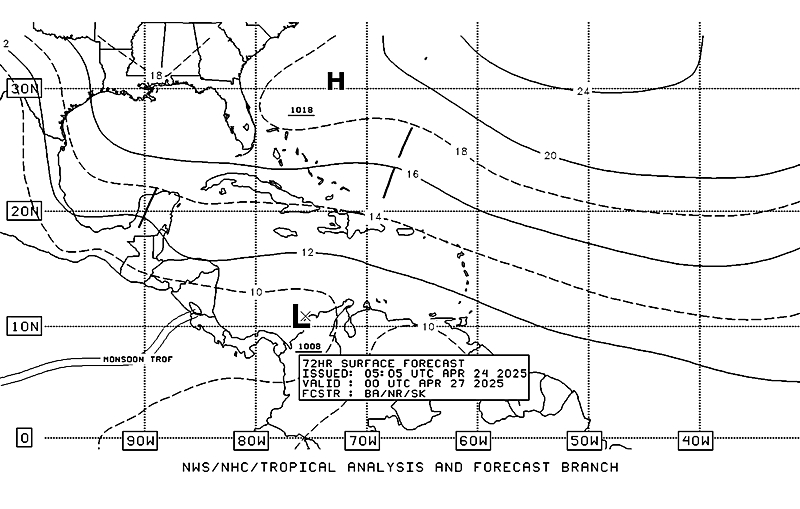
TAFB=72 hours Surface Analysis Forecast
Image
0 likes   

User avatar
HURAKAN
Professional-Met
Professional-Met
Posts: 46086
Age: 37
Joined: Thu May 20, 2004 4:34 pm
Location: Key West, FL
Contact:

#24 Postby HURAKAN » Sat Sep 18, 2010 3:27 pm

Looking at the recent loops, it seems 94L has a nice MLC or LLC. Outflow appears to be establishing too.
0 likes   

CrazyC83
Professional-Met
Professional-Met
Posts: 33398
Joined: Tue Mar 07, 2006 11:57 pm
Location: Deep South, for the first time!

#25 Postby CrazyC83 » Sat Sep 18, 2010 3:31 pm

If it can stay low, we might have yet another Cape Verde threat...but this might be the lid-closer for that.
0 likes   

User avatar
alan1961
Category 2
Category 2
Posts: 767
Joined: Mon Mar 20, 2006 11:58 am
Location: Derby, Derbyshire, England
Contact:

Re: ATL : INVEST 94L - Discussion

#26 Postby alan1961 » Sat Sep 18, 2010 4:04 pm

Yes a good lot of dry air to the north and west for Injest 94L :lol:
Image
0 likes   

User avatar
HURAKAN
Professional-Met
Professional-Met
Posts: 46086
Age: 37
Joined: Thu May 20, 2004 4:34 pm
Location: Key West, FL
Contact:

#27 Postby HURAKAN » Sat Sep 18, 2010 4:37 pm

Image

May be a little too early but here you got it!
0 likes   

User avatar
wxman57
Moderator-Pro Met
Moderator-Pro Met
Posts: 22505
Age: 66
Joined: Sat Jun 21, 2003 8:06 pm
Location: Houston, TX (southwest)

Re: ATL : INVEST 94L - Discussion

#28 Postby wxman57 » Sat Sep 18, 2010 5:40 pm

94L looks considerably more like a TS than Julia.
0 likes   

User avatar
HURAKAN
Professional-Met
Professional-Met
Posts: 46086
Age: 37
Joined: Thu May 20, 2004 4:34 pm
Location: Key West, FL
Contact:

#29 Postby HURAKAN » Sat Sep 18, 2010 5:41 pm

Image

Yeah, looks to be improving
0 likes   

User avatar
Ptarmigan
Category 5
Category 5
Posts: 5273
Joined: Wed Aug 16, 2006 9:06 pm

Re:

#30 Postby Ptarmigan » Sat Sep 18, 2010 6:18 pm

HURAKAN wrote:http://rapidfire.sci.gsfc.nasa.gov/realtime/2010261/crefl1_143.A2010261121000-2010261121500.2km.jpg

Pic of the SAL


It's RAID for tropical waves. :lol:
0 likes   

User avatar
cycloneye
Admin
Admin
Posts: 139593
Age: 67
Joined: Thu Oct 10, 2002 10:54 am
Location: San Juan, Puerto Rico

Re: ATL : INVEST 94L - Discussion

#31 Postby cycloneye » Sat Sep 18, 2010 6:36 pm

8 PM Tropical Weather Outlook=Up to 40%

A LOW PRESSURE SYSTEM LOCATED A COUPLE HUNDRED MILES WEST OF THE
CAPE VERDE ISLANDS IS MOVING WESTWARD AT 5 TO 10 MPH. THUNDERSTORM
ACTIVITY HAS INCREASED DURING THE PAST FEW HOURS AND ENVIRONMENTAL
CONDITIONS ARE GRADUALLY BECOMING MORE FAVORABLE FOR ADDITIONAL
DEVELOPMENT OF THIS DISTURBANCE. THERE IS A MEDIUM CHANCE...
40 PERCENT...OF THIS SYSTEM BECOMING A TROPICAL CYCLONE DURING
THE NEXT 48 HOURS.

Image
0 likes   
Visit the Caribbean-Central America Weather Thread where you can find at first post web cams,radars
and observations from Caribbean basin members Click Here

Weatherfreak000

#32 Postby Weatherfreak000 » Sat Sep 18, 2010 7:07 pm

I am shocked that we have a clearly developing system..and everyone is over in talking tropics buzzing about a system that doesn't even exist yet! :lol:
0 likes   

User avatar
expat2carib
S2K Supporter
S2K Supporter
Posts: 458
Joined: Tue Jul 22, 2008 1:44 pm
Location: Sint Maarten

Re: ATL : INVEST 94L - Discussion

#33 Postby expat2carib » Sat Sep 18, 2010 7:35 pm

:uarrow:

It's because those pouches might be a US hit. This one is not. Probably a fish is the mental pattern. The islands..... Yeah that's not the US. So what the h...?
0 likes   

User avatar
southerngale
Retired Staff
Retired Staff
Posts: 27420
Joined: Thu Oct 10, 2002 1:27 am
Location: Southeast Texas (Beaumont area)

Re:

#34 Postby southerngale » Sat Sep 18, 2010 7:36 pm

Weatherfreak000 wrote:I am shocked that we have a clearly developing system..and everyone is over in talking tropics buzzing about a system that doesn't even exist yet! :lol:


I'm not. IF the other system(s) develops, it would affect land sooner than 94L would, if it ever does. While you have weather junkies that follow/track everything, the majority of people are interested in what could possibly affect them or people they know.
0 likes   
Please support Storm2k by making a donation today. It is greatly appreciated! Click here: Image

Image my Cowboys Image my RocketsImage my Astros

User avatar
southerngale
Retired Staff
Retired Staff
Posts: 27420
Joined: Thu Oct 10, 2002 1:27 am
Location: Southeast Texas (Beaumont area)

Re: ATL : INVEST 94L - Discussion

#35 Postby southerngale » Sat Sep 18, 2010 7:44 pm

expat2carib wrote::uarrow:

It's because those pouches might be a US hit. This one is not. Probably a fish is the mental pattern. The islands..... Yeah that's not the US. So what the h...?


Good grief. The other areas being talked about could affect the islands too, depending on where they actually form, if they even do form. And if I'm not mistaken, the current model runs for 94L imply it will likely miss the islands (of course they could change).

Anyway, the majority of people are naturally more interested in what could affect land, and yes, even more people are interested in what could affect them. That's just natural.
0 likes   
Please support Storm2k by making a donation today. It is greatly appreciated! Click here: Image

Image my Cowboys Image my RocketsImage my Astros

User avatar
expat2carib
S2K Supporter
S2K Supporter
Posts: 458
Joined: Tue Jul 22, 2008 1:44 pm
Location: Sint Maarten

Re: ATL : INVEST 94L - Discussion

#36 Postby expat2carib » Sat Sep 18, 2010 7:58 pm

southerngale wrote:
expat2carib wrote::uarrow:

It's because those pouches might be a US hit. This one is not. Probably a fish is the mental pattern. The islands..... Yeah that's not the US. So what the h...?


Good grief. The other areas being talked about could affect the islands too, depending on where they actually form, if they even do form. And if I'm not mistaken, the current model runs for 94L imply it will likely miss the islands (of course they could change).

Anyway, the majority of people are naturally more interested in what could affect land, and yes, even more people are interested in what could affect them. That's just natural.


It's because those pouches might be a US hit. This one is not. Probably a fish is the mental pattern.


This one is not a CONUS hit is what I'm saying.

And i recognize that people are generally looking at their own navel. That's more or less natural. I guess.

Back on topic. Still going WNW.
0 likes   

User avatar
Ptarmigan
Category 5
Category 5
Posts: 5273
Joined: Wed Aug 16, 2006 9:06 pm

Re: ATL : INVEST 94L - Discussion

#37 Postby Ptarmigan » Sat Sep 18, 2010 8:47 pm

We need cans of RAID to suppress any tropical cyclone development. These tropical waves are like cockroaches. :lol: :grrr:
0 likes   

Weatherfreak000

Re: Re:

#38 Postby Weatherfreak000 » Sat Sep 18, 2010 9:31 pm

southerngale wrote:
Weatherfreak000 wrote:I am shocked that we have a clearly developing system..and everyone is over in talking tropics buzzing about a system that doesn't even exist yet! :lol:


I'm not. IF the other system(s) develops, it would affect land sooner than 94L would, if it ever does. While you have weather junkies that follow/track everything, the majority of people are interested in what could possibly affect them or people they know.


I know, I know and i'm telling you most of the time I would be in the same boat...but good grief I like to at least wait for a trackable surface feature. It seems kinda silly when you have 20 pages of essentially model run discussion and the storm never even forms I have seen it happen :lol:
0 likes   

User avatar
HURAKAN
Professional-Met
Professional-Met
Posts: 46086
Age: 37
Joined: Thu May 20, 2004 4:34 pm
Location: Key West, FL
Contact:

#39 Postby HURAKAN » Sat Sep 18, 2010 9:41 pm

Image

In other news, recent pic of 94L
0 likes   

User avatar
brunota2003
S2K Supporter
S2K Supporter
Posts: 9476
Age: 33
Joined: Sat Jul 30, 2005 9:56 pm
Location: Stanton, KY...formerly Havelock, NC
Contact:

#40 Postby brunota2003 » Sat Sep 18, 2010 9:48 pm

I've been watching both...really, I can't receive a direct hit by a TC here in NW New York (other than the remnants, or if one hit NYC moving NW...which is about as likely as me being hit in the foot by a meteor). I just "love" to watch the tropics, and study them. To be honest, 94L looked a lot better earlier, but maybe it'll be another one of those that takes a few days to spin up because DMIN is always mean to it.
0 likes   


Return to “2010”

Who is online

Users browsing this forum: No registered users and 10 guests