ATL : INVEST 90L
Moderator: S2k Moderators
-
Hurricane Andrew

- S2K Supporter

- Posts: 1891
- Age: 27
- Joined: Sun May 23, 2010 2:53 pm
- Location: KS

-
cwachal
-
Hurricane Andrew
- S2K Supporter
- Posts: 1891
- Age: 27
- Joined: Sun May 23, 2010 2:53 pm
- Location: KS
-
pepeavilenho
- Tropical Storm

- Posts: 171
- Joined: Thu Jul 09, 2009 12:01 pm

Yeah I'm calling this one done now, convecion really has decreased and its as far as ever from developing and thew waters its moving into only get cooler from now on...
0 likes
Personal Forecast Disclaimer:
The posts in this forum are NOT official forecast and should not be used as such. They are just the opinion of the poster and may or may not be backed by sound meteorological data. They are NOT endorsed by any professional institution or storm2k.org. For official information, please refer to the NHC and NWS products
The posts in this forum are NOT official forecast and should not be used as such. They are just the opinion of the poster and may or may not be backed by sound meteorological data. They are NOT endorsed by any professional institution or storm2k.org. For official information, please refer to the NHC and NWS products
-
tolakram
- Admin

- Posts: 20186
- Age: 62
- Joined: Sun Aug 27, 2006 8:23 pm
- Location: Florence, KY (name is Mark)
Re: ATL : INVEST 90L=CODE YELLOW
Perhaps.
http://wwwghcc.msfc.nasa.gov/cgi-bin/ge ... mframes=18
Pretty storm, and looks to me more organized ... but not more tropical at the moment. If that convection near the center can persist then the storm may have a chance, especially if it stalls near the gulf stream.

It's moving NNW with a turn to more NW expected, so in my opinion it's moving into more favorable conditions, not less.
http://wwwghcc.msfc.nasa.gov/cgi-bin/ge ... mframes=18
Pretty storm, and looks to me more organized ... but not more tropical at the moment. If that convection near the center can persist then the storm may have a chance, especially if it stalls near the gulf stream.
It's moving NNW with a turn to more NW expected, so in my opinion it's moving into more favorable conditions, not less.
0 likes
M a r k
- - - - -
Join us in chat: Storm2K Chatroom Invite. Android and IOS apps also available.
The posts in this forum are NOT official forecasts and should not be used as such. Posts are NOT endorsed by any professional institution or STORM2K.org. For official information and forecasts, please refer to NHC and NWS products.

Re: ATL : INVEST 90L=CODE YELLOW
Everyone jumping off, but it looks as good as it has in a while to me. LLC looks better defined and the convection is starting to fire near the still broad but better defined center, which will/would be the only way it could develop. Ill give it till tonite before I start calling for Bones!
0 likes
The following post is NOT an official forecast and should not be used as such. It is just the opinion of the poster and may or may not be backed by sound meteorological data. It is NOT endorsed by any professional institution including storm2k.org For Official Information please refer to the NHC and NWS products.
-
tolakram
- Admin
- Posts: 20186
- Age: 62
- Joined: Sun Aug 27, 2006 8:23 pm
- Location: Florence, KY (name is Mark)
Re: ATL : INVEST 90L=CODE YELLOW

0 likes
M a r k
- - - - -
Join us in chat: Storm2K Chatroom Invite. Android and IOS apps also available.
The posts in this forum are NOT official forecasts and should not be used as such. Posts are NOT endorsed by any professional institution or STORM2K.org. For official information and forecasts, please refer to NHC and NWS products.
- - - - -
Join us in chat: Storm2K Chatroom Invite. Android and IOS apps also available.
The posts in this forum are NOT official forecasts and should not be used as such. Posts are NOT endorsed by any professional institution or STORM2K.org. For official information and forecasts, please refer to NHC and NWS products.


Re: ATL : INVEST 90L=CODE YELLOW
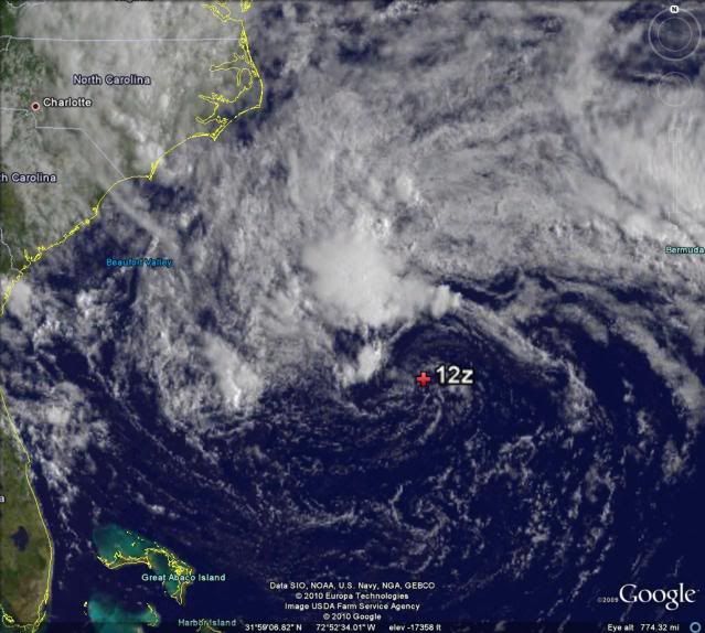
Looks more orgainzed this morning as the broad LLC is tightening up and convection has blossomed over the north half of the system and is now getting pulled CC around its west side. As SSTs warm to the west, 90L might have a chance to go subtropical - as of now, pressure is 1007 mb. The system also seems to be absorbing the moisture associated with the ULL over the carolinas.
http://weather.cod.edu/loops/Caribbean-VIS.loop.html
http://weather.cod.edu/loops/Caribbean-VIS.loop.html
0 likes
Re: ATL : INVEST 90L=CODE YELLOW
thanks hurakan, pressure now 1005 mb. LLC over 25 deg C water now and only about 150 miles away to the west or northwest of 26 deg C SSTs.
0 likes
-
HURAKAN

- Professional-Met

- Posts: 46084
- Age: 39
- Joined: Thu May 20, 2004 4:34 pm
- Location: Key West, FL
- Contact:
Re: ATL : INVEST 90L=CODE YELLOW
ronjon wrote:thanks hurakan, pressure now 1005 mb. LLC over 25 deg C water now and only about 150 miles away to the west or northwest of 26 deg C SSTs.
I think people are giving up too soon. For example,
24 hours before Gabrielle, 2007, formed:

1st advisory:

Yes, I know it was September, but storms can look really bad and still develop. The main problem 90L has is the dry air and we know Andrea was able to deal with that.
0 likes
-
Category 5

- Category 5

- Posts: 10074
- Age: 36
- Joined: Sun Feb 11, 2007 10:00 pm
- Location: New Brunswick, NJ
- Contact:
Re: ATL : INVEST 90L=CODE YELLOW
I wouldn't pull the plug just yet. Remember we're not talking about Tropical development, but Subtropical development, remember Andrea. Similar system.
0 likes
-
cwachal
-
JonathanBelles
- Professional-Met
- Posts: 11430
- Age: 35
- Joined: Sat Dec 24, 2005 9:00 pm
- Location: School: Florida State University (Tallahassee, FL) Home: St. Petersburg, Florida
- Contact:
Who is online
Users browsing this forum: No registered users and 33 guests