#305 Postby KWT » Thu Jun 03, 2010 6:22 pm
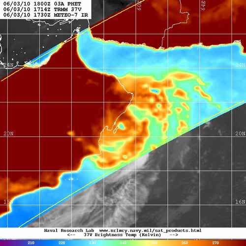
Wow well that was a bit quicker then I thought, but yeah the structure looks alot worse now which is what you'd expect with a system making landfall in a region that is very dry and has lots of stable air aloft.
0 likes
Personal Forecast Disclaimer:
The posts in this forum are NOT official forecast and should not be used as such. They are just the opinion of the poster and may or may not be backed by sound meteorological data. They are NOT endorsed by any professional institution or storm2k.org. For official information, please refer to the NHC and NWS products


