ARABIAN SEA - DEEP DEPRESSION (03A)

Moderator: S2k Moderators

Message
Author
User avatar
wyq614
Category 3
Category 3
Posts: 827
Age: 35
Joined: Sun Dec 02, 2007 12:32 am
Location: Beijing, China (Hometown: Qingdao, China, 36.06N 120.43E)
Contact:

ARABIAN SEA - DEEP DEPRESSION (03A)

#1 Postby wyq614 » Sun May 30, 2010 2:43 am

Image

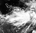
06z position: 14.5N 65.5E, EC develops it and predicts that it will make landfall around India-Pakistan border
0 likes   

User avatar
salmon123
Tropical Storm
Tropical Storm
Posts: 100
Age: 43
Joined: Mon Apr 28, 2008 1:56 pm
Location: karachi pakistan
Contact:

#2 Postby salmon123 » Sun May 30, 2010 3:36 am

Could Be A Strong System...
0 likes   

Iceperple
Tropical Wave
Tropical Wave
Posts: 7
Joined: Sun May 30, 2010 4:16 am

Re: Arabian Sea - Invest 94A

#3 Postby Iceperple » Sun May 30, 2010 4:27 am

EC has changed a lot from 5-27
0 likes   

User avatar
Crostorm
Category 5
Category 5
Posts: 2060
Age: 49
Joined: Mon Dec 25, 2006 3:51 pm
Location: Croatia-Europe
Contact:

Re: Arabian Sea - Invest 94A

#4 Postby Crostorm » Sun May 30, 2010 4:39 am

Image
0 likes   

omani1
Tropical Wave
Tropical Wave
Posts: 5
Joined: Sun May 30, 2010 4:47 am

#5 Postby omani1 » Sun May 30, 2010 5:17 am

Hi
This is the first post for me?
What is the projected path of A94?
0 likes   

User avatar
HURAKAN
Professional-Met
Professional-Met
Posts: 46086
Age: 37
Joined: Thu May 20, 2004 4:34 pm
Location: Key West, FL
Contact:

Re: Arabian Sea - Invest 94A

#6 Postby HURAKAN » Sun May 30, 2010 8:29 am

Image

Image

Image

Computer models
0 likes   

User avatar
HURAKAN
Professional-Met
Professional-Met
Posts: 46086
Age: 37
Joined: Thu May 20, 2004 4:34 pm
Location: Key West, FL
Contact:

#7 Postby HURAKAN » Sun May 30, 2010 8:51 am

Image

AN AREA OF CONVECTION HAS PERSISTED NEAR 14.5N 65.5E,
APPROXIMATELY 495 NM WEST-SOUTHWEST OF MUMBAI, INDIA. ANIMATED
MULTISPECTRAL IMAGERY SHOWS A BROAD LOW LEVEL CIRCULATION CENTER WITH
LOOSELY ORGANIZED CONVECTION ALONG THE DEVELOPING MONSOON TROUGH IN
THE ARABIAN SEA. UPPER LEVEL ANALYSIS INDICATES THE SYSTEM IS SOUTH
OF A HIGH PRESSURE CENTER ANCHORED OVER OMAN IN AN AREA OF MODERATE
EASTERLY VERTICAL WIND SHEAR. MAXIMUM SUSTAINED SURFACE WINDS,
SUPPORTED BY A 300528Z ASCAT SCATTEROMETRY PASS, ARE ESTIMATED AT 15
TO 20 KNOTS. MINIMUM SEA LEVEL PRESSURE IS ESTIMATED TO BE NEAR 1007
MB. THE POTENTIAL FOR THE DEVELOPMENT OF A SIGNIFICANT TROPICAL
CYCLONE WITHIN THE NEXT 24 HOURS IS POOR.
0 likes   

User avatar
HURAKAN
Professional-Met
Professional-Met
Posts: 46086
Age: 37
Joined: Thu May 20, 2004 4:34 pm
Location: Key West, FL
Contact:

#8 Postby HURAKAN » Sun May 30, 2010 8:56 am

30/0830 UTC 14.7N 65.2E T1.0/1.0 94A -- Arabian Sea

latest
0 likes   

User avatar
cycloneye
Admin
Admin
Posts: 139175
Age: 67
Joined: Thu Oct 10, 2002 10:54 am
Location: San Juan, Puerto Rico

Re: Arabian Sea - Invest 94A

#9 Postby cycloneye » Sun May 30, 2010 5:18 pm

301800
MSGID/GENADMIN/NAVMARFCSTCEN PEARL HARBOR HI/JTWC//
SUBJ/SIGNIFICANT TROPICAL WEATHER ADVISORY FOR THE INDIAN
/OCEAN/301800Z-311800ZMAY2010//
RMKS/
1. NORTH INDIAN OCEAN AREA (MALAY PENINSULA WEST TO COAST OF AFRICA):
A. TROPICAL CYCLONE SUMMARY: NONE.
B. TROPICAL DISTURBANCE SUMMARY:
(1) THE AREA OF CONVECTION PREVIOUSLY LOCATED NEAR 14.5N
65.5E, IS NOW LOCATED NEAR 14.4N 64.2E, APPROXIMATELY 570 NM WEST-
SOUTHWEST OF MUMBAI, INDIA. ANIMATED MULTISPECTRAL AND INFRARED
SATELLITE IMAGERY SHOW CONTINUED CONSOLIDATION OF THE LOW LEVEL
CIRCULATION CENTER (LLCC) WITH INCREASED DEEP CONVECTION BUILDING IN
THE VICINITY OF THE LLCC. UPPER LEVEL ANALYSIS INDICATES AN ANTI-
CYCLONE LOCATED OVER THE NORTHERN ARABIAN SEA IS PROVIDING FAVORABLE
EQUATORWARD OUTFLOW AND CREATING A MODERATE VERTICAL WIND SHEAR ENVI-
RONMENT FOR THE LLCC. SURFACE CONDITIONS ARE FAVORABLE WITH SEA SUR-
FACE TEMPERATURES AROUND 31 CELSIUS BASED ON RECENT BUOY OBSERVA-
TIONS. MAXIMUM SUSTAINED SURFACE WINDS ARE ESTIMATED AT 20 TO 25
KNOTS. MINIMUM SEA LEVEL PRESSURE IS ESTIMATED TO BE NEAR 1005 MB.
BASED ON BUILDING DEEP CONVECTION AND FAVORABLE SURFACE CONDITIONS,
THE POTENTIAL FOR THE DEVELOPMENT OF A SIGNIFICANT TROPICAL CYCLONE
WITHIN THE NEXT 24 HOURS IS UPGRADED TO FAIR.


Image
0 likes   
Visit the Caribbean-Central America Weather Thread where you can find at first post web cams,radars
and observations from Caribbean basin members Click Here

User avatar
HURAKAN
Professional-Met
Professional-Met
Posts: 46086
Age: 37
Joined: Thu May 20, 2004 4:34 pm
Location: Key West, FL
Contact:

Re: Arabian Sea - Invest 94A

#10 Postby HURAKAN » Sun May 30, 2010 6:31 pm

Image

Latest ... looking good
0 likes   

User avatar
cycloneye
Admin
Admin
Posts: 139175
Age: 67
Joined: Thu Oct 10, 2002 10:54 am
Location: San Juan, Puerto Rico

Re: Arabian Sea - Invest 94A

#11 Postby cycloneye » Sun May 30, 2010 6:33 pm

Does anyone know what are the averages of named cyclones in the Arabian Sea? I ask because it has been active so far this year.
0 likes   
Visit the Caribbean-Central America Weather Thread where you can find at first post web cams,radars
and observations from Caribbean basin members Click Here

User avatar
HURAKAN
Professional-Met
Professional-Met
Posts: 46086
Age: 37
Joined: Thu May 20, 2004 4:34 pm
Location: Key West, FL
Contact:

Re: Arabian Sea - Invest 94A

#12 Postby HURAKAN » Sun May 30, 2010 6:46 pm

30/2130 UTC 14.9N 64.4E T1.5/1.5 94A -- Arabian Sea

25 knots
0 likes   

User avatar
HURAKAN
Professional-Met
Professional-Met
Posts: 46086
Age: 37
Joined: Thu May 20, 2004 4:34 pm
Location: Key West, FL
Contact:

Re: Arabian Sea - Invest 94A

#13 Postby HURAKAN » Sun May 30, 2010 6:54 pm

DEMS-RSMC TROPICAL CYCLONES NEW DELHI DATED: 30-05-2010

TROPICAL WEATHER OUTLOOK FOR NORTH INDIAN OCEAN (THE BAY OF BENGAL

AND ARABIAN SEA) VALID FOR NEXT 24 HOURS ISSUED AT 0600 UTC (.)

A LOW PRESSURE AREA WOULD FORM OVER SOUTHEAST AND ADJOINING EASTCENTRAL ARABIAN SEA DURING NEXT 48 HOURS.

CONVECTIVE CLOUDS ARE SEEN OVER PARTS OF SOUTH & ADJOINING CENTRAL ARABIAN SEA, EASTCENTRAL BAY OF BENGAL AND ANDMAN SEA.

THE RIDGE LINE AT 200 hPa RUNS ALONG LAT 17°N OVER INDIAN REGION.
0 likes   

ugaap
Tropical Depression
Tropical Depression
Posts: 72
Joined: Tue Apr 29, 2008 3:10 am
Location: India
Contact:

Re: Arabian Sea - Invest 94A

#14 Postby ugaap » Sun May 30, 2010 8:12 pm

From IMD

Synoptic features (based on 1730 hrs IST) 30th May 2010 @ 1200 UTC

· A low pressure has formed over east central and adjoining west central and south Arabian Sea, it is likely to concentrate into a depression during next 1-2 days.
0 likes   

HurricaneBill
Category 5
Category 5
Posts: 3420
Joined: Sun Apr 11, 2004 5:51 pm
Location: East Longmeadow, MA, USA

Re:

#15 Postby HurricaneBill » Sun May 30, 2010 9:13 pm

omani1 wrote:Hi
This is the first post for me?
What is the projected path of A94?


Welcome to Storm2k!
0 likes   

bob rulz
Category 5
Category 5
Posts: 1667
Age: 34
Joined: Sat Jan 28, 2006 7:30 pm
Location: Salt Lake City, Utah

Re: Arabian Sea - Invest 94A

#16 Postby bob rulz » Sun May 30, 2010 9:41 pm

cycloneye wrote:Does anyone know what are the averages of named cyclones in the Arabian Sea? I ask because it has been active so far this year.


According to Wikipedia, the entire North Indian Ocean basin averages only 4 to 6 storms per year, and the Bay of Bengal sees 5-6 times more activity than the Arabian Sea, so it's safe to assume that the average number of storms to form in the Arabian Sea is only about 1 per year. Looking back through about 10 years of North Indian seasons the average seems to be slightly more than 1 (maybe about 1.2).

http://en.wikipedia.org/wiki/Tropical_c ... dian_Ocean
0 likes   

User avatar
Chacor
Category 5
Category 5
Posts: 10229
Joined: Mon Oct 02, 2006 10:43 pm
Location: Singapore

#17 Postby Chacor » Sun May 30, 2010 9:56 pm

Hard to call, as the IMD's best track is very unreliable and the naming of storms in this basin is a relatively new phenomenon.

Also, as we always say with other basins, even inactive years can produce monsters. Remember Gonu?
0 likes   

User avatar
cycloneye
Admin
Admin
Posts: 139175
Age: 67
Joined: Thu Oct 10, 2002 10:54 am
Location: San Juan, Puerto Rico

Re: Arabian Sea - Invest 94A

#18 Postby cycloneye » Sun May 30, 2010 9:57 pm

bob rulz wrote:
cycloneye wrote:Does anyone know what are the averages of named cyclones in the Arabian Sea? I ask because it has been active so far this year.


According to Wikipedia, the entire North Indian Ocean basin averages only 4 to 6 storms per year, and the Bay of Bengal sees 5-6 times more activity than the Arabian Sea, so it's safe to assume that the average number of storms to form in the Arabian Sea is only about 1 per year. Looking back through about 10 years of North Indian seasons the average seems to be slightly more than 1 (maybe about 1.2).

http://en.wikipedia.org/wiki/Tropical_c ... dian_Ocean


Thank you for the information.
0 likes   
Visit the Caribbean-Central America Weather Thread where you can find at first post web cams,radars
and observations from Caribbean basin members Click Here

User avatar
HURAKAN
Professional-Met
Professional-Met
Posts: 46086
Age: 37
Joined: Thu May 20, 2004 4:34 pm
Location: Key West, FL
Contact:

#19 Postby HURAKAN » Sun May 30, 2010 10:15 pm

Image

Continues to get better organized
0 likes   

User avatar
Chacor
Category 5
Category 5
Posts: 10229
Joined: Mon Oct 02, 2006 10:43 pm
Location: Singapore

#20 Postby Chacor » Sun May 30, 2010 10:38 pm

Gonu was declared INVEST 92A on May 31, 2007. So around the same time as this one, hopefully nowhere close as big.
0 likes   


Return to “2010”

Who is online

Users browsing this forum: No registered users and 66 guests