ATL : TOMAS - Models
Moderator: S2k Moderators


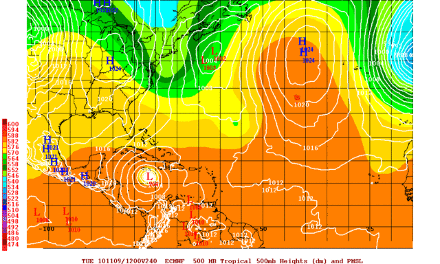
The GFS op run is quite abit slower then it has been though, not reaching the Caribbean Islands before day 6 now and quite a fe of the ensemble members are slower then that from the looks of things...
0 likes
Personal Forecast Disclaimer:
The posts in this forum are NOT official forecast and should not be used as such. They are just the opinion of the poster and may or may not be backed by sound meteorological data. They are NOT endorsed by any professional institution or storm2k.org. For official information, please refer to the NHC and NWS products
The posts in this forum are NOT official forecast and should not be used as such. They are just the opinion of the poster and may or may not be backed by sound meteorological data. They are NOT endorsed by any professional institution or storm2k.org. For official information, please refer to the NHC and NWS products

-
caneman
-
Weatherfreak000

Re:
caneman wrote:I'm fairly certain it won't come to FLorida too but I was also fairly certain the last storm would come to Florida and well we know what happened there so I'll take a wait and see approach.
according to all the NWS bureaus around the state. A strong front will pass thru the Florida area late next week so that should keep Tomas away from us.Not a slam dunk but 99.9% sure of it.0.01% unsure.
0 likes
-
gatorcane

- S2K Supporter

- Posts: 23499
- Age: 46
- Joined: Sun Mar 13, 2005 3:54 pm
- Location: Boca Raton, FL
Re: ATL : TOMAS - Models
Ivanhater wrote:Yep..new Euro still does not recurve and leaves a strengthening hurricane in the Caribbean

Interesting. Why does the euro not show a stronger system initially though?
0 likes
Re: ATL : TOMAS - Models
gatorcane wrote:Ivanhater wrote:Yep..new Euro still does not recurve and leaves a strengthening hurricane in the Caribbean
Interesting. Why does the euro not show a stronger system initially though?
Has the Euro been right this year I know they did well last year.I think the GFS has got them this year so far.
0 likes
Thats the question Gatorcane, whilst it does look like steering currejnts may slacken I think the ECM probably is underestimating how strong Tomas gets in the short term and thus it'll probably underdo the latitude gain until the upper ridge shunts the system back westwards.
Looking more and more like a Hazel track in the Caribbean...
Looking more and more like a Hazel track in the Caribbean...
0 likes
Personal Forecast Disclaimer:
The posts in this forum are NOT official forecast and should not be used as such. They are just the opinion of the poster and may or may not be backed by sound meteorological data. They are NOT endorsed by any professional institution or storm2k.org. For official information, please refer to the NHC and NWS products
The posts in this forum are NOT official forecast and should not be used as such. They are just the opinion of the poster and may or may not be backed by sound meteorological data. They are NOT endorsed by any professional institution or storm2k.org. For official information, please refer to the NHC and NWS products
-
caneman
Re: ATL : TOMAS - Models
I do agree that GFS has outperformed the Euro this year but you can't discount the possibility of the Euro possibly being right. Any storm possibly sitting below Cuba is worth paying attention to.
0 likes

-
snowcane180

-
Ivanhater

- Storm2k Moderator

- Posts: 10852
- Age: 37
- Joined: Fri Jul 01, 2005 8:25 am
- Location: Pensacola
Re:
Vortmax1 wrote:Trough is not deep enough to pick it up...so it keeps moving west or westnorthwest towards the western caribbean
Yep...I realize that.
But there doesn't seem to be much agreement with that forecast does there?
There is actually good agreement on the trough getting Tomas. We are discussing the outlier possibilities.
0 likes
Michael
-
TheDreamTraveler

- Category 2

- Posts: 633
- Joined: Sun Aug 22, 2010 3:10 am
- Location: PA
Re:
Vortmax1 wrote:Actually...NO agreement!
Wow at the TVCN going straight into Haiti. That's pretty chilling.
0 likes
-
Ivanhater
- Storm2k Moderator
- Posts: 10852
- Age: 37
- Joined: Fri Jul 01, 2005 8:25 am
- Location: Pensacola
Re:
Vortmax1 wrote:We are discussing the outlier possibilities.
I'm not discussing any outlier here.
The ECM is saying something I need to hear.
But the forecast is 10 days out and could change...but the ECM is still hanging tough with the cut-off forecast!
Makes me think more than twice.....
The Euro IS the outlier.
0 likes
Michael
Who is online
Users browsing this forum: No registered users and 55 guests