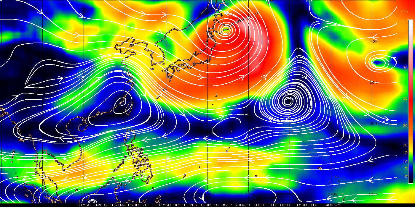
supercane wrote:oaba09, the shading on that ECMWF graphic shows wind speeds at the 850-mb level, not rain, although they probably accompany each other.
Thanks for the clarification!
Moderator: S2k Moderators

supercane wrote:oaba09, the shading on that ECMWF graphic shows wind speeds at the 850-mb level, not rain, although they probably accompany each other.


drdavisjr wrote:Is anyone except me surprised at how far west this system seems to be moving?


oaba09 wrote:It looks like it's moving west but it's really tough to say because it's hard to determine the center....The circulation is also quite broad
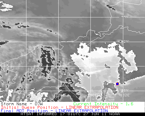
drdavisjr wrote:oaba09 wrote:It looks like it's moving west but it's really tough to say because it's hard to determine the center....The circulation is also quite broad
I think this shows the center pretty well.

oaba09 wrote:Thanks!
dexterlabio wrote:Is it just me or the circulation just got bigger?
dexterlabio wrote:I believe PAGASA has the track to the east most in align with NOGAPS.From what I've been watching on the local news, it was said that this storm won't affect any parts of the country except for some monsoon inducement. I wish the local agency's forecast will turn out right, or else people out here will start complaining again just like the frenzy caused by PAGASA's Songda track.

Is it just me or the circulation just got bigger?

Users browsing this forum: No registered users and 24 guests