ATL: RINA - Post-Tropical - Discussion

Moderator: S2k Moderators

Message
Author
User avatar
wxman57
Moderator-Pro Met
Moderator-Pro Met
Posts: 22506
Age: 66
Joined: Sat Jun 21, 2003 8:06 pm
Location: Houston, TX (southwest)

Re: ATL: INVEST 96L - Discussion

#141 Postby wxman57 » Sat Oct 22, 2011 8:45 am

sunnyday wrote:Just visited the models page(s), and the folks there said that most models are dropping this. 8-)


Development is by no means a certainty. Latest models are trending away from any south FL threat. Much will depend on the timing of the strong cold front moving across the Gulf next Thu/Fri.
0 likes   

User avatar
NDG
S2K Supporter
S2K Supporter
Posts: 14947
Joined: Sun Jul 09, 2006 10:14 pm
Location: Orlando, FL

#142 Postby NDG » Sat Oct 22, 2011 9:08 am

West winds continue in the Island of San Andres.

METAR text: SKSP 221400Z 28018KT 9999 FEW015 BKN080 26/24 A2978
Conditions at: SKSP (SAN ANDRES ISLAN, CO) observed 1400 UTC 22 October 2011
Temperature: 26.0°C (79°F)
Dewpoint: 24.0°C (75°F) [RH = 89%]
Pressure (altimeter): 29.78 inches Hg (1008.5 mb)
Winds: from the W (280 degrees) at 21 MPH (18 knots; 9.4 m/s)
Visibility: 6 or more miles (10+ km)
Ceiling: 8000 feet AGL
Clouds: few clouds at 1500 feet AGL
broken clouds at 8000 feet AGL
Weather: no significant weather observed at this time
0 likes   

User avatar
hurricanetrack
HurricaneTrack.com
HurricaneTrack.com
Posts: 1776
Joined: Tue Dec 02, 2003 10:46 pm
Location: Wilmington, NC
Contact:

#143 Postby hurricanetrack » Sat Oct 22, 2011 9:11 am

Wonder how much this is playing in to it all:

http://www.ssd.noaa.gov/PS/TROP/TCFP/da ... carins.png

Vertical instability is WELL below climo levels- has been almost all season. Why would that change now?
0 likes   

User avatar
NDG
S2K Supporter
S2K Supporter
Posts: 14947
Joined: Sun Jul 09, 2006 10:14 pm
Location: Orlando, FL

#144 Postby NDG » Sat Oct 22, 2011 9:26 am

I am suspicious in the area near 12.8N & 82W of a possible LLC, based out of vis sat loop and surface reports from the island of San Andres this morning.

Image

Personal Forecast Disclaimer:
The posts in this forum are NOT official forecast and should not be used as such. They are just the opinion of the poster and may or may not be backed by sound meteorological data. They are NOT endorsed by any professional institution or storm2k.org. For official information, please refer to the NHC and NWS products
0 likes   

User avatar
cycloneye
Admin
Admin
Posts: 139596
Age: 67
Joined: Thu Oct 10, 2002 10:54 am
Location: San Juan, Puerto Rico

Re: ATL: INVEST 96L - Discussion

#145 Postby cycloneye » Sat Oct 22, 2011 9:31 am

Here is todays TCPOD.Recon canceled for today.

WEATHER RECONNAISSANCE FLIGHTS
CARCAH, NATIONAL HURRICANE CENTER, MIAMI, FL.
1030 AM EDT SAT 22 OCTOBER 2011
SUBJECT: TROPICAL CYCLONE PLAN OF THE DAY (TCPOD)
VALID 23/1100Z TO 24/1100Z OCTOBER 2011
TCPOD NUMBER.....11-144

I. ATLANTIC REQUIREMENTS
1. SUSPECT AREA (WESTERN CARIBBEAN)
FLIGHT ONE -- TEAL 70
A. 23/1900Z
B. AFXXX 01KKA INVEST
C. 23/1500Z
D. 14.6N 82.5W
E. 23/1830Z TO 23/2230Z
F. SFC TO 10,000 FT

2. OUTLOOK FOR SUCCEEDING DAY: BEGIN 6-HRLY FIXES AT
24/1800Z NEAR 16.5N 84.0W IF SYSTEM DEVELOPS.
3.
REMARK: LOW-LEVEL INVEST FOR 22/2000Z CANCELED BY
NHC AT 22/1205Z.
0 likes   
Visit the Caribbean-Central America Weather Thread where you can find at first post web cams,radars
and observations from Caribbean basin members Click Here

User avatar
cycloneye
Admin
Admin
Posts: 139596
Age: 67
Joined: Thu Oct 10, 2002 10:54 am
Location: San Juan, Puerto Rico

Re: ATL: INVEST 96L - Discussion

#146 Postby cycloneye » Sat Oct 22, 2011 10:06 am

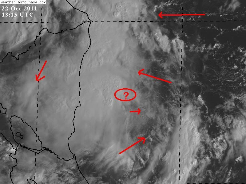
This mornings discussion by Dr Jeff Masters:

A region of disturbed weather in the Western Caribbean (Invest 96L) is bringing heavy rains to coastal Nicaragua and Honduras, and has the potential to develop into a tropical depression Sunday or Monday. Visible satellite loops show that 96L has changed little in organization since yesterday. Some rotation is apparent, but the heavy thunderstorm activity is quite limited due to a large region of dry air to the east, as seen on water vapor satellite loops. There are no signs of a surface circulation. Surface pressures have been falling since Thursday at San Andres Island, near the center of 96L. Wind shear is a moderate 10 - 20 knots in the region, and is expected remain in the moderate range through Tuesday. Water temperatures are very warm, 29 - 30°C, and these warm waters extend to great depth.

Forecast for 96L
The moderate wind shear and warm waters should allow for some development of 96L over the next few days, though this will be slowed by the dry air to the storm's east, and perhaps by proximity to the land areas of Nicaragua and Honduras. The models are less enthusiastic today about developing 96L into a tropical depression than they were yesterday. The ECMWF no longer predicts development, and the GFS and NOGAPS predict only weak development before 96L moves ashore over Honduras on Tuesday. On Wednesday, a strong trough of low pressure will be passing over the Eastern U.S., and this trough has the potential to turn 96L northwards into Western Cuba. This is more likely to happen if 96L is stronger and deeper, and thus able to "feel" the upper-level winds the trough will bring. The UKMET model predicts 96L will develop into a tropical storm that moves through the Yucatan Channel between Cuba and Mexico on Thursday. If 96L remains a weak and shallow system, though, it is more likely to stay trapped in the Western Caribbean and make landfall in Nicaragua or Honduras. NHC gave 96L a 60% chance of developing into a tropical depression by Monday in their 8 am Tropical Weather Outlook today. The hurricane hunter mission scheduled for today was cancelled due to the lack of development of 96L; the mission has been re-scheduled for Sunday afternoon.

0 likes   
Visit the Caribbean-Central America Weather Thread where you can find at first post web cams,radars
and observations from Caribbean basin members Click Here

User avatar
wxman57
Moderator-Pro Met
Moderator-Pro Met
Posts: 22506
Age: 66
Joined: Sat Jun 21, 2003 8:06 pm
Location: Houston, TX (southwest)

Re: ATL: INVEST 96L - Discussion

#147 Postby wxman57 » Sat Oct 22, 2011 10:14 am

I agree, no signs of a surface circulation today. Nothing much for recon to investigate. Give it another 24-36 hrs.
0 likes   

Rainband

Re: ATL: INVEST 96L - Discussion

#148 Postby Rainband » Sat Oct 22, 2011 10:27 am

good news. models are not as aggressive and this may stay down in the Caribbean. :D
0 likes   

Sanibel
Category 5
Category 5
Posts: 10348
Joined: Mon Aug 30, 2004 11:06 pm
Location: Offshore SW Florida

Re: ATL: INVEST 96L - Discussion

#149 Postby Sanibel » Sat Oct 22, 2011 10:31 am

I think it still has potential as long as it doesn't drift over Central America. Part of the reason it isn't getting going is low latitude and lack of coriolis.
0 likes   

Rainband

Re: ATL: INVEST 96L - Discussion

#150 Postby Rainband » Sat Oct 22, 2011 10:34 am

Sanibel wrote:I think it still has potential as long as it doesn't drift over Central America. Part of the reason it isn't getting going is low latitude and lack of coriolis.
I think 97L the one to watch.
0 likes   

psyclone
S2K Supporter
S2K Supporter
Posts: 4510
Joined: Wed Aug 24, 2005 9:04 pm
Location: palm harbor fl

Re: ATL: INVEST 96L - Discussion

#151 Postby psyclone » Sat Oct 22, 2011 11:06 am

Sanibel wrote:I think it still has potential as long as it doesn't drift over Central America. Part of the reason it isn't getting going is low latitude and lack of coriolis.


there's not a lack of coriolis at that latitude. hurricane ivan hit grenada as a major at a slightly lower latitude than this disturbance presently resides.
0 likes   

Rainband

Re: ATL: INVEST 96L - Discussion

#152 Postby Rainband » Sat Oct 22, 2011 11:07 am

psyclone wrote:
Sanibel wrote:I think it still has potential as long as it doesn't drift over Central America. Part of the reason it isn't getting going is low latitude and lack of coriolis.


there's not a lack of coriolis at that latitude. hurricane ivan hit grenada as a major at a slightly lower latitude than this disturbance presently resides.
but Ivan was a well developed system by then.
0 likes   

LarryWx
Category 5
Category 5
Posts: 5790
Joined: Sun Sep 07, 2003 2:04 pm
Location: GA

Re: ATL: INVEST 96L - Discussion

#153 Postby LarryWx » Sat Oct 22, 2011 11:09 am

Rainband wrote:good news. models are not as aggressive and this may stay down in the Caribbean. :D


It ain't over yet, but the not so small lady is stepping up to the mic. IF this recent lack of excitement trend continues with 96L, it will fit in with this season, one that had so much more potential than what was actually realized. This season is an embarassment and should be ashamed of itself. :lol:
0 likes   
Personal Forecast Disclaimer:
The posts in this forum are NOT official forecasts and should not be used as such. They are just the opinion of the poster and may or may not be backed by sound meteorological data. They are NOT endorsed by any professional institution or storm2k.org. For official information, please refer to the NHC and NWS products.

psyclone
S2K Supporter
S2K Supporter
Posts: 4510
Joined: Wed Aug 24, 2005 9:04 pm
Location: palm harbor fl

Re: ATL: INVEST 96L - Discussion

#154 Postby psyclone » Sat Oct 22, 2011 11:11 am

Rainband wrote:
psyclone wrote: there's not a lack of coriolis at that latitude. hurricane ivan hit grenada as a major at a slightly lower latitude than this disturbance presently resides.


but Ivan was a well developed system by then.


meaning that it developed its spin at and even lower latitude farther east. stating that the reason for a lack of development is a lack of coriolis is inaccurate.
0 likes   

Steve H.
Category 5
Category 5
Posts: 2134
Joined: Sat Oct 19, 2002 9:06 am
Location: Palm Bay, Florida

Re: ATL: INVEST 96L - Discussion

#155 Postby Steve H. » Sat Oct 22, 2011 11:14 am

I wonder what our friend Joe Bastardi will say now? Don't get me wrong, I like the guy - but will he do a 180 like some of the models? We all had some pretty bold ideas about the potential of 96L. The models led us in that direction. Models have had trouble handling systems this year. They are just tools. Watch them do another 180 this evening :cheesy: Strange year :flag:
0 likes   

User avatar
hurricanetrack
HurricaneTrack.com
HurricaneTrack.com
Posts: 1776
Joined: Tue Dec 02, 2003 10:46 pm
Location: Wilmington, NC
Contact:

#156 Postby hurricanetrack » Sat Oct 22, 2011 11:19 am

12Z GFS has no development. Wow, this is incredible. It really is. I do not recall seeing anything like this in some time. What the heck? I guess it could still happen but with the major globals jumping off, what are the odds? Probably low. I guess that it all comes down to "why change now?" In other words, why would the Caribbean suddenly come to life now when it has had zero all season due to lack of instability and other issues? Simply amazing turn of events in just the last 24 hours.
0 likes   

User avatar
Hurricanehink
S2K Supporter
S2K Supporter
Posts: 2023
Joined: Sun Nov 16, 2003 2:05 pm
Location: New Jersey

#157 Postby Hurricanehink » Sat Oct 22, 2011 11:20 am

It seems that the system has an exposed circulation at 13N, 81W, per the latest frame in the visible satellite. We'll see after the next few frames if that will become the dominant circulation.
0 likes   

Rainband

#158 Postby Rainband » Sat Oct 22, 2011 11:26 am

Image
0 likes   

Rainband

Re:

#159 Postby Rainband » Sat Oct 22, 2011 11:27 am

Rainband wrote:Image
seems to be at or south of the line.
0 likes   

User avatar
cycloneye
Admin
Admin
Posts: 139596
Age: 67
Joined: Thu Oct 10, 2002 10:54 am
Location: San Juan, Puerto Rico

Re: ATL: INVEST 96L - Discussion

#160 Postby cycloneye » Sat Oct 22, 2011 11:30 am

IMO,after the GFS failing at 12z to develop it,NHC will drop some more the % at 2 PM TWO.
0 likes   
Visit the Caribbean-Central America Weather Thread where you can find at first post web cams,radars
and observations from Caribbean basin members Click Here


Return to “2011”

Who is online

Users browsing this forum: No registered users and 6 guests