ATL: INVEST 94L - DISCUSSION

Moderator: S2k Moderators

Message
Author
User avatar
ronjon
Category 5
Category 5
Posts: 4671
Joined: Fri Aug 19, 2005 5:17 pm
Location: Hernando Beach, FL

Re: ATL: INVEST 94L - DISCUSSION

#521 Postby ronjon » Mon Jun 06, 2011 9:54 pm

boca wrote:How many times does the NAM model pan out?


Not many times on true tropical systems but it keeps 94L weak which will probably verify and it has both 500 mb and 200 mb ULLs positioned over the eastern GOM which funnels the tropical moisture northward. In this case, the upper level winds (shear) is oriented more N-S over the peninsula.
0 likes   

User avatar
boca
Category 5
Category 5
Posts: 6306
Age: 59
Joined: Mon Dec 15, 2003 8:49 am
Location: Boca Raton,FL

Re: ATL: INVEST 94L - DISCUSSION

#522 Postby boca » Mon Jun 06, 2011 9:56 pm

AJC3 wrote:The NAM progs are contingent upon there being a coherent 1006MB low about 50 miles south of KEY and moving due north, which is at odds with most of the reliable guidance. Its solution is very likely far too aggressive. While the best chance of rain over Florida will be over the keys and southern peninsula, I have some doubts as to just how far north the deep layer moisture will get. It all depends on the evolution of the GOMEX mid-upper low...if it takes the form of a positive tilt trough, then central/eastern Cuba and the Bahamas will get the lion's share of rainfall from this. Extreme south Florida and the Keys could get in on some good rains in this scenario as well.

On the other hand, a cutoff low or a more meridionally oriented H50 trough/H25 jet would send deep layer moisture and high rain chances farther north into Florida.

I'd say the NAM is about 24 hours too quick with the the moisture increase, and definitely too low with surface pressures north of west-central Cuba. I can't see any way the broad Caribbean gyre runs northward underneath a 60-70kt ST jetstreak and somehow manages to intensify.

If you're in Florida and rooting for rain, then root for the mid/upper flow to back as much as it can by the end of the week.


The ULL would have to move SW in order for the rain to make it to Florida am I correct?
0 likes   

User avatar
ronjon
Category 5
Category 5
Posts: 4671
Joined: Fri Aug 19, 2005 5:17 pm
Location: Hernando Beach, FL

Re: ATL: INVEST 94L - DISCUSSION

#523 Postby ronjon » Mon Jun 06, 2011 10:04 pm

I agree that the NAM is probably overdone but it depends on the ULL position and orintation over the GOM. Have to watch the evolution of the GFS and Euro the next few days. I still think S FL will still see some rain from this. We are transitioning to the rainy season.

Image
0 likes   

User avatar
boca
Category 5
Category 5
Posts: 6306
Age: 59
Joined: Mon Dec 15, 2003 8:49 am
Location: Boca Raton,FL

Re: ATL: INVEST 94L - DISCUSSION

#524 Postby boca » Mon Jun 06, 2011 10:08 pm

ronjon wrote:
boca wrote:How many times does the NAM model pan out?


Not many times on true tropical systems but it keeps 94L weak which will probably verify and it has both 500 mb and 200 mb ULLs positioned over the eastern GOM which funnels the tropical moisture northward. In this case, the upper level winds (shear) is oriented more N-S over the peninsula.


Right now the orientation is SW to NE I believe do you agree?
0 likes   

User avatar
AJC3
Admin
Admin
Posts: 3874
Age: 60
Joined: Tue Aug 31, 2004 7:04 pm
Location: West Melbourne, Florida
Contact:

Re: ATL: INVEST 94L - DISCUSSION

#525 Postby AJC3 » Mon Jun 06, 2011 10:50 pm

boca wrote: The ULL would have to move SW in order for the rain to make it to Florida am I correct?


It's less an issue of it's location than it is how it's oriented.

Open/pos tilt mid-upper trough = deep layer moisture goes more NE than N

Cut off low/amplified neutral tilt mid-upper trough = deep layer moisture can go farther north/NNW
0 likes   

User avatar
Rgv20
S2K Supporter
S2K Supporter
Posts: 2456
Age: 37
Joined: Wed Jan 05, 2011 5:42 pm
Location: Edinburg/McAllen Tx

#526 Postby Rgv20 » Tue Jun 07, 2011 12:47 am

NAM showing a lot of moisture in south florida.

Image
0 likes   
The following post is NOT an official forecast and should not be used as such. It is just the opinion of the poster and may or may not be backed by sound meteorological data. It is NOT endorsed by any professional institution including storm2k.org For Official Information please refer to the NHC and NWS products.

User avatar
LaBreeze
Category 5
Category 5
Posts: 1497
Joined: Thu Sep 04, 2003 1:57 pm
Location: SW Louisiana

Re:

#527 Postby LaBreeze » Tue Jun 07, 2011 2:39 am

Rgv20 wrote:NAM showing a lot of moisture in south florida.

http://i61.photobucket.com/albums/h62/c ... _SE084.gif


Rgv20, do you think that this moisture (if indeed it does make it to the Florida Peninsula) will be out of there by the 15th or 16th of June? Just wondering.
0 likes   

User avatar
LaBreeze
Category 5
Category 5
Posts: 1497
Joined: Thu Sep 04, 2003 1:57 pm
Location: SW Louisiana

Re:

#528 Postby LaBreeze » Tue Jun 07, 2011 2:45 am

gatorcane wrote:
The posts in this forum are NOT official forecast and should not be used as such. They are just the opinion of the poster and may or may not be backed by sound meteorological data. They are NOT endorsed by any professional institution or storm2k.org. For official information, please refer to the NHC and NWS products.


18z gfs shows a mid-level high sitting over the yucatan at 120 hours. Another high is just off of the carolinas. There looks to be a building ridge over the central and eastern Caribbean. That would allow the system to track slowly northwest then north over western Cuba and into the straits of Florida.

But the 250mb winds are hostile over the nw Carib and Florida by then as it looks like the subtropical jet moves in. So a strong system in the GOM or over Florida looks unlikely at this time.


Gatorcane, if this system were to track slowly nw, n, and into the Florida Straits, do you think that this moisture will still be hanging around by the 15th or 16th? Thanks in advance for a reply.
0 likes   

User avatar
KWT
Category 5
Category 5
Posts: 31391
Joined: Tue Aug 17, 2004 11:02 am
Location: UK!!!

#529 Postby KWT » Tue Jun 07, 2011 4:40 am

Wow that NAM run really is quite agressive when it comes to rainfallfor S.Florida.

ECM shears it slightly to the south but southern Florida does get some rain.
0 likes   
Personal Forecast Disclaimer:
The posts in this forum are NOT official forecast and should not be used as such. They are just the opinion of the poster and may or may not be backed by sound meteorological data. They are NOT endorsed by any professional institution or storm2k.org. For official information, please refer to the NHC and NWS products

HURRICANELONNY
Category 5
Category 5
Posts: 1381
Joined: Wed May 07, 2003 6:48 am
Location: HOLLYWOOD.FL

Re: ATL: INVEST 94L - DISCUSSION

#530 Postby HURRICANELONNY » Tue Jun 07, 2011 6:36 am

Nam would be nice. It won't happen. What's left of it is getting sheared apart already. It's only early June. Hopefully an increase in afternoon thundershowers. Looking at sat loops. That looks about it. :roll:
0 likes   
hurricanelonny

User avatar
Extratropical94
Professional-Met
Professional-Met
Posts: 3535
Age: 29
Joined: Wed Oct 20, 2010 6:36 am
Location: Hamburg, Germany
Contact:

#531 Postby Extratropical94 » Tue Jun 07, 2011 6:42 am

8AM (1200Z) TWO: down to 20%

ZCZC MIATWOAT ALL
TTAA00 KNHC DDHHMM

TROPICAL WEATHER OUTLOOK
NWS NATIONAL HURRICANE CENTER MIAMI FL
800 AM EDT TUE JUN 7 2011

FOR THE NORTH ATLANTIC...CARIBBEAN SEA AND THE GULF OF MEXICO...

1. A LARGE LOW PRESSURE AREA LOCATED OVER THE NORTHWESTERN CARIBBEAN
SEA ABOUT 100 MILES SOUTH-SOUTHWEST OF GRAND CAYMAN IS PRODUCING
DISORGANIZED SHOWER AND THUNDERSTORM ACTIVITY. UPPER-LEVEL WINDS
ARE BECOMING LESS FAVORABLE FOR DEVELOPMENT OF THIS SYSTEM...AND
THE AIR FORCE RESERVE RECONNAISSANCE MISSION SCHEDULED TO
INVESTIGATE THE SYSTEM THIS AFTERNOON HAS BEEN CANCELED
. THERE IS
A LOW CHANCE...20 PERCENT...OF THIS SYSTEM BECOMING A TROPICAL
CYCLONE DURING THE NEXT 48 HOURS. REGARDLESS OF DEVELOPMENT...
HEAVY RAINS COULD CAUSE FLASH FLOODS AND MUD SLIDES OVER PORTIONS OF
HAITI...THE DOMINICAN REPUBLIC...JAMAICA...AND CUBA AS THE SYSTEM
MOVES SLOWLY TOWARD THE NORTHWEST OR NORTH DURING THE NEXT COUPLE
OF DAYS.

ELSEWHERE...TROPICAL CYCLONE FORMATION IS NOT EXPECTED DURING THE
NEXT 48 HOURS.

$$
FORECASTER BRENNAN
NNNN
0 likes   
54° 11' 59'' N, 9° 9' 20'' E
Boomer Sooner!
Go Broncos! Go Cards! Go Niners!
- Daniel

User avatar
tailgater
S2K Supporter
S2K Supporter
Posts: 3339
Joined: Sun Jul 11, 2004 9:13 pm
Location: St. Amant La.

Re: ATL: INVEST 94L - DISCUSSION

#532 Postby tailgater » Tue Jun 07, 2011 7:41 am

GFDL out to 126hrs.

Image

Sorry Texas but this run actually has what left of 94 drifting a little westward in the GOM.
0 likes   
The following post is NOT an official forecast and should not be used as such. It is just the opinion of the poster and may or may not be backed by sound meteorological data. It is NOT endorsed by any professional institution including storm2k.org For Official Information please refer to the NHC and NWS products.

User avatar
ronjon
Category 5
Category 5
Posts: 4671
Joined: Fri Aug 19, 2005 5:17 pm
Location: Hernando Beach, FL

Re: ATL: INVEST 94L - DISCUSSION

#533 Postby ronjon » Tue Jun 07, 2011 7:42 am

HURRICANELONNY wrote:Nam would be nice. It won't happen. What's left of it is getting sheared apart already. It's only early June. Hopefully an increase in afternoon thundershowers. Looking at sat loops. That looks about it. :roll:


NWS Key West begs to differ - lots of high PWAT air moving into S FL from the tropics.

SHORT TERM (TODAY THROUGH FRIDAY NIGHT)...
FORECAST REASONING HAS CHANGED LITTLE BUT IT APPEARS OUR LONG AND
PERSISTENT DRY PATTERN MAY BE COMING TO AN END A LITTLE EARLIER THAN
PREVIOUSLY THOUGHT. NOW FOR SOME GENERAL DETAILS. A MID AND UPPER
LEVEL(500-200 MB) TROUGH COVERING A GOOD PORTION OF THE GULF OF
MEXICO WILL MIGRATE EASTWARD...RESULTING IN A GRADUAL INCREASE IN
LARGE SCALE ASCENT ACROSS OUR REGION FOR THE BALANCE OF THIS
WEEK...WITH THE BULK OF DIVERGENCE AND VORTICITY ADVECTION INDICATED
THURSDAY INTO FRIDAY. MEANWHILE...OUR REGION WILL REMAIN ON THE
SOUTHERN PERIPHERY OF A LOW LEVEL (SURFACE TO 700 MB) ANTICYCLONIC
FLOW THROUGH MOST OF WEDNESDAY. BECAUSE OF THIS...FORECAST SOUNDINGS
REVEAL A TENACIOUS LOW LEVEL INVERSION/STABLE LAYER NEAR 850 MB
TODAY AND TONIGHT...BEFORE GRADUALLY ERODING WITHIN A INTENSIFYING
AND MOISTENING EASTERLY FLOW ON WEDNESDAY. THEREAFTER...EXPECT THE
BROAD AREA OF LOW PRESSURE IN THE NORTHWEST CARIBBEAN SEA TO BE
GUIDED TOWARD THE YUCATAN PENINSULA/WESTERN CUBA AREA PULLING AN
ASSOCIATED TROUGH (SURFACE TO 850 MB) ACROSS OUR REGION THURSDAY AND
FRIDAY. GIVEN AN ABSENCE OF CONVECTIVE INHIBITION...PLENTY OF
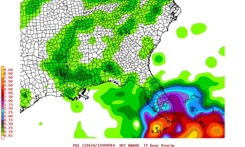
MOISTURE (PWAT AVERAGING AROUND 1.90 INCHES) AND ENHANCED LOW LEVEL
CONVERGENCE...THE AFOREMENTIONED MID AND UPPER LEVEL LIFT WILL
LIKELY PROVIDE WELL ABOVE NORMAL POPS BEGINNING LATE WEDNESDAY NIGHT
THROUGH FRIDAY. HENCE...POPS WILL BE RAISED TO 40 PERCENT LATE
WEDNESDAY NIGHT...AND TO 50 PERCENT THURSDAY THROUGH FRIDAY. BUT
UNTIL THEN...DIME POPS WILL BE KEPT FOR TODAY AND TONIGHT AND 20
PERCENT FOR WEDNESDAY. TEMPERATURE WISE...THE COMBINATION OF
ADDITIONAL CLOUD COVER AND PRECIPITATION WILL PROMPT HIGH
TEMPERATURES TO BE KEPT IN THE MID AND UPPER 80S...WITH OVERNIGHT
LOWS IN THE UPPER 70S OUTSIDE OF RAINFALL.
0 likes   

User avatar
artist
Category 5
Category 5
Posts: 9793
Joined: Mon Jun 06, 2005 3:26 pm
Location: West Palm

Re: Re:

#534 Postby artist » Tue Jun 07, 2011 8:02 am

LaBreeze wrote:
gatorcane wrote:
The posts in this forum are NOT official forecast and should not be used as such. They are just the opinion of the poster and may or may not be backed by sound meteorological data. They are NOT endorsed by any professional institution or storm2k.org. For official information, please refer to the NHC and NWS products.


18z gfs shows a mid-level high sitting over the yucatan at 120 hours. Another high is just off of the carolinas. There looks to be a building ridge over the central and eastern Caribbean. That would allow the system to track slowly northwest then north over western Cuba and into the straits of Florida.

But the 250mb winds are hostile over the nw Carib and Florida by then as it looks like the subtropical jet moves in. So a strong system in the GOM or over Florida looks unlikely at this time.


Gatorcane, if this system were to track slowly nw, n, and into the Florida Straits, do you think that this moisture will still be hanging around by the 15th or 16th? Thanks in advance for a reply.

not gator, but any area in particular you are wanting to know about LaBreeze? I would think more than likely not, but there is no certanty this far out, and where you are talking about would probably make a difference as well. I checked the models for around that date (not out quite that far) and they are all over the place, depending on where in Florida. Maybe ask AJC3 from Melbourne, if you don't get anything here.
0 likes   

User avatar
Nimbus
Category 5
Category 5
Posts: 4928
Joined: Mon Jul 19, 2004 10:54 am

Re: ATL: INVEST 94L - DISCUSSION

#535 Postby Nimbus » Tue Jun 07, 2011 8:49 am

Southeast florida is where the drought is deepest so maybe there will be a silver lining after all. Have to see how that ULL in the gulf evolves.
0 likes   

User avatar
ronjon
Category 5
Category 5
Posts: 4671
Joined: Fri Aug 19, 2005 5:17 pm
Location: Hernando Beach, FL

Re: ATL: INVEST 94L - DISCUSSION

#536 Postby ronjon » Tue Jun 07, 2011 8:53 am

Looks like the weak low has drifted a little south overnight. From VIS SAT, I have it around 17.8N-81.5W - very near the southern edge of the heavy convection - while its on its last legs, the drift south could marginally improve its chances as its away from the shear zone to the NW.

http://www.ssd.noaa.gov/goes/flt/t2/flash-vis.html
0 likes   

User avatar
wxman57
Moderator-Pro Met
Moderator-Pro Met
Posts: 22484
Age: 66
Joined: Sat Jun 21, 2003 8:06 pm
Location: Houston, TX (southwest)

Re: ATL: INVEST 94L - DISCUSSION

#537 Postby wxman57 » Tue Jun 07, 2011 10:14 am

Shear is ripping it apart today. I don't know how much moisture will make it into the FL peninsula. Euro and Canadian take all the moisture NNE-NE east of the peninsula.
0 likes   

floridasun78
Category 5
Category 5
Posts: 3755
Joined: Sun May 17, 2009 10:16 pm
Location: miami fl

Re: ATL: INVEST 94L - DISCUSSION

#538 Postby floridasun78 » Tue Jun 07, 2011 10:37 am

it look like upper low to west of 94l moving west in gulf pulling alway from 94l http://www.goes.noaa.gov/HURRLOOPS/huirloop.html look at upper gulf you see moving west toward texas
0 likes   

User avatar
boca
Category 5
Category 5
Posts: 6306
Age: 59
Joined: Mon Dec 15, 2003 8:49 am
Location: Boca Raton,FL

Re: ATL: INVEST 94L - DISCUSSION

#539 Postby boca » Tue Jun 07, 2011 10:37 am

I knew 2 days ago that all the moisture would be east of the state due to that ULL over the GOM.The dry days continue on. Thw water vapor loop tells it all.

http://www.ssd.noaa.gov/goes/east/watl/flash-wv.html
0 likes   

User avatar
ronjon
Category 5
Category 5
Posts: 4671
Joined: Fri Aug 19, 2005 5:17 pm
Location: Hernando Beach, FL

Re: ATL: INVEST 94L - DISCUSSION

#540 Postby ronjon » Tue Jun 07, 2011 10:48 am

wxman57 wrote:Shear is ripping it apart today. I don't know how much moisture will make it into the FL peninsula. Euro and Canadian take all the moisture NNE-NE east of the peninsula.


On the other hand, the NAM and GFS bring lots of high PWAT air into the peninsula. Just have to see how the ULL orientation pans out.
0 likes   


Return to “2011”

Who is online

Users browsing this forum: No registered users and 6 guests