TROPICAL CYCLONE ADVICE NUMBER 41
Issued at 8:54 pm WST on Monday 21 February 2011
A Cyclone WARNING is current for coastal areas from Wallal to Exmouth,
extending to the adjacent inland Pilbara including Millstream.
A Cyclone WATCH is current for areas from Exmouth to Carnarvon, extending to
adjacent inland areas including Nanutarra and Minilya Roadhouse.
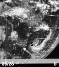
At 8:00 pm WST Tropical Cyclone Carlos, was estimated to be
195 kilometres north northeast of Port Hedland
and 340 kilometres northeast of Karratha and
moving west southwest at 22 kilometres per hour.
Tropical Cyclone Carlos is expected to continue moving in a general west
southwest track roughly parallel to the Pilbara coast and gradually intensify
overnight and during Tuesday.
GALES with wind gusts to 100 kilometres per hour may develop in coastal areas
near Port Hedland later tonight extending west to Karratha Tuesday morning and
then towards Exmouth later on Tuesday. There is the risk of DESTRUCTIVE winds
with gusts exceeding 125 kilometres near Whim Creek early on Tuesday , then
extending further west toward Onslow during Tuesday, possibly reaching Exmouth
by late Tuesday.
On Wednesday gales may extend south to Cape Cuvier, possibly reaching as far
south as Carnarvon by Wednesday evening.
Residents of Pilbara coastal towns are warned that tides may rise significantly
above the high water mark as the cyclone moves down the coast, even if it
doesn't cross the coast. DAMAGING WAVES and FLOODING of low lying coastal areas
are possible particularly on Tuesday's high tide in the Karratha region.
HEAVY RAIN is expected to cause significant stream rises with possible
localised flooding for Pilbara coastal streams overnight and during Tuesday.
Most of the rainfall is to the west of the cyclone, so rainfall is expected to
ease soon after the cyclone passes. Refer to the Flood Advice for the Pilbara
[IDW39620].
FESA-State Emergency Service advises of the following community alerts:
YELLOW ALERT: People in or near Pardoo to Mardie including Pardoo, Port
Hedland, South Hedland, Whim Creek, Roebourne, Wickham, Point Samson,
Roebourne, Karratha, Dampier, Mardie and surrounding communities need to take
action and get ready to shelter from a cyclone.
Anticipated RED ALERT:People in or near communities between Whim Creek and
Mardie, including Whim Creek, Roebourne, Wickham, Point Samson, Roebourne,
Karratha, Dampier and Mardie are advised that a RED ALERT is expected between
midnight and 3am depending on current weather conditions in the area.
BLUE ALERT: People in or near the communities between Mardie and Coral Bay
including Onslow, Pannawonica, Exmouth, Coral Bay and surrounding communities
should commence taking precautions.
Communities between Coral Bay and Carnarvon should listen for the next advice.
Details of Tropical Cyclone Carlos at 8:00 pm WST:
.Centre located near...... 18.7 degrees South 119.3 degrees East
.Location accuracy........ within 35 kilometres
.Recent movement.......... towards the west southwest at 22 kilometres per hour
.Wind gusts near centre... 100 kilometres per hour
.Severity category........ 1
.Central pressure......... 988 hectoPascals
The next advice will be issued by 12:00 am WST Tuesday 22 February.
Cyclone advices and State Emergency Service Community Alerts are available by
dialling 1300 659 210
A map showing the track of the cyclone is available at:
http://www.bom.gov.au/weather/cyclone
SIO: CARLOS (17U/15S) - Tropical Cyclone
Moderator: S2k Moderators
-
HURAKAN

- Professional-Met

- Posts: 46086
- Age: 37
- Joined: Thu May 20, 2004 4:34 pm
- Location: Key West, FL
- Contact:
TROPICAL CYCLONE TECHNICAL BULLETIN: AUSTRALIA - WESTERN REGION
Issued by PERTH TROPICAL CYCLONE WARNING CENTRE
at: 1307 UTC 21/02/2011
Name: Tropical Cyclone Carlos
Identifier: 17U
Data At: 1200 UTC
Latitude: 18.7S
Longitude: 119.3E
Location Accuracy: within 20 nm [35 km]
Movement Towards: west southwest [245 deg]
Speed of Movement: 12 knots [22 km/h]
Maximum 10-Minute Wind: 45 knots [85 km/h]
Maximum 3-Second Wind Gust: 55 knots [100 km/h]
Central Pressure: 988 hPa
Radius of 34-knot winds NE quadrant: 40 nm [75 km]
Radius of 34-knot winds SE quadrant: 40 nm [75 km]
Radius of 34-knot winds SW quadrant: 90 nm [165 km]
Radius of 34-knot winds NW quadrant: 70 nm [130 km]
Radius of 48-knot winds NE quadrant:
Radius of 48-knot winds SE quadrant:
Radius of 48-knot winds SW quadrant:
Radius of 48-knot winds NW quadrant:
Radius of 64-knot winds:
Radius of Maximum Winds: 15 nm [30 km]
Dvorak Intensity Code: T3.0/3.0/D0.5/24HRS STT:S0.0/6HRS
Pressure of outermost isobar: 998 hPa
Radius of outermost closed isobar: 120 nm [220 km]
Storm Depth: Deep
FORECAST DATA
Date/Time : Location : Loc. Accuracy: Max Wind : Central Pressure
[UTC] : degrees : nm [km]: knots[km/h]: hPa
+12: 22/0000: 19.9S 117.3E: 045 [085]: 055 [100]: 976
+24: 22/1200: 21.0S 115.4E: 070 [130]: 060 [110]: 972
+36: 23/0000: 22.3S 113.6E: 100 [185]: 060 [110]: 971
+48: 23/1200: 23.4S 111.7E: 130 [240]: 070 [130]: 963
+60: 24/0000: 24.6S 110.1E: 160 [295]: 065 [120]: 966
+72: 24/1200: 25.7S 108.7E: 190 [350]: 060 [110]: 969
REMARKS:
Tropical Cyclone Carlos is moving on a west southwest track towards the Pilbara
coast. Deep convection is evident northwest of the centre but the system is
battling 20 knots of easterly wind shear.
Dvorak estimates estimates range from 3.0 to 3.5 with FT/CI=3.0. SATCON at 11UTC
is 52 knots [1-minute mean] with ADT lower and AMSU slightly higher. Offshore
observations are reading around 40 knots well away from the system centre on the
southern side. Final intensity estimate is 45 knots [10-min].
The forecast track persists steadily to the west southwest taking it very close
to the Pilbara coast, possibly crossing the coast, under the influence of a
middle-level ridge to the southeast. Model guidance indicates relatively high
confidence in the consensus track due to low spread..
The current forecast indicates some intensification off the Pilbara coast.
Despite high ocean heat content, moderate easterly shear should constrain
intensification. Once clear of land in the longer term there is a better chance
of intensification when shear eases though in th elonger term ocean heat content
will begin to constrain the system.
Carlos presents a significant storm surge threat especially as tides are close
to HAT in this region during the next few days. The shelf wave is likely to
cause tides to rise above the high water mark regardless of whether the cyclone
directly causes a storm surge on the coast.
Copyright Commonwealth of Australia
==
The next bulletin for this system will be issued by: 21/1900 UTC by Perth TCWC.
0 likes

-
Graham1973
- Tropical Low

- Posts: 42
- Joined: Sun Jan 30, 2011 6:35 am
Re: SIO: CARLOS (17U/15S) - Tropical Cyclone
I wonder if this one is going to turn south as Bianca did?
0 likes

-
HURAKAN
- Professional-Met
- Posts: 46086
- Age: 37
- Joined: Thu May 20, 2004 4:34 pm
- Location: Key West, FL
- Contact:
TROPICAL CYCLONE ADVICE NUMBER 42
Issued at 11:54 pm WST on Monday 21 February 2011
A Cyclone WARNING is current for coastal areas from Wallal to Ningaloo.
A Cyclone WATCH is current for areas from Ningaloo to Carnarvon.
At 11:00 pm WST Tropical Cyclone Carlos, was estimated to be
140 kilometres north northeast of Port Hedland
and 280 kilometres northeast of Karratha and
moving west southwest at 22 kilometres per hour.
Tropical Cyclone Carlos is expected to continue moving in a general west
southwest track roughly parallel to the Pilbara coast and gradually intensify
overnight and during Tuesday.
GALES with wind gusts to 100 kilometres per hour may develop in coastal areas
near Port Hedland later tonight extending west to Karratha Tuesday morning and
then towards Exmouth later on Tuesday. There is the risk of DESTRUCTIVE winds
with gusts exceeding 125 kilometres near Whim Creek early on Tuesday , then
extending further west toward Onslow during Tuesday, possibly reaching Exmouth
by late Tuesday.
On Wednesday gales may extend south to Cape Cuvier, possibly reaching as far
south as Carnarvon by Wednesday evening.
Residents of Pilbara coastal towns are warned that tides may rise significantly
above the high water mark as the cyclone moves down the coast, even if it
doesn't cross the coast. DAMAGING WAVES and FLOODING of low lying coastal areas
are possible particularly on Tuesday's high tide in the Karratha region.
HEAVY RAIN is expected to cause significant stream rises with possible
localised flooding for Pilbara coastal streams overnight and during Tuesday.
Most of the rainfall is to the west of the cyclone, so rainfall is expected to
ease soon after the cyclone passes. Refer to the Flood Advice for the Pilbara
[IDW39620].
FESA-State Emergency Service advises of the following community alerts:
YELLOW ALERT: People in or near Pardoo to Mardie including Pardoo, Port
Hedland, South Hedland, Whim Creek, Roebourne, Wickham, Point Samson, Karratha,
Dampier, Mardie and surrounding communities need to take action and get ready
to shelter from a cyclone.
Anticipated RED ALERT:People in or near communities between Whim Creek and
Mardie, including Whim Creek, Roebourne, Wickham, Point Samson, Roebourne,
Karratha, Dampier and Mardie are advised that a RED ALERT is expected between
midnight and 3am depending on current weather conditions in the area.
BLUE ALERT: People in or near the communities between Mardie and Coral Bay
including Onslow, Pannawonica, Exmouth, Coral Bay and surrounding communities
should commence taking precautions.
Communities between Coral Bay and Carnarvon should listen for the next advice.
Details of Tropical Cyclone Carlos at 11:00 pm WST:
.Centre located near...... 19.1 degrees South 118.9 degrees East
.Location accuracy........ within 30 kilometres
.Recent movement.......... towards the west southwest at 22 kilometres per hour
.Wind gusts near centre... 120 kilometres per hour
.Severity category........ 1
.Central pressure......... 986 hectoPascals
The next advice will be issued by 3:00 am WST Tuesday 22 February.
Cyclone advices and State Emergency Service Community Alerts are available by
dialling 1300 659 210
A map showing the track of the cyclone is available at:
http://www.bom.gov.au/weather/cyclone
0 likes

-
HURAKAN
- Professional-Met
- Posts: 46086
- Age: 37
- Joined: Thu May 20, 2004 4:34 pm
- Location: Key West, FL
- Contact:

WTXS32 PGTW 211500
MSGID/GENADMIN/NAVMARFCSTCEN PEARL HARBOR HI/JTWC//
SUBJ/TROPICAL CYCLONE 15S (CARLOS) WARNING NR 008//
RMKS/
1. TROPICAL CYCLONE 15S (CARLOS) WARNING NR 008
02 ACTIVE TROPICAL CYCLONES IN SOUTHIO
MAX SUSTAINED WINDS BASED ON ONE-MINUTE AVERAGE
WIND RADII VALID OVER OPEN WATER ONLY
---
WARNING POSITION:
211200Z --- NEAR 18.9S 119.3E
MOVEMENT PAST SIX HOURS - 235 DEGREES AT 10 KTS
POSITION ACCURATE TO WITHIN 040 NM
POSITION BASED ON CENTER LOCATED BY A COMBINATION OF
SATELLITE AND RADAR
PRESENT WIND DISTRIBUTION:
MAX SUSTAINED WINDS - 045 KT, GUSTS 055 KT
WIND RADII VALID OVER OPEN WATER ONLY
RADIUS OF 034 KT WINDS - 045 NM NORTHEAST QUADRANT
050 NM SOUTHEAST QUADRANT
050 NM SOUTHWEST QUADRANT
040 NM NORTHWEST QUADRANT
REPEAT POSIT: 18.9S 119.3E
---
FORECASTS:
12 HRS, VALID AT:
220000Z --- 20.0S 117.2E
MAX SUSTAINED WINDS - 050 KT, GUSTS 065 KT
WIND RADII VALID OVER OPEN WATER ONLY
RADIUS OF 034 KT WINDS - 045 NM NORTHEAST QUADRANT
055 NM SOUTHEAST QUADRANT
055 NM SOUTHWEST QUADRANT
045 NM NORTHWEST QUADRANT
VECTOR TO 24 HR POSIT: 240 DEG/ 10 KTS
---
24 HRS, VALID AT:
221200Z --- 21.0S 115.3E
MAX SUSTAINED WINDS - 055 KT, GUSTS 070 KT
WIND RADII VALID OVER OPEN WATER ONLY
RADIUS OF 050 KT WINDS - 015 NM NORTHEAST QUADRANT
020 NM SOUTHEAST QUADRANT
020 NM SOUTHWEST QUADRANT
015 NM NORTHWEST QUADRANT
RADIUS OF 034 KT WINDS - 060 NM NORTHEAST QUADRANT
070 NM SOUTHEAST QUADRANT
070 NM SOUTHWEST QUADRANT
060 NM NORTHWEST QUADRANT
VECTOR TO 36 HR POSIT: 245 DEG/ 09 KTS
---
36 HRS, VALID AT:
230000Z --- 21.8S 113.5E
MAX SUSTAINED WINDS - 065 KT, GUSTS 080 KT
WIND RADII VALID OVER OPEN WATER ONLY
RADIUS OF 050 KT WINDS - 035 NM NORTHEAST QUADRANT
045 NM SOUTHEAST QUADRANT
040 NM SOUTHWEST QUADRANT
035 NM NORTHWEST QUADRANT
RADIUS OF 034 KT WINDS - 075 NM NORTHEAST QUADRANT
085 NM SOUTHEAST QUADRANT
085 NM SOUTHWEST QUADRANT
075 NM NORTHWEST QUADRANT
VECTOR TO 48 HR POSIT: 245 DEG/ 08 KTS
---
EXTENDED OUTLOOK:
48 HRS, VALID AT:
231200Z --- 22.5S 112.0E
MAX SUSTAINED WINDS - 070 KT, GUSTS 085 KT
WIND RADII VALID OVER OPEN WATER ONLY
RADIUS OF 064 KT WINDS - 025 NM NORTHEAST QUADRANT
025 NM SOUTHEAST QUADRANT
025 NM SOUTHWEST QUADRANT
025 NM NORTHWEST QUADRANT
RADIUS OF 050 KT WINDS - 040 NM NORTHEAST QUADRANT
050 NM SOUTHEAST QUADRANT
045 NM SOUTHWEST QUADRANT
040 NM NORTHWEST QUADRANT
RADIUS OF 034 KT WINDS - 085 NM NORTHEAST QUADRANT
095 NM SOUTHEAST QUADRANT
095 NM SOUTHWEST QUADRANT
085 NM NORTHWEST QUADRANT
VECTOR TO 72 HR POSIT: 235 DEG/ 09 KTS
---
72 HRS, VALID AT:
241200Z --- 24.4S 108.9E
MAX SUSTAINED WINDS - 065 KT, GUSTS 080 KT
WIND RADII VALID OVER OPEN WATER ONLY
RADIUS OF 050 KT WINDS - 030 NM NORTHEAST QUADRANT
035 NM SOUTHEAST QUADRANT
030 NM SOUTHWEST QUADRANT
030 NM NORTHWEST QUADRANT
RADIUS OF 034 KT WINDS - 065 NM NORTHEAST QUADRANT
065 NM SOUTHEAST QUADRANT
070 NM SOUTHWEST QUADRANT
065 NM NORTHWEST QUADRANT
VECTOR TO 96 HR POSIT: 205 DEG/ 09 KTS
---
LONG RANGE OUTLOOK:
NOTE...ERRORS FOR TRACK HAVE AVERAGED NEAR 250 NM
ON DAY 4 AND 350 NM ON DAY 5... AND FOR INTENSITY
NEAR 20 KT EACH DAY.
---
96 HRS, VALID AT:
251200Z --- 27.7S 107.1E
MAX SUSTAINED WINDS - 055 KT, GUSTS 070 KT
WIND RADII VALID OVER OPEN WATER ONLY
VECTOR TO 120 HR POSIT: 170 DEG/ 09 KTS
---
120 HRS, VALID AT:
261200Z --- 31.3S 108.0E
MAX SUSTAINED WINDS - 040 KT, GUSTS 050 KT
WIND RADII VALID OVER OPEN WATER ONLY
BECOMING EXTRATROPICAL
---
REMARKS:
211500Z POSITION NEAR 19.2S 118.8E.
TROPICAL CYCLONE (TC) 15S (CARLOS), LOCATED APPROXIMATELY 355 NM
EAST-NORTHEAST OF LEARMONTH, AUSTRALIA, HAS TRACKED SOUTHWESTWARD
AT 10 KNOTS OVER THE PAST SIX HOURS. ANIMATED INFRARED SATELLITE
IMAGERY AND A 211136Z TRMM IMAGE DEPICT A CONSOLIDATING LOW-LEVEL
CIRCULATION CENTER (LLCC) WITH IMPROVED DEEP CONVECTIVE BANDING
WRAPPING FROM THE WEST QUADRANT INTO THE SOUTHEAST QUADRANT. RADAR
IMAGERY ALSO DEPICTS A BETTER ORGANIZED LLCC AND SUPPORTS THE
CURRENT POSITION WITH GOOD CONFIDENCE. THE CURRENT INTENSITY IS
BASED ON DVORAK ESTIMATES OF 45 KNOTS FROM PGTW, APRF AND KNES.
TC 15S IS TRACKING UNDER THE STEERING INFLUENCE OF THE LOW- TO MID-
LEVEL STEERING RIDGE POSITIONED OVER WESTERN AUSTRALIA AND IS
FORECAST TO TRACK WEST-SOUTHWESTWARD TO SOUTHWESTWARD ALONG THE
COAST OF AUSTRALIA THROUGH TAU 72. OVER THE PAST 12 HOURS, MODEL
GUIDANCE HAS TRENDED TOWARD SLOWER TRACK SPEEDS THROUGH TAU 48,
THEREFORE, THE CURRENT FORECAST REFLECTS SLIGHTLY SLOWER TRACK
SPEEDS AND A LATER CPA AT LEARMONTH. THIS IS BASED ON A WEAKER THAN
EXPECTED STEERING RIDGE DUE TO A DIGGING SHORTWAVE TROUGH, CLEARLY
EVIDENT ON SATELLITE IMAGERY, MOVING INTO WESTERN AUSTRALIA. MODEL
GUIDANCE TO INCLUDE NOGAPS, GFS AND ECMWF INDICATE A PERSISTENT
UPPER-LEVEL TROUGH OVER SOUTHWEST AUSTRALIA THROUGH AT LEAST TAU 48.
AFTER TAU 72, MODEL GUIDANCE DIVERGES WITH GFDN INDICATING A MORE
WESTWARD TRACK, AND UKMET RE-CURVING TC 15S SHARPLY SOUTHEASTWARD.
TC 15S IS EXPECTED TO STRENGTHEN AT A SLOW RATE THROUGH TAU 48 DUE
TO MODERATE EASTERLY VERTICAL WIND SHEAR BUT SHOULD REACH A PEAK
INTENSITY OF 65-70 KNOTS, AND THEN WILL WEAKEN SIGNIFICANTLY AFTER
TAU 72 AS IT TRACKS OVER COOLER SST AND ENCOUNTERS INCREASING
VERTICAL WIND SHEAR ASSOCIATED WITH AN APPROACHING MIDLATITUDE
TROUGH. TC 15S IS EXPECTED TO BEGIN EXTRA-TROPICAL TRANSITION NEAR
TAU 120. MAXIMUM SIGNIFICANT WAVE HEIGHT AT 211200Z IS 12 FEET. NEXT
WARNINGS AT 212100Z, 220300Z, 220900Z AND 221500Z. REFER TO TROPICAL
CYCLONE 16S (DIANNE) WARNINGS (WTXS33 PGTW) FOR TWELVE-HOURLY
UPDATES.//
NNNN
0 likes
-
HURAKAN
- Professional-Met
- Posts: 46086
- Age: 37
- Joined: Thu May 20, 2004 4:34 pm
- Location: Key West, FL
- Contact:
Re: SIO: CARLOS (17U/15S) - Tropical Cyclone
TROPICAL CYCLONE ADVICE NUMBER 43
Issued at 2:51 am WST on Tuesday 22 February 2011
A Cyclone WARNING is current for coastal areas from Pardoo to Coral Bay.
A Cyclone WATCH is current for areas from Coral Bay to Carnarvon.
At 2:00 am WST Tropical Cyclone Carlos, was estimated to be
95 kilometres north northwest of Port Hedland
and 205 kilometres northeast of Karratha and
moving southwest at 22 kilometres per hour.
Tropical Cyclone Carlos is expected to continue moving in a general west
southwest track and gradually intensify during Tuesday as it approaches the
Pilbara coast.
GALES with wind gusts to 100 kilometres per hour are being experienced in
coastal areas near Port Hedland, and will extend west to Karratha Tuesday
morning and then towards Exmouth later on Tuesday and Coral Bay early on
Wednesday morning. There is the risk of DESTRUCTIVE winds with gusts exceeding
125 kilometres between Whim Creek and Dampier on Tuesday morning, extending
further west towards Onslow during Tuesday afternoon, possibly reaching Exmouth
by late Tuesday.
On Wednesday gales may extend south to Cape Cuvier, possibly reaching as far
south as Carnarvon by Wednesday evening.
Residents of Pilbara coastal towns are warned that tides may rise significantly
above the high water mark as the cyclone moves down the coast, even if it
doesn't cross the coast. DAMAGING WAVES and FLOODING of low lying coastal areas
are possible particularly on Tuesday's high tide in the Karratha region.
HEAVY RAIN is expected to cause significant stream rises with possible
localised flooding for Pilbara coastal streams during Tuesday. Most of the
rainfall is to the west of the cyclone, so rainfall is expected to ease soon
after the cyclone passes. Refer to the Flood Advice for the Pilbara [IDW39620].
FESA-State Emergency Service advises of the following community alerts:
RED ALERT: Is now current as of 3am for people in or near communities between
Whim Creek and Mardie, including Whim Creek, Roebourne, Wickham, Point Samson,
Roebourne, Karratha, Dampier and Mardie, and need to take shelter immediately.
YELLOW ALERT: People in or near communities from Pardoo to Whim Creek,
including Pardoo, Port Hedland, South Hedland, Whim Creek and surrounding
communities need to take action and get ready to shelter from a cyclone.
BLUE ALERT: People in or near the communities between Mardie and Coral Bay
including Onslow, Pannawonica, Exmouth, Coral Bay and surrounding communities
should commence taking precautions.
Communities between Coral Bay and Carnarvon should listen for the next advice.
Details of Tropical Cyclone Carlos at 2:00 am WST:
.Centre located near...... 19.5 degrees South 118.3 degrees East
.Location accuracy........ within 35 kilometres
.Recent movement.......... towards the southwest at 22 kilometres per hour
.Wind gusts near centre... 130 kilometres per hour
.Severity category........ 2
.Central pressure......... 980 hectoPascals
The next advice will be issued by 6:00 am WST Tuesday 22 February.
Cyclone advices and State Emergency Service Community Alerts are available by
dialling 1300 659 210
A map showing the track of the cyclone is available at:
http://www.bom.gov.au/weather/cyclone
0 likes
-
HURAKAN
- Professional-Met
- Posts: 46086
- Age: 37
- Joined: Thu May 20, 2004 4:34 pm
- Location: Key West, FL
- Contact:
Re: SIO: CARLOS (17U/15S) - Tropical Cyclone
WTXS32 PGTW 212100
MSGID/GENADMIN/NAVMARFCSTCEN PEARL HARBOR HI/JTWC//
SUBJ/TROPICAL CYCLONE 15S (CARLOS) WARNING NR 009//
RMKS/
1. TROPICAL CYCLONE 15S (CARLOS) WARNING NR 009
02 ACTIVE TROPICAL CYCLONES IN SOUTHIO
MAX SUSTAINED WINDS BASED ON ONE-MINUTE AVERAGE
WIND RADII VALID OVER OPEN WATER ONLY
---
WARNING POSITION:
211800Z --- NEAR 19.6S 118.4E
MOVEMENT PAST SIX HOURS - 230 DEGREES AT 11 KTS
POSITION ACCURATE TO WITHIN 030 NM
POSITION BASED ON CENTER LOCATED BY A COMBINATION OF
SATELLITE, RADAR AND SYNOPTIC DATA
PRESENT WIND DISTRIBUTION:
MAX SUSTAINED WINDS - 050 KT, GUSTS 065 KT
WIND RADII VALID OVER OPEN WATER ONLY
RADIUS OF 034 KT WINDS - 050 NM NORTHEAST QUADRANT
055 NM SOUTHEAST QUADRANT
065 NM SOUTHWEST QUADRANT
055 NM NORTHWEST QUADRANT
REPEAT POSIT: 19.6S 118.4E
---
FORECASTS:
12 HRS, VALID AT:
220600Z --- 20.7S 116.5E
MAX SUSTAINED WINDS - 055 KT, GUSTS 070 KT
WIND RADII VALID OVER OPEN WATER ONLY
RADIUS OF 050 KT WINDS - 025 NM NORTHEAST QUADRANT
030 NM SOUTHEAST QUADRANT
030 NM SOUTHWEST QUADRANT
025 NM NORTHWEST QUADRANT
RADIUS OF 034 KT WINDS - 055 NM NORTHEAST QUADRANT
060 NM SOUTHEAST QUADRANT
070 NM SOUTHWEST QUADRANT
060 NM NORTHWEST QUADRANT
VECTOR TO 24 HR POSIT: 245 DEG/ 10 KTS
---
24 HRS, VALID AT:
221800Z --- 21.6S 114.6E
MAX SUSTAINED WINDS - 060 KT, GUSTS 075 KT
WIND RADII VALID OVER OPEN WATER ONLY
RADIUS OF 050 KT WINDS - 030 NM NORTHEAST QUADRANT
035 NM SOUTHEAST QUADRANT
035 NM SOUTHWEST QUADRANT
030 NM NORTHWEST QUADRANT
RADIUS OF 034 KT WINDS - 060 NM NORTHEAST QUADRANT
065 NM SOUTHEAST QUADRANT
070 NM SOUTHWEST QUADRANT
065 NM NORTHWEST QUADRANT
VECTOR TO 36 HR POSIT: 240 DEG/ 09 KTS
---
36 HRS, VALID AT:
230600Z --- 22.5S 112.9E
MAX SUSTAINED WINDS - 065 KT, GUSTS 080 KT
WIND RADII VALID OVER OPEN WATER ONLY
RADIUS OF 050 KT WINDS - 035 NM NORTHEAST QUADRANT
045 NM SOUTHEAST QUADRANT
040 NM SOUTHWEST QUADRANT
035 NM NORTHWEST QUADRANT
RADIUS OF 034 KT WINDS - 075 NM NORTHEAST QUADRANT
085 NM SOUTHEAST QUADRANT
080 NM SOUTHWEST QUADRANT
075 NM NORTHWEST QUADRANT
VECTOR TO 48 HR POSIT: 240 DEG/ 08 KTS
---
EXTENDED OUTLOOK:
48 HRS, VALID AT:
231800Z --- 23.3S 111.4E
MAX SUSTAINED WINDS - 070 KT, GUSTS 085 KT
WIND RADII VALID OVER OPEN WATER ONLY
RADIUS OF 064 KT WINDS - 025 NM NORTHEAST QUADRANT
025 NM SOUTHEAST QUADRANT
025 NM SOUTHWEST QUADRANT
025 NM NORTHWEST QUADRANT
RADIUS OF 050 KT WINDS - 040 NM NORTHEAST QUADRANT
050 NM SOUTHEAST QUADRANT
045 NM SOUTHWEST QUADRANT
040 NM NORTHWEST QUADRANT
RADIUS OF 034 KT WINDS - 085 NM NORTHEAST QUADRANT
095 NM SOUTHEAST QUADRANT
090 NM SOUTHWEST QUADRANT
085 NM NORTHWEST QUADRANT
VECTOR TO 72 HR POSIT: 230 DEG/ 08 KTS
---
72 HRS, VALID AT:
241800Z --- 25.4S 108.7E
MAX SUSTAINED WINDS - 065 KT, GUSTS 080 KT
WIND RADII VALID OVER OPEN WATER ONLY
RADIUS OF 050 KT WINDS - 040 NM NORTHEAST QUADRANT
045 NM SOUTHEAST QUADRANT
040 NM SOUTHWEST QUADRANT
040 NM NORTHWEST QUADRANT
RADIUS OF 034 KT WINDS - 075 NM NORTHEAST QUADRANT
080 NM SOUTHEAST QUADRANT
075 NM SOUTHWEST QUADRANT
075 NM NORTHWEST QUADRANT
VECTOR TO 96 HR POSIT: 195 DEG/ 09 KTS
---
LONG RANGE OUTLOOK:
NOTE...ERRORS FOR TRACK HAVE AVERAGED NEAR 250 NM
ON DAY 4 AND 350 NM ON DAY 5... AND FOR INTENSITY
NEAR 20 KT EACH DAY.
---
96 HRS, VALID AT:
251800Z --- 28.7S 107.6E
MAX SUSTAINED WINDS - 050 KT, GUSTS 065 KT
WIND RADII VALID OVER OPEN WATER ONLY
BECOMING EXTRATROPICAL
VECTOR TO 120 HR POSIT: 165 DEG/ 13 KTS
---
120 HRS, VALID AT:
261800Z --- 33.8S 109.3E
MAX SUSTAINED WINDS - 035 KT, GUSTS 045 KT
WIND RADII VALID OVER OPEN WATER ONLY
EXTRATROPICAL
---
REMARKS:
212100Z POSITION NEAR 19.9S 117.9E.
TROPICAL CYCLONE (TC) 15S (CARLOS), LOCATED APPROXIMATELY 290 NM
EAST-NORTHEAST OF LEARMONTH, AUSTRALIA, HAS TRACKED SOUTHWESTWARD
AT 11 KNOTS OVER THE PAST SIX HOURS. RECENT INFRARED SATELLITE
IMAGERY SHOWS SLIGHTLY SHEARED DEEP CONVECTION INCREASING OVER A
CONSOLIDATING LOW LEVEL CIRCULATION CENTER (LLCC) EVIDENT IN RECENT
MICROWAVE SATELLITE IMAGERY AND RADAR DATA FROM BROOME, AUSTRALIA.
THE CURRENT POSITION IS BASED ON RECENT FIXES FROM PGTW AND APRF,
SYNTOPTIC OBSERVATIONS, AND RADAR IMAGERY. THE CURRENT INTENSITY
ESTIMATE OF 50 KNOTS IS CONSISTENT WITH DVORAK INTENSITY ESTIMATES
RANGING FROM 45 TO 55 KNOTS AND SURFACE OBSERVATIONS. TC 15S
CONTINUES TO TRACK ALONG THE NORTHERN PERIPHERY OF A SUBTROPICAL
STEERING RIDGE OVER WESTERN AUSTRALIA. THE CYCLONE HAS TAKEN A
SLIGHT POLEWARD DIP IN RESPONSE TO A SLIGHT WEAKENING OF THE
STEERING RIDGE BY AN UPPER LEVEL TROUGH TO THE SOUTH-SOUTHEAST.
BECAUSE OF THIS RECENT TRACK SHIFT, THE SYSTEM IS NOW EXPECTED TO
TRACK SLIGHTLY CLOSER TO THE COASTLINE THAN PREVIOUSLY FORECAST. THE
CYCLONE WILL INTENSIFY SLOWLY OVER THE UPCOMING 48 HOUR PERIOD AS
PERSISTENT EASTERLY VERTICAL WIND SHEAR SOMEWHAT OFFSETS THE
FAVORABLE INFLUENCES OF PASSAGE OVER VERY WARM WATER AND STRONG
DIFFLUENCE ALOFT. THE CYCLONE IS EXPECTED TO TURN POLEWARD AROUND
THE WESTERN PERIPHERY OF THE STEERING RIDGE TOWARD A DEVELOPING MID-
LATITUDE TROUGH AFTER TAU 72 AND UNDERGO EXTRATROPICAL TRANSITION.
THE AVAILABLE NUMERICAL MODEL GUIDANCE IS IN FAIR AGREEMENT WITH THE
CURRENT FORECAST, ALTHOUGH THERE IS SOME DISAGREEMENT OVER HOW MUCH
THE UPPER LEVEL TROUGH ANALYZED TO THE SOUTHEAST OF TC 15S WILL
MODIFY THE STEERING RIDGE IN THE DAYS AHEAD. THE CURRENT FORECAST
FAVORS A RELATIVELY CONTINUOUS STEERING FLOW PATTERN AND LIES
SLIGHTLY FASTER THAN, BUT CLOSE TO, THE MODEL CONSENSUS. MAXIMUM
SIGNIFICANT WAVE HEIGHT AT 211800Z IS 15 FEET. NEXT WARNINGS AT
220300Z, 220900Z, 221500Z AND 222100Z. REFER TO TROPICAL CYCLONE 16S
(DIANNE) WARNINGS (WTXS33 PGTW) FOR TWELVE-HOURLY UPDATES.//
NNNN
0 likes

-
HURAKAN
- Professional-Met
- Posts: 46086
- Age: 37
- Joined: Thu May 20, 2004 4:34 pm
- Location: Key West, FL
- Contact:
TROPICAL CYCLONE ADVICE NUMBER 44
Issued at 5:54 am WST on Tuesday 22 February 2011
A Cyclone WARNING is current for coastal areas from Pardoo to Coral Bay and
adjacent inland parts.
A Cyclone WATCH is current for areas from Coral Bay to Carnarvon.
At 5:00 am WST Tropical Cyclone Carlos, was estimated to be
95 kilometres west northwest of Port Hedland
and 135 kilometres northeast of Karratha and
moving southwest at 22 kilometres per hour.
Tropical Cyclone Carlos is expected to continue moving in a general west
southwest track during Tuesday, close to the Pilbara coast.
GALES with wind gusts to 100 kilometres per hour are being experienced in
coastal areas from just east of Port Hedland to near Karratha, and will extend
west towards Exmouth later on Tuesday and Coral Bay early on Wednesday morning.
There is the risk of DESTRUCTIVE winds with gusts exceeding 125 kilometres
between Whim Creek and Dampier on Tuesday morning, extending further west
towards Onslow during Tuesday afternoon, possibly reaching Exmouth early
Wednesday morning.
On Wednesday gales may extend south to Cape Cuvier, possibly reaching as far
south as Carnarvon by Wednesday evening.
Residents of Pilbara coastal towns are warned that tides may rise significantly
above the high water mark as the cyclone moves down the coast, even if it
doesn't cross the coast. DAMAGING WAVES and FLOODING of low lying coastal areas
are possible particularly on Tuesday's high tide in the Karratha region.
HEAVY RAIN is expected to cause significant stream rises with possible
localised flooding for Pilbara coastal streams during Tuesday. Most of the
rainfall is to the west of the cyclone, so rainfall is expected to ease soon
after the cyclone passes. Refer to the Flood Advice for the Pilbara [IDW39620].
FESA-State Emergency Service advises of the following community alerts:
RED ALERT: People in or near communities between Whim Creek and Mardie,
including Whim Creek, Roebourne, Wickham, Point Samson, Roebourne, Karratha,
Dampier and Mardie need to take shelter immediately.
YELLOW ALERT: People in or near communities from Pardoo to Whim Creek,
including Pardoo, Port Hedland, South Hedland and surrounding communities need
to take action and get ready to shelter from a cyclone.
BLUE ALERT: People in or near the communities between Mardie and Coral Bay
including Onslow, Pannawonica, Exmouth, Coral Bay and surrounding communities
should commence taking precautions.
Communities between Coral Bay and Carnarvon should listen for the next advice.
Details of Tropical Cyclone Carlos at 5:00 am WST:
.Centre located near...... 19.9 degrees South 117.8 degrees East
.Location accuracy........ within 35 kilometres
.Recent movement.......... towards the southwest at 22 kilometres per hour
.Wind gusts near centre... 130 kilometres per hour
.Severity category........ 2
.Central pressure......... 980 hectoPascals
The next advice will be issued by 9:00 am WST Tuesday 22 February.
Cyclone advices and State Emergency Service Community Alerts are available by
dialling 1300 659 210
0 likes

-
HURAKAN
- Professional-Met
- Posts: 46086
- Age: 37
- Joined: Thu May 20, 2004 4:34 pm
- Location: Key West, FL
- Contact:
Re: SIO: CARLOS (17U/15S) - Tropical Cyclone
TROPICAL CYCLONE ADVICE NUMBER 45
Issued at 8:55 am WST on Tuesday 22 February 2011
A Cyclone WARNING is current for coastal areas from Pardoo to Coral Bay and
adjacent inland parts.
A Cyclone WATCH is current for areas from Coral Bay to Carnarvon.
At 8:00 am WST Tropical Cyclone Carlos, was estimated to be
75 kilometres northeast of Karratha
and 135 kilometres west of Port Hedland and
moving southwest at 22 kilometres per hour.
Tropical Cyclone Carlos is expected to continue moving on a general southwest
track today, close to the Pilbara coast.
GALES with wind gusts to 100 kilometres per hour are being experienced in
coastal areas between Pardoo and Karratha. Winds will increase west of Whim
Creek to Dampier including Karratha in the next few hours with the risk of
DESTRUCTIVE winds with gusts exceeding 125 kilometres. These winds will extend
further west towards Onslow this evening, possibly reaching Exmouth Wednesday
morning.
On Wednesday gales may extend south to Cape Cuvier, possibly reaching as far
south as Carnarvon and offshore islands by Wednesday evening.
Residents of Pilbara coastal towns are warned that tides may rise significantly
above the high water mark as the cyclone moves down the coast, even if it
doesn't cross the coast. DAMAGING WAVES and FLOODING of low lying coastal areas
are possible particularly on today's high tide [near 1pm] in the Karratha and
Point Samson region.
HEAVY RAIN is expected to cause significant stream rises with possible
localised flooding for Pilbara coastal streams today. Refer to the Flood Advice
for the Pilbara [IDW39620].
FESA-State Emergency Service advises of the following community alerts:
RED ALERT: People in or near communities between Whim Creek and Mardie,
including Whim Creek, Roebourne, Wickham, Point Samson, Roebourne, Karratha,
Dampier and Mardie need to take shelter immediately.
YELLOW ALERT: People in or near communities of Onslow and from Pardoo to Whim
Creek, including Pardoo, Port Hedland, South Hedland and surrounding
communities need to take action and get ready to shelter from a cyclone.
BLUE ALERT: People in or near the communities between Onslow and Coral Bay
including Pannawonica, Exmouth, Coral Bay and surrounding communities should
commence taking precautions.
Communities between Coral Bay and Denham should listen for the next advice.
Details of Tropical Cyclone Carlos at 8:00 am WST:
.Centre located near...... 20.2 degrees South 117.3 degrees East
.Location accuracy........ within 30 kilometres
.Recent movement.......... towards the southwest at 22 kilometres per hour
.Wind gusts near centre... 140 kilometres per hour
.Severity category........ 2
.Central pressure......... 980 hectoPascals
The next advice will be issued by 12:00 pm WST Tuesday 22 February.
Cyclone advices and State Emergency Service Community Alerts are available by
dialling 1300 659 210
A map showing the track of the cyclone is available at:
http://www.bom.gov.au/weather/cyclone
0 likes

-
HURAKAN
- Professional-Met
- Posts: 46086
- Age: 37
- Joined: Thu May 20, 2004 4:34 pm
- Location: Key West, FL
- Contact:
TROPICAL CYCLONE ADVICE NUMBER 46
Issued at 11:57 am WST on Tuesday 22 February 2011
A Cyclone WARNING is current for coastal areas from Port Hedland to Coral Bay
and adjacent inland parts.
A Cyclone WATCH is current for areas from Coral Bay to Carnarvon.
The Cyclone WARNING from Pardoo to Port Hedland has been cancelled.
At 11:00 am WST Tropical Cyclone Carlos, was estimated to be
40 kilometres north northeast of Karratha
and 240 kilometres northeast of Onslow and
moving southwest at 20 kilometres per hour.
Tropical Cyclone Carlos is expected to continue moving along the Pilbara coast
today.
GALES with wind gusts to 110 kilometres per hour are being experienced in
coastal areas west of Port Hedland to Dampier. Winds may become DESTRUCTIVE
with gusts to 140 kilometres per hour in the Roebourne to Mardie region for
the next few hours, then extending further west towards Onslow this evening and
possibly reaching Exmouth Wednesday morning. Conditions should gradually ease
from the east as the cyclone moves to the southwest.
On Wednesday gales may extend south to Cape Cuvier, possibly reaching as far
south as Carnarvon and offshore islands by Wednesday evening.
Residents of Pilbara coastal towns are warned that tides may rise significantly
above the high water mark as the cyclone moves down the coast, even if the
cyclone doesn't cross the coast. DAMAGING WAVES and FLOODING of low lying
coastal areas are possible particularly on today's high tide [near 1pm] in the
Karratha and Point Samson region.
HEAVY RAIN is expected to cause significant stream rises with possible
localised flooding for Pilbara coastal streams today. Refer to the Flood Advice
for the Pilbara [IDW39620].
FESA-State Emergency Service advises of the following community alerts:
RED ALERT: People in or near communities between Whim Creek and Mardie,
including Whim Creek, Roebourne, Wickham, Point Samson, Karratha, Dampier and
Mardie need to take shelter immediately.
YELLOW ALERT: People in or near communities of Onslow and Pannawonica and
surrounding communities need to take action and get ready to shelter from a
cyclone.
BLUE ALERT: People in or near the communities between Onslow and Coral Bay
including Exmouth, Coral Bay and surrounding communities should commence taking
precautions.
ALL CLEAR: People in communities between Pardoo and Port Hedland including Port
Hedland and South Hedland are advised that wind and storm surge dangers have
passed but you need to take care to avoid the dangers caused by damage.
Communities between Coral Bay and Carnarvon should listen for the next advice.
Details of Tropical Cyclone Carlos at 11:00 am WST:
.Centre located near...... 20.4 degrees South 117.0 degrees East
.Location accuracy........ within 30 kilometres
.Recent movement.......... towards the southwest at 20 kilometres per hour
.Wind gusts near centre... 140 kilometres per hour
.Severity category........ 2
.Central pressure......... 980 hectoPascals
The next advice will be issued by 3:00 pm WST Tuesday 22 February.
Cyclone advices and State Emergency Service Community Alerts are available by
dialling 1300 659 210
A map showing the track of the cyclone is available at:
http://www.bom.gov.au/weather/cyclone
0 likes

-
HURAKAN
- Professional-Met
- Posts: 46086
- Age: 37
- Joined: Thu May 20, 2004 4:34 pm
- Location: Key West, FL
- Contact:
WTXS32 PGTW 220300
MSGID/GENADMIN/NAVMARFCSTCEN PEARL HARBOR HI/JTWC//
SUBJ/TROPICAL CYCLONE 15S (CARLOS) WARNING NR 010//
RMKS/
1. TROPICAL CYCLONE 15S (CARLOS) WARNING NR 010
02 ACTIVE TROPICAL CYCLONES IN SOUTHIO
MAX SUSTAINED WINDS BASED ON ONE-MINUTE AVERAGE
WIND RADII VALID OVER OPEN WATER ONLY
---
WARNING POSITION:
220000Z --- NEAR 20.2S 117.3E
MOVEMENT PAST SIX HOURS - 240 DEGREES AT 12 KTS
POSITION ACCURATE TO WITHIN 030 NM
POSITION BASED ON CENTER LOCATED BY A COMBINATION OF
SATELLITE, RADAR AND SYNOPTIC DATA
PRESENT WIND DISTRIBUTION:
MAX SUSTAINED WINDS - 055 KT, GUSTS 070 KT
WIND RADII VALID OVER OPEN WATER ONLY
RADIUS OF 050 KT WINDS - 030 NM NORTHEAST QUADRANT
030 NM SOUTHEAST QUADRANT
030 NM SOUTHWEST QUADRANT
030 NM NORTHWEST QUADRANT
RADIUS OF 034 KT WINDS - 050 NM NORTHEAST QUADRANT
050 NM SOUTHEAST QUADRANT
060 NM SOUTHWEST QUADRANT
055 NM NORTHWEST QUADRANT
REPEAT POSIT: 20.2S 117.3E
---
FORECASTS:
12 HRS, VALID AT:
221200Z --- 21.3S 115.5E
MAX SUSTAINED WINDS - 060 KT, GUSTS 075 KT
WIND RADII VALID OVER OPEN WATER ONLY
RADIUS OF 050 KT WINDS - 030 NM NORTHEAST QUADRANT
035 NM SOUTHEAST QUADRANT
035 NM SOUTHWEST QUADRANT
030 NM NORTHWEST QUADRANT
RADIUS OF 034 KT WINDS - 055 NM NORTHEAST QUADRANT
070 NM SOUTHEAST QUADRANT
070 NM SOUTHWEST QUADRANT
060 NM NORTHWEST QUADRANT
VECTOR TO 24 HR POSIT: 240 DEG/ 09 KTS
---
24 HRS, VALID AT:
230000Z --- 22.2S 113.8E
MAX SUSTAINED WINDS - 065 KT, GUSTS 080 KT
WIND RADII VALID OVER OPEN WATER ONLY
RADIUS OF 050 KT WINDS - 030 NM NORTHEAST QUADRANT
045 NM SOUTHEAST QUADRANT
040 NM SOUTHWEST QUADRANT
030 NM NORTHWEST QUADRANT
RADIUS OF 034 KT WINDS - 075 NM NORTHEAST QUADRANT
085 NM SOUTHEAST QUADRANT
080 NM SOUTHWEST QUADRANT
075 NM NORTHWEST QUADRANT
VECTOR TO 36 HR POSIT: 240 DEG/ 08 KTS
---
36 HRS, VALID AT:
231200Z --- 23.0S 112.2E
MAX SUSTAINED WINDS - 065 KT, GUSTS 080 KT
WIND RADII VALID OVER OPEN WATER ONLY
RADIUS OF 050 KT WINDS - 030 NM NORTHEAST QUADRANT
045 NM SOUTHEAST QUADRANT
040 NM SOUTHWEST QUADRANT
030 NM NORTHWEST QUADRANT
RADIUS OF 034 KT WINDS - 075 NM NORTHEAST QUADRANT
085 NM SOUTHEAST QUADRANT
080 NM SOUTHWEST QUADRANT
075 NM NORTHWEST QUADRANT
VECTOR TO 48 HR POSIT: 240 DEG/ 09 KTS
---
EXTENDED OUTLOOK:
48 HRS, VALID AT:
240000Z --- 23.9S 110.6E
MAX SUSTAINED WINDS - 065 KT, GUSTS 080 KT
WIND RADII VALID OVER OPEN WATER ONLY
RADIUS OF 050 KT WINDS - 040 NM NORTHEAST QUADRANT
045 NM SOUTHEAST QUADRANT
040 NM SOUTHWEST QUADRANT
040 NM NORTHWEST QUADRANT
RADIUS OF 034 KT WINDS - 075 NM NORTHEAST QUADRANT
080 NM SOUTHEAST QUADRANT
075 NM SOUTHWEST QUADRANT
075 NM NORTHWEST QUADRANT
VECTOR TO 72 HR POSIT: 220 DEG/ 08 KTS
---
72 HRS, VALID AT:
250000Z --- 26.2S 108.3E
MAX SUSTAINED WINDS - 060 KT, GUSTS 075 KT
WIND RADII VALID OVER OPEN WATER ONLY
RADIUS OF 050 KT WINDS - 035 NM NORTHEAST QUADRANT
040 NM SOUTHEAST QUADRANT
035 NM SOUTHWEST QUADRANT
035 NM NORTHWEST QUADRANT
RADIUS OF 034 KT WINDS - 065 NM NORTHEAST QUADRANT
075 NM SOUTHEAST QUADRANT
070 NM SOUTHWEST QUADRANT
065 NM NORTHWEST QUADRANT
VECTOR TO 96 HR POSIT: 190 DEG/ 08 KTS
---
LONG RANGE OUTLOOK:
NOTE...ERRORS FOR TRACK HAVE AVERAGED NEAR 250 NM
ON DAY 4 AND 350 NM ON DAY 5... AND FOR INTENSITY
NEAR 20 KT EACH DAY.
---
96 HRS, VALID AT:
260000Z --- 29.3S 107.8E
MAX SUSTAINED WINDS - 045 KT, GUSTS 055 KT
WIND RADII VALID OVER OPEN WATER ONLY
VECTOR TO 120 HR POSIT: 165 DEG/ 12 KTS
---
120 HRS, VALID AT:
270000Z --- 34.0S 109.1E
MAX SUSTAINED WINDS - 035 KT, GUSTS 045 KT
WIND RADII VALID OVER OPEN WATER ONLY
BECOMING EXTRATROPICAL
---
REMARKS:
220300Z POSITION NEAR 20.5S 116.8E.
TROPICAL CYCLONE (TC) 15S (CARLOS), LOCATED APPROXIMATELY 215 NM
NORTHEAST OF LEARMONTH, AUSTRALIA, HAS TRACKED WEST-SOUTHWESTWARD
AT 12 KNOTS OVER THE PAST SIX HOURS. RECENT INFRARED SATELLITE
IMAGERY SHOWS SLIGHTLY SHEARED DEEP CONVECTION PERSISTING OVER A
CONSOLIDATING LOW LEVEL CIRCULATION CENTER (LLCC) EVIDENT IN RECENT
MICROWAVE SATELLITE IMAGERY AND COMPOSITE RADAR DATA FROM BROOME AND
LEARMONTH, AUSTRALIA. THE CURRENT POSITION IS BASED ON RECENT FIXES
FROM PGTW AND APRF, SYNOPTIC OBSERVATIONS, AND RADAR IMAGERY. THE
CURRENT INTENSITY ESTIMATE OF 55 KNOTS IS CONSISTENT WITH DVORAK
INTENSITY ESTIMATES RANGING FROM 55 TO 65 KNOTS AND SURFACE
OBSERVATIONS. TC 15S CONTINUES TO TRACK ALONG THE NORTHERN PERIPHERY
OF A SUBTROPICAL STEERING RIDGE OVER WESTERN AUSTRALIA. THIS RIDGE
IS EXPECTED TO REMAIN THE DOMINANT STEERING MECHANISM THROUGHOUT THE
FORECAST PERIOD. THE CYCLONE WILL INTENSIFY SLOWLY OVER THE UPCOMING
24 HOUR PERIOD AS PERSISTENT EASTERLY VERTICAL WIND SHEAR SOMEWHAT
NEGATES THE FAVORABLE INFLUENCES OF PASSAGE OVER VERY WARM WATER AND
STRONG DIFFLUENCE ALOFT. THE CYCLONE IS EXPECTED TO TURN POLEWARD
AROUND THE WESTERN PERIPHERY OF THE STEERING RIDGE TOWARD A
DEVELOPING MID-LATITUDE TROUGH AFTER TAU 72. BASED ON THE LATEST
NUMERICAL MODEL GUIDANCE, THE CYCLONE IS NOT EXPECTED TO BEGIN
EXTRATROPICAL TRANSITION (ET) UNTIL AFTER TAU 96. BECAUSE PASSAGE
OVER COOLER WATER AND INCREASING VERTICAL WIND SHEAR WILL IMPACT THE
CYCLONE AT THAT POINT IN THE FORECAST, DISSIPATION BELOW THE WARNING
THRESHOLD INTENSITY OF 35 KNOTS COULD OCCUR BEFORE THE CYCLONE
COMPLETES ET. THE AVAILABLE NUMERICAL MODEL GUIDANCE IS COMING INTO
BETTER AGREEMENT, WITH THE NOGAPS AND WBAR NOW STANDING ALONE AS
WESTERN OUTLIERS. THE CURRENT FORECAST LIES SLIGHTLY FASTER THAN,
BUT CLOSE TO, THE MODEL CONSENSUS. MAXIMUM SIGNIFICANT WAVE HEIGHT
AT 220000Z IS 16 FEET. NEXT WARNINGS AT 220900Z, 221500Z, 222100Z
AND 230300Z. REFER TO TROPICAL CYCLONE 16S (DIANNE) WARNINGS (WTXS33
PGTW) FOR THE FINAL WARNING ON THAT SYSTEM.//
NNNN
0 likes
-
HURAKAN
- Professional-Met
- Posts: 46086
- Age: 37
- Joined: Thu May 20, 2004 4:34 pm
- Location: Key West, FL
- Contact:
TROPICAL CYCLONE ADVICE NUMBER 49
Issued at 5:50 pm WST on Tuesday 22 February 2011
A Cyclone WARNING is current for coastal areas from Whim Creek to Cape Cuvier
and adjacent inland parts.
A Cyclone WATCH is current for areas from Cape Cuvier to Carnarvon.
At 5:00 pm WST Tropical Cyclone Carlos, was estimated to be
100 kilometres west southwest of Karratha
and 105 kilometres east northeast of Onslow and
moving southwest at 20 kilometres per hour.
Tropical Cyclone Carlos has just passed over Mardie and is moving southwest
along the Pilbara coast towards Onslow and Exmouth.
GALES with wind gusts to 120 kilometres per hour are being experienced in
coastal areas between Whim Creek and Onslow, and are expected to extend further
west towards Exmouth overnight and possibly south to Cape Cuvier during
Wednesday morning. Gales may reach as far south as Carnarvon and offshore
islands by Wednesday evening.
Residents of Pilbara coastal towns between Point Samson and Exmouth are warned
that tides are likely to rise above the normal high tide mark with rough seas
and possible flooding of low-lying coastal areas.
HEAVY RAIN is expected to cause significant stream rises with possible
localised flooding for Pilbara coastal streams today. Refer to the Flood Advice
for the Pilbara [IDW39620].
FESA-State Emergency Service advises of the following community alerts:
RED ALERT: People in Mardie and sourrounding areas need to take shelter
immediately.
YELLOW ALERT: People in or near communities of Onslow to Coral Bay including
Onslow, Exmouth, Coral Bay and Pannawonica need to take action and get ready to
shelter from a cyclone.
ALL CLEAR: People in communities between Point Samson and Karratha, including
Point Samson, Wickham, Dampier, Roebourne and Karratha are advised that wind
and storm surge dangers have passed but you need to take care to avoid the
dangers caused by damage.
Communities between Coral Bay and Carnarvon should listen for the next advice.
Details of Tropical Cyclone Carlos at 5:00 pm WST:
.Centre located near...... 21.2 degrees South 116.0 degrees East
.Location accuracy........ within 30 kilometres
.Recent movement.......... towards the southwest at 20 kilometres per hour
.Wind gusts near centre... 120 kilometres per hour
.Severity category........ 1
.Central pressure......... 982 hectoPascals
The next advice will be issued by 9:00 pm WST Tuesday 22 February.
Cyclone advices and State Emergency Service Community Alerts are available by
dialling 1300 659 210
A map showing the track of the cyclone is available at:
http://www.bom.gov.au/weather/cyclone
0 likes
Who is online
Users browsing this forum: No registered users and 84 guests