06Z
AL, 91, 2011042106, , BEST, 0, 233N, 625W, 35, 1010, LO
ATL: INVEST 91L - Discussion
Moderator: S2k Moderators

-
Evil Jeremy

- S2K Supporter

- Posts: 5459
- Age: 30
- Joined: Mon Apr 10, 2006 2:10 pm
- Location: Los Angeles, CA
Re: Invest 91L=Code Yellow
Looking good this morning, at least as a pre-season shear induced subtropical invest can look lol. Circulation is still there and isn't completely uncovered.
0 likes
Frances 04 / Jeanne 04 / Katrina 05 / Wilma 05 / Fay 08 / Debby 12 / Andrea 13 / Colin 16 / Hermine 16 / Matthew 16 / Irma 17
-
HURAKAN

- Professional-Met

- Posts: 46086
- Age: 37
- Joined: Thu May 20, 2004 4:34 pm
- Location: Key West, FL
- Contact:
Link: http://ftp.nhc.noaa.gov/atcf/stext/1104 ... _ships.txt
SHIPS was started with 85 knots of shear, that's obviously wrong when looking at the satellite images. There is shear affecting the system, but not that strong.
SHIPS was started with 85 knots of shear, that's obviously wrong when looking at the satellite images. There is shear affecting the system, but not that strong.
0 likes

Re: Invest 91L=Code Yellow
91L will have the best chances of doing something over the next 24-48 hrs before conditions get even worst.
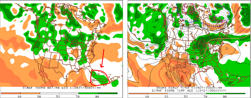
Euro, CMC and to some extent GFS continue to show that the moisture will be moving into FL by Monday and Tuesday.
Last night's euro:
Euro, CMC and to some extent GFS continue to show that the moisture will be moving into FL by Monday and Tuesday.
Last night's euro:
0 likes

Re: Invest 91L=Code Yellow
Cu's are not bad and UL winds may have relaxed just a bit.
Core has cooled to 1C.
Core has cooled to 1C.
0 likes
-
Gustywind

- Category 5

- Posts: 12334
- Joined: Mon Sep 03, 2007 7:29 am
- Location: Baie-Mahault, GUADELOUPE
Re:
AdamFirst wrote:Is this swirl related from the trough that dumped a bunch of rain on the leewards last week?
I tkink you're right my friend. Yeah, last week Guadeloupe has received very nice amounts of water from this trough. Values has climbed to 100 millimeters in somes areas
0 likes
-
Evil Jeremy
- S2K Supporter
- Posts: 5459
- Age: 30
- Joined: Mon Apr 10, 2006 2:10 pm
- Location: Los Angeles, CA
Re: ATL: INVEST 91L - Discussion
000
ABNT20 KNHC 211743
TWOAT
SPECIAL TROPICAL WEATHER OUTLOOK
NWS NATIONAL HURRICANE CENTER MIAMI FL
145 PM EDT THU APR 21 2011
FOR THE NORTH ATLANTIC...CARIBBEAN SEA AND THE GULF OF MEXICO...
A LOW PRESSURE AREA LOCATED ABOUT 450 MILES NORTH-NORTHEAST OF SAN
JUAN PUERTO RICO IS PRODUCING POORLY ORGANIZED SHOWER AND
THUNDERSTORM ACTIVITY. UPPER-LEVEL WINDS ARE EXPECTED TO BECOME
LESS CONDUCIVE FOR DEVELOPMENT ON FRIDAY...AND DEVELOPMENT OF THE
SYSTEM...IF ANY...SHOULD BE SLOW TO OCCUR AS IT MOVES NORTHWESTWARD
TO NORTHWARD AT ABOUT 10 MPH DURING THE NEXT DAY OR TWO. THERE IS
A LOW CHANCE...10 PERCENT...OF THIS SYSTEM DEVELOPING INTO A
SUBTROPICAL OR TROPICAL CYCLONE DURING THE NEXT 48 HOURS.
ADDITIONAL INFORMATION ON THIS LOW CAN BE FOUND IN HIGH SEAS
FORECASTS ISSUED BY THE NHC/TROPICAL ANALYSIS AND FORECAST
BRANCH...UNDER AWIPS HEADER NFDHSFAT2 AND WMO HEADER FZNT02 KNHC.
ANOTHER SPECIAL OUTLOOK WILL BE ISSUED ON FRIDAY...OR SOONER IF
NECESSARY.
ELSEWHERE...TROPICAL CYCLONE FORMATION IS NOT EXPECTED DURING THE
NEXT 48 HOURS.
$$
FORECASTER BEVEN
0 likes
Frances 04 / Jeanne 04 / Katrina 05 / Wilma 05 / Fay 08 / Debby 12 / Andrea 13 / Colin 16 / Hermine 16 / Matthew 16 / Irma 17
-
SouthFloridawx

- S2K Supporter
- Posts: 8344
- Age: 45
- Joined: Tue Jul 26, 2005 1:16 am
- Location: Sarasota, FL
- Contact:


-
Decomdoug

- Tropical Storm

- Posts: 177
- Age: 71
- Joined: Sun Aug 29, 2004 8:34 am
- Location: Port St. Lucie, Florida
From The Sun-Sentinel:
"Atlantic disturbance looking less likely to develop
Ken Kaye
April 21st, 2011 2:09 PM
The chance of the Atlantic disturbance developing over the next 48 hours have been lowered from 20 to 10 percent, the National Hurricane Center said in a special outlook today.
As previously noted, the thing doesn’t pose much of a threat to any land.
However, it could increase the chance of rain in South Florida by early next week.
Currently, the National Weather Service puts the chance of rain at 20 percent on Monday and a 30 percent chance on Tuesday and Wednesday.
"At 1:45 today, the poorly organized blob of low pressure – of interest mainly because it popped up six weeks before the official start of hurricane season — was about 450 miles northeast of San Juan, Puerto Rico. It was moving north-northwest at 10 mph.
Considering it’s under heavy attack from wind shear, any development would be slow to occur, senior hurricane specialist Jack Beven of the hurricane center said.
The winds should become even more hostile on Friday, when the next advisory will be issued, he said."
http://blogs.sun-sentinel.com/weather-h ... o-develop/
0 likes


Re: ATL: INVEST 91L - Discussion
Definitely looks good, but it just moved north of the 25 degree isotherm. That's not going to cut it. And although the models move it south over the next few days, shear is forecast to blow up before the system reaches warmer waters.
0 likes
Eyes: Emily '86, Dean '89, Felix '95, Gert '99, Fabian '03, Humberto '19, Paulette '20


Re: ATL: INVEST 91L - Discussion
[youtube]http://www.youtube.com/watch?v=NB1qzOhSPhI&feature=player_embedded[/youtube]
0 likes
-
Ivanhater

- Storm2k Moderator

- Posts: 10852
- Age: 37
- Joined: Fri Jul 01, 2005 8:25 am
- Location: Pensacola
Re: ATL: INVEST 91L - Discussion
Convection has been firing near the CoC...with the center producing its own thunderstorms and this is warm core with 40mph, why is this not being classified. Had this been in the Gulf, I would imagine it would be. Just my 2 cents though.

0 likes
Michael
-
SETXWXLADY
- Tropical Storm
- Posts: 216
- Joined: Wed May 20, 2009 3:26 pm
- Location: SE TX Orange County
Re: ATL: INVEST 91L - Discussion
Jam151 wrote:[youtube]http://www.youtube.com/watch?v=NB1qzOhSPhI&feature=player_embedded[/youtube]
Nice job Jam.
0 likes

-
wxman57

- Moderator-Pro Met

- Posts: 22482
- Age: 66
- Joined: Sat Jun 21, 2003 8:06 pm
- Location: Houston, TX (southwest)
Re: ATL: INVEST 91L - Discussion
Development chances near zero. Shear will be on the increase tomorrow. Won't be much left of it in 36-48 hrs.
0 likes
Who is online
Users browsing this forum: No registered users and 116 guests