BEGIN
NHC_ATCF
invest_al932011.invest
FSTDA
R
U
040
010
0000
201110091821
NONE
NOTIFY=ATRP
END
INVEST, AL, L, , , , , 93, 2011, DB, O, 2011100918, 9999999999, , , , , , METWATCH, , AL932011
AL, 93, 2011100818, , BEST, 0, 240N, 770W, 35, 1011, SS, 34, NEQ, 225, 250, 0, 0,
AL, 93, 2011100900, , BEST, 0, 250N, 773W, 35, 1010, SS, 34, NEQ, 225, 250, 0, 0,
AL, 93, 2011100906, , BEST, 0, 260N, 778W, 35, 1009, SS, 34, NEQ, 225, 250, 0, 0,
AL, 93, 2011100912, , BEST, 0, 268N, 785W, 35, 1008, SS, 34, NEQ, 225, 250, 0, 0,
AL, 93, 2011100918, , BEST, 0, 274N, 794W, 35, 1007, SS
Thread at Talking Tropics that was topic for this area.
viewtopic.php?f=31&t=112044&st=0&sk=t&sd=a
ATL: INVEST 93L - Discussion
Moderator: S2k Moderators
-
cycloneye

- Admin

- Posts: 139137
- Age: 67
- Joined: Thu Oct 10, 2002 10:54 am
- Location: San Juan, Puerto Rico
ATL: INVEST 93L - Discussion
0 likes
Visit the Caribbean-Central America Weather Thread where you can find at first post web cams,radars
and observations from Caribbean basin members Click Here
and observations from Caribbean basin members Click Here


Re: ATL: INVEST 93L - Discussion
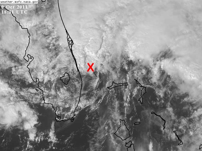
Last night there was a lot of low scud off the west coast of Florida near Tampa bay. Guess this is one of those end of front tails that made it to the surface. They usually track southwest initially.
0 likes


Re: ATL: INVEST 93L - Discussion
000
FXUS62 KJAX 091859
AFDJAX
AREA FORECAST DISCUSSION
NATIONAL WEATHER SERVICE JACKSONVILLE FL
300 PM EDT SUN OCT 9 2011
...FLOOD WATCH IN EFFECT FOR THE COAST THROUGH MONDAY...
.SHORT TERM (TONIGHT-WEDNESDAY)...
LOW PRESSURES ACROSS THE SE GULF AND OFF THE SE COAST OF FL WILL
MERGE INTO ONE LOW AND GRADUALLY MOVE NORTH ALONG THE FL WEST
COAST INTO MONDAY AND INTO NORTH FL BY TUE BEFORE WEAKENING.
WIDESPREAD RAIN...WITH A FEW EMBEDDED STORMS...CAN BE EXPECTED
TONIGHT INTO MONDAY MORNING DUE TO THE STRONG LOW LEVEL CONVERGENCE
COINCIDING WITH UPPER LEVEL FORCING. HEAVIEST RAINS ARE EXPECTED
ALONG THE COAST WHERE THE FLOOD WATCH WILL BE IN EFFECT INTO MONDAY.
ANOTHER CONCERN IS THE POTENTIAL FOR HEAVY RAINFALL RATES TO
COINCIDE WITH TIMES OF ASTRONOMICAL HIGH TIDES EARLY MONDAY
MORNING...ESPECIALLY SINCE TIDE ANOMALIES WILL BE HIGH DUE TO STRONG
ONSHORE FLOW. IF THIS OCCURS ...FLOODING CAN BE EXPECTED IN NORMALLY
PRONE AREAS ALONG THE COAST WHERE DRAINAGE MAY BE COMPROMISED. FOR
EXAMPLE...BRUNSWICK...ST AUGUSTINE...JACKSONVILLE BEACH...AND THE
SAN MARCO/RIVERSIDE AREA OF JACKSONVILLE. WINDS WILL BEGIN TO SETTLE
DOWN ON MONDAY AS THE LOW LIFTS INTO THE AREA...THUS LOOSENING THE
PRESSURE GRADIENT. LOCALLY HEAVY RAINFALL THOUGH WILL REMAIN
POSSIBLE INTO TUESDAY AS THE LOW MOVES INTO NORTH N FL. PRECIP
CHANCES DECREASE WED AS SFC LOW DEPARTS AND DRIER AIR ADVANCES SE.
KEPT LOW END CHANCE POPS GOING FOR THE SE ZONES AS THE ASSOCIATED
COLD FRONT WILL BE MOVING THROUGH.
NWS JAX pretty certain on what is going to happen. Rare to see them confident like that.
0 likes


-
Florida1118
- Category 5

- Posts: 1805
- Age: 27
- Joined: Sat Jun 19, 2010 12:57 pm
- Location: Tampa, Florida
Re: ATL: INVEST 93L - Discussion
Tampa_God wrote:NDG wrote:Winds have really picked here in Orlando this afternoon, gusts well over 30 mph now.
Winds here in New Port Richey really have died down from yesterday.
Yeah, the winds here have died down completely, havent noticed even 10mph here so far today.
0 likes
-
cycloneye
- Admin
- Posts: 139137
- Age: 67
- Joined: Thu Oct 10, 2002 10:54 am
- Location: San Juan, Puerto Rico
Re: ATL: INVEST 93L - Discussion

0 likes
Visit the Caribbean-Central America Weather Thread where you can find at first post web cams,radars
and observations from Caribbean basin members Click Here
and observations from Caribbean basin members Click Here
-
Florida1118
- Category 5
- Posts: 1805
- Age: 27
- Joined: Sat Jun 19, 2010 12:57 pm
- Location: Tampa, Florida
Re: ATL: INVEST 93L - Discussion
0 likes
-
chris_fit

- Category 5
- Posts: 3078
- Joined: Wed Sep 10, 2003 11:58 pm
- Location: Tampa Bay Area, FL
- Contact:
I don't understand why this isn't named already. NHC has named storms that looked tons worse than this.
Clearly we had development of a LCC this afternoon... The winds are there TS force, and it's right next to land. Take a look at the buoys offshore for wind readings. I'm by i-95 in Brevard County and I would say it's gusting to 35-40mph already.
I mean really? Look at this on Radar...
http://radar.weather.gov/radar.php?rid= ... 1&loop=yes
0 likes
-
HurricaneBelle

- S2K Supporter

- Posts: 974
- Joined: Sun Aug 27, 2006 6:12 pm
- Location: Clearwater, FL
Re:
chris_fit wrote:I don't understand why this isn't named already. NHC has named storms that looked tons worse than this.
Probably because they only gave it a 30% chance to form at 2PM. The Melbourne NWS had to put out what was essentially a homemade tropical storm warning in that SPS quoted above.
0 likes
-
AJC3

- Admin
- Posts: 3873
- Age: 60
- Joined: Tue Aug 31, 2004 7:04 pm
- Location: West Melbourne, Florida
- Contact:
Re:
chris_fit wrote:I don't understand why this isn't named already. NHC has named storms that looked tons worse than this.
Clearly we had development of a LCC this afternoon... The winds are there TS force, and it's right next to land. Take a look at the buoys offshore for wind readings. I'm by i-95 in Brevard County and I would say it's gusting to 35-40mph already.
I mean really? Look at this on Radar...
http://radar.weather.gov/radar.php?rid= ... 1&loop=yes
You probably don't realize what a logistical nightmare this would cause our office to name this thing at such a late hour. We would have to cancel the Gale Warning, High Surf Advisory, Wind Advisory and Lake Wind Advisory that have been up now for two days and replace them with Subtropical Storm Warning. We would need to put out products cancelling the current advisories, and then issue a Subtropical Storm Local Statement, update the Zone Forecasts, Coastal Waters Forecast Hazardous Weather Outlook, our blog and Short term Forecast. Local graphics would have to be updated as well as our forecast grids.
All this for a low center that will be moving inland shortly.
All this to describe sensible weather conditions that have been well-handled by the current suite of products.
To name this thing would be counter-productive and create a bunch of duplicative work.
Something to think about before we start calling out folks within our agency.
0 likes
-
Dean4Storms
- S2K Supporter
- Posts: 6355
- Age: 61
- Joined: Sun Aug 31, 2003 1:01 pm
- Location: Miramar Bch. FL
-
brunota2003

- S2K Supporter
- Posts: 9476
- Age: 33
- Joined: Sat Jul 30, 2005 9:56 pm
- Location: Stanton, KY...formerly Havelock, NC
- Contact:
-
chris_fit
- Category 5
- Posts: 3078
- Joined: Wed Sep 10, 2003 11:58 pm
- Location: Tampa Bay Area, FL
- Contact:
Re: Re:
AJC3 wrote:
You probably don't realize what a logistical nightmare this would cause our office to name this thing at such a late hour. We would have to cancel the Gale Warning, High Surf Advisory, Wind Advisory and Lake Wind Advisory that have been up now for two days and replace them with Subtropical Storm Warning. We would need to put out products cancelling the current advisories, and then issue a Subtropical Storm Local Statement, update the Zone Forecasts, Coastal Waters Forecast Hazardous Weather Outlook, our blog and Short term Forecast. Local graphics would have to be updated as well as our forecast grids.
All this for a low center that will be moving inland shortly.
All this to describe sensible weather conditions that have been well-handled by the current suite of products.
To name this thing would be counter-productive and create a bunch of duplicative work.
Something to think about before we start calling out folks within our agency.
Never thought about that, makes sense I guess! Keep up the good work!
0 likes
-
chris_fit
- Category 5
- Posts: 3078
- Joined: Wed Sep 10, 2003 11:58 pm
- Location: Tampa Bay Area, FL
- Contact:
Re: Re:
AJC3 wrote:chris_fit wrote: Never thought about that, makes sense I guess! Keep up the good work!
Thanks.
Do you work at Melbourne NWS?
I went to FL Tech and studied meteorology for a semester. I love it but was afraid of not finding employment after graduating. I remember we took a "field trip" to the Melbourne NWS. Was a fun day!
0 likes
Who is online
Users browsing this forum: No registered users and 67 guests