Hurricane Andrew wrote:Do you think it's decoupled, Wx?
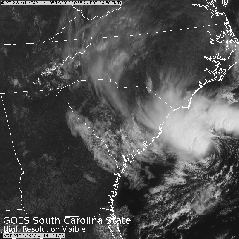
Decoupled from what? It's spinning over 80+ deg water and no frontal boundary in the region.
Moderator: S2k Moderators


wxman57 wrote:Hurricane Andrew wrote:Do you think it's decoupled, Wx?
Decoupled from what? It's spinning over 80+ deg water and no frontal boundary in the region.


Hurricane Andrew wrote:Do you think the MLC and LLC are stacked, or not stacked?


TropicalAnalystwx13 wrote:The following post is NOT an official forecast and should not be used as such. It is just the opinion of the poster and may or may not be backed by sound meteorological data. It is NOT endorsed by any professional institution including storm2k.org. For Official Information please refer to the NHC and NWS products
I think Alberto will be designated at 5.
I'm on my iPhone, somebody edit this post to include that forecast disclaimer.

Hurricane Andrew wrote:Cyclone: When will the next ASCAT pass be?

bg1 wrote:Well, I guess there is a closed low after all!
This is potentially a very scary situation, as it may spin up rapidly.
If they don't start advisories at 5, they should at least put up tropical storm warnings.

Chacor wrote:bg1 wrote:Well, I guess there is a closed low after all!
This is potentially a very scary situation, as it may spin up rapidly.
If they don't start advisories at 5, they should at least put up tropical storm warnings.
While they could certainly put up wind warnings and heavy rain warnings, it's not yet in their remit to issue tropical cyclone warnings publicly before a TC has been warned on. They're doing that internally this year but the public won't have access to these warnings.

cycloneye wrote:TropicalAnalystwx13 wrote:The following post is NOT an official forecast and should not be used as such. It is just the opinion of the poster and may or may not be backed by sound meteorological data. It is NOT endorsed by any professional institution including storm2k.org. For Official Information please refer to the NHC and NWS products
I think Alberto will be designated at 5.
I'm on my iPhone, somebody edit this post to include that forecast disclaimer.
Added it.
Users browsing this forum: No registered users and 27 guests


