northjaxpro wrote:Observing WV imagery of the CONUS, the one player which I think will help determine 96L's fate is the potent shortwave which is currently moving through the Upper Plains riding over the ridge over the Intermountian West. I am watching this feature very closely.
This energy may sharpen the trough over the east coast just enough during the Sunday-Monday period and delay the High over the Intermountain West from building farther east. If this happens, then the weakness may be in place to pick 96L up through to the northeast. This is something I am just pointing out.
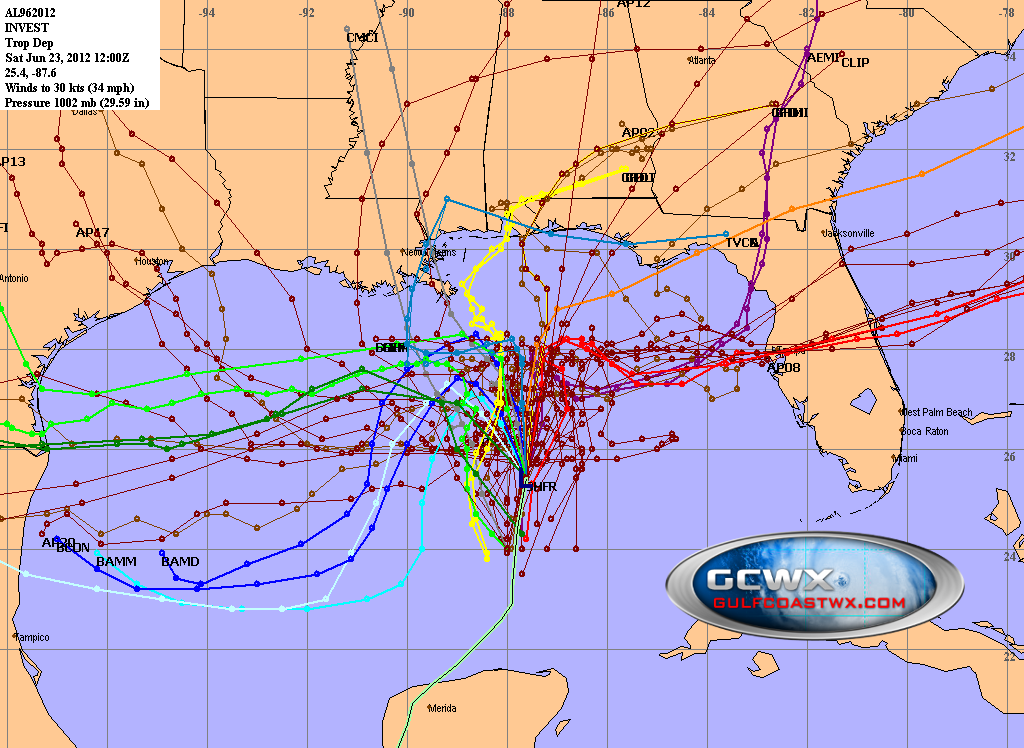
This is going to be an extremely close call. Fascinating wathcing this unfold.
The posts in this forum are NOT official forecast and should not be used as such. They are just the opinion of the poster and may or may not be backed by sound meteorological data. They are NOT endorsed by any professional institution or storm2k.org. For official information, please refer to the NHC and NWS products.
From what I've seen, that is what the GFS has been showing over the last few runs. The trough over the East Coast deepens in three days thanks to the kick provided by the aforementioned shortwave, and 96L/Debby follows a weakness left by the trough/some weird vorticity spawn to the NE. I think the GFS may be trying to do what AFM just described. It may be spitting out extra vorticity each time it tries to reform the center to the NE due to the heavier convection being over there. A lot of unknowns.