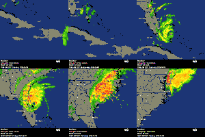
ATL: BERYL - Post-Tropical

Moderator: S2k Moderators

Message
Author
User avatar
MiamiHurricanes10
S2K Supporter
S2K Supporter
Posts: 260
Joined: Mon Jul 19, 2010 7:56 pm
Location: Miami, Florida

Re: Re:

#1521 Postby MiamiHurricanes10 » Sun May 27, 2012 9:05 pm

ozonepete wrote:
CrazyC83 wrote:I still wonder if this is really an intense subtropical storm. It doesn't look like a classic tropical storm at all.


Looks completely tropical to me. NHC has said it is. What makes you think it isn't?

The fact that the convection is meager, at best lol. I mean, on infrared Beryl looks uh, disastrous, in a bad way.
0 likes   

Terry
S2K Supporter
S2K Supporter
Posts: 1450
Joined: Wed Aug 11, 2004 8:25 pm
Location: Lakeland and Anna Maria Island, FL
Contact:

Re: ATL: BERYL - Tropical Storm

#1522 Postby Terry » Sun May 27, 2012 9:05 pm

WJXT4 just tweeted:

Orange Park (NAS Jax) just recorded a wind gust of 60 mph
0 likes   

ozonepete
Professional-Met
Professional-Met
Posts: 4743
Joined: Mon Sep 07, 2009 3:23 pm
Location: From Ozone Park, NYC / Now in Brooklyn, NY

Re: ATL: BERYL - Tropical Storm

#1523 Postby ozonepete » Sun May 27, 2012 9:06 pm

jinftl wrote:Mike Seidel noted just now that is an unofficial measurement and the instrument was at an elevated height...not to say that gusts to hurricane force won't happen but it seems to be an outlier reading so far...power lines coming down with gusts to 60 mph...


Emmett_Brown wrote:Per Brian Norcross on TWC, Mathews bridge in down town Jax recorded 87 mph (at an elevated height) during the past hour.


Still looks like highest winds will come in over SE Georgia and FL/GA border where there are very few measuring instruments. We may never know.
0 likes   

ozonepete
Professional-Met
Professional-Met
Posts: 4743
Joined: Mon Sep 07, 2009 3:23 pm
Location: From Ozone Park, NYC / Now in Brooklyn, NY

Re: Re:

#1524 Postby ozonepete » Sun May 27, 2012 9:07 pm

MiamiHurricanes10 wrote:
ozonepete wrote:
CrazyC83 wrote:I still wonder if this is really an intense subtropical storm. It doesn't look like a classic tropical storm at all.


Looks completely tropical to me. NHC has said it is. What makes you think it isn't?

The fact that the convection is meager, at best lol. I mean, on infrared Beryl looks uh, disastrous, in a bad way.


That has nothing to do with whether it's tropical or not, right?
0 likes   

User avatar
jdray
Category 3
Category 3
Posts: 853
Joined: Tue Aug 31, 2004 10:07 pm
Location: NE Florida

Re: ATL: BERYL - Tropical Storm

#1525 Postby jdray » Sun May 27, 2012 9:08 pm

And right on cue, power went out for a minute, luckily have battery backups on internet and wifi and am on a laptop.

Might be a fun nite lol.
0 likes   

User avatar
HurricaneBrain
S2K Supporter
S2K Supporter
Posts: 520
Joined: Thu Jun 30, 2011 2:07 pm

#1526 Postby HurricaneBrain » Sun May 27, 2012 9:08 pm

Are there anymore Jacksonville cams? JaxPierCam is down.
0 likes   

User avatar
lester
S2K Supporter
S2K Supporter
Posts: 1305
Age: 36
Joined: Sat Aug 27, 2005 5:21 pm
Location: Washington, DC
Contact:

#1527 Postby lester » Sun May 27, 2012 9:08 pm

4 W Mayport [Duval Co, FL] mesonet reports TROPICAL STORM at 10:00 PM EDT -- wind gust report of 67 mph at buck island on st. johns river.
0 likes   

CrazyC83
Professional-Met
Professional-Met
Posts: 34001
Joined: Tue Mar 07, 2006 11:57 pm
Location: Deep South, for the first time!

Re: ATL: BERYL - Tropical Storm

#1528 Postby CrazyC83 » Sun May 27, 2012 9:08 pm

jdray wrote:And right on cue, power went out for a minute, luckily have battery backups on internet and wifi and am on a laptop.

Might be a fun nite lol.


Stay safe out there!
0 likes   

CrazyC83
Professional-Met
Professional-Met
Posts: 34001
Joined: Tue Mar 07, 2006 11:57 pm
Location: Deep South, for the first time!

#1529 Postby CrazyC83 » Sun May 27, 2012 9:09 pm

From tweets, even in the dry slot, it is not a calm eye on the beaches.
0 likes   

User avatar
jdray
Category 3
Category 3
Posts: 853
Joined: Tue Aug 31, 2004 10:07 pm
Location: NE Florida

Re: ATL: BERYL - Tropical Storm

#1530 Postby jdray » Sun May 27, 2012 9:10 pm

Terry wrote:WJXT4 just tweeted:

Orange Park (NAS Jax) just recorded a wind gust of 60 mph


http://www.weather.gov/data/obhistory/KNIP.html
Offical, 36 sustained, 60 gust already.

Going to be a fun nite as this storm comes ashore, TS or not.
0 likes   

Aric Dunn
Category 5
Category 5
Posts: 21238
Age: 42
Joined: Sun Sep 19, 2004 9:58 pm
Location: Ready for the Chase.
Contact:

Re:

#1531 Postby Aric Dunn » Sun May 27, 2012 9:14 pm

HurricaneBrain wrote:Are there anymore Jacksonville cams? JaxPierCam is down.


Steve is out in the storm. doing some video uploads and live streaming http://ustre.am/L0OY
0 likes   
Note: If I make a post that is brief. Please refer back to previous posts for the analysis or reasoning. I do not re-write/qoute what my initial post said each time.
If there is nothing before... then just ask :)

Space & Atmospheric Physicist, Embry-Riddle Aeronautical University,
I believe the sky is falling...

User avatar
thundercam96
Tropical Storm
Tropical Storm
Posts: 129
Joined: Thu Aug 18, 2011 3:01 pm
Location: Boston, MA

#1532 Postby thundercam96 » Sun May 27, 2012 9:15 pm

It Is Quiet In Daytona Beach....Hav'nt Seen Rain Since About 7....
0 likes   
Fay '08 / Mathew 16'

Personal Forecast Disclaimer: I am not a certified meteorologist, therefore, what is posted on this forum under my header should not be treated as an official forecast. Please refer to the NWS/NHC products for forecast information.

Aric Dunn
Category 5
Category 5
Posts: 21238
Age: 42
Joined: Sun Sep 19, 2004 9:58 pm
Location: Ready for the Chase.
Contact:

Re:

#1533 Postby Aric Dunn » Sun May 27, 2012 9:18 pm

thundercam96 wrote:It Is Quiet In Daytona Beach....Hav'nt Seen Rain Since About 7....


yeah the south side is always typically not so exciting unless it was moving east.
0 likes   
Note: If I make a post that is brief. Please refer back to previous posts for the analysis or reasoning. I do not re-write/qoute what my initial post said each time.
If there is nothing before... then just ask :)

Space & Atmospheric Physicist, Embry-Riddle Aeronautical University,
I believe the sky is falling...

jinftl
Category 5
Category 5
Posts: 4312
Joined: Tue Aug 31, 2004 4:47 pm
Location: fort lauderdale, fl

Re: ATL: BERYL - Tropical Storm

#1534 Postby jinftl » Sun May 27, 2012 9:19 pm

This bouy has been a good indicator on conditions that will be coming ashore the jax-st augustine area since it is 50 miles or so due east. The buoy is moving out of the large dry slot just moving into the jax area. So far the buoy is seeing winds comparable (a bit less so far) to what they saw on the western side of the dry slot - winds once again approaching sustained tropical force. No sign of the sustained 70 mph winds on the 8pm advisory near the buoy.

If Beryl is classified as a hurricane in post-analysis, it probably hit that a few hours ago. With half the circulation onshore, it certainly has peaked already in intensity. Satellite images show the storm looking less 'tight'...less like a storm that is 'winding up' like it did before.

Image
0 likes   

Terry
S2K Supporter
S2K Supporter
Posts: 1450
Joined: Wed Aug 11, 2004 8:25 pm
Location: Lakeland and Anna Maria Island, FL
Contact:

Re: ATL: BERYL - Tropical Storm

#1535 Postby Terry » Sun May 27, 2012 9:22 pm

From ActionNewsJax.com:

Sunday @ 10:16 PM: Action News reporter Catherine Varnum is at the city's Emergency Operations Center. Officials have announced that the Hart Bridge is now closed. Motorists were advised to take alternate routes
0 likes   

User avatar
cycloneye
Admin
Admin
Posts: 143867
Age: 68
Joined: Thu Oct 10, 2002 10:54 am
Location: San Juan, Puerto Rico

Re: ATL: BERYL - Tropical Storm

#1536 Postby cycloneye » Sun May 27, 2012 9:22 pm

Almost at landfall.

Image
0 likes   
Visit the Caribbean-Central America Weather Thread where you can find at first post web cams,radars
and observations from Caribbean basin members Click Here

Aric Dunn
Category 5
Category 5
Posts: 21238
Age: 42
Joined: Sun Sep 19, 2004 9:58 pm
Location: Ready for the Chase.
Contact:

Re: ATL: BERYL - Tropical Storm

#1537 Postby Aric Dunn » Sun May 27, 2012 9:28 pm

cycloneye wrote:Almost at landfall.

[img]http://radar.weather.gov/ridge/lite/N0R/JAX_0.png[/ig]


well the center is just about right in the middle of eye. well duh I guess that would be the center. lol anyway still a few hours till official landfall.
0 likes   
Note: If I make a post that is brief. Please refer back to previous posts for the analysis or reasoning. I do not re-write/qoute what my initial post said each time.
If there is nothing before... then just ask :)

Space & Atmospheric Physicist, Embry-Riddle Aeronautical University,
I believe the sky is falling...

User avatar
SouthFLTropics
Category 5
Category 5
Posts: 4236
Age: 49
Joined: Thu Aug 14, 2003 8:04 am
Location: Port St. Lucie, Florida

ATL: BERYL - Tropical Storm

#1538 Postby SouthFLTropics » Sun May 27, 2012 9:30 pm

Beryl is giving us a nice shot of rain here in Port St. Lucie tonight with a long reaching feeder band. I still can't believe that it is May 27th and we are talking about the second named storm already. Looks to be an exciting season. Alberto and Beryl must be the Tropics equivilant to preseason football.

SFT
0 likes   
Fourth Generation Florida Native

Personal Storm History: David 79, Andrew 92, Erin 95, Floyd 99, Irene 99, Frances 04, Jeanne 04, Wilma 05, Matthew 16, Irma 17, Ian 22, Nicole 22, Milton 24

Ev1948
S2K Supporter
S2K Supporter
Posts: 65
Joined: Mon Jun 28, 2010 6:16 pm
Location: Florida USA -from South New Jersey

Re: ATL: BERYL - Tropical Storm

#1539 Postby Ev1948 » Sun May 27, 2012 9:38 pm

We are getting a lot of rain in Sebastian, thunder and lighting. All of you up North FL stay safe.
0 likes   

User avatar
cycloneye
Admin
Admin
Posts: 143867
Age: 68
Joined: Thu Oct 10, 2002 10:54 am
Location: San Juan, Puerto Rico

Re: ATL: BERYL - Advisories

#1540 Postby cycloneye » Sun May 27, 2012 9:45 pm

BULLETIN
TROPICAL STORM BERYL ADVISORY NUMBER 9
NWS NATIONAL HURRICANE CENTER MIAMI FL AL022012
1100 PM EDT SUN MAY 27 2012

...CENTER OF TROPICAL STORM BERYL ABOUT TO MOVE INLAND...TROPICAL
STORM CONDITIONS SPREADING INLAND...


SUMMARY OF 1100 PM EDT...0300 UTC...INFORMATION
-----------------------------------------------
LOCATION...30.2N 81.1W
ABOUT 35 MI...60 KM E OF JACKSONVILLE FLORIDA
ABOUT 75 MI...120 KM SSE OF BRUNSWICK GEORGIA
MAXIMUM SUSTAINED WINDS...70 MPH...110 KM/H
PRESENT MOVEMENT...W OR 270 DEGREES AT 7 MPH...11 KM/H
MINIMUM CENTRAL PRESSURE...993 MB...29.32 INCHES


WATCHES AND WARNINGS
--------------------
CHANGES WITH THIS ADVISORY...

NONE.

SUMMARY OF WATCHES AND WARNINGS IN EFFECT...

A TROPICAL STORM WARNING IS IN EFFECT FOR...
* VOLUSIA/BREVARD COUNTY LINE FLORIDA TO EDISTO BEACH SOUTH CAROLINA

FOR STORM INFORMATION SPECIFIC TO YOUR AREA INCLUDING POSSIBLE
INLAND WATCHES AND WARNINGS...PLEASE MONITOR PRODUCTS ISSUED BY
YOUR LOCAL NATIONAL WEATHER SERVICE FORECAST OFFICE.

DISCUSSION AND 48-HOUR OUTLOOK
------------------------------
AT 1100 PM EDT...0300 UTC...THE CENTER OF TROPICAL STORM BERYL WAS
LOCATED NEAR LATITUDE 30.2 NORTH...LONGITUDE 81.1 WEST. BERYL IS
MOVING TOWARD THE WEST NEAR 7 MPH...11 KM/H. ON THE FORECAST
TRACK...THE CENTER SHOULD CROSS THE COAST WITHIN THE WARNING AREA
DURING THE NEXT FEW HOURS. AFTER LANDFALL...BERYL IS EXPECTED TO
MOVE SLOWLY WEST-NORTHWESTWARD AND THEN TURN NORTHEASTWARD OVER
PORTIONS OF NORTHEASTERN FLORIDA AND SOUTHEASTERN GEORGIA ON MONDAY
AND TUESDAY.

MAXIMUM SUSTAINED WINDS REMAIN NEAR 70 MPH...110 KM/H...WITH HIGHER
GUSTS. BERYL SHOULD BEGIN TO WEAKEN AS THE CENTER MOVES INLAND AND
BECOME A TROPICAL DEPRESSION IN DAY OR SO.

TROPICAL STORM FORCE WINDS EXTEND OUTWARD UP TO 115 MILES...185 KM
FROM THE CENTER. HUGUENOT PARK NEAR JACKSONVILLE BEACH RECENTLY
REPORTED SUSTAINED WINDS OF 53 MPH...85 KM/H...WITH A GUST OF 68
MPH...109 KM/H.

THE ESTIMATED MINIMUM CENTRAL PRESSURE IS 993 MB...29.32 INCHES.


HAZARDS AFFECTING LAND
----------------------
WIND...TROPICAL STORM CONDITIONS ARE ALREADY AFFECTING THE COAST OF
NORTHEASTERN FLORIDA AND SOUTHEASTERN GEORGIA. THESE CONDITIONS WILL
CONTINUE TO SPREAD INLAND TONIGHT AND MONDAY. GUSTS TO HURRICANE
FORCE ARE STILL POSSIBLE OVER PORTIONS OF NORTHEASTERN FLORIDA AND
SOUTHEASTERN GEORGIA TONIGHT.

STORM SURGE...THE COMBINATION OF A STORM SURGE AND THE TIDE WILL
CAUSE NORMALLY DRY AREAS NEAR THE COAST TO BE FLOODED BY RISING
WATERS. THE WATER COULD REACH THE FOLLOWING DEPTHS ABOVE GROUND IF
THE PEAK SURGE OCCURS AT THE TIME OF HIGH TIDE...

GEORGIA AND NORTHEASTERN FLORIDA...2 TO 4 FT
SOUTHERN SOUTH CAROLINA...1 TO 2 FT

THE DEEPEST WATER WILL OCCUR ALONG THE IMMEDIATE COAST NEAR AND TO
THE NORTH OF THE LANDFALL LOCATION...WHERE THE SURGE WILL BE
ACCOMPANIED BY LARGE WAVES. SURGE-RELATED FLOODING DEPENDS ON THE
RELATIVE TIMING OF THE SURGE AND THE TIDAL CYCLE...AND CAN VARY
GREATLY OVER SHORT DISTANCES. FOR INFORMATION SPECIFIC TO YOUR
AREA...PLEASE SEE PRODUCTS ISSUED BY YOUR LOCAL NATIONAL WEATHER
SERVICE OFFICE.

SURF...DANGEROUS SURF CONDITIONS...INCLUDING RIP CURRENTS...ARE
EXPECTED ALONG THE COAST FROM NORTHEASTERN FLORIDA TO NORTH
CAROLINA OVER THE REMAINDER OF THE MEMORIAL DAY WEEKEND. PLEASE SEE
STATEMENTS ISSUED BY YOUR LOCAL NATIONAL WEATHER SERVICE OFFICE FOR
INFORMATION SPECIFIC TO YOUR AREA.

RAINFALL...BERYL IS EXPECTED TO PRODUCE TOTAL RAIN ACCUMULATIONS OF
4 TO 8 INCHES...WITH ISOLATED MAXIMUM AMOUNTS OF 12 INCHES...FROM
NORTHERN FLORIDA THROUGH SOUTHEASTERN NORTH CAROLINA.


NEXT ADVISORY
-------------
NEXT INTERMEDIATE ADVISORY...200 AM EDT.
NEXT COMPLETE ADVISORY...500 AM EDT.

$$
FORECASTER AVILA/KIMBERLAIN

TROPICAL STORM BERYL DISCUSSION NUMBER 9
NWS NATIONAL HURRICANE CENTER MIAMI FL AL022012
1100 PM EDT SUN MAY 27 2012


A HURRICANE HUNTER AIRCRAFT WAS IN BERYL FOR SEVERAL HOURS EARLIER
THIS EVENING AND REPORTED PEAK FLIGHT-LEVEL WINDS OF 80 KT...AND A
RAIN-INFLATED PEAK SFMR WIND OF 62 KT. CORRECTING THE SFMR WIND FOR
THE RAIN YIELDS 55 KT. IN THIS CASE...THE SURFACE TO FLIGHT-LEVEL
WIND SPEED RATIO WAS A LITTLE LOWER THAN NORMAL. EARLIER DOPPLER
RADAR DATA ALSO INDICATED WINDS AT 5000-6000 FT AS STRONG AS THOSE
MEASURED BY THE AIRCRAFT AT FLIGHT-LEVEL. HOWEVER...THE PLANE
MEASURED PEAK SFMR WINDS OF ONLY 50-55 KT WITHIN THIS
REGION...SUGGESTING THAT EARLIER REDUCTION FACTOR WAS REASONABLE.
SINCE THAT TIME...THE STRONG DOPPLER WIND SPEED ESTIMATES WINDS
HAVE DECREASED WHILE DVORAK INTENSITY ESTIMATES REMAIN AT ABOUT
3.5. A BLEND OF THESE DATA SUGGEST THAT BERYL IS NO LONGER
INTENSIFYING...AND THE INITIAL INTENSITY IS KEPT AT 60 KNOTS. THE
LARGE CIRCULATION OF BERYL IS ABOUT TO MOVE INLAND DURING THE NEXT
FEW HOURS...LEAVING NO TIME FOR ANY ADDITIONAL STRENGTHENING. IN
FACT...SINCE A PORTION OF THE CIRCULATION IS ALREADY
INLAND...WEAKENING SHOULD BEGIN SOON. THE OFFICIAL FORECAST FOLLOWS
DSHIPS MODEL WHILE BERYL IS OVER LAND. SOME RESTRENGTHENING IS
POSSIBLE WHEN BERYL EMERGES OVER THE WESTERN ATLANTIC...BUT IT
SHOULD BEGIN EXTRATROPICAL TRANSITION IN ABOUT 4 DAYS.

RADAR FIXES AND SURFACE DATA INDICATE THAT BERYL IS MOVING TOWARD
THE WEST OR 270 DEGREES AT 6 KNOTS. A MID-LEVEL RIDGE TO THE NORTH
SHOULD CONTINUE TO STEER BERYL WESTWARD FOR THE NEXT DAY OR SO.
MID-LATITUDE WESTERLIES ARE FORECAST BY THE GLOBAL MODELS TO BECOME
ESTABLISHED OVER THE UNITED STATES AND THE WESTERN ATLANTIC. THIS
FLOW PATTERN SHOULD CARRY BERYL EAST-NORTHEASTWARD OVER THE
ATLANTIC UNTIL DISSIPATION.


FORECAST POSITIONS AND MAX WINDS

INIT 28/0300Z 30.2N 81.1W 60 KT 70 MPH
12H 28/1200Z 30.3N 82.0W 45 KT 50 MPH...INLAND
24H 29/0000Z 30.5N 82.7W 35 KT 40 MPH...INLAND
36H 29/1200Z 31.2N 82.0W 30 KT 35 MPH...INLAND
48H 30/0000Z 32.0N 81.0W 30 KT 35 MPH...INLAND
72H 31/0000Z 34.5N 75.0W 35 KT 40 MPH...OVER WATER
96H 01/0000Z 37.5N 66.0W 40 KT 45 MPH...POST-TROP/EXTRATROP
120H 02/0000Z 40.0N 55.0W 40 KT 45 MPH...POST-TROP/EXTRATROP

$$
FORECASTER AVILA/KIMBERLAIN
0 likes   
Visit the Caribbean-Central America Weather Thread where you can find at first post web cams,radars
and observations from Caribbean basin members Click Here


Return to “2012”

Who is online

Users browsing this forum: No registered users and 33 guests