#1846 Postby Aric Dunn » Fri Aug 03, 2012 9:33 pm
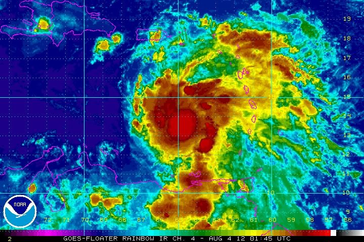
what a improvement from earlier... could see a hurricane before the forecast calls for.
I wonder what kind of influence 91l will have on ernesto. it may end up making the weakness a little more pronounced and causing a more wnw to nw motion late tomorrow and sunday.
0 likes
Note: If I make a post that is brief. Please refer back to previous posts for the analysis or reasoning. I do not re-write/qoute what my initial post said each time.
If there is nothing before... then just ask

Space & Atmospheric Physicist, Embry-Riddle Aeronautical University,
I believe the sky is falling...


