ATL: ISAAC - Models

Moderator: S2k Moderators

Message
Author
User avatar
Vortex
S2K Supporter
S2K Supporter
Posts: 4644
Age: 53
Joined: Fri Aug 01, 2003 9:34 pm
Location: Hilton Head, SC

Re: ATL: ISAAC - Models

#2701 Postby Vortex » Thu Aug 23, 2012 9:58 pm

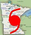
deltadog03 wrote:I know its the NAM BUT that is a pretty big weakness......

Image

Uploaded with ImageShack.us


very interesting.....
0 likes   

wxman76
Tropical Depression
Tropical Depression
Posts: 84
Age: 49
Joined: Sun Aug 19, 2012 4:19 pm
Location: Gibsonton FL

#2702 Postby wxman76 » Thu Aug 23, 2012 9:58 pm

Look at the 48 hr 00z NAM it actually has the main low north of Cuba and a second weak low south of it. Then it does a fujiwara effect sending Isaac west towards the keys then North again. Strange but a definite shift to the west. I believe this is the first run to show it on the west coast. Not that I believe that track but trying to get some insights into what the big boys are gonna do tonight.
Last edited by wxman76 on Thu Aug 23, 2012 9:58 pm, edited 1 time in total.
0 likes   

User avatar
ronjon
Category 5
Category 5
Posts: 4837
Joined: Fri Aug 19, 2005 5:17 pm
Location: Hernando Beach, FL

Re: ATL: ISAAC - Models

#2703 Postby ronjon » Thu Aug 23, 2012 9:58 pm

yeah 00z NAM into the middle keys and cape sable.

NAM
0 likes   

User avatar
Steve
S2K Supporter
S2K Supporter
Posts: 9623
Joined: Sat Apr 05, 2003 11:41 pm
Location: Not a state-caster

Re: ATL: ISAAC - Models

#2704 Postby Steve » Thu Aug 23, 2012 9:59 pm

In the beginning, the giants of weather started posting on the internet. Dericho, John and Mike C, frank pelligrini, cycloneye, hank frank, Jason Kelly, Lois Cane, and yours truly. Well me, I don't even own a computer any more and so be it. I haven't even logged into an account since like 2009. But like Superman, when you need his ass, he might be around. So here is the deal. Models have swayed from out to sea, to Miami/SC-NC, to the West Coast of Florida to the panhandle and now, possibly points farther west. I still think it is way too early to pinpoint any landfall assuming Isaac can get and keep his act together. We don't know, and we won't know for about 4 days what's really going to happen. So even though this is the model thread, there is one place you can go to see what will happen in the 6-10 day range. That is the joint typhoon warning center. Go look at the forecast graphics for Tembin and Bolaven. Its all there. 6 days out, the teleconnection is ridging in the SW Atlantic in the Northern Hemisphere. Based on Bolaven's track alone, up in behind the Korean Peninsula, it telegraphs a NW FL/AL hit. Now whether the jtwc's track verifies remains to be seen. Stay tuned. But the lack of a recurve here with a NW/WNW bend in the interim, would wake me up if I lived between Bay Co., FL and Jackson Co., MS. Just some food for thought while you are waiting on more models to come out. Love to all, especially up in Lincoln Park, I'll. ;) this post is fully disclaimed as per site rules yet it sends all the love I got to all y'all. Keep the discourse up to a level you would be proud of, and I will see you all next major threat. Peace.
0 likes   

User avatar
ronjon
Category 5
Category 5
Posts: 4837
Joined: Fri Aug 19, 2005 5:17 pm
Location: Hernando Beach, FL

Re: ATL: ISAAC - Models

#2705 Postby ronjon » Thu Aug 23, 2012 10:00 pm

ronjon wrote:yeah 00z NAM into the middle keys and cape sable.

NAM


Very similar to 00z BAMM and 18Z GFDL.
0 likes   

User avatar
deltadog03
Professional-Met
Professional-Met
Posts: 3580
Joined: Tue Jul 05, 2005 6:16 pm
Location: Macon, GA

#2706 Postby deltadog03 » Thu Aug 23, 2012 10:00 pm

Well, if that is right...the Alley way there, then we could see some swings back towards the right tonight.
0 likes   

User avatar
Vortex
S2K Supporter
S2K Supporter
Posts: 4644
Age: 53
Joined: Fri Aug 01, 2003 9:34 pm
Location: Hilton Head, SC

#2707 Postby Vortex » Thu Aug 23, 2012 10:00 pm

30 min as we all await 00z GFS with data incorprated gorm the G-IV....
0 likes   

User avatar
boca
Category 5
Category 5
Posts: 6370
Age: 60
Joined: Mon Dec 15, 2003 8:49 am
Location: Boca Raton,FL

Re: ATL: ISAAC - Models

#2708 Postby boca » Thu Aug 23, 2012 10:03 pm

Steve Weagle says that its better news for S Florida that we are out of the error cone.
0 likes   

User avatar
ronjon
Category 5
Category 5
Posts: 4837
Joined: Fri Aug 19, 2005 5:17 pm
Location: Hernando Beach, FL

Re:

#2709 Postby ronjon » Thu Aug 23, 2012 10:05 pm

deltadog03 wrote:Well, if that is right...the Alley way there, then we could see some swings back towards the right tonight.


Agreed DD - at least up to the 72-84 hr time frame.
0 likes   

Aric Dunn
Category 5
Category 5
Posts: 21238
Age: 42
Joined: Sun Sep 19, 2004 9:58 pm
Location: Ready for the Chase.
Contact:

Re:

#2710 Postby Aric Dunn » Thu Aug 23, 2012 10:05 pm

deltadog03 wrote:Well, if that is right...the Alley way there, then we could see some swings back towards the right tonight.


very true. look at 5oomb heights.

quite be less expansive ridge.

pre g-iv data.

Image

00z run

Image
0 likes   
Note: If I make a post that is brief. Please refer back to previous posts for the analysis or reasoning. I do not re-write/qoute what my initial post said each time.
If there is nothing before... then just ask :)

Space & Atmospheric Physicist, Embry-Riddle Aeronautical University,
I believe the sky is falling...

User avatar
Hurricane Alexis
Category 2
Category 2
Posts: 683
Age: 29
Joined: Thu Jun 14, 2012 7:59 pm
Location: Miami,Florida

Re: ATL: ISAAC - Models

#2711 Postby Hurricane Alexis » Thu Aug 23, 2012 10:11 pm

boca wrote:Steve Weagle says that its better news for S Florida that we are out of the error cone.


We're in the cone still lol.
0 likes   
Personal Forecast Disclaimer:
The posts in this forum are NOT official forecast and should not be used as such. They are just the opinion of the poster and may or may not be backed by sound meteorological data. They are NOT endorsed by any professional institution or storm2k.org. For official information, please refer to the NHC and NWS products.

jlauderdal
S2K Supporter
S2K Supporter
Posts: 7202
Joined: Wed May 19, 2004 5:46 am
Location: NE Fort Lauderdale
Contact:

Re: ATL: ISAAC - Models

#2712 Postby jlauderdal » Thu Aug 23, 2012 10:15 pm

boca wrote:Steve Weagle says that its better news for S Florida that we are out of the error cone.

this weagle is a funny guy, what channel is he on
0 likes   

User avatar
ronjon
Category 5
Category 5
Posts: 4837
Joined: Fri Aug 19, 2005 5:17 pm
Location: Hernando Beach, FL

Re: ATL: ISAAC - Models

#2713 Postby ronjon » Thu Aug 23, 2012 10:15 pm

NHC sees the weaker ridge too. From 11 PM disc.

A MID-TROPOSPHERIC TROUGH
OVER THE SOUTHEASTERN U.S. IS CAUSING A BREAK IN THE SUBTROPICAL
RIDGE. IN RESPONSE TO THIS...ISAAC SHOULD TURN TOWARD A MORE
NORTHWESTWARD HEADING OVER THE NEXT FEW DAYS. THE MODEL CONSENSUS
HAS SHIFTED A BIT TO THE RIGHT DURING THE FIRST HALF OF THE FORECAST
PERIOD...PRIMARILY DUE TO AN EASTWARD SHIFT OF THE LATEST GFS
TRACK. THE OFFICIAL FORECAST IS NUDGED A BIT TO THE RIGHT
OF
THE PREVIOUS ONE AND IS SOMEWHAT FASTER BASED ON THE LATEST MODEL
GUIDANCE.
0 likes   

User avatar
boca
Category 5
Category 5
Posts: 6370
Age: 60
Joined: Mon Dec 15, 2003 8:49 am
Location: Boca Raton,FL

Re: ATL: ISAAC - Models

#2714 Postby boca » Thu Aug 23, 2012 10:18 pm

jlauderdal wrote:
boca wrote:Steve Weagle says that its better news for S Florida that we are out of the error cone.

this weagle is a funny guy, what channel is he on


He's on WPTV channel 5 West Palm he is terrible
0 likes   

User avatar
OverlandHurricane
S2K Supporter
S2K Supporter
Posts: 58
Joined: Thu Aug 28, 2008 4:50 pm
Location: Minnesota

Re: ATL: ISAAC - Models

#2715 Postby OverlandHurricane » Thu Aug 23, 2012 10:20 pm

I present you with the 21Aug TCHP map of the Atlantic.

Image
0 likes   

User avatar
Jevo
S2K Supporter
S2K Supporter
Posts: 1729
Age: 47
Joined: Tue Aug 03, 2004 8:45 pm
Location: The Flemish Cap
Contact:

#2716 Postby Jevo » Thu Aug 23, 2012 10:28 pm

GFS is a runnin

0z Initialized

Image
0 likes   
Disclaimer: 50% of the time I have no clue of what I am talking about. Chances are I am taking a less than educated guess that sounds good because 10 years ago I stole Mike Watkins book 'The Hurricane and its Impact'. For official information please direct yourself to the NHC and their cadre of weather geniuses.

Aric Dunn
Category 5
Category 5
Posts: 21238
Age: 42
Joined: Sun Sep 19, 2004 9:58 pm
Location: Ready for the Chase.
Contact:

Re: ATL: ISAAC - Models

#2717 Postby Aric Dunn » Thu Aug 23, 2012 10:28 pm

18z initialize ridging ... big difference in the strength and expanse .... more east shifts coming ?

Image

00z with recon gulfstream data.

Image
0 likes   
Note: If I make a post that is brief. Please refer back to previous posts for the analysis or reasoning. I do not re-write/qoute what my initial post said each time.
If there is nothing before... then just ask :)

Space & Atmospheric Physicist, Embry-Riddle Aeronautical University,
I believe the sky is falling...

Aric Dunn
Category 5
Category 5
Posts: 21238
Age: 42
Joined: Sun Sep 19, 2004 9:58 pm
Location: Ready for the Chase.
Contact:

#2718 Postby Aric Dunn » Thu Aug 23, 2012 10:30 pm

by the way the nam 00z initial ridging is nearly identical to the 00z gfs... sign of things to come ?
0 likes   
Note: If I make a post that is brief. Please refer back to previous posts for the analysis or reasoning. I do not re-write/qoute what my initial post said each time.
If there is nothing before... then just ask :)

Space & Atmospheric Physicist, Embry-Riddle Aeronautical University,
I believe the sky is falling...

JPmia
S2K Supporter
S2K Supporter
Posts: 1070
Joined: Thu Jun 03, 2004 11:01 pm
Location: Fort Lauderdale, FL

Re: ATL: ISAAC - Models

#2719 Postby JPmia » Thu Aug 23, 2012 10:30 pm

boca wrote:
jlauderdal wrote:
boca wrote:Steve Weagle says that its better news for S Florida that we are out of the error cone.

this weagle is a funny guy, what channel is he on


He's on WPTV channel 5 West Palm he is terrible


Not to be off topic too much, but I think that should be a firing offense for a TV met.. just my opinion.
0 likes   

User avatar
Jevo
S2K Supporter
S2K Supporter
Posts: 1729
Age: 47
Joined: Tue Aug 03, 2004 8:45 pm
Location: The Flemish Cap
Contact:

#2720 Postby Jevo » Thu Aug 23, 2012 10:31 pm

0z GFS + 12

Image
0 likes   
Disclaimer: 50% of the time I have no clue of what I am talking about. Chances are I am taking a less than educated guess that sounds good because 10 years ago I stole Mike Watkins book 'The Hurricane and its Impact'. For official information please direct yourself to the NHC and their cadre of weather geniuses.


Return to “2012”

Who is online

Users browsing this forum: No registered users and 15 guests