ATL: ERNESTO - Post-Tropical

Moderator: S2k Moderators

Message
Author
User avatar
Gustywind
Category 5
Category 5
Posts: 12334
Joined: Mon Sep 03, 2007 7:29 am
Location: Baie-Mahault, GUADELOUPE

#3181 Postby Gustywind » Sun Aug 05, 2012 12:00 pm

Latest on Ernesto :). Let's hope Ernesto don't pose too much problem for our friends of Jamaica.

000
WTNT35 KNHC 051453
TCPAT5

BULLETIN
TROPICAL STORM ERNESTO ADVISORY NUMBER 16...CORRECTED
NWS NATIONAL HURRICANE CENTER MIAMI FL AL052012
1100 AM EDT SUN AUG 05 2012

CORRECTED FORMAT IN WATCHES AND WARNING SECTION.

...POORLY-ORGANIZED ERNESTO MOVING RAPIDLY WESTWARD...


SUMMARY OF 1100 AM EDT...1500 UTC...INFORMATION
-----------------------------------------------
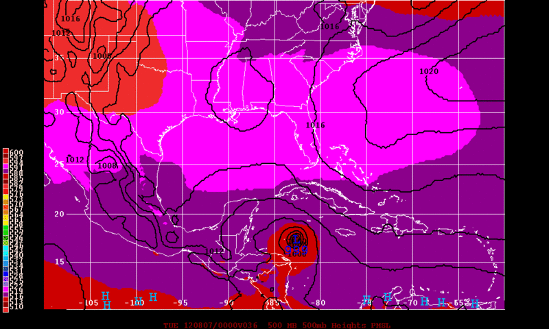
LOCATION...15.0N 77.1W
ABOUT 210 MI...335 KM S OF KINGSTON JAMAICA
ABOUT 405 MI...655 KM E OF CABO GRACIAS A DIOS ON NIC/HON BORDER
MAXIMUM SUSTAINED WINDS...50 MPH...85 KM/H
PRESENT MOVEMENT...W OR 270 DEGREES AT 23 MPH...37 KM/H
MINIMUM CENTRAL PRESSURE...1006 MB...29.71 INCHES


HAZARDS AFFECTING LAND
----------------------
WIND...TROPICAL STORM CONDITIONS ARE EXPECTED IN JAMAICA BY THIS
AFTERNOON. TROPICAL STORM CONDITIONS ARE POSSIBLE IN GRAND CAYMAN
TONIGHT AND EARLY MONDAY AND IN THE WATCH AREA ALONG THE COAST OF
HONDURAS BY LATE MONDAY. SOME SQUALLS WILL CONTINUE TO AFFECT THE
SOUTH COAST OF HISPANIOLA TODAY.

RAINFALL...RAINFALL ACCUMULATIONS OF 3 TO 6 INCHES...WITH ISOLATED
HIGHER AMOUNTS...CAN BE EXPECTED IN JAMAICA AS ERNESTO MOVES BY THE
ISLAND. SHOWERS AND THUNDERSTORMS...OCCASIONALLY HEAVY...ARE
POSSIBLE OVER THE DOMINICAN REPUBLIC AND HAITI TODAY.
0 likes   

HurricaneAndrew92

Re: ATL: ERNESTO - Tropical Storm

#3182 Postby HurricaneAndrew92 » Sun Aug 05, 2012 12:08 pm

Ernesto looks like a wave...center is just a bunch of cumulus clouds, looking worse each frame.
http://www.wunderground.com/tropical/tr ... 5_sat.html
0 likes   

User avatar
TeamPlayersBlue
Category 5
Category 5
Posts: 3445
Joined: Tue Feb 02, 2010 1:44 am
Location: Denver/Applewood, CO

Re: ATL: ERNESTO - Tropical Storm

#3183 Postby TeamPlayersBlue » Sun Aug 05, 2012 12:09 pm

mcheer23 wrote:I think we all owe an apology to GFS and EURO

:lol:


No kidding. Those things are so smart!`
0 likes   
Personal Forecast Disclaimer:
The posts in this forum are NOT official forecast and should not be used as such. They are just the opinion of the poster and may or may not be backed by sound meteorological data. They are NOT endorsed by any professional institution or storm2k.org. For official information, please refer to the NHC and NWS products.

HurricaneAndrew92

Re: ATL: ERNESTO - Tropical Storm

#3184 Postby HurricaneAndrew92 » Sun Aug 05, 2012 12:16 pm

If NHC keeps this as any thing other than "invest" ernesto I'll be stunned. Because it has no closed center, it's probably a code red at 2.
0 likes   

User avatar
cycloneye
Admin
Admin
Posts: 145545
Age: 68
Joined: Thu Oct 10, 2002 10:54 am
Location: San Juan, Puerto Rico

Re: ATL: ERNESTO - Models

#3185 Postby cycloneye » Sun Aug 05, 2012 12:19 pm

Folks,GFS was the first to smell what Ernesto is going thru now followed by the Euro. I think is time to visit the "Global Model Runs Discussion" thread at Talking Tropics forum where you can see interesting things for the future. :)
0 likes   
Visit the Caribbean-Central America Weather Thread where you can find at first post web cams,radars
and observations from Caribbean basin members Click Here

User avatar
Buck
S2K Supporter
S2K Supporter
Posts: 1173
Joined: Fri Sep 10, 2004 12:04 pm
Location: Atlanta, GA

#3186 Postby Buck » Sun Aug 05, 2012 12:27 pm

Strange that after such a whirlwind start to the season, we go a month without hardly even an invest. All of the sudden, two storms form with a lot of promise and they both piddle out quickly. I would say when it rains it pours, but then it just dries up.
0 likes   

HurricaneAndrew92

Re:

#3187 Postby HurricaneAndrew92 » Sun Aug 05, 2012 12:33 pm

Buck wrote:Strange that after such a whirlwind start to the season, we go a month without hardly even an invest. All of the sudden, two storms form with a lot of promise and they both piddle out quickly. I would say when it rains it pours, but then it just dries up.

Actually, wouldnt count Florence out yet.
0 likes   

User avatar
beoumont
Category 1
Category 1
Posts: 473
Joined: Sun Jul 10, 2011 4:13 pm
Location: East Central Florida
Contact:

Re:

#3188 Postby beoumont » Sun Aug 05, 2012 12:33 pm

Lane wrote:I have a question in understanding the current conditions that Ernesto is experiencing. In 1995 I was in Destin Fl when Hurricane Opal hit. She was moving very fast as well however that did not seem to have any over all affect on her. Heck, Opal was still a cat 1 when it came through Montgomery Alabama. I can’t remember perfectly but I think Opal was moving north at 18 – 22mph. What is the difference in the two storms? One is getting ripped apart because of the forward progress and the other flourished from it.


Brisk forward motion is only one of many factors that can determine intensification or weakening. There are many factors and "rules" of trop. cyclone development; but most of these rules are made to be broken: this is one reason why the study of tropical storms can be so fascinating.

One prime example of two of these rules being broken was Elena, 1985. The disturbance, then depression, that became Elena was moving 22 mph when it moved directly over land and organized and intensified all the while. As the depression entered Cuba near Guantanamo, the pressure was 1012 mb, and highest winds 35 mph. After traveling directly over some mountainous territory at 22mph the length of Cuber, it exited the NW side of the island at 994 mb. with max. winds of 65 mph. Not nine hours later it was a hurricane.

Image
0 likes   
List of 79 tropical cyclones intercepted by Richard Horodner:
http://www.canebeard.com/page/page/572246.htm

User avatar
mcheer23
Professional-Met
Professional-Met
Posts: 436
Age: 32
Joined: Sun Jun 24, 2012 8:24 pm
Location: Sugar Land, Texas

#3189 Postby mcheer23 » Sun Aug 05, 2012 12:45 pm

GFS is 2 for 2
0 likes   

User avatar
Rgv20
S2K Supporter
S2K Supporter
Posts: 2466
Age: 39
Joined: Wed Jan 05, 2011 5:42 pm
Location: Edinburg/McAllen Tx

#3190 Postby Rgv20 » Sun Aug 05, 2012 1:18 pm

12zECMWF has Ernesto in the Yucatan by Wednesday Morning..

Image


By Thursday Morning Ernesto is in the BOC..

Image
0 likes   
The following post is NOT an official forecast and should not be used as such. It is just the opinion of the poster and may or may not be backed by sound meteorological data. It is NOT endorsed by any professional institution including storm2k.org For Official Information please refer to the NHC and NWS products.

Nederlander
S2K Supporter
S2K Supporter
Posts: 1250
Joined: Sat Jul 19, 2008 4:28 pm
Location: Conroe, TX

Re: ATL: ERNESTO - Tropical Storm

#3191 Postby Nederlander » Sun Aug 05, 2012 1:20 pm

Question... Where's the western edge of the atlantic ridge that was supposed to be the steering mechanism? He's stayed nearly 270 since yesterday..
0 likes   

HurricaneAndrew92

Re: ATL: ERNESTO - Tropical Storm

#3192 Postby HurricaneAndrew92 » Sun Aug 05, 2012 1:20 pm

Why is Ernesto a TS???
0 likes   

User avatar
Rgv20
S2K Supporter
S2K Supporter
Posts: 2466
Age: 39
Joined: Wed Jan 05, 2011 5:42 pm
Location: Edinburg/McAllen Tx

#3193 Postby Rgv20 » Sun Aug 05, 2012 1:32 pm

Well according to this morning 12z runs of the ECMWF, GFDL, and HWRF tomorrow is when Ernesto should really start organizing. Going to be interesting to see if Ernesto can pull itself together.
0 likes   
The following post is NOT an official forecast and should not be used as such. It is just the opinion of the poster and may or may not be backed by sound meteorological data. It is NOT endorsed by any professional institution including storm2k.org For Official Information please refer to the NHC and NWS products.

User avatar
Rgv20
S2K Supporter
S2K Supporter
Posts: 2466
Age: 39
Joined: Wed Jan 05, 2011 5:42 pm
Location: Edinburg/McAllen Tx

#3194 Postby Rgv20 » Sun Aug 05, 2012 1:37 pm

By Monday Evening the 12zGFDL has Ernesto at 999mb..

Image


By the end of the Run it has a full blown Hurricane...I know the GFDL has been overestimating Ernesto's Strength but it shows that it still has some potential to become a hurricane later on.

Image
0 likes   
The following post is NOT an official forecast and should not be used as such. It is just the opinion of the poster and may or may not be backed by sound meteorological data. It is NOT endorsed by any professional institution including storm2k.org For Official Information please refer to the NHC and NWS products.

crimi481
Category 2
Category 2
Posts: 602
Joined: Thu Sep 09, 2004 4:47 pm

Re: ATL: ERNESTO - Tropical Storm

#3195 Postby crimi481 » Sun Aug 05, 2012 1:40 pm

does anyone think a new center may form -back to the east of that current center swirl?
0 likes   

tolakram
Admin
Admin
Posts: 20012
Age: 62
Joined: Sun Aug 27, 2006 8:23 pm
Location: Florence, KY (name is Mark)

Re: ATL: ERNESTO - Tropical Storm

#3196 Postby tolakram » Sun Aug 05, 2012 1:46 pm

Looks finished, circulation breaking down IMO.

Latest Visible

Image
0 likes   
M a r k
- - - - -
Join us in chat: Storm2K Chatroom Invite. Android and IOS apps also available.

The posts in this forum are NOT official forecasts and should not be used as such. Posts are NOT endorsed by any professional institution or STORM2K.org. For official information and forecasts, please refer to NHC and NWS products.

HurricaneAndrew92

Re: ATL: ERNESTO - Tropical Storm

#3197 Postby HurricaneAndrew92 » Sun Aug 05, 2012 1:48 pm

tolakram wrote:Looks finished, circulation breaking down IMO.

Latest Visible

http://img715.imageshack.us/img715/784/zztemp.jpg

Are you saying invest at 5?
0 likes   

HurricaneAndrew92

Re: ATL: ERNESTO - Tropical Storm

#3198 Postby HurricaneAndrew92 » Sun Aug 05, 2012 1:49 pm

crimi481 wrote:does anyone think a new center may form -back to the east of that current center swirl?

Not likely in the next 12 hours, but what do I know?
0 likes   

tolakram
Admin
Admin
Posts: 20012
Age: 62
Joined: Sun Aug 27, 2006 8:23 pm
Location: Florence, KY (name is Mark)

Re: ATL: ERNESTO - Tropical Storm

#3199 Postby tolakram » Sun Aug 05, 2012 1:50 pm

BIG picture, what's left of Ernesto and Florence.

*linked ... too big for inline display*

http://img402.imageshack.us/img402/784/zztemp.jpg
Last edited by tolakram on Sun Aug 05, 2012 2:03 pm, edited 1 time in total.
Reason: removed inline display
0 likes   
M a r k
- - - - -
Join us in chat: Storm2K Chatroom Invite. Android and IOS apps also available.

The posts in this forum are NOT official forecasts and should not be used as such. Posts are NOT endorsed by any professional institution or STORM2K.org. For official information and forecasts, please refer to NHC and NWS products.

User avatar
Kingarabian
S2K Supporter
S2K Supporter
Posts: 16008
Joined: Sat Aug 08, 2009 3:06 am
Location: Honolulu, Hawaii

#3200 Postby Kingarabian » Sun Aug 05, 2012 2:05 pm

Sigh Ernesto... I wanted you to defy all the models against you so badly.
0 likes   
RIP Kobe Bryant


Return to “2012”

Who is online

Users browsing this forum: No registered users and 8 guests