

I asked the chief met on twitter who I talk to quite a bit at a station in North Carolina about the stall and the trend west...
Brad Panovich WCNC @wxbrad
@richschellhase yes they are a trend I've been watching closely.
ATL: ISAAC - Post-Tropical - Discussion
Moderator: S2k Moderators


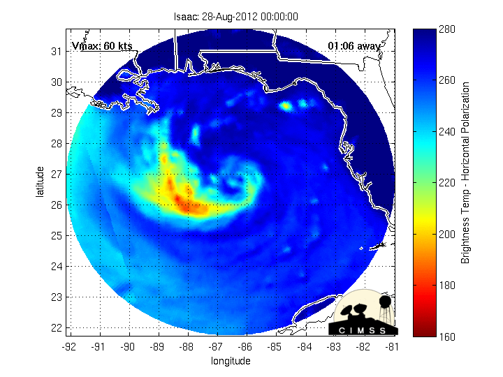
From the looks of the radar it looks as if he is trying to build a secondary eyewall
Personal Forecast Disclaimer:
The posts in this forum are NOT official forecast and should not be used as such. They are just the opinion of the poster and may or may not be backed by sound meteorological data. They are NOT endorsed by any professional institution or storm2k.org. For official information, please refer to the NHC and NWS products.
0 likes
Re:
wkwally wrote:From the looks of the radar it looks as if he is trying to build a secondary eyewall
Personal Forecast Disclaimer:
The posts in this forum are NOT official forecast and should not be used as such. They are just the opinion of the poster and may or may not be backed by sound meteorological data. They are NOT endorsed by any professional institution or storm2k.org. For official information, please refer to the NHC and NWS products.
I thought a pro met said that was a dry spot earlier...
0 likes
Just like Jon Snow..."I know nothing" except what I know, and most of what I know is gathered by the fine people of the NHC


Re: ATL: ISAAC - Hurricane - Discussion
Who here is also concerned because they didn't move the cone further West and didn't say it would intensify anymore?
Also when did they decide to start doing the intermediate advisories every 2 hours? I know the main advisories are every 6 hours, thought the intermediate advisories were every 3 hours?
Also when did they decide to start doing the intermediate advisories every 2 hours? I know the main advisories are every 6 hours, thought the intermediate advisories were every 3 hours?
0 likes
Personal Forecast Disclaimer:
The posts in this forum are NOT official forecast and should not be used as such. They are just the opinion of the poster and may or may not be backed by sound meteorological data. They are NOT endorsed by any professional institution or storm2k.org. For official information, please refer to the NHC and NWS products.
The posts in this forum are NOT official forecast and should not be used as such. They are just the opinion of the poster and may or may not be backed by sound meteorological data. They are NOT endorsed by any professional institution or storm2k.org. For official information, please refer to the NHC and NWS products.
-
superstareporter
- Tropical Low

- Posts: 31
- Joined: Mon Aug 27, 2012 12:06 pm
Re:
TwisterFanatic wrote:It's REALLY slowing down.
And appears to be getting a northern aspect to it. Doesnt look like it is ready to visit NOLA just yet, might want the big casinos over in MS. Anyone else see that as well?
Disclaimer...yadda yadda, I dont know what I am talking about as I am just a lay person in meteorology. Dont take anything I say as fact.
0 likes

Re: Re:
LSU2001 wrote:monicaei wrote:Those familiar with the lay of the "land" (I use that term loosely) in coastal La, does it seem like Barataria Bay looks likely to be the ultimate destination for Isaac? Or other side of the river, closer to the sound?
It looks like the cluster of strong stuff seems headed for the horseshoe between GI and Venice, that area between the Grand Terre chain/Quatre Bayous and maybe Bastain Bay? I'm a complete neophyte, so disregard if I'm totally wrong.
What are the implications surge wise if it's one side of the river or the other?
I think Barateria bay looks like ground zero for now. However if some of the models verify we could see Morgan city to vermillion bay. I know it is getting bad here in cut off which is only about 25 miles as the crow flies from GI.
Tim
Only the opinion of a non-qualified poster see NHC and local officials for accurate info.
I know where Cut Off is.
0 likes
from the looks of that radar and I could be wrong it looks like he is trying to build a second eye wall
Personal Forecast Disclaimer:
The posts in this forum are NOT official forecast and should not be used as such. They are just the opinion of the poster and may or may not be backed by sound meteorological data. They are NOT endorsed by any professional institution or storm2k.org. For official information, please refer to the NHC and NWS products.
0 likes
-
tolakram
- Admin

- Posts: 20167
- Age: 62
- Joined: Sun Aug 27, 2006 8:23 pm
- Location: Florence, KY (name is Mark)
Re:
Latest visible

0 likes
M a r k
- - - - -
Join us in chat: Storm2K Chatroom Invite. Android and IOS apps also available.
The posts in this forum are NOT official forecasts and should not be used as such. Posts are NOT endorsed by any professional institution or STORM2K.org. For official information and forecasts, please refer to NHC and NWS products.
Re: ATL: ISAAC - Hurricane - Discussion
Looks like he is getting a pin-hole eye that is inside the storms of the CDO that is surrounded by dry air (which might look like an outside eye).
I know they slowed down the forward movement to 8 MPH, is that just in case they have to adjust the cone, and it won't look so bad?
I know they slowed down the forward movement to 8 MPH, is that just in case they have to adjust the cone, and it won't look so bad?
0 likes
Personal Forecast Disclaimer:
The posts in this forum are NOT official forecast and should not be used as such. They are just the opinion of the poster and may or may not be backed by sound meteorological data. They are NOT endorsed by any professional institution or storm2k.org. For official information, please refer to the NHC and NWS products.
The posts in this forum are NOT official forecast and should not be used as such. They are just the opinion of the poster and may or may not be backed by sound meteorological data. They are NOT endorsed by any professional institution or storm2k.org. For official information, please refer to the NHC and NWS products.
80mph as per the NHC if it stays out over water just could turn into a cat 2.
Personal Forecast Disclaimer:
The posts in this forum are NOT official forecast and should not be used as such. They are just the opinion of the poster and may or may not be backed by sound meteorological data. They are NOT endorsed by any professional institution or storm2k.org. For official information, please refer to the NHC and NWS products.
0 likes

-
Puddinhead
- Tropical Low
- Posts: 40
- Joined: Fri Aug 17, 2007 11:12 pm
- Location: Gentilly Terrace, New Orleans, LA
Re: Re:
LSU2001 wrote:monicaei wrote:Those familiar with the lay of the "land" (I use that term loosely) in coastal La, does it seem like Barataria Bay looks likely to be the ultimate destination for Isaac? Or other side of the river, closer to the sound?
It looks like the cluster of strong stuff seems headed for the horseshoe between GI and Venice, that area between the Grand Terre chain/Quatre Bayous and maybe Bastain Bay? I'm a complete neophyte, so disregard if I'm totally wrong.
What are the implications surge wise if it's one side of the river or the other?
I think Barateria bay looks like ground zero for now. However if some of the models verify we could see Morgan city to vermillion bay. I know it is getting bad here in cut off which is only about 25 miles as the crow flies from GI.
Tim
Only the opinion of a non-qualified poster see NHC and local officials for accurate info.
Yikes. I've got a cousin who's riding it out with her two small sons and her 22 year old stepson at their home in Marrero off the highway to Lafitte. Her husband's a NOLA firefighter who, of course, will be on-duty for the duration.
0 likes

Re: ATL: ISAAC - Hurricane - Discussion
Very large hot tower firing up NW of the LLC just off coast.
http://www.nrlmry.navy.mil/nexdat/CONUS ... xico.0.jpg
http://tropicalatlantic.com/satellite/c ... 27&lon=-88
http://rammb.cira.colostate.edu/product ... 282045.jpg
http://www.nrlmry.navy.mil/nexdat/CONUS ... xico.0.jpg
http://tropicalatlantic.com/satellite/c ... 27&lon=-88
http://rammb.cira.colostate.edu/product ... 282045.jpg
0 likes
-
Puddinhead
- Tropical Low
- Posts: 40
- Joined: Fri Aug 17, 2007 11:12 pm
- Location: Gentilly Terrace, New Orleans, LA
Re: ATL: ISAAC - Hurricane - Discussion
Yes, please do. That would be great first hand information.[/quote]
But better to do it on the Observations thread instead of this one.[/quote]
OMG -- this is a brand new member willing to contribute real-time OBS from NOLA and you are asking her/him to post in another forum? These H discussion threads mostly get quiet after landfall anyway, so can we accommodate this one new poster's input for now? Next year, she/he will become more familiar with the site.[/quote]
I'm still around....I won't clutter up the thread with posts that don't belong here, though. That Observation thread is pretty dead, though. LOL
0 likes

Re:
CronkPSU wrote:I asked the chief met on twitter who I talk to quite a bit at a station in North Carolina about the stall and the trend west...
Brad Panovich WCNC @wxbrad
@richschellhase yes they are a trend I've been watching closely.
Brad is the BEST! He's a Charlotte treasure...
0 likes
-
Extratropical94

- Professional-Met

- Posts: 3545
- Age: 30
- Joined: Wed Oct 20, 2010 6:36 am
- Location: Hamburg, Germany
- Contact:
Re: ATL: ISAAC - Hurricane - Discussion
Blinhart wrote:Who here is also concerned because they didn't move the cone further West and didn't say it would intensify anymore?
Also when did they decide to start doing the intermediate advisories every 2 hours? I know the main advisories are every 6 hours, thought the intermediate advisories were every 3 hours?
They issue 2 hour intermediates when strong systems are about to make landfall or threaten a populated area, just to keep everyone updated as conditions can change rather quickly with landfalling storms.
So we will see updates with advisories 31A and 31B at 7pm and 9pm Eastern (6pm and 8pm Central), instead of the 8pm Eastern (7pm Central) one.
0 likes
54° 11' 59'' N, 9° 9' 20'' E
Boomer Sooner!
Go Broncos! Go Cards!
Clinching counties, one at a time: https://mob-rule.com/user-gifs/USA/xtrp94.gif
- Daniel
Boomer Sooner!
Go Broncos! Go Cards!
Clinching counties, one at a time: https://mob-rule.com/user-gifs/USA/xtrp94.gif
- Daniel
I'm still around....I won't clutter up the thread with posts that don't belong here, though. That Observation thread is pretty dead, though. LOL [/quote]
 I'm new here, but I think it's cuz it's not hitting texas... YET!
Was lafitte under an evac?
Was lafitte under an evac?
Last edited by monicaei on Tue Aug 28, 2012 4:10 pm, edited 1 time in total.
0 likes
Who is online
Users browsing this forum: No registered users and 20 guests