ATL: DEBBY - Post-Tropical

Moderator: S2k Moderators

Message
Author
User avatar
linkerweather
Professional-Met
Professional-Met
Posts: 261
Joined: Sat Jul 23, 2005 5:59 am
Location: tampa bay area

Re: ATL: DEBBY - Tropical Depression - Discussion

#4421 Postby linkerweather » Tue Jun 26, 2012 9:34 pm

ozonepete wrote:
linkerweather wrote:Debby is CLEARLY moving South or SSE
http://www.baynews9.com/content/news/ba ... .html.html
Just off the coast of the Nature Coast. For those unfamiliar with that part of Florida it is just about 50 miles nnw of Tampa Bay


What are you basing that on? I sure hope not on what you see on radar or satellite. Here is a RAP/UCAR surface analysis from METARS taken at 10:16PM EDT. I circled where the center is based on those two wind reports - one from the NE and one from the SW. Do you have different wind reports?

Image

Cedar Key winds are NE, Crystal River has a SE wind right now. My initial opinion was radar based then I checked the obs around the area. Also, several un official weather stations are reporting east winds in N. Citrus COunty. Enough evidence for me.

Pete...no worries...all friendly!
0 likes   

User avatar
StormingB81
S2K Supporter
S2K Supporter
Posts: 5676
Age: 42
Joined: Thu Aug 27, 2009 1:45 am
Location: Rockledge, Florida

#4422 Postby StormingB81 » Tue Jun 26, 2012 9:37 pm

WFTV in Orlando also said that it was moving South
0 likes   

ozonepete
Professional-Met
Professional-Met
Posts: 4743
Joined: Mon Sep 07, 2009 3:23 pm
Location: From Ozone Park, NYC / Now in Brooklyn, NY

Re: ATL: DEBBY - Tropical Depression - Discussion

#4423 Postby ozonepete » Tue Jun 26, 2012 9:38 pm

linkerweather wrote:
ozonepete wrote:
linkerweather wrote:Debby is CLEARLY moving South or SSE
http://www.baynews9.com/content/news/ba ... .html.html
Just off the coast of the Nature Coast. For those unfamiliar with that part of Florida it is just about 50 miles nnw of Tampa Bay


What are you basing that on? I sure hope not on what you see on radar or satellite. Here is a RAP/UCAR surface analysis from METARS taken at 10:16PM EDT. I circled where the center is based on those two wind reports - one from the NE and one from the SW. Do you have different wind reports?

Image

Cedar Key winds are NE, Crystal River has a SE wind right now. My initial opinion was radar based then I checked the obs around the area. Also, several un official weather stations are reporting east winds in N. Citrus COunty. Enough evidence for me.

Pete...no worries...all friendly!


Absolutely! Nice to meet you. :)
0 likes   

User avatar
HurricaneBelle
S2K Supporter
S2K Supporter
Posts: 975
Joined: Sun Aug 27, 2006 6:12 pm
Location: Clearwater, FL

#4424 Postby HurricaneBelle » Tue Jun 26, 2012 9:39 pm

And now NHC is confirming the SE movement.

From the 11PM advisory:

PRESENT MOVEMENT TOWARD THE SOUTHEAST OR 125 DEGREES AT 6 KT

REPEAT...CENTER LOCATED NEAR 29.0N 82.8W AT 27/0300Z
AT 27/0000Z CENTER WAS LOCATED NEAR 29.4N 83.1W
0 likes   

User avatar
linkerweather
Professional-Met
Professional-Met
Posts: 261
Joined: Sat Jul 23, 2005 5:59 am
Location: tampa bay area

Re: ATL: DEBBY - Tropical Depression - Discussion

#4425 Postby linkerweather » Tue Jun 26, 2012 9:39 pm

11 pm advisory says moving SE
0 likes   

User avatar
cycloneye
Admin
Admin
Posts: 139194
Age: 67
Joined: Thu Oct 10, 2002 10:54 am
Location: San Juan, Puerto Rico

Re: ATL: DEBBY - Advisories

#4426 Postby cycloneye » Tue Jun 26, 2012 9:41 pm

WTNT34 KNHC 270240
TCPAT4

BULLETIN
TROPICAL DEPRESSION DEBBY ADVISORY NUMBER 15
NWS NATIONAL HURRICANE CENTER MIAMI FL AL042012
1100 PM EDT TUE JUN 26 2012

...CENTER OF DEBBY TURNS SOUTHEASTWARD...EXPECTED TO RESUME AN
EASTWARD MOTION LATER TONIGHT...


SUMMARY OF 1100 PM EDT...0300 UTC...INFORMATION
-----------------------------------------------
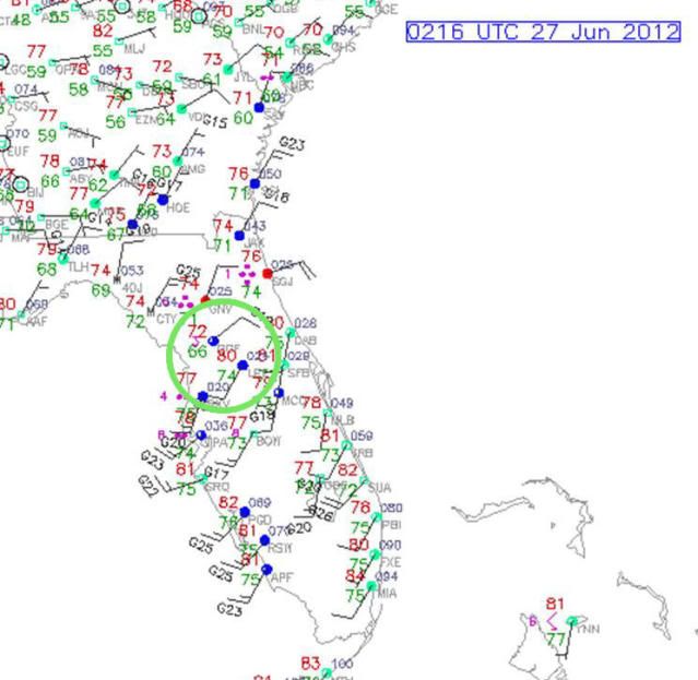
LOCATION...29.0N 82.8W
ABOUT 20 MI...30 KM ESE OF CEDAR KEY FLORIDA
ABOUT 110 MI...175 KM W OF DAYTONA BEACH FLORIDA
MAXIMUM SUSTAINED WINDS...35 MPH...55 KM/H
PRESENT MOVEMENT...SE OR 125 DEGREES AT 7 MPH...11 KM/H
MINIMUM CENTRAL PRESSURE...1000 MB...29.53 INCHES


WATCHES AND WARNINGS
--------------------
THERE ARE NO COASTAL WATCHES OR WARNINGS IN EFFECT.


DISCUSSION AND 48-HOUR OUTLOOK
------------------------------
AT 1100 PM EDT...0300 UTC...THE CENTER OF TROPICAL DEPRESSION DEBBY
WAS LOCATED NEAR LATITUDE 29.0 NORTH...LONGITUDE 82.8 WEST. THE
DEPRESSION IS MOVING TOWARD THE SOUTHEAST NEAR 7 MPH...11 KM/H. A
TURN TOWARD THE EAST IS EXPECTED LATER TONIGHT...WITH A MOTION
TOWARD THE EAST-NORTHEAST AND AN INCREASE IN FORWARD SPEED EXPECTED
ON WEDNESDAY. ON THE FORECAST TRACK...THE CENTER OF DEBBY WILL
CROSS THE NORTHERN FLORIDA PENINSULA TONIGHT AND WEDNESDAY
MORNING...AND POSSIBLY EMERGE INTO THE ATLANTIC WEDNESDAY AFTERNOON
OR WEDNESDAY NIGHT.

MAXIMUM SUSTAINED WINDS ARE NEAR 35 MPH...55 KM/H...WITH HIGHER
GUSTS. LITTLE CHANGE IN STRENGTH IS FORECAST WHILE THE CENTER IS
OVER THE FLORIDA PENINSULA. SLOW STRENGTHENING IS POSSIBLE AFTER
THE CENTER REACHES THE ATLANTIC.

THE ESTIMATED MINIMUM CENTRAL PRESSURE BASED ON SURFACE OBSERVATIONS
IS
1000 MB...29.53 INCHES.


HAZARDS AFFECTING LAND
----------------------
STORM SURGE...EVEN THOUGH DEBBY CONTINUES TO SLOWLY WEAKEN...
THE COASTAL FLOODING THREAT HAS NOT FULLY DIMINISHED DUE TO
PERSISTENT ONSHORE WINDS. THE COMBINATION OF A STORM SURGE AND THE
TIDE WILL CAUSE AREAS NEAR THE COAST TO BE FLOODED BY RISING WATERS
DURING THE NEXT HIGH TIDE WEDNESDAY MORNING. THE WATER COULD REACH
THE FOLLOWING DEPTHS ABOVE GROUND...

FLORIDA WEST COAST INCLUDING TAMPA BAY...1 TO 3 FT

THE DEEPEST WATER WILL OCCUR ALONG THE IMMEDIATE COAST SOUTH OF
THE CENTER IN AREAS OF ONSHORE FLOW. SURGE-RELATED FLOODING DEPENDS
ON THE RELATIVE TIMING OF THE SURGE AND THE TIDAL CYCLE...AND CAN
VARY GREATLY OVER SHORT DISTANCES. FOR INFORMATION SPECIFIC TO
YOUR AREA... PLEASE SEE PRODUCTS ISSUED BY YOUR LOCAL NATIONAL
WEATHER SERVICE OFFICE.

RAINFALL...DEBBY IS EXPECTED TO PRODUCE ADDITIONAL RAIN
ACCUMULATIONS OF 2 TO 3 INCHES OVER NORTHERN FLORIDA THROUGH
WEDNESDAY EVENING...WITH ISOLATED 5 INCH AMOUNTS POSSIBLE. ISOLATED
STORM TOTAL AMOUNTS OF 25 INCHES ARE POSSIBLE IN NORTHERN FLORIDA.

TORNADOES...ISOLATED TORNADOES ARE POSSIBLE ACROSS THE FLORIDA
PENINSULA TONIGHT.


NEXT ADVISORY
-------------
NEXT COMPLETE ADVISORY...500 AM EDT.

$$
FORECASTER BEVEN
0 likes   
Visit the Caribbean-Central America Weather Thread where you can find at first post web cams,radars
and observations from Caribbean basin members Click Here

psyclone
S2K Supporter
S2K Supporter
Posts: 4488
Joined: Wed Aug 24, 2005 9:04 pm
Location: palm harbor fl

#4427 Postby psyclone » Tue Jun 26, 2012 9:42 pm

the winds are veering more and more westerly at my location in northern pinellas county so i have no doubt that you are correct Josh. not that it makes much difference to the sensible wx outside of weather geek land but it sure is interesting nonetheless. it looks like the thing is being drawn and quartered....ripped to shreds. i hope it is.
0 likes   

ozonepete
Professional-Met
Professional-Met
Posts: 4743
Joined: Mon Sep 07, 2009 3:23 pm
Location: From Ozone Park, NYC / Now in Brooklyn, NY

Re: ATL: DEBBY - Tropical Depression - Discussion

#4428 Postby ozonepete » Tue Jun 26, 2012 9:43 pm

linkerweather wrote:11 pm advisory says moving SE


Ok, I take my crow with a thick barbecue sauce! :lol:
Last edited by ozonepete on Tue Jun 26, 2012 9:55 pm, edited 1 time in total.
0 likes   

psyclone
S2K Supporter
S2K Supporter
Posts: 4488
Joined: Wed Aug 24, 2005 9:04 pm
Location: palm harbor fl

Re: ATL: DEBBY - Tropical Depression - Discussion

#4429 Postby psyclone » Tue Jun 26, 2012 9:44 pm

ozonepete wrote:
linkerweather wrote:11 pm advisory says moving SE


Ok, I take my crow with a light barbecue sauce! :lol:

hey we have an unfair advantage here....all we need to do is step outside!
0 likes   

ozonepete
Professional-Met
Professional-Met
Posts: 4743
Joined: Mon Sep 07, 2009 3:23 pm
Location: From Ozone Park, NYC / Now in Brooklyn, NY

Re: ATL: DEBBY - Tropical Depression - Discussion

#4430 Postby ozonepete » Tue Jun 26, 2012 9:44 pm

Though I think it's a temporary move as the NHC indicates, and the center is getting so diffuse/stretched that it will be more and more difficult to locate.
0 likes   

User avatar
linkerweather
Professional-Met
Professional-Met
Posts: 261
Joined: Sat Jul 23, 2005 5:59 am
Location: tampa bay area

Re:

#4431 Postby linkerweather » Tue Jun 26, 2012 9:47 pm

psyclone wrote:the winds are veering more and more westerly at my location in northern pinellas county so i have no doubt that you are correct Josh. not that it makes much difference to the sensible wx outside of weather geek land but it sure is interesting nonetheless. it looks like the thing is being drawn and quartered....ripped to shreds. i hope it is.

You make a great point and I have been trying to highlight this on air that no difference to our sensible weather or the forecast really just of interest!
0 likes   

User avatar
robbielyn
Category 5
Category 5
Posts: 1239
Joined: Wed May 07, 2003 9:45 am
Location: brooksville, fl

Re: ATL: DEBBY - Tropical Depression - Discussion

#4432 Postby robbielyn » Tue Jun 26, 2012 9:51 pm

ozonepete wrote:Though I think it's a temporary move as the NHC indicates, and the center is getting so diffuse/stretched that it will be more and more difficult to locate.


Im sorry ozonepete. Didn't realize u were a pro met or I wouldn't have said anything. u r right one needs to back up what they say I was just defending our local met cuz I didn't know u a pro met. Ill buy the bbq sauce how's that?
0 likes   
Robbielyn McCrary
I know just about enough to sound like I know what I'm talking about sometimes. But for your safety please follow the nhc for truly professional forecasting. :D

User avatar
linkerweather
Professional-Met
Professional-Met
Posts: 261
Joined: Sat Jul 23, 2005 5:59 am
Location: tampa bay area

Re: ATL: DEBBY - Tropical Depression - Discussion

#4433 Postby linkerweather » Tue Jun 26, 2012 9:52 pm

ozonepete wrote:Though I think it's a temporary move as the NHC indicates, and the center is getting so diffuse/stretched that it will be more and more difficult to locate.


Oh I agree, no one said Debby was a pretty one (no offense to any ladies named Debby)
0 likes   

User avatar
Tampa Bay Hurricane
Category 5
Category 5
Posts: 5594
Age: 36
Joined: Fri Jul 22, 2005 7:54 pm
Location: St. Petersburg, FL

#4434 Postby Tampa Bay Hurricane » Tue Jun 26, 2012 9:52 pm

I love watching this little swirl. Yes SE it goes...
0 likes   

ozonepete
Professional-Met
Professional-Met
Posts: 4743
Joined: Mon Sep 07, 2009 3:23 pm
Location: From Ozone Park, NYC / Now in Brooklyn, NY

Re: ATL: DEBBY - Tropical Depression - Discussion

#4435 Postby ozonepete » Tue Jun 26, 2012 9:57 pm

robbielyn wrote:
ozonepete wrote:Though I think it's a temporary move as the NHC indicates, and the center is getting so diffuse/stretched that it will be more and more difficult to locate.


Im sorry ozonepete. Didn't realize u were a pro met or I wouldn't have said anything. u r right one needs to back up what they say I was just defending our local met cuz I didn't know u a pro met. Ill buy the bbq sauce how's that?


LOL, it's all good. Just make it a good sauce, cause I'm tired of eatin' crow. :)
0 likes   

ozonepete
Professional-Met
Professional-Met
Posts: 4743
Joined: Mon Sep 07, 2009 3:23 pm
Location: From Ozone Park, NYC / Now in Brooklyn, NY

Re: ATL: DEBBY - Tropical Depression - Discussion

#4436 Postby ozonepete » Tue Jun 26, 2012 9:59 pm

linkerweather wrote:
ozonepete wrote:Though I think it's a temporary move as the NHC indicates, and the center is getting so diffuse/stretched that it will be more and more difficult to locate.


Oh I agree, no one said Debby was a pretty one (no offense to any ladies named Debby)


YEah, I hear you. Though I still think it will regenerate. But I have the GFS and ECMWF to back me up, so it's not that big of a risk to say it. Interesting that the 11PM disco is late again. I guess they have to explain why they said it's moving SE but the 11PM track is ENE.
0 likes   

User avatar
cycloneye
Admin
Admin
Posts: 139194
Age: 67
Joined: Thu Oct 10, 2002 10:54 am
Location: San Juan, Puerto Rico

Re: ATL: DEBBY - Advisories

#4437 Postby cycloneye » Tue Jun 26, 2012 10:04 pm

11 PM EDT Discussion came out very late but here it is

WTNT44 KNHC 270301
TCDAT4

TROPICAL DEPRESSION DEBBY DISCUSSION NUMBER 15
NWS NATIONAL HURRICANE CENTER MIAMI FL AL042012
1100 PM EDT TUE JUN 26 2012

THE CENTER OF DEBBY MADE LANDFALL IN THE FLORIDA BIG BEND
REGION AT AROUND 2100 UTC. SINCE THAT TIME...THE CENTER HAS TURNED
SOUTHEASTWARD...POSSIBLY DUE TO INTERACTION WITH A GUST FRONT FROM
THE MOST RECENT CONVECTIVE BURST AND A MESOSCALE VORTICITY CENTER
OVER NORTHEASTERN FLORIDA. THE CIRCULATION HAS ALSO BECOME
ELONGATED WITH THE CENTRAL PRESSURE RISING TO AROUND 1000 MB. THE
INITIAL INTENSITY OF 30 KT IS BASED ON COASTAL OBSERVATIONS AND THE
CHANCE THAT SOME STRONGER WINDS MAY EXIST OVER THE WATER.

THE INITIAL MOTION IS 125/6. A DEEP-LAYER TROUGH IS NORTH AND
NORTHEAST OF DEBBY...AND AN ASSOCIATED SURFACE FRONTAL ZONE EXTENDS
FROM SOUTHERN GEORGIA EAST-NORTHEASTWARD INTO THE ATLANTIC. WHILE
THE LARGE-SCALE MODELS FORECAST THESE FEATURES TO WEAKEN DURING THE
NEXT 72 HR...THEY AGREE THAT THERE WILL BE ENOUGH WESTERLY STEERING
FLOW TO ALLOW THE CENTER TO CROSS FLORIDA AND REACH THE ATLANTIC
DURING THE NEXT 24 HR OR SO. THE MODELS DIVERGE AFTER THAT. THE
NOGAPS AND CANADIAN MODELS SHOW THE CENTER STALLING OFF THE U. S.
COAST...WHILE THE GFS...UKMET...ECMWF...GFDL...AND HWRF MOVE IT
EAST-NORTHEASTWARD INTO THE ATLANTIC AT VARYING SPEEDS. THE
FORECAST TRACK GOES WITH THE LATTER SCENARIO. THE NEW FORECAST IS
ADJUSTED SOUTH OF THE PREVIOUS TRACK BASED ON THE INITIAL POSITION
AND MOTION...AND IS A BIT FASTER. IT SHOULD BE NOTED THAT
ADDITIONAL ADJUSTMENTS TO THE TRACK FORECAST MAY BE NECESSARY IF
THE CENTER RE-FORMS WHILE CROSSING FLORIDA.

DEBBY IS CURRENTLY EXPERIENCING MODERATE VERTICAL WIND SHEAR...DRY
AIR ENTRAINMENT...AND LAND INTERACTION. THIS COMBINATION SHOULD
PERSIST UNTIL THE CENTER REACHES THE ATLANTIC. IN 36-48 HR...THE
GFS...UKMET...AND ECMWF FORECAST AN UPPER-LEVEL TROUGH TO INTERACT
WITH THE CYCLONE...WHICH COULD REDUCE THE SHEAR AND PROVIDE
FAVORABLE UPPER-LEVEL DIVERGENCE. HOWEVER...DEEP-LAYER DRY AIR
SHOULD STILL BE NEAR DEBBY AT THAT TIME...WHICH COULD PREVENT THE
MORE FAVORABLE DYNAMICS FROM STRENGTHENING THE SYSTEM. THUS...THE
NEW INTENSITY FORECAST IS ALMOST IDENTICAL TO THE PREVIOUS
FORECAST.


FORECAST POSITIONS AND MAX WINDS

INIT 27/0300Z 29.0N 82.8W 30 KT 35 MPH
12H 27/1200Z 29.3N 81.7W 30 KT 35 MPH...INLAND
24H 28/0000Z 29.7N 80.0W 30 KT 35 MPH...OVER WATER
36H 28/1200Z 30.3N 77.8W 30 KT 35 MPH
48H 29/0000Z 30.7N 75.6W 35 KT 40 MPH
72H 30/0000Z 32.0N 72.5W 40 KT 45 MPH
96H 01/0000Z 35.0N 69.0W 45 KT 50 MPH
120H 02/0000Z 39.0N 62.0W 45 KT 50 MPH

$$
FORECASTER BEVEN
0 likes   
Visit the Caribbean-Central America Weather Thread where you can find at first post web cams,radars
and observations from Caribbean basin members Click Here

User avatar
robbielyn
Category 5
Category 5
Posts: 1239
Joined: Wed May 07, 2003 9:45 am
Location: brooksville, fl

#4438 Postby robbielyn » Tue Jun 26, 2012 10:04 pm

Looking at water vapor the dry air is pushing Debby outta here d/t the ridge or trough sorry not good at this part looking at satellite im thinking trough cuz of the dry air its pushing the ull back into Texas quite rapidly and dry out our state amd pushing debby's center to the south. Our saving grace.
Last edited by robbielyn on Tue Jun 26, 2012 10:09 pm, edited 1 time in total.
0 likes   
Robbielyn McCrary
I know just about enough to sound like I know what I'm talking about sometimes. But for your safety please follow the nhc for truly professional forecasting. :D

ozonepete
Professional-Met
Professional-Met
Posts: 4743
Joined: Mon Sep 07, 2009 3:23 pm
Location: From Ozone Park, NYC / Now in Brooklyn, NY

Re: ATL: DEBBY - Tropical Depression - Discussion

#4439 Postby ozonepete » Tue Jun 26, 2012 10:05 pm

Ok, here's the whole 11PM disco. In reality nothing much has changed, except for the possibility of a stall east of Florida, but the NOGAPS and CMC are the worst for this kind of forecast.

TROPICAL DEPRESSION DEBBY DISCUSSION NUMBER 15
NWS NATIONAL HURRICANE CENTER MIAMI FL AL042012
1100 PM EDT TUE JUN 26 2012

THE CENTER OF DEBBY MADE LANDFALL IN THE FLORIDA BIG BEND
REGION AT AROUND 2100 UTC. SINCE THAT TIME...THE CENTER HAS TURNED
SOUTHEASTWARD...POSSIBLY DUE TO INTERACTION WITH A GUST FRONT FROM
THE MOST RECENT CONVECTIVE BURST AND A MESOSCALE VORTICITY CENTER
OVER NORTHEASTERN FLORIDA. THE CIRCULATION HAS ALSO BECOME
ELONGATED WITH THE CENTRAL PRESSURE RISING TO AROUND 1000 MB. THE
INITIAL INTENSITY OF 30 KT IS BASED ON COASTAL OBSERVATIONS AND THE
CHANCE THAT SOME STRONGER WINDS MAY EXIST OVER THE WATER.

THE INITIAL MOTION IS 125/6. A DEEP-LAYER TROUGH IS NORTH AND
NORTHEAST OF DEBBY...AND AN ASSOCIATED SURFACE FRONTAL ZONE EXTENDS
FROM SOUTHERN GEORGIA EAST-NORTHEASTWARD INTO THE ATLANTIC. WHILE
THE LARGE-SCALE MODELS FORECAST THESE FEATURES TO WEAKEN DURING THE
NEXT 72 HR...THEY AGREE THAT THERE WILL BE ENOUGH WESTERLY STEERING
FLOW TO ALLOW THE CENTER TO CROSS FLORIDA AND REACH THE ATLANTIC
DURING THE NEXT 24 HR OR SO. THE MODELS DIVERGE AFTER THAT. THE
NOGAPS AND CANADIAN MODELS SHOW THE CENTER STALLING OFF THE U. S.
COAST...WHILE THE GFS...UKMET...ECMWF...GFDL...AND HWRF MOVE IT
EAST-NORTHEASTWARD INTO THE ATLANTIC AT VARYING SPEEDS. THE
FORECAST TRACK GOES WITH THE LATTER SCENARIO. THE NEW FORECAST IS
ADJUSTED SOUTH OF THE PREVIOUS TRACK BASED ON THE INITIAL POSITION
AND MOTION...AND IS A BIT FASTER. IT SHOULD BE NOTED THAT
ADDITIONAL ADJUSTMENTS TO THE TRACK FORECAST MAY BE NECESSARY IF
THE CENTER RE-FORMS WHILE CROSSING FLORIDA.

DEBBY IS CURRENTLY EXPERIENCING MODERATE VERTICAL WIND SHEAR...DRY
AIR ENTRAINMENT...AND LAND INTERACTION. THIS COMBINATION SHOULD
PERSIST UNTIL THE CENTER REACHES THE ATLANTIC. IN 36-48 HR...THE
GFS...UKMET...AND ECMWF FORECAST AN UPPER-LEVEL TROUGH TO INTERACT
WITH THE CYCLONE...WHICH COULD REDUCE THE SHEAR AND PROVIDE
FAVORABLE UPPER-LEVEL DIVERGENCE. HOWEVER...DEEP-LAYER DRY AIR
SHOULD STILL BE NEAR DEBBY AT THAT TIME...WHICH COULD PREVENT THE
MORE FAVORABLE DYNAMICS FROM STRENGTHENING THE SYSTEM. THUS...THE
NEW INTENSITY FORECAST IS ALMOST IDENTICAL TO THE PREVIOUS
FORECAST.


FORECAST POSITIONS AND MAX WINDS

INIT 27/0300Z 29.0N 82.8W 30 KT 35 MPH
12H 27/1200Z 29.3N 81.7W 30 KT 35 MPH...INLAND
24H 28/0000Z 29.7N 80.0W 30 KT 35 MPH...OVER WATER
36H 28/1200Z 30.3N 77.8W 30 KT 35 MPH
48H 29/0000Z 30.7N 75.6W 35 KT 40 MPH
72H 30/0000Z 32.0N 72.5W 40 KT 45 MPH
96H 01/0000Z 35.0N 69.0W 45 KT 50 MPH
120H 02/0000Z 39.0N 62.0W 45 KT 50 MPH

$$
FORECASTER BEVEN
0 likes   

User avatar
jdray
Category 3
Category 3
Posts: 846
Joined: Tue Aug 31, 2004 10:07 pm
Location: NE Florida

Re: ATL: DEBBY - Tropical Depression - Discussion

#4440 Postby jdray » Tue Jun 26, 2012 10:09 pm

Ok, seriously Debby, you've been fun, but you have overstayed your welcome.
Can we take up a donation for fans to blow her away, some wiccans, maybe a voodoo priestess or two?

We are literally drowning here. My sister and her family have to park at a church lot and walk 1/2 mile to their house as the roads are not fit for cars. I almost flooded my car 4 times on the way home from work tonight. Its getting ridiculous.
0 likes   


Return to “2012”

Who is online

Users browsing this forum: No registered users and 29 guests