ATL: KIRK - Models

Moderator: S2k Moderators

Message
Author
User avatar
South Texas Storms
Professional-Met
Professional-Met
Posts: 4005
Joined: Thu Jun 24, 2010 12:28 am
Location: Houston, TX

ATL: KIRK - Models

#1 Postby South Texas Storms » Fri Aug 24, 2012 2:29 am

First models plots for Invest 97L.

Image

Uploaded with ImageShack.us
0 likes   

Senobia
Category 1
Category 1
Posts: 274
Joined: Sat Aug 05, 2006 2:59 pm
Location: Somewhere over the rainbow

Re: ATL: INVEST 97L - Models

#2 Postby Senobia » Sat Aug 25, 2012 1:24 pm

Any updated model info for this?
0 likes   

User avatar
Gustywind
Category 5
Category 5
Posts: 12334
Joined: Mon Sep 03, 2007 7:29 am
Location: Baie-Mahault, GUADELOUPE

Re: ATL: INVEST 97L - Models

#3 Postby Gustywind » Sat Aug 25, 2012 1:28 pm

Senobia wrote:Any updated model info for this?

:) Looks like the posters of the models thread are in strike :lol: But, what are they doing :P? Maybe focus on Isaac as 97L :cheesy:
0 likes   

tolakram
Admin
Admin
Posts: 19165
Age: 60
Joined: Sun Aug 27, 2006 8:23 pm
Location: Florence, KY (name is Mark)

Re: ATL: INVEST 97L - Models

#4 Postby tolakram » Sat Aug 25, 2012 1:31 pm

Euro doesn't show much, GFS shows well north, but another storm behind it.

Image
0 likes   
M a r k
- - - - -
Join us in chat: Storm2K Chatroom Invite. Android and IOS apps also available.

The posts in this forum are NOT official forecasts and should not be used as such. Posts are NOT endorsed by any professional institution or STORM2K.org. For official information and forecasts, please refer to NHC and NWS products.

rainstorm

#5 Postby rainstorm » Sun Aug 26, 2012 7:11 am

http://moe.met.fsu.edu/cgi-bin/gfstc2.c ... hour=168hr

gfs shows what would be a hurricane. also shows leslie.
0 likes   

User avatar
Blown Away
S2K Supporter
S2K Supporter
Posts: 9861
Joined: Wed May 26, 2004 6:17 am

Re:

#6 Postby Blown Away » Sun Aug 26, 2012 8:31 am

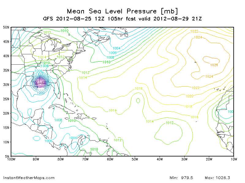
rainstorm wrote:http://moe.met.fsu.edu/cgi-bin/gfstc2.cgi?time=2012082606&field=Sea+Level+Pressure&hour=168hr

gfs shows what would be a hurricane. also shows leslie.


Is that 97L near the islands or the wave behind it?
0 likes   
Hurricane Eye Experience: David 79, Irene 99, Frances 04, Jeanne 04, Wilma 05...
Hurricane Brush Experience: Andrew 92, Erin 95, Floyd 99, Matthew 16, Irma 17, Ian 22, Nicole 22…

rainstorm

#7 Postby rainstorm » Sun Aug 26, 2012 8:32 am

wave behind it. 97L is east of bermuda as a cane.
0 likes   

janswizard
S2K Supporter
S2K Supporter
Posts: 586
Joined: Thu Jul 10, 2003 3:08 am
Location: Fort Pierce, FL

ATL : INVEST 97L

#8 Postby janswizard » Tue Aug 28, 2012 2:33 pm

Are there any models or anything available on this one? Earlier, I heard possible recurve - is that still the consensus?
0 likes   
Note: Opinions expressed are my own. Please look to the NHC for the most accurate information.

User avatar
cycloneye
Admin
Admin
Posts: 139080
Age: 67
Joined: Thu Oct 10, 2002 10:54 am
Location: San Juan, Puerto Rico

Re: ATL: INVEST 97L - Models

#9 Postby cycloneye » Tue Aug 28, 2012 2:37 pm

Code: Select all

WHXX01 KWBC 281904
CHGHUR
TROPICAL CYCLONE GUIDANCE MESSAGE
NWS NATIONAL HURRICANE CENTER MIAMI FL
1904 UTC TUE AUG 28 2012
 
DISCLAIMER...NUMERICAL MODELS ARE SUBJECT TO LARGE ERRORS.
PLEASE REFER TO NHC OFFICIAL FORECASTS FOR TROPICAL CYCLONE
AND SUBTROPICAL CYCLONE INFORMATION.
 
ATLANTIC OBJECTIVE AIDS FOR
 
TROPICAL CYCLONE ELEVEN (AL112012) 20120828 1800 UTC
 
        ...00 HRS...   ...12 HRS...   ...24 HRS. ..   ...36 HRS...
        120828  1800   120829  0600   120829  1800   120830  0600
 
         LAT    LON     LAT    LON     LAT    LON     LAT    LON
BAMS    23.7N  43.4W   24.7N  45.2W   25.8N  46.9W   27.1N  48.4W
BAMD    23.7N  43.4W   24.3N  44.5W   25.0N  45.8W   26.0N  47.2W
BAMM    23.7N  43.4W   24.4N  44.7W   25.2N  46.1W   26.2N  47.5W
LBAR    23.7N  43.4W   24.6N  44.2W   25.7N  45.4W   27.1N  46.5W
SHIP        30KTS          31KTS          33KTS          35KTS
DSHP        30KTS          31KTS          33KTS          35KTS
 
        ...48 HRS...   ...72 HRS...   ...96 HRS. ..   ..120 HRS...
        120830  1800   120831  1800   120901  1800   120902  1800
 
         LAT    LON     LAT    LON     LAT    LON     LAT    LON
BAMS    28.7N  49.7W   32.7N  48.9W   34.7N  42.8W   34.1N  38.7W
BAMD    27.1N  48.5W   29.4N  50.1W   32.2N  48.6W   33.7N  42.9W
BAMM    27.4N  48.9W   30.1N  50.3W   33.3N  48.5W   35.9N  42.1W
LBAR    28.6N  47.0W   32.4N  45.4W   36.3N  41.4W   43.2N  37.8W
SHIP        37KTS          42KTS          48KTS          55KTS
DSHP        37KTS          42KTS          48KTS          55KTS
 
         ...INITIAL CONDITIONS...
LATCUR =  23.7N LONCUR =  43.4W DIRCUR = 335DEG SPDCUR =   9KT
LATM12 =  21.9N LONM12 =  42.7W DIRM12 = 333DEG SPDM12 =  10KT
LATM24 =  20.6N LONM24 =  41.5W
WNDCUR =   30KT RMAXWD =  100NM WNDM12 =   30KT
CENPRS = 1008MB OUTPRS = 1014MB OUTRAD =  160NM SDEPTH =   S
RD34NE =    0NM RD34SE =    0NM RD34SW =    0NM RD34NW =   0NM


Image
0 likes   
Visit the Caribbean-Central America Weather Thread where you can find at first post web cams,radars
and observations from Caribbean basin members Click Here


Return to “2012”

Who is online

Users browsing this forum: No registered users and 113 guests