ATL: INVEST 90L --- Models
Moderator: S2k Moderators
- tropicwatch
- Category 5

- Posts: 3205
- Age: 60
- Joined: Sat Jun 02, 2007 10:01 am
- Location: Panama City Florida
- Contact:
I don't see anything that would move it in any direction anytime soon.
0 likes
Tropicwatch
Agnes 72', Eloise 75, Elena 85', Kate 85', Charley 86', Florence 88', Beryl 94', Dean 95', Erin 95', Opal 95', Earl 98', Georges 98', Ivan 2004', Arlene 2005', Dennis 2005', Ida 2009' Debby 2012' Irma 2017' Michael 2018'
Agnes 72', Eloise 75, Elena 85', Kate 85', Charley 86', Florence 88', Beryl 94', Dean 95', Erin 95', Opal 95', Earl 98', Georges 98', Ivan 2004', Arlene 2005', Dennis 2005', Ida 2009' Debby 2012' Irma 2017' Michael 2018'
- SouthDadeFish
- Professional-Met

- Posts: 2835
- Joined: Thu Sep 23, 2010 2:54 pm
- Location: Miami, FL
- Contact:
Re: ATL: INVEST 90L --- Models
The Navgem has joined the party. Now we are really cooking. Lol!!!


0 likes
The following post is NOT an official forecast and should not be used as such. It is just the opinion of the poster and may or may not be backed by sound meteorological data. It is NOT endorsed by any professional institution including storm2k.org For Official Information please refer to the NHC and NWS products.
-
stormlover2013
- Category 5

- Posts: 2312
- Joined: Thu Aug 22, 2013 12:06 pm
- Location: Lumberton, Texas
Re: ATL: INVEST 90L --- Models
yeah and that isn't tell next week, yall go post what Joe bastardi said on twitter, my work computer won't let me do it...so maybe somebody can post the 3 tweets he posted.
0 likes
-
stormlover2013
- Category 5

- Posts: 2312
- Joined: Thu Aug 22, 2013 12:06 pm
- Location: Lumberton, Texas
Re: ATL: INVEST 90L --- Models
Joe Bastardi @BigJoeBastardi · 2h
We are expecting an early season development threat, just want to emphasize that trusting GFS with its storm a run not way to go
Euro big rains in Texas and now has gulf system but not heading for s Fla.. more likely path up through central gulf.
ok I figured it out, that was from big joe
We are expecting an early season development threat, just want to emphasize that trusting GFS with its storm a run not way to go
Euro big rains in Texas and now has gulf system but not heading for s Fla.. more likely path up through central gulf.
ok I figured it out, that was from big joe
0 likes
- Evil Jeremy
- S2K Supporter

- Posts: 5459
- Age: 30
- Joined: Mon Apr 10, 2006 2:10 pm
- Location: Los Angeles, CA
Re: ATL: INVEST 90L --- Models
Joe Bastardi has no idea what's going to happen. I don't think anyone can or should make a prediction for a system that wont likely affect any part of the USA for at least 5 days. This is going to be a drawn out system, if it even develops.
0 likes
Frances 04 / Jeanne 04 / Katrina 05 / Wilma 05 / Fay 08 / Debby 12 / Andrea 13 / Colin 16 / Hermine 16 / Matthew 16 / Irma 17
- TheStormExpert
- Category 5

- Posts: 8487
- Age: 30
- Joined: Wed Feb 16, 2011 5:38 pm
- Location: Palm Beach Gardens, FL
- northjaxpro
- S2K Supporter

- Posts: 8900
- Joined: Mon Sep 27, 2010 11:21 am
- Location: Jacksonville, FL
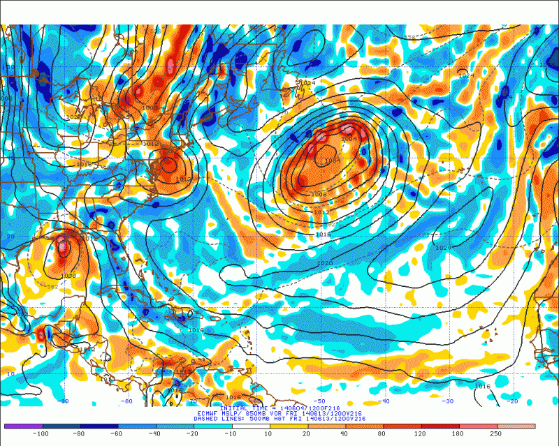
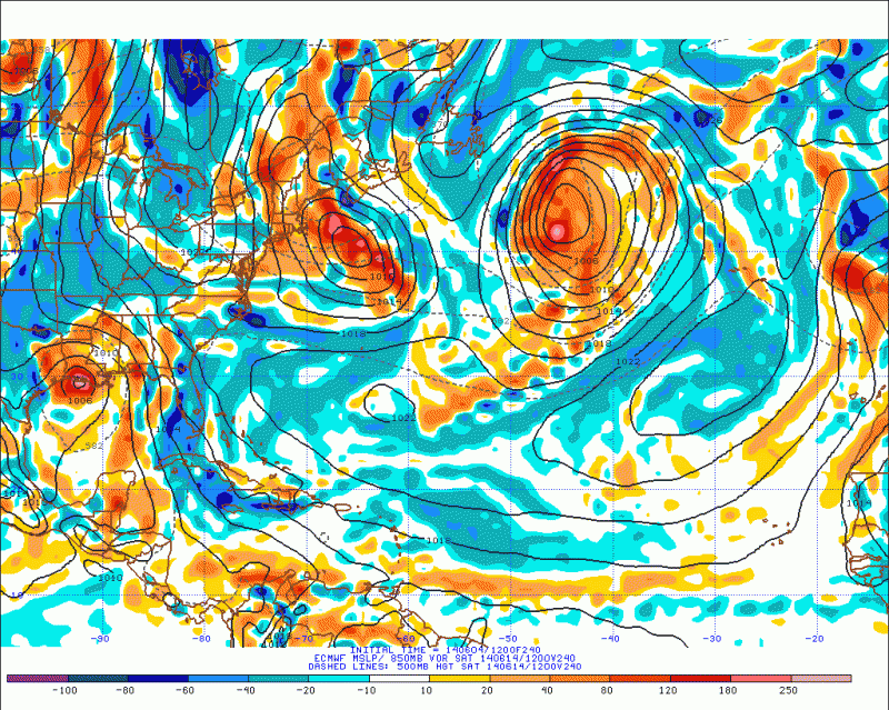
Well, apparently EURO is now beginning to pick up on the trend of moving 90L north and east. For the first time, we are seeing the two major models (GFS & EURO) come into some agreement. Time will tell if these trends will continue. This is still a good ways out and much can still change of course.
0 likes
NEVER, EVER SAY NEVER in the tropics and weather in general, and most importantly, with life itself!!
________________________________________________________________________________________
Fay 2008 Beryl 2012 Debby 2012 Colin 2016 Hermine 2016 Julia 2016 Matthew 2016 Irma 2017 Dorian 2019
________________________________________________________________________________________
Fay 2008 Beryl 2012 Debby 2012 Colin 2016 Hermine 2016 Julia 2016 Matthew 2016 Irma 2017 Dorian 2019
-
SeGaBob
Re: ATL: INVEST 90L --- Models
I think what JB and others are probably saying is given the European models shift east today, the fairly persistent GFS rightward bias, and just plain ole climatology, the best guess at a landfall location is the central gulf coast. Take it for what it is - a prediction 7 days out from a system that hasn't even formed yet.
0 likes
- TheStormExpert
- Category 5

- Posts: 8487
- Age: 30
- Joined: Wed Feb 16, 2011 5:38 pm
- Location: Palm Beach Gardens, FL
00z Model Plots. Not much has changed with them still plowing this into Mexico, IMO it's way too early to tell. 


0 likes
The following post is NOT an official forecast and should not be used as such. It is just the opinion of the poster and may or may not be backed by sound meteorological data. It is NOT endorsed by storm2k.org.
- Hurricane Alexis
- Category 2

- Posts: 683
- Age: 27
- Joined: Thu Jun 14, 2012 7:59 pm
- Location: Miami,Florida
Re: ATL: INVEST 90L --- Models
Excerpt from Miami NWS:
THE GFS STILL MAINTAINS AN AREA OF LOW PRESSURE ACROSS THE BAY OF
CAMPECHE PUSHING NORTHEAST...EVENTUALLY MAKING IT TO SOUTH
FLORIDA THROUGH THE LATTER HALF OF NEXT WEEK. THE ECMWF ON THE
OTHER HAND HAS HAD BETTER RUN TO RUN CONSISTENCIES KEEPING THIS
LOW ACROSS THE BAY OF CAMPECHE. AS A RESULT...PLACED MUCH MORE
WEIGHT WITH THE ECMWF SOLUTION DURING THIS TIME FRAME IN THE
OFFICIAL FORECAST.
0 likes
Personal Forecast Disclaimer:
The posts in this forum are NOT official forecast and should not be used as such. They are just the opinion of the poster and may or may not be backed by sound meteorological data. They are NOT endorsed by any professional institution or storm2k.org. For official information, please refer to the NHC and NWS products.
The posts in this forum are NOT official forecast and should not be used as such. They are just the opinion of the poster and may or may not be backed by sound meteorological data. They are NOT endorsed by any professional institution or storm2k.org. For official information, please refer to the NHC and NWS products.
- johngaltfla
- Category 5

- Posts: 1938
- Joined: Sun Jul 10, 2005 9:17 pm
- Location: Sarasota County, FL
- Contact:
Re: ATL: INVEST 90L --- Models
adam0983 wrote:I hope the GFS is correct. Florida needs the rain to end the drought. Just an opinion not a forecast.
Uh, what drought? We're 5"+ for the year in my location.....everyone I know has a surplus and we had zip, zero, nada of a fire season for once (thankfully).
0 likes
-
tolakram
- Admin

- Posts: 19165
- Age: 60
- Joined: Sun Aug 27, 2006 8:23 pm
- Location: Florence, KY (name is Mark)
Re: ATL: INVEST 90L --- Models
Everyone, please stick to the topic of 90L and the 90L model runs and avoid personal opinions about the overall performance of a model.
Thanks.
Thanks.
0 likes
M a r k
- - - - -
Join us in chat: Storm2K Chatroom Invite. Android and IOS apps also available.
The posts in this forum are NOT official forecasts and should not be used as such. Posts are NOT endorsed by any professional institution or STORM2K.org. For official information and forecasts, please refer to NHC and NWS products.
Re: ATL: INVEST 90L --- Models
johngaltfla wrote:adam0983 wrote:I hope the GFS is correct. Florida needs the rain to end the drought. Just an opinion not a forecast.
Uh, what drought? We're 5"+ for the year in my location.....everyone I know has a surplus and we had zip, zero, nada of a fire season for once (thankfully).
http://imageshack.us/photo/my-images/838/g1l6.png/
The attached shows South Florida in a short term drought.
0 likes
- Hurricaneman
- Category 5

- Posts: 7282
- Age: 43
- Joined: Tue Aug 31, 2004 3:24 pm
- Location: central florida
What I see from the last several runs of the GFS is that the trough over the Bahamas and Hispaniola seem to get an energy transfer from 90L as 90L goes into Mexico and become a system in and of itself. Its one of the more tough forecast that has potential to bust real bad
The posts in this forum are NOT official forecast and should not be used as such. They are just the opinion of the poster and may or may not be backed by sound meteorological data. They are NOT endorsed by any professional institution or storm2k.org. For official information, please refer to the NHC and NWS products
The posts in this forum are NOT official forecast and should not be used as such. They are just the opinion of the poster and may or may not be backed by sound meteorological data. They are NOT endorsed by any professional institution or storm2k.org. For official information, please refer to the NHC and NWS products
0 likes
- TheStormExpert
- Category 5

- Posts: 8487
- Age: 30
- Joined: Wed Feb 16, 2011 5:38 pm
- Location: Palm Beach Gardens, FL
Re: ATL: INVEST 90L --- Models
fci wrote:johngaltfla wrote:adam0983 wrote:I hope the GFS is correct. Florida needs the rain to end the drought. Just an opinion not a forecast.
Uh, what drought? We're 5"+ for the year in my location.....everyone I know has a surplus and we had zip, zero, nada of a fire season for once (thankfully).
http://imageshack.us/photo/my-images/838/g1l6.png/
The attached shows South Florida in a short term drought.
Still would of been nice to get some rain out of this system.
0 likes
The following post is NOT an official forecast and should not be used as such. It is just the opinion of the poster and may or may not be backed by sound meteorological data. It is NOT endorsed by storm2k.org.
-
SeGaBob
Who is online
Users browsing this forum: No registered users and 111 guests


