
ATL: INVEST 90L - Discussion
Moderator: S2k Moderators
-
ozonepete
- Professional-Met

- Posts: 4743
- Joined: Mon Sep 07, 2009 3:23 pm
- Location: From Ozone Park, NYC / Now in Brooklyn, NY
Re: ATL: INVEST 90L - Discussion
Far from dead... This was, and is, a TD, no matter what happens going forward....
0 likes

-
ozonepete
- Professional-Met
- Posts: 4743
- Joined: Mon Sep 07, 2009 3:23 pm
- Location: From Ozone Park, NYC / Now in Brooklyn, NY
Re:
Nimbus wrote:There is an upper level low near 25N 50W that is providing an outflow channel for this little LLC.
Probably the same source for the forecast shear.
The SAL looks like it may erode 91L from the north and force it to feed off the ITCZ for a while so..
Yes an upper level low will often give very positive outflow to an approaching tropical cyclone. As far as 91L is concerned, that is a good observation but you need to post it in the 91L thread.
I am still wondering what all of the people who wrote this one off are thinking now.
0 likes
-
ozonepete
- Professional-Met
- Posts: 4743
- Joined: Mon Sep 07, 2009 3:23 pm
- Location: From Ozone Park, NYC / Now in Brooklyn, NY
Re: ATL: INVEST 90L - Discussion
Most of the models are forecasting decreasing shear ahead of this and mid-level moisture is certainly increasing now. Don't know why you would write this off yet. Maybe a couple of days down the road this will have problems but not right now... Just look at it.
0 likes
-
cycloneye

- Admin

- Posts: 139127
- Age: 67
- Joined: Thu Oct 10, 2002 10:54 am
- Location: San Juan, Puerto Rico
Re: ATL: INVEST 90L - Discussion
A small area of low pressure located about 650 miles west of the
Cape Verde Islands is producing disorganized showers and
thunderstorms. Environmental conditions are forecast to remain
unfavorable for significant development during the next several
days while it moves west-northwestward at 10 to 15 mph.
* Formation chance through 48 hours...low...near 10 percent.
* Formation chance through 5 days...low...near 10 percent
0 likes
Visit the Caribbean-Central America Weather Thread where you can find at first post web cams,radars
and observations from Caribbean basin members Click Here
and observations from Caribbean basin members Click Here


-
Gustywind

- Category 5

- Posts: 12334
- Joined: Mon Sep 03, 2007 7:29 am
- Location: Baie-Mahault, GUADELOUPE
TROPICAL WEATHER DISCUSSION
NWS NATIONAL HURRICANE CENTER MIAMI FL
805 AM EDT SUN SEP 07 2014
AN ATLANTIC OCEAN TROPICAL WAVE IS ALONG 32W/33W FROM 19N
SOUTHWARD. A 1010 MB LOW PRESSURE CENTER IS ALONG THE WAVE NEAR
16N. THE WAVE IS MOVING WESTWARD 15 KNOTS. CONVECTIVE
PRECIPITATION...SCATTERED MODERATE TO ISOLATED STRONG FROM 15N
TO 18N BETWEEN 33W AND 36W.
0 likes
-
cycloneye
- Admin
- Posts: 139127
- Age: 67
- Joined: Thu Oct 10, 2002 10:54 am
- Location: San Juan, Puerto Rico
Re: ATL: INVEST 90L - Discussion
12z Best Track:
90L INVEST 140907 1200 15.5N 34.9W ATL 25 1010
90L INVEST 140907 1200 15.5N 34.9W ATL 25 1010
0 likes
Visit the Caribbean-Central America Weather Thread where you can find at first post web cams,radars
and observations from Caribbean basin members Click Here
and observations from Caribbean basin members Click Here
-
Blown Away

- S2K Supporter

- Posts: 9863
- Joined: Wed May 26, 2004 6:17 am
Re: ATL: INVEST 90L - Discussion

Looks like 91L catches 90L...
0 likes
Hurricane Eye Experience: David 79, Irene 99, Frances 04, Jeanne 04, Wilma 05...
Hurricane Brush Experience: Andrew 92, Erin 95, Floyd 99, Matthew 16, Irma 17, Ian 22, Nicole 22…
Hurricane Brush Experience: Andrew 92, Erin 95, Floyd 99, Matthew 16, Irma 17, Ian 22, Nicole 22…

Re: ATL: INVEST 90L - Discussion
I don't understand why this is still 10%. It is clear by the visible that is much better organized than 10%. I think they should be focusing on what is going on now and not what the models predict will happen.
0 likes
The following post is NOT an official forecast and should not be used as such. It is just the opinion of the poster and may or may not be backed by sound meteorological data. It is NOT endorsed by any professional institution including storm2k.org For Official Information please refer to the NHC and NWS products.
-
gatorcane

- S2K Supporter
- Posts: 23499
- Age: 46
- Joined: Sun Mar 13, 2005 3:54 pm
- Location: Boca Raton, FL
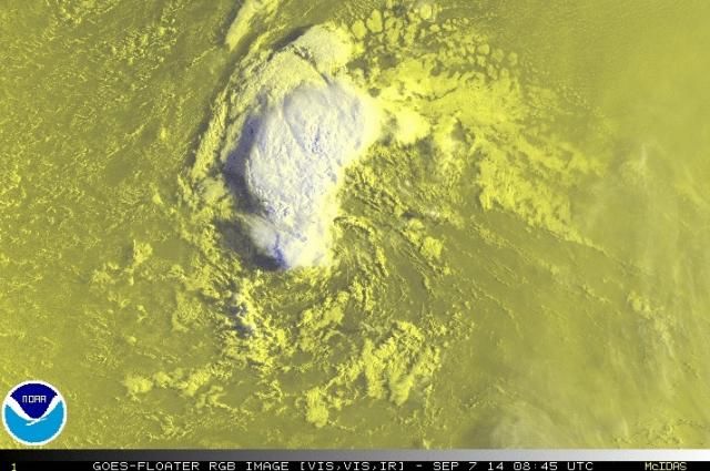
I think this system might have been a depression yesterday but since last night, it has started to really struggle. Looking at the latest vis loop, all of the convection has now been sheared to the NW leaving a naked swirl off to the SE which has become less defined.
http://rammb.cira.colostate.edu/ramsdis ... display=12
http://rammb.cira.colostate.edu/ramsdis ... display=12
0 likes
Re: ATL: INVEST 90L - Discussion
The ascat confirms the exposed swirl seen on visible is where the llc is located. Like Gator mentioned looks to be getting more broad and ascat shows it might be opening up.

0 likes
The following post is NOT an official forecast and should not be used as such. It is just the opinion of the poster and may or may not be backed by sound meteorological data. It is NOT endorsed by any professional institution including storm2k.org For Official Information please refer to the NHC and NWS products.

-
TropicalAnalystwx13

- Category 5
- Posts: 2109
- Age: 26
- Joined: Tue Jul 19, 2011 8:20 pm
- Location: Wilmington, NC
- Contact:
Re: ATL: INVEST 90L - Discussion
Made it to 35w before becoming a naked swirl and in 24 hours the surface pressure gradient will be flat.
Since its further north, away from the ITCZ it will be interesting to see if the models bring it back when the mid Atlantic ridge build in?
Since its further north, away from the ITCZ it will be interesting to see if the models bring it back when the mid Atlantic ridge build in?
0 likes
-
AEWspotter
- Professional-Met
- Posts: 57
- Joined: Wed Aug 08, 2012 9:41 am
-
cycloneye
- Admin
- Posts: 139127
- Age: 67
- Joined: Thu Oct 10, 2002 10:54 am
- Location: San Juan, Puerto Rico
Re: ATL: INVEST 90L - Discussion
2. Showers and thunderstorms associated with a weak area of low
pressure located about 675 miles west of the Cape Verde Islands
have diminished and become well separated from the low center.
Environmental conditions are forecast to remain unfavorable for
development during the next several days while the system moves
west-northwestward at 10 to 15 mph.
* Formation chance through 48 hours...low...10 percent.
* Formation chance through 5 days...low...10 percent.
0 likes
Visit the Caribbean-Central America Weather Thread where you can find at first post web cams,radars
and observations from Caribbean basin members Click Here
and observations from Caribbean basin members Click Here
-
cycloneye
- Admin
- Posts: 139127
- Age: 67
- Joined: Thu Oct 10, 2002 10:54 am
- Location: San Juan, Puerto Rico
Re: ATL: INVEST 90L - Discussion
18z Best Track:
90L INVEST 140907 1800 15.6N 36.2W ATL 20 1010
90L INVEST 140907 1800 15.6N 36.2W ATL 20 1010
0 likes
Visit the Caribbean-Central America Weather Thread where you can find at first post web cams,radars
and observations from Caribbean basin members Click Here
and observations from Caribbean basin members Click Here

Definately not closed but looks a bit better at the low levels than yesterday, surprisingly.
0 likes
The above post is not official and should not be used as such. It is the opinion of the poster and may or may not be backed by sound meteorological data. It is not endorsed by any professional institution or storm2k.org. For official information, please refer to the NHC and NWS products.
Who is online
Users browsing this forum: No registered users and 52 guests