
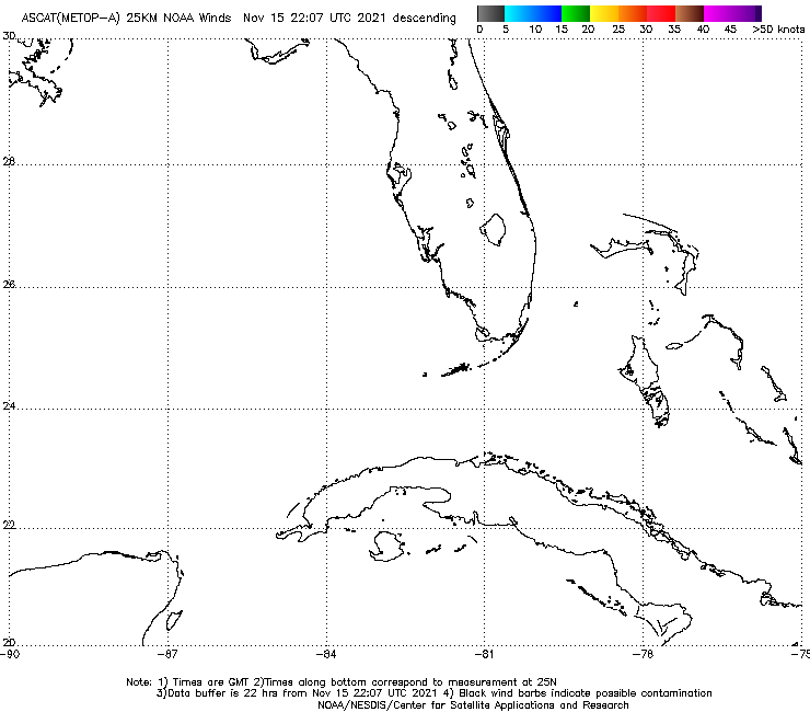
http://manati.star.nesdis.noaa.gov/ascat_images/cur_25km_META/zooms/WMBds75.png
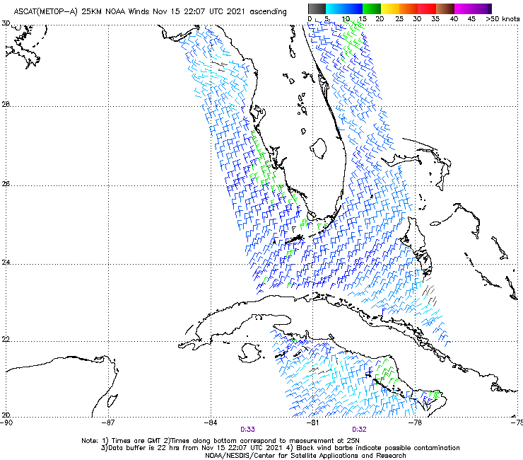
ASCAT earlier shows a very very weak rotation, winds no higher than 15kts, but the latest shows that while the center may not be fully closed at the moment, winds have increased and it does seem to be attempting a redevelopment a bit further south.
http://manati.star.nesdis.noaa.gov/ascat_images/cur_25km_META/zooms/WMBas75.png
ATL: INVEST 92L - Discussion
Moderator: S2k Moderators
Re: ATL: INVEST 92L - Discussion
0 likes
The above post is not official and should not be used as such. It is the opinion of the poster and may or may not be backed by sound meteorological data. It is not endorsed by any professional institution or storm2k.org. For official information, please refer to the NHC and NWS products.

Re: ATL: INVEST 92L - Discussion
Loop of the upper low or what almost looks like TUTT.
http://www.ssd.noaa.gov/PS/TROP/floater ... -long.html

http://www.ssd.noaa.gov/PS/TROP/floater ... -long.html
0 likes
The following post is NOT an official forecast and should not be used as such. It is just the opinion of the poster and may or may not be backed by sound meteorological data. It is NOT endorsed by any professional institution including storm2k.org For Official Information please refer to the NHC and NWS products.
-
floridasun78
- Category 5

- Posts: 3755
- Joined: Sun May 17, 2009 10:16 pm
- Location: miami fl
-
TARHEELPROGRAMMER
Sure looks like it is developing quickly to me. It could be a trick of the eyes but I am pretty sure that the spinning is the system itself.
http://tropic.ssec.wisc.edu/real-time/atlantic/winds/wg8vor.GIF
This map seems to put the center in the convection. I think the center has already reformed.
http://tropic.ssec.wisc.edu/real-time/atlantic/winds/wg8vor.GIF
This map seems to put the center in the convection. I think the center has already reformed.
0 likes
-
Huckster

- Category 1

- Posts: 394
- Age: 42
- Joined: Fri Aug 13, 2004 2:33 am
- Location: Baton Rouge, LA
- Contact:
Re:
TARHEELPROGRAMMER wrote:Sure looks like it is developing quickly to me. It could be a trick of the eyes but I am pretty sure that the spinning is the system itself.
http://tropic.ssec.wisc.edu/real-time/atlantic/winds/wg8vor.GIF
This map seems to put the center in the convection. I think the center has already reformed.
Lots of shear and upper lows all around. I don't see a center, just a bunch of moisture. This thing has had a very difficult time obviously. I think all the spinning you see is in the upper levels.
0 likes
God lufode middaneard swa þæt he sealde his ancennedan Sunu, þæt nan ne forwurðe þe on hine gelyfð, ac hæbbe þæt ece lif. - Old English/Anglo-Saxon, John 3:16
-
cycloneye

- Admin

- Posts: 139082
- Age: 67
- Joined: Thu Oct 10, 2002 10:54 am
- Location: San Juan, Puerto Rico
Re: ATL: INVEST 92L - Discussion
8 AM TWO:
A broad low pressure system located over the central Gulf of Mexico
is producing disorganized showers activity. Upper-level winds are
not conducive for development at this time, and the low could
degenerate into a trough of low pressure while it moves westward
across the Gulf of Mexico during the next couple of days.
* Formation chance through 48 hours...low...near 0 percent.
* Formation chance through 5 days...low...near 0 percent.
0 likes
Visit the Caribbean-Central America Weather Thread where you can find at first post web cams,radars
and observations from Caribbean basin members Click Here
and observations from Caribbean basin members Click Here


-
Tireman4

- S2K Supporter

- Posts: 5674
- Age: 58
- Joined: Fri Jun 30, 2006 1:08 pm
- Location: Humble, Texas
- Contact:
Re: ATL: INVEST 92L - Discussion
[quote="wxman57"]Time to call it - 7:32am CDT Sunday, September 14th...
 [/quote
Well that settles it. I am done. Ready to worry about fronts....
[/quoteWell that settles it. I am done. Ready to worry about fronts....
0 likes
Re: ATL: INVEST 92L - Discussion
The shear airmass wore it down to nothing.
If you want to see a cyclone worth tracking look at EPAC's Odile.
If you want to see a cyclone worth tracking look at EPAC's Odile.
0 likes
-
galaxy401

- Category 5
- Posts: 2299
- Age: 28
- Joined: Sat Aug 25, 2012 9:04 pm
- Location: Casa Grande, Arizona
Re: ATL: INVEST 92L - Discussion
Sanibel wrote:The shear airmass wore it down to nothing.
If you want to see a cyclone worth tracking look at EPAC's Odile.
Or Edouard.
0 likes
Got my eyes on moving right into Hurricane Alley: Florida.
-
MGC

- S2K Supporter
- Posts: 5792
- Joined: Sun Mar 23, 2003 9:05 pm
- Location: Pass Christian MS, or what is left.
Re: ATL: INVEST 92L - Discussion
Dry air and shear, a double edged sword......farewell 92L.....MGC
0 likes
-
ConvergenceZone
.gif)
- Category 5
- Posts: 4833
- Joined: Fri Jul 29, 2005 1:40 am
- Location: Northern California
Re:
ConvergenceZone wrote:Just a lot of fake outs.
Did you miss the four hurricanes that have happened? Including the one that made landfall as one, and the current one that is strengthening?
0 likes
The above post is not official and should not be used as such. It is the opinion of the poster and may or may not be backed by sound meteorological data. It is not endorsed by any professional institution or storm2k.org. For official information, please refer to the NHC and NWS products.
-
WPBWeather

- S2K Supporter
- Posts: 535
- Age: 65
- Joined: Thu Jul 18, 2013 12:33 pm
Re: Re:
Hammy wrote:ConvergenceZone wrote:Just a lot of fake outs.
Did you miss the four hurricanes that have happened? Including the one that made landfall as one, and the current one that is strengthening?
There you go again Hammy! Trying to confuse us with the facts...
0 likes
Who is online
Users browsing this forum: No registered users and 110 guests