

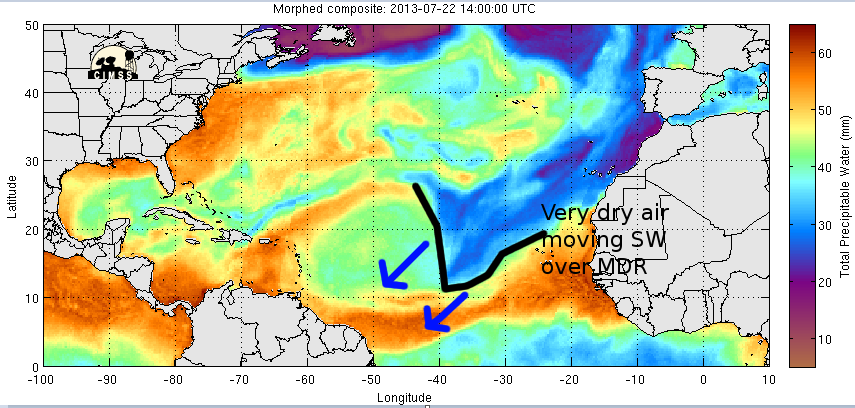
cycloneye wrote:You don't get such a vigorous tropical wave along the African coast on July 22nd in a normal hurricane season. This is a good sign of a active Cape Verde season come August regardless of how much this develops if it does.
Good point Cycloneye. I can't remember the last time we had an invest declared so close to the African Coastline in July.
Should be active out there in the Atlantic one month from now if not sooner.


