ATL: GABRIELLE - Models
Moderator: S2k Moderators
-
TheStormExpert

- Category 5

- Posts: 8487
- Age: 30
- Joined: Wed Feb 16, 2011 5:38 pm
- Location: Palm Beach Gardens, FL
-
'CaneFreak

- Category 5
- Posts: 1475
- Joined: Mon Jun 05, 2006 10:50 am
- Location: New Bern, NC
Re:
From the 00Z SHIPS Model (6 hour increments):
SHEAR (KT) 4 4 8 4 4 14 16 17 20 21 28 30 35
SHEAR (KT) 4 4 8 4 4 14 16 17 20 21 28 30 35
TheStormExpert wrote:Does anyone have the shear forecast for Gabrielle?
0 likes

Re: Re:
'CaneFreak wrote:From the 00Z SHIPS Model (6 hour increments):
SHEAR (KT) 4 4 8 4 4 14 16 17 20 21 28 30 35TheStormExpert wrote:Does anyone have the shear forecast for Gabrielle?
But isn't that for just the expected spot of where Gabrielle is suppose to be, what is the shear suppose to be in other areas of the basin that Gabrielle might be at. Also isn't the shear forecast very suspect after 48 hours??
0 likes
Personal Forecast Disclaimer:
The posts in this forum are NOT official forecast and should not be used as such. They are just the opinion of the poster and may or may not be backed by sound meteorological data. They are NOT endorsed by any professional institution or storm2k.org. For official information, please refer to the NHC and NWS products.
The posts in this forum are NOT official forecast and should not be used as such. They are just the opinion of the poster and may or may not be backed by sound meteorological data. They are NOT endorsed by any professional institution or storm2k.org. For official information, please refer to the NHC and NWS products.

Re: ATL: GABRIELLE - Models
00z so far no more second vort. This may be a different run from the others.
http://www.tropicaltidbits.com/analysis/models/gfs/2013090500/gfs_z850_vort_atl_24.png
http://www.tropicaltidbits.com/analysis/models/gfs/2013090500/gfs_z850_vort_atl_24.png
0 likes
The following post is NOT an official forecast and should not be used as such. It is just the opinion of the poster and may or may not be backed by sound meteorological data. It is NOT endorsed by any professional institution including storm2k.org For Official Information please refer to the NHC and NWS products.
-
Riptide

- Category 2

- Posts: 753
- Age: 32
- Joined: Fri Jul 23, 2010 3:33 pm
- Location: Cape May, New Jersey
- Contact:
Re: ATL: GABRIELLE - Models
Gabrielle is trapped on the 0z GFS; no more convective feedback from the northern vort.

0 likes
Re: ATL: GABRIELLE - Models
00z is certainly much different and no clear cut recurve yet and we are at 162 hours that is 6 days and anything can happen that far out all you need is a stronger than predicted high to build back in.
http://www.tropicaltidbits.com/analysis/models/gfs/2013090500/gfs_mslp_pcpn_atl_53.png
http://www.tropicaltidbits.com/analysis/models/gfs/2013090500/gfs_mslp_pcpn_atl_53.png
Last edited by blp on Wed Sep 04, 2013 11:30 pm, edited 1 time in total.
0 likes
The following post is NOT an official forecast and should not be used as such. It is just the opinion of the poster and may or may not be backed by sound meteorological data. It is NOT endorsed by any professional institution including storm2k.org For Official Information please refer to the NHC and NWS products.
-
'CaneFreak
- Category 5
- Posts: 1475
- Joined: Mon Jun 05, 2006 10:50 am
- Location: New Bern, NC
Re: Re:
It just gives you a very GENERAL sense of what the shear might be like in the environment surrounding Gabrielle. Yes, the shear forecasts after 48 hours typically aren't very accurate but I don't think they are too far off considering this will likely be interacting with a trough in 5 days.
Blinhart wrote:'CaneFreak wrote:From the 00Z SHIPS Model (6 hour increments):
SHEAR (KT) 4 4 8 4 4 14 16 17 20 21 28 30 35TheStormExpert wrote:Does anyone have the shear forecast for Gabrielle?
But isn't that for just the expected spot of where Gabrielle is suppose to be, what is the shear suppose to be in other areas of the basin that Gabrielle might be at. Also isn't the shear forecast very suspect after 48 hours??
0 likes

Re: ATL: GABRIELLE - Models
yeah she or he gets trapped...but probably too far north and just waiting for the next trof...
0 likes
-
tolakram
- Admin

- Posts: 19165
- Age: 60
- Joined: Sun Aug 27, 2006 8:23 pm
- Location: Florence, KY (name is Mark)
Re: ATL: GABRIELLE - Models
Watch the loop. GFS now moves the vorticity west after a few frames of NE. Good grief.
http://www.tropicaltidbits.com/analysis/models/gfs/2013090500/gfs_vort850_uv200_atltropics.html
http://www.tropicaltidbits.com/analysis/models/gfs/2013090500/gfs_vort850_uv200_atltropics.html
0 likes
M a r k
- - - - -
Join us in chat: Storm2K Chatroom Invite. Android and IOS apps also available.
The posts in this forum are NOT official forecasts and should not be used as such. Posts are NOT endorsed by any professional institution or STORM2K.org. For official information and forecasts, please refer to NHC and NWS products.
Re: ATL: GABRIELLE - Models
288hr no recurve ridge nudges it SW then disappears after that.
http://www.tropicaltidbits.com/analysis/models/gfs/2013090500/gfs_mslp_pcpn_atl_71.png
http://www.tropicaltidbits.com/analysis/models/gfs/2013090500/gfs_mslp_pcpn_atl_71.png
0 likes
The following post is NOT an official forecast and should not be used as such. It is just the opinion of the poster and may or may not be backed by sound meteorological data. It is NOT endorsed by any professional institution including storm2k.org For Official Information please refer to the NHC and NWS products.
-
tolakram
- Admin
- Posts: 19165
- Age: 60
- Joined: Sun Aug 27, 2006 8:23 pm
- Location: Florence, KY (name is Mark)
Re: ATL: GABRIELLE - Models
blp wrote:288hr no recurve ridge nudges it SW then disappears after that.
http://www.tropicaltidbits.com/analysis/models/gfs/2013090500/gfs_mslp_pcpn_atl_71.png
Vorticity is better to watch IMO, since GFS doesn't really handle intensity. Hopefully it stays weak, or gets weaker as it heads west.
0 likes
M a r k
- - - - -
Join us in chat: Storm2K Chatroom Invite. Android and IOS apps also available.
The posts in this forum are NOT official forecasts and should not be used as such. Posts are NOT endorsed by any professional institution or STORM2K.org. For official information and forecasts, please refer to NHC and NWS products.
- - - - -
Join us in chat: Storm2K Chatroom Invite. Android and IOS apps also available.
The posts in this forum are NOT official forecasts and should not be used as such. Posts are NOT endorsed by any professional institution or STORM2K.org. For official information and forecasts, please refer to NHC and NWS products.
-
Hurricaneman

- Category 5
- Posts: 7282
- Age: 43
- Joined: Tue Aug 31, 2004 3:24 pm
- Location: central florida
Re: ATL: GABRIELLE - Models
blp wrote:288hr no recurve ridge nudges it SW then disappears after that.
http://www.tropicaltidbits.com/analysis/models/gfs/2013090500/gfs_mslp_pcpn_atl_71.png
and the remains landfall in Florida at 336 so we may be dealing with this for a long time to come
The posts in this forum are NOT official forecast and should not be used as such. They are just the opinion of the poster and may or may not be backed by sound meteorological data. They are NOT endorsed by any professional institution or storm2k.org. For official information, please refer to the NHC and NWS products
0 likes
-
Riptide
- Category 2
- Posts: 753
- Age: 32
- Joined: Fri Jul 23, 2010 3:33 pm
- Location: Cape May, New Jersey
- Contact:
Re: ATL: GABRIELLE - Models
We might be tracking this for some time, according to the 0z GFS. I have my doubts about the intensity depicted but also realize that stalled storms are usually on the weaker side; due to upwelling and shear.

0 likes
-
tolakram
- Admin
- Posts: 19165
- Age: 60
- Joined: Sun Aug 27, 2006 8:23 pm
- Location: Florence, KY (name is Mark)
Re: ATL: GABRIELLE - Models
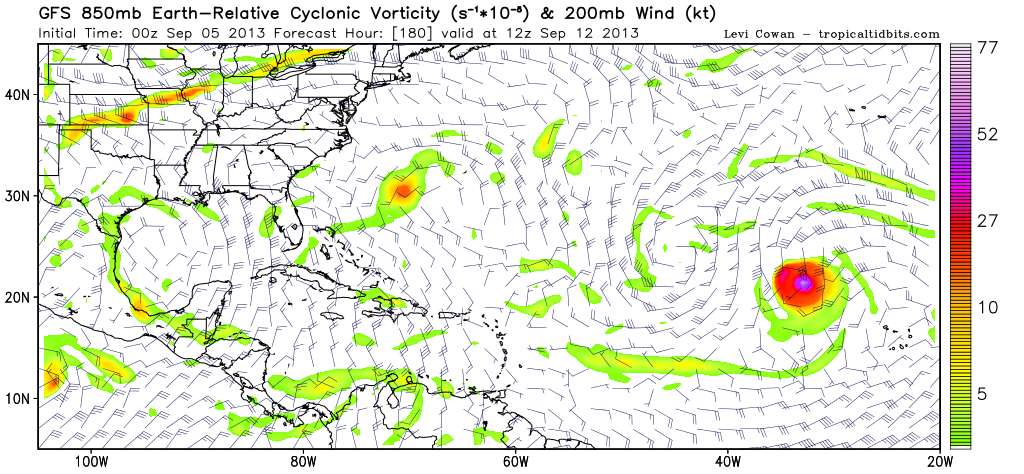
With the caveat that wind shear forecasts are almost always wrong... the windshear loop
http://www.tropicaltidbits.com/analysis/models/gfs/2013090500/gfs_shear_atltropics.html
http://www.tropicaltidbits.com/analysis/models/gfs/2013090500/gfs_shear_atltropics.html
0 likes
M a r k
- - - - -
Join us in chat: Storm2K Chatroom Invite. Android and IOS apps also available.
The posts in this forum are NOT official forecasts and should not be used as such. Posts are NOT endorsed by any professional institution or STORM2K.org. For official information and forecasts, please refer to NHC and NWS products.
- - - - -
Join us in chat: Storm2K Chatroom Invite. Android and IOS apps also available.
The posts in this forum are NOT official forecasts and should not be used as such. Posts are NOT endorsed by any professional institution or STORM2K.org. For official information and forecasts, please refer to NHC and NWS products.
-
SouthFLTropics

- Category 5
- Posts: 4156
- Age: 48
- Joined: Thu Aug 14, 2003 8:04 am
- Location: Port St. Lucie, Florida
Re: ATL: GABRIELLE - Models
That GFS run is eerily starting to remind me of Jeanne. Pulled north by a trough only to get left behind...Cyclonic loop and then west into FLA.
SFT
SFT
0 likes
Fourth Generation Floridian...With lots of storm knowledge passed down from my elders...
Personal Storm History: David 79, Andrew 92, Erin 95, Floyd 99, Irene 99, Frances 04, Jeanne 04, Wilma 05, Matthew 16, Irma 17
Personal Storm History: David 79, Andrew 92, Erin 95, Floyd 99, Irene 99, Frances 04, Jeanne 04, Wilma 05, Matthew 16, Irma 17
Re: ATL: GABRIELLE - Models
Riptide wrote:We might be tracking this for some time, according to the 0z GFS. I have my doubts about the intensity depicted but also realize that stalled storms are usually on the weaker side; due to upwelling and shear.
Yea, it never gets stronger than 1007mb during 12 days and about 4 different High's building over top of it. Looks suspect.
0 likes
The following post is NOT an official forecast and should not be used as such. It is just the opinion of the poster and may or may not be backed by sound meteorological data. It is NOT endorsed by any professional institution including storm2k.org For Official Information please refer to the NHC and NWS products.
Re: ATL: GABRIELLE - Models
0 likes
The following post is NOT an official forecast and should not be used as such. It is just the opinion of the poster and may or may not be backed by sound meteorological data. It is NOT endorsed by any professional institution including storm2k.org For Official Information please refer to the NHC and NWS products.
-
ScottNAtlanta

- Category 5
- Posts: 1998
- Joined: Sat May 25, 2013 3:11 pm
- Location: Atlanta, GA
Re: ATL: GABRIELLE - Models
SouthFLTropics wrote:That GFS run is eerily starting to remind me of Jeanne. Pulled north by a trough only to get left behind...Cyclonic loop and then west into FLA.
SFT
...and also with Jeanne, it was a relatively weak storm until it made the loop back to FL which is when it got its act together...thats when it really deepened. It was a rain maker more than anything...which is also looking familiar (just in PR not Haiti)
0 likes
The posts in this forum are NOT official forecast and should not be used as such. They are just the opinion of the poster and may or may not be backed by sound meteorological data. They are NOT endorsed by any professional institution or storm2k.org. For official information, please refer to the NHC and NWS products.
Who is online
Users browsing this forum: No registered users and 30 guests