ATL: INVEST 95L - Discussion
Moderator: S2k Moderators

-
TeamPlayersBlue

- Category 5

- Posts: 3307
- Joined: Tue Feb 02, 2010 1:44 am
- Location: Denver/Applewood, CO
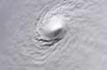
Interesting, especially if shear is down but like it was said earlier, way too much dry air. It is in a very similar spot that Humberto was in though and actually looks similar. Thank goodness for all the dry air.
0 likes
Personal Forecast Disclaimer:
The posts in this forum are NOT official forecast and should not be used as such. They are just the opinion of the poster and may or may not be backed by sound meteorological data. They are NOT endorsed by any professional institution or storm2k.org. For official information, please refer to the NHC and NWS products.
The posts in this forum are NOT official forecast and should not be used as such. They are just the opinion of the poster and may or may not be backed by sound meteorological data. They are NOT endorsed by any professional institution or storm2k.org. For official information, please refer to the NHC and NWS products.
-
Stormcenter
- S2K Supporter

- Posts: 6617
- Joined: Wed Sep 03, 2003 11:27 am
- Location: Houston, TX
Re:
Despite the dry air convection has been on the increase and pressures remain rather low.
http://weather.rap.ucar.edu/satellite/displaySat.php?region=GOM&itype=vis&size=large&endDate=20130923&endTime=-1&duration=12
http://weather.rap.ucar.edu/satellite/displaySat.php?region=GOM&itype=vis&size=large&endDate=20130923&endTime=-1&duration=12
TeamPlayersBlue wrote:Interesting, especially if shear is down but like it was said earlier, way too much dry air. It is in a very similar spot that Humberto was in though and actually looks similar. Thank goodness for all the dry air.
0 likes

Re: ATL: Ex INVEST 95L - Discussion
Shear is decreasing over the low pressure but the dry air in the mid levels of the atmosphere is now all around killing the chances for much organization, yesterday morning it looked better. The low pressure is surrounded by mid to upper 70s dewpoints at the surface in the NW GOM, even low 80s in some spots.
0 likes
-
Stormcenter
- S2K Supporter
- Posts: 6617
- Joined: Wed Sep 03, 2003 11:27 am
- Location: Houston, TX
Re: ATL: Ex INVEST 95L - Discussion
It looks much better now than it did this morning or last night despite the dry air. IMO
NDG wrote:Shear is decreasing over the low pressure but the dry air in the mid levels of the atmosphere is now all around killing the chances for much organization, yesterday morning it looked better. The low pressure is surrounded by mid to upper 70s dewpoints at the surface in the NW GOM, even low 80s in some spots.
0 likes
-
CYCLONE MIKE
- Category 5
- Posts: 2183
- Joined: Tue Aug 31, 2004 6:04 pm
- Location: Gonzales, LA
Looks, once again can be very deceiving. Here is a nice detailed, albeit highly unusual, write up about this ex-invest from the new Orleans office. For those not interested in reading, not going to develop 
.SHORT TERM...
TWO NOTABLE THINGS ON THE WX MAP TODAY ARE THE WARM FRONT BRINGING
DEEP MOISTURE BACK TO THE AREA AND THE LEFT OVER SFC LOW AND
ASSOCIATED VORTICITY CENTER WITH NICE FEEDER BANDS IN THE NW
GULF. THIS SFC LOW FEATURE WILL CONTINUE TO WEAKEN AND BECOME MORE
INTEGRATED WITH THE OLD SFC FRONT AS IT MOVES NORTH THEN NE OVER
THE NEXT FEW DAYS. DRY AIR BEHIND THE LAST FRONT HAS BECOME DEEPLY
ENTRENCHED INTO THIS SYSTEM...WHICH IS A GOOD THING OR SOMEONE
WOULD HAVE A BIGGER PROBLEM THAN JUST RAINFALL. THE DRY AIR WILL CONTINUE
TO MIX INTO THE SYSTEMS CORE CAUSING STRONG DENSITY
DISCONTINUITIES. THIS SCENARIO MAKES THE SYSTEMS CENTER BEGIN TO
DEVELOP LOBES AROUND IT CAUSING IT TO WOBBLE AND EVENTUALLY
ELONGATE(STRETCH) ALONG THE SYNOPTIC FRONTAL BOUNDARY AND OVERALL
WEAKENING THE SYSTEM. ENOUGH MET101.
0 likes
-
vbhoutex

- Storm2k Executive

- Posts: 28974
- Age: 72
- Joined: Wed Oct 09, 2002 11:31 pm
- Location: Spring Branch area, Houston, TX
- Contact:
Re:
CYCLONE MIKE wrote:Looks, once again can be very deceiving. Here is a nice detailed, albeit highly unusual, write up about this ex-invest from the new Orleans office. For those not interested in reading, not going to develop
.SHORT TERM...
TWO NOTABLE THINGS ON THE WX MAP TODAY ARE THE WARM FRONT BRINGING
DEEP MOISTURE BACK TO THE AREA AND THE LEFT OVER SFC LOW AND
ASSOCIATED VORTICITY CENTER WITH NICE FEEDER BANDS IN THE NW
GULF. THIS SFC LOW FEATURE WILL CONTINUE TO WEAKEN AND BECOME MORE
INTEGRATED WITH THE OLD SFC FRONT AS IT MOVES NORTH THEN NE OVER
THE NEXT FEW DAYS. DRY AIR BEHIND THE LAST FRONT HAS BECOME DEEPLY
ENTRENCHED INTO THIS SYSTEM...WHICH IS A GOOD THING OR SOMEONE
WOULD HAVE A BIGGER PROBLEM THAN JUST RAINFALL. THE DRY AIR WILL CONTINUE
TO MIX INTO THE SYSTEMS CORE CAUSING STRONG DENSITY
DISCONTINUITIES. THIS SCENARIO MAKES THE SYSTEMS CENTER BEGIN TO
DEVELOP LOBES AROUND IT CAUSING IT TO WOBBLE AND EVENTUALLY
ELONGATE(STRETCH) ALONG THE SYNOPTIC FRONTAL BOUNDARY AND OVERALL
WEAKENING THE SYSTEM. ENOUGH MET101.
Thanks for posting that. I learned something new today.
0 likes
Skywarn, C.E.R.T.
Please click below to donate to STORM2K to help with the expenses of keeping the site going:

Please click below to donate to STORM2K to help with the expenses of keeping the site going:
-
vbhoutex
- Storm2k Executive
- Posts: 28974
- Age: 72
- Joined: Wed Oct 09, 2002 11:31 pm
- Location: Spring Branch area, Houston, TX
- Contact:
Re: Re:
Stormcenter wrote:Despite the dry air convection has been on the increase and pressures remain rather low.
http://weather.rap.ucar.edu/satellite/displaySat.php?region=GOM&itype=vis&size=large&endDate=20130923&endTime=-1&duration=12
TeamPlayersBlue wrote:Interesting, especially if shear is down but like it was said earlier, way too much dry air. It is in a very similar spot that Humberto was in though and actually looks similar. Thank goodness for all the dry air.
This is in relation to 95L and to the rest of the season also. From what I can gather in my reading and hearing on the TV the biggest reason so many TCs this season haven't "developed" into hurricanes is the mid-level dry air. Why wasn't this seen by those making long term forecasts and why does it seem like many are still not taking it into account including models that want to really develop these systems?
0 likes
Skywarn, C.E.R.T.
Please click below to donate to STORM2K to help with the expenses of keeping the site going:
Please click below to donate to STORM2K to help with the expenses of keeping the site going:
Re: ATL: Ex INVEST 95L - Discussion

NWS discussion
A WEAK MIDLEVEL PERTURBATION OVER THE ERN GULF OF MEXICO WILL
TRANSLATE ENEWD ACROSS THE PENINSULA TONIGHT...SUPPORTING THE
CONTINUATION OF ONGOING STORMS.
00Z SOUNDINGS SHOW THE PRESENCE OF A VERY MOIST AIR MASS /I.E. PW VALUES OF 2.00-2.25 INCHES/ WHICH IS CONTRIBUTING TO A MODERATELY UNSTABLE ENVIRONMENT. WHILE THE STRONGEST STORMS MAY EXHIBIT SOME WEAK MIDLEVEL ROTATION WITH A RISK FOR LOCALLY STRONG WIND GUSTS...POOR LAPSE RATES AND GENERALLY WEAK DEEP-LAYER SHEAR ARE EXPECTED TO PRECLUDE ORGANIZED SEVERE WEATHER POTENTIAL.
Last edited by stormkite on Tue Sep 24, 2013 10:18 pm, edited 1 time in total.
0 likes

Why is this clearly defined low spinning in the Gulf not an invest? Having a well defined low in the Gulf this time of year with warm water seems like it could blow up at anytime.
http://rapidfire.sci.gsfc.nasa.gov/imagery/subsets/?subset=USA7.2013267.terra.1km
http://weather.rap.ucar.edu/satellite/displaySat.php?region=GOM&itype=vis&size=large&endDate=20130923&endTime=-1&duration=12
http://rapidfire.sci.gsfc.nasa.gov/imagery/subsets/?subset=USA7.2013267.terra.1km
http://weather.rap.ucar.edu/satellite/displaySat.php?region=GOM&itype=vis&size=large&endDate=20130923&endTime=-1&duration=12
0 likes
Who is online
Users browsing this forum: No registered users and 120 guests