Global model runs discussion

Moderator: S2k Moderators

Message
Author
3090
Category 1
Category 1
Posts: 290
Age: 64
Joined: Fri Aug 19, 2011 4:01 pm

Re: Global Model Runs Discussion

#2701 Postby 3090 » Mon Sep 05, 2011 9:35 am

CYCLONE MIKE wrote:Thanks something funny. Looks like we have some model support for possible development down there later this week. Something definitely to watch for. Makes me think back to Opal from years ago. I know she didn't form on the tail end of a stalled out front but exploded overnight in the gulf. Scared the you know what out of folks around here.


Do I remember Opal. Unreal. But she was in late September, early October, if memory serves me right. In any event, she had rapid intensification and got shunted off toward Pensacola. Could we have something stewing about to kick up in the BOC over the next 4-5 days?

It's getting busy in the Tropics.

Looking at the latest satellite imagery, some ingredients are getting thrown in already it appears.
0 likes   

HurricaneFan
Tropical Storm
Tropical Storm
Posts: 192
Age: 40
Joined: Tue Jan 18, 2011 6:16 pm
Location: Anguilla,Leeward Islands 18.3N 63.0W

Re: Global Model Runs Discussion

#2702 Postby HurricaneFan » Mon Sep 05, 2011 10:26 am

95L was struggling before and now it has flared up alot and have some(not a whole lot according to some models) potential to develop.
Will the wave coming off of Africa now that is also struggling,flare up in the near future?What are the models saying in terms of track and intensity with this wave?
0 likes   

lostsole
Tropical Depression
Tropical Depression
Posts: 55
Age: 54
Joined: Thu Aug 13, 2009 3:31 pm
Location: Pensacola, FL
Contact:

Re: Global Model Runs Discussion

#2703 Postby lostsole » Mon Sep 05, 2011 5:48 pm

somethingfunny wrote:
CYCLONE MIKE wrote:As Lee is wrapping up around here(no pun intended) I am already starting to look at our next possible threat. Saw the GFS runs last night and this morning that was showing a system in the central gulf onthe 11th originating deep in the BOC. Probably develops from the tailend of the cold front that is supposed to move through here tomorrow and tuesday. Saw one euro run last night that also showed this possibilty. Have been away from computer today, has anything changed or do we still have model support for this scenario?


12Z model rundown on Katia and next week's BOC storm:

GFS: recurve, BOC storm forms, NW Caribbean storm pushed back to 9/20
UKMET: gonna hit Jax-SC area, no BOC storm
CMC: recurve, BOC storm forms
NOGAPS: recurve, BOC storm forms
...and of course the Euro.....
recurve (LOL 929mb off cape cod), no BOC storm, but that NW caribbean storm is developing at 9/14


Thanks for the rundown, that was really nice of you, made it very easy to get caught up very quickly. Well done.
0 likes   

User avatar
cycloneye
Admin
Admin
Posts: 139604
Age: 67
Joined: Thu Oct 10, 2002 10:54 am
Location: San Juan, Puerto Rico

Re: Global Model Runs Discussion

#2704 Postby cycloneye » Mon Sep 05, 2011 11:59 pm

GFS continues to develop in the NW Caribbean on long range. After this timeframe,it goes to the Florida Penninsula.

Image

Saved image.
0 likes   
Visit the Caribbean-Central America Weather Thread where you can find at first post web cams,radars
and observations from Caribbean basin members Click Here

HurricaneFan
Tropical Storm
Tropical Storm
Posts: 192
Age: 40
Joined: Tue Jan 18, 2011 6:16 pm
Location: Anguilla,Leeward Islands 18.3N 63.0W

Re: Global Model Runs Discussion

#2705 Postby HurricaneFan » Tue Sep 06, 2011 8:54 am

So what are the models saying about the wave behind 95L(just off the coast of Africa now)in terms of track and intensity?
0 likes   

User avatar
TYNI
S2K Supporter
S2K Supporter
Posts: 550
Age: 57
Joined: Sun Sep 07, 2008 12:59 pm
Location: Ontario, Canada

Re: Global Model Runs Discussion

#2706 Postby TYNI » Tue Sep 06, 2011 1:14 pm

Curious to see what the models show us in the next runs. There's stuff popping everywhere in the tropical Atlantic at the moment!

Image

Uploaded with ImageShack.us
0 likes   
Personal Forecast Disclaimer:
The posts in this forum are NOT official forecast and should not be used as such. They are just the opinion of the poster and may or may not be backed by sound meteorological data. They are NOT endorsed by any professional institution or storm2k.org. For official information, please refer to the NHC and NWS products.

HurricaneFan
Tropical Storm
Tropical Storm
Posts: 192
Age: 40
Joined: Tue Jan 18, 2011 6:16 pm
Location: Anguilla,Leeward Islands 18.3N 63.0W

Re: Global Model Runs Discussion

#2707 Postby HurricaneFan » Wed Sep 07, 2011 11:17 am

The wave to the SE of Maria looks to be holding its own still.
Are the models saying anything about it yet?
0 likes   

bigdan35
Tropical Depression
Tropical Depression
Posts: 83
Age: 48
Joined: Sat Jun 04, 2011 9:56 am
Location: Sarasota Florida
Contact:

Re: Global Model Runs Discussion

#2708 Postby bigdan35 » Wed Sep 07, 2011 2:14 pm

This is 2 runs in a row gfs shows similar results but time frame is in la la land :lol:


Image

Uploaded with ImageShack.us


http://stormcenter2011.ucoz.com/
0 likes   

User avatar
cycloneye
Admin
Admin
Posts: 139604
Age: 67
Joined: Thu Oct 10, 2002 10:54 am
Location: San Juan, Puerto Rico

Re: Global Model Runs Discussion

#2709 Postby cycloneye » Wed Sep 07, 2011 6:12 pm

Make it three in a row going there :uarrow: What I am posting here is the starting phase of the development by GFS at 18z run at 276 hours.

Image

Saved image.
0 likes   
Visit the Caribbean-Central America Weather Thread where you can find at first post web cams,radars
and observations from Caribbean basin members Click Here

bigdan35
Tropical Depression
Tropical Depression
Posts: 83
Age: 48
Joined: Sat Jun 04, 2011 9:56 am
Location: Sarasota Florida
Contact:

Re: Global Model Runs Discussion

#2710 Postby bigdan35 » Wed Sep 07, 2011 7:38 pm

Image

Uploaded with ImageShack.us

And the finish of that run :eek:


http://stormcenter2011.ucoz.com/
0 likes   

HurricaneWarning92
Category 2
Category 2
Posts: 519
Joined: Sat Jul 23, 2011 4:33 pm
Location: Pembroke Pines, S. Florida (Lat: 26.00N, Lon: 80.22W)

#2711 Postby HurricaneWarning92 » Wed Sep 07, 2011 7:40 pm

Interesting, so it comes from the south...
0 likes   
The posts in this forum are NOT official forecast and should not be used as such. They are just the opinion of the poster and may or may not be backed by sound meteorological data. They are NOT endorsed by any professional institution or storm2k.org. For official information, please refer to the NHC and NWS products.

User avatar
somethingfunny
ChatStaff
ChatStaff
Posts: 3926
Age: 35
Joined: Thu May 31, 2007 10:30 pm
Location: McKinney, Texas

#2712 Postby somethingfunny » Thu Sep 08, 2011 2:24 am

0z dropped it.
0 likes   
I am not a meteorologist, and any posts made by me are not official forecasts or to be interpreted as being intelligent. These posts are just my opinions and are probably silly opinions.

User avatar
BigA
Professional-Met
Professional-Met
Posts: 1317
Joined: Sun Jul 24, 2005 10:56 pm

Re: Global Model Runs Discussion

#2713 Postby BigA » Thu Sep 08, 2011 6:33 am

06 picked it back up. Two storms now at the end of the run: one in W Carib and one in Bahamas. This tells me that the GFS is seeing action start focusing farther west in late September, which makes climatological sense as the MDR becomes less favorable for development.
0 likes   

User avatar
HurricaneMaster_PR
Category 2
Category 2
Posts: 795
Joined: Tue Jul 22, 2003 6:23 pm
Location: San Juan, Puerto Rico

Re: Global Model Runs Discussion

#2714 Postby HurricaneMaster_PR » Fri Sep 09, 2011 1:08 am

The 00Z GFS yet develops another system in 168 hrs and moves it through the Lesser Antilles and very close to PR. Mercy!

Image

Uploaded with ImageShack.us
0 likes   

User avatar
Macrocane
Category 5
Category 5
Posts: 4218
Age: 35
Joined: Sun May 24, 2009 5:35 pm
Location: El Salvador

Re: Global Model Runs Discussion

#2715 Postby Macrocane » Fri Sep 09, 2011 8:53 am

The 0z FIM starts developing a tropical wave in 168-174 hours before it reaches the Lesser Antilles at a very low latitude (roughly at 12N), later at 210 hours it develops another system near the western tip of Cuba, by the end of the run (240 h) the systems are strengthening and one is located well southeast of Puerto Rico and the other north of Yucatan peninsula (see the image below).

Image
0 likes   

User avatar
gatorcane
S2K Supporter
S2K Supporter
Posts: 23499
Age: 46
Joined: Sun Mar 13, 2005 3:54 pm
Location: Boca Raton, FL

Re: Global Model Runs Discussion

#2716 Postby gatorcane » Fri Sep 09, 2011 5:52 pm

wake me up when the Euro and GFS show something of interest. Right now it is quite boring :sleeping:

Looking forward to the first cold front here in South Florida, though we are still at least 6 weeks away or so.
0 likes   

User avatar
Rgv20
S2K Supporter
S2K Supporter
Posts: 2456
Age: 37
Joined: Wed Jan 05, 2011 5:42 pm
Location: Edinburg/McAllen Tx

#2717 Postby Rgv20 » Fri Sep 09, 2011 11:31 pm

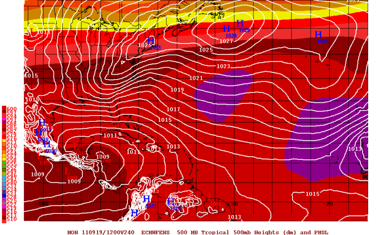
Looks like the 12zECMWF Ensembles are trying to sniff out something in the NW Caribbean in 10 days. The GFS has been hinting at it too.

12zECMWF Ensembles 10 day forecast. Do not look at specifics but instead notice that it starts to lower pressures in the NW Caribbean.
Image
0 likes   
The following post is NOT an official forecast and should not be used as such. It is just the opinion of the poster and may or may not be backed by sound meteorological data. It is NOT endorsed by any professional institution including storm2k.org For Official Information please refer to the NHC and NWS products.

bexar
Tropical Storm
Tropical Storm
Posts: 182
Joined: Sat Aug 20, 2011 11:23 am

Re: Global Model Runs Discussion

#2718 Postby bexar » Sat Sep 10, 2011 9:45 am

It's really getting boring.... there have been 14 named storms already yet only two has reached hurricane status :sleeping:

this season so far has been quantity over quality... and with peak now in reach, nothing interesting out there really in most long range models.
0 likes   

psyclone
S2K Supporter
S2K Supporter
Posts: 4510
Joined: Wed Aug 24, 2005 9:04 pm
Location: palm harbor fl

#2719 Postby psyclone » Sat Sep 10, 2011 10:14 am

I've been saying quantity over quality for awhile now...no question it's true. but we are quickly approaching the time of the year to look to the western caribbean. that area can produce some serious late season quality. for my region (west coast of florida) we're just now reaching the higher risk time of year as most of our threats come late and from the south rather that early and from the east.
0 likes   

User avatar
gatorcane
S2K Supporter
S2K Supporter
Posts: 23499
Age: 46
Joined: Sun Mar 13, 2005 3:54 pm
Location: Boca Raton, FL

Re:

#2720 Postby gatorcane » Sat Sep 10, 2011 10:15 am

psyclone wrote:I've been saying quantity over quality for awhile now...no question it's true. but we are quickly approaching the time of the year to look to the western caribbean. that area can produce some serious late season quality. for my region (west coast of florida) we're just now reaching the higher risk time of year as most of our threats come late and from the south rather that early and from the east.


Agreed September and October are THE months for Florida hits if you look back in history.
0 likes   


Return to “2015”

Who is online

Users browsing this forum: No registered users and 11 guests