TROPICAL WEATHER OUTLOOK
NWS NATIONAL HURRICANE CENTER MIAMI FL
500 AM PDT WED JUN 10 2015
For the eastern North Pacific...east of 140 degrees west longitude:
Showers and thunderstorms associated with a low pressure area a
few hundred miles southwest of the Gulf of Tehuantepec have become
better organized since yesterday. Environmental conditions are
conducive for development, and a tropical depression is likely to
form later today or on Thursday while this system moves slowly
northwestward or northward.
* Formation chance through 48 hours...high...80 percent
* Formation chance through 5 days...high...90 percent
$$
Forecaster Landsea
EPAC: CARLOS - Post-Tropical
Moderator: S2k Moderators
-
cycloneye

- Admin

- Posts: 149275
- Age: 69
- Joined: Thu Oct 10, 2002 10:54 am
- Location: San Juan, Puerto Rico
Re: EPAC: INVEST 94E
0 likes
Visit the Caribbean-Central America Weather Thread where you can find at first post web cams,radars
and observations from Caribbean basin members Click Here
and observations from Caribbean basin members Click Here
-
cycloneye
- Admin
- Posts: 149275
- Age: 69
- Joined: Thu Oct 10, 2002 10:54 am
- Location: San Juan, Puerto Rico
Re: EPAC: INVEST 94E
Recon for Friday.
PACIFIC REQUIREMENTS
1. NEGATIVE RECONNAISSANCE REQUIREMENTS.
2. SUCCEEDING DAY OUTLOOK: FIX A DEVELOPING SYSTEM AT
12/1730Z NEAR 15.0N 97.5W
PACIFIC REQUIREMENTS
1. NEGATIVE RECONNAISSANCE REQUIREMENTS.
2. SUCCEEDING DAY OUTLOOK: FIX A DEVELOPING SYSTEM AT
12/1730Z NEAR 15.0N 97.5W
0 likes
Visit the Caribbean-Central America Weather Thread where you can find at first post web cams,radars
and observations from Caribbean basin members Click Here
and observations from Caribbean basin members Click Here
-
Yellow Evan

- Professional-Met

- Posts: 16231
- Age: 27
- Joined: Fri Jul 15, 2011 12:48 pm
- Location: Henderson, Nevada/Honolulu, HI
- Contact:
-
HurricaneTracker2031
- Tropical Storm

- Posts: 248
- Age: 26
- Joined: Fri Jul 19, 2013 7:20 pm
- Location: Pembroke Pines, FL, USA
- Contact:
Re: EPAC: INVEST 94E
94E is getting better organized and has lots of convection that is circulating. It should become a TD later today or Thursday.

Synopsis on 94E and other basins: http://goo.gl/pCyYyT
Personal Forecast Disclaimer:
The posts in this forum are NOT official forecast and should not be used as such. They are just the opinion of the poster and may or may not be backed by sound meteorological data. They are NOT endorsed by any professional institution or storm2k.org. For official information, please refer to the NHC and NWS products.
0 likes
SHORT VERSION OF DISCLAIMER: THIS SITE LINK BELOW IS NOT AN OFFICIAL FORECASTING OFFICE AND SHOULD NOT BE USED TO MAKE ANY EMERGENCY DECISIONS....
http://www.macstropicalweather.weebly.com
http://www.macstropicalweather.weebly.com
-
Yellow Evan
- Professional-Met
- Posts: 16231
- Age: 27
- Joined: Fri Jul 15, 2011 12:48 pm
- Location: Henderson, Nevada/Honolulu, HI
- Contact:
-
Yellow Evan
- Professional-Met
- Posts: 16231
- Age: 27
- Joined: Fri Jul 15, 2011 12:48 pm
- Location: Henderson, Nevada/Honolulu, HI
- Contact:
-
cycloneye
- Admin
- Posts: 149275
- Age: 69
- Joined: Thu Oct 10, 2002 10:54 am
- Location: San Juan, Puerto Rico
Re: EPAC: INVEST 94E
Moving more west and that eliminates any crossover scenario.
0 likes
Visit the Caribbean-Central America Weather Thread where you can find at first post web cams,radars
and observations from Caribbean basin members Click Here
and observations from Caribbean basin members Click Here
-
Yellow Evan
- Professional-Met
- Posts: 16231
- Age: 27
- Joined: Fri Jul 15, 2011 12:48 pm
- Location: Henderson, Nevada/Honolulu, HI
- Contact:
Re: EPAC: INVEST 94E
0z GFDL moves 94E west for the next 30 hours or so before heading due north into far southeastern Oaxaca and then crossing into the BoC where it deepens as it continues to head due north.
+78 hrs

+126 hrs

+78 hrs
+126 hrs
0 likes
-
cycloneye
- Admin
- Posts: 149275
- Age: 69
- Joined: Thu Oct 10, 2002 10:54 am
- Location: San Juan, Puerto Rico
Re: EPAC: INVEST 94E
TROPICAL WEATHER OUTLOOK
NWS NATIONAL HURRICANE CENTER MIAMI FL
1100 AM PDT WED JUN 10 2015
For the eastern North Pacific...east of 140 degrees west longitude:
Showers and thunderstorms associated with a low pressure area a
few hundred miles southwest of the Gulf of Tehuantepec continue
to show signs of organization. Environmental conditions are
conducive for development, and a tropical depression is likely to
form later today or tonight while the system moves slowly
northwestward or northward. Interests in southern Mexico should
monitor the progress of this system. A tropical storm or hurricane
watch could be required for a portion of the coast of Mexico near
the Gulf of Tehuantepec later today.
* Formation chance through 48 hours...high...90 percent
* Formation chance through 5 days...high...90 percent
$$
Forecaster Pasch/Landsea
0 likes
Visit the Caribbean-Central America Weather Thread where you can find at first post web cams,radars
and observations from Caribbean basin members Click Here
and observations from Caribbean basin members Click Here
-
Yellow Evan
- Professional-Met
- Posts: 16231
- Age: 27
- Joined: Fri Jul 15, 2011 12:48 pm
- Location: Henderson, Nevada/Honolulu, HI
- Contact:
-
cycloneye
- Admin
- Posts: 149275
- Age: 69
- Joined: Thu Oct 10, 2002 10:54 am
- Location: San Juan, Puerto Rico
Re: EPAC: INVEST 94E
Models are more west.
EP, 94, 2015061018, , BEST, 0, 121N, 984W, 30, 1004, DB

EP, 94, 2015061018, , BEST, 0, 121N, 984W, 30, 1004, DB
0 likes
Visit the Caribbean-Central America Weather Thread where you can find at first post web cams,radars
and observations from Caribbean basin members Click Here
and observations from Caribbean basin members Click Here
-
cycloneye
- Admin
- Posts: 149275
- Age: 69
- Joined: Thu Oct 10, 2002 10:54 am
- Location: San Juan, Puerto Rico
Re: EPAC: INVEST 94E
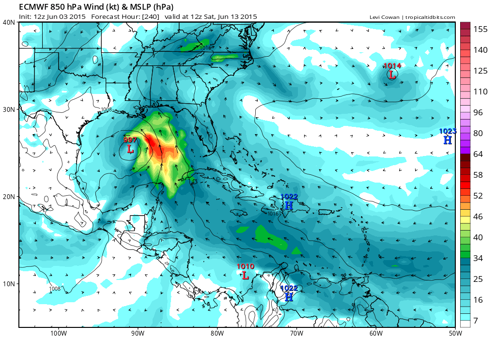
12z ECMWF has a bonifide hurricane tracking torwards Cabo San Lucas.

0 likes
Visit the Caribbean-Central America Weather Thread where you can find at first post web cams,radars
and observations from Caribbean basin members Click Here
and observations from Caribbean basin members Click Here
-
srainhoutx

- S2K Supporter

- Posts: 6919
- Age: 68
- Joined: Sun Jan 14, 2007 11:34 am
- Location: Haywood County, NC
- Contact:
Re: EPAC: INVEST 94E
cycloneye wrote:12z ECMWF has a bonifide hurricane tracking torwards Cabo San Lucas.
And 7 days ago the Euro had it going to Louisiana...
0 likes
Carla/Alicia/Jerry(In The Eye)/Michelle/Charley/Ivan/Dennis/Katrina/Rita/Wilma/Ike/Harvey
Member: National Weather Association
Wx Infinity Forums
http://wxinfinity.com/index.php
Facebook.com/WeatherInfinity
Twitter @WeatherInfinity
Member: National Weather Association
Wx Infinity Forums
http://wxinfinity.com/index.php
Facebook.com/WeatherInfinity
Twitter @WeatherInfinity
-
Yellow Evan
- Professional-Met
- Posts: 16231
- Age: 27
- Joined: Fri Jul 15, 2011 12:48 pm
- Location: Henderson, Nevada/Honolulu, HI
- Contact:
-
cycloneye
- Admin
- Posts: 149275
- Age: 69
- Joined: Thu Oct 10, 2002 10:54 am
- Location: San Juan, Puerto Rico
Re: EPAC: INVEST 94E
0 likes
Visit the Caribbean-Central America Weather Thread where you can find at first post web cams,radars
and observations from Caribbean basin members Click Here
and observations from Caribbean basin members Click Here
-
Yellow Evan
- Professional-Met
- Posts: 16231
- Age: 27
- Joined: Fri Jul 15, 2011 12:48 pm
- Location: Henderson, Nevada/Honolulu, HI
- Contact:
-
Yellow Evan
- Professional-Met
- Posts: 16231
- Age: 27
- Joined: Fri Jul 15, 2011 12:48 pm
- Location: Henderson, Nevada/Honolulu, HI
- Contact:
20150610 1745 12.0 98.6 T1.0/1.0 94E 94E
* EAST PACIFIC SHIPS INTENSITY FORECAST *
* IR SAT DATA AVAILABLE, OHC AVAILABLE *
* INVEST EP942015 06/10/15 18 UTC *
TIME (HR) 0 6 12 18 24 36 48 60 72 84 96 108 120
V (KT) NO LAND 30 34 38 42 46 55 65 68 68 68 68 68 69
V (KT) LAND 30 34 38 42 46 55 65 68 44 33 29 28 27
V (KT) LGE mod 30 33 37 41 45 53 62 72 47 DIS DIS DIS DIS
Storm Type TROP TROP TROP TROP TROP TROP TROP TROP TROP N/A N/A N/A N/A
SHEAR (KT) 16 16 15 13 13 11 7 13 11 N/A N/A N/A N/A
SHEAR ADJ (KT) -1 -2 0 0 0 4 4 3 4 N/A N/A N/A N/A
SHEAR DIR 50 46 54 58 63 44 35 32 45 N/A N/A N/A N/A
SST (C) 30.2 30.1 30.1 30.1 30.1 30.2 30.2 30.2 30.1 N/A N/A N/A N/A
POT. INT. (KT) 166 164 163 162 163 165 165 164 163 N/A N/A N/A N/A
200 MB T (C) -52.6 -52.1 -52.3 -52.5 -52.0 -52.1 -52.0 -52.0 -51.7 N/A N/A N/A N/A
TH_E DEV (C) 8 9 8 8 8 8 9 9 10 N/A N/A N/A N/A
700-500 MB RH 76 75 74 75 74 75 74 72 69 N/A N/A N/A N/A
MODEL VTX (KT) 12 11 10 10 11 11 13 11 10 LOST LOST LOST LOST
850 MB ENV VOR 56 58 49 36 28 41 49 77 78 N/A N/A N/A N/A
200 MB DIV 66 53 67 93 97 97 68 47 60 N/A N/A N/A N/A
700-850 TADV 0 -1 -2 -1 0 0 3 0 -2 N/A N/A N/A N/A
LAND (KM) 434 390 350 323 297 213 114 12 -72 N/A N/A N/A N/A
LAT (DEG N) 12.1 xx.x xx.x xx.x xx.x xx.x xx.x xx.x xx.x xx.x xx.x xx.x xx.x
LONG(DEG W) 98.4 xxx.x xxx.x xxx.x xxx.x xxx.x xxx.x xxx.x xxx.x xxx.x xxx.x xxx.x xxx.x
STM SPEED (KT) 7 5 4 2 3 5 5 4 4 N/A N/A N/A N/A
HEAT CONTENT 38 41 44 46 47 41 39 19 46 0 0 0 0
FORECAST TRACK FROM OFPI INITIAL HEADING/SPEED (DEG/KT):320/ 8 CX,CY: -4/ 6
T-12 MAX WIND: 25 PRESSURE OF STEERING LEVEL (MB): 510 (MEAN=581)
GOES IR BRIGHTNESS TEMP. STD DEV. 50-200 KM RAD: 6.0 (MEAN=14.5)
% GOES IR PIXELS WITH T < -20 C 50-200 KM RAD: 100.0 (MEAN=65.0)
INDIVIDUAL CONTRIBUTIONS TO INTENSITY CHANGE
6 12 18 24 36 48 60 72 84 96 108 120
----------------------------------------------------------
SAMPLE MEAN CHANGE 0. 0. 0. 1. 1. 1. 0. 0. -1. -1. -2. -2.
SST POTENTIAL 0. 0. 1. 2. 8. 15. 22. 29. 32. 34. 36. 39.
VERTICAL SHEAR MAG 0. 1. 1. 1. 2. 3. 3. 2. 2. 3. 3. 3.
VERTICAL SHEAR ADJ 0. 0. 0. 0. 0. -1. -1. -1. -1. -1. -2. -2.
VERTICAL SHEAR DIR 1. 1. 3. 4. 6. 8. 10. 10. 11. 12. 12. 12.
PERSISTENCE 1. 1. 2. 2. 2. 2. 2. 1. 1. 1. 1. 0.
200/250 MB TEMP. 0. -1. -2. -3. -5. -7. -10. -12. -13. -14. -14. -14.
THETA_E EXCESS 0. 0. 0. 0. 0. 0. 0. 0. 0. 0. 0. 0.
700-500 MB RH 0. 0. 1. 1. 2. 3. 3. 4. 4. 5. 5. 5.
MODEL VTX TENDENCY 0. -1. -2. -2. -2. 1. -1. -3. -2. -2. -2. -2.
850 MB ENV VORTICITY 0. 0. 0. 0. 1. 1. 1. 2. 2. 3. 4. 4.
200 MB DIVERGENCE 0. 1. 1. 2. 2. 2. 2. 1. 1. 0. -1. -2.
850-700 T ADVEC 0. 0. 0. 0. 0. 0. 0. 0. 0. 0. 0. 0.
ZONAL STORM MOTION 0. 0. 0. -1. -1. -1. -2. -2. -2. -2. -2. -2.
STEERING LEVEL PRES 0. 0. 0. 0. 0. -1. -1. -1. -1. -1. -1. -1.
DAYS FROM CLIM. PEAK 0. 0. 0. 0. 0. 0. 0. -1. -1. -1. -1. -1.
GOES PREDICTORS 2. 4. 5. 6. 7. 6. 6. 4. 3. 1. 1. 1.
OCEAN HEAT CONTENT 0. 1. 1. 2. 3. 3. 3. 2. 2. 2. 1. 1.
----------------------------------------------------------
TOTAL CHANGE 4. 8. 12. 17. 25. 35. 38. 38. 38. 38. 38. 39.
** 2013 E. Pacific RI INDEX EP942015 INVEST 06/10/15 18 UTC **
( 30 KT OR MORE MAX WIND INCREASE IN NEXT 24 HR)
12 HR PERSISTENCE (KT): 5.0 Range:-22.0 to 38.5 Scaled/Wgted Val: 0.4/ 1.0
850-200 MB SHEAR (KT) : 14.5 Range: 18.7 to 1.4 Scaled/Wgted Val: 0.2/ 0.3
POT = MPI-VMAX (KT) : 133.7 Range: 40.3 to 141.7 Scaled/Wgted Val: 0.9/ 1.0
STD DEV OF IR BR TEMP : 6.0 Range: 38.9 to 2.4 Scaled/Wgted Val: 0.9/ 0.9
Heat content (KJ/cm2) : 43.2 Range: 3.6 to 75.9 Scaled/Wgted Val: 0.5/ 0.5
D200 (10**7s-1) : 75.2 Range:-11.0 to 135.3 Scaled/Wgted Val: 0.6/ 0.4
% area w/pixels <-30 C: 100.0 Range: 41.4 to 100.0 Scaled/Wgted Val: 1.0/ 0.5
850-700 MB REL HUM (%): 77.4 Range: 57.6 to 96.8 Scaled/Wgted Val: 0.5/ -0.1
Prob of RI for 25 kt RI threshold= 61% is 4.6 times the sample mean(13.1%)
Prob of RI for 30 kt RI threshold= 32% is 3.7 times the sample mean( 8.7%)
Prob of RI for 35 kt RI threshold= 24% is 4.0 times the sample mean( 6.0%)
Prob of RI for 40 kt RI threshold= 17% is 4.0 times the sample mean( 4.3%)
Last edited by Yellow Evan on Wed Jun 10, 2015 2:49 pm, edited 1 time in total.
0 likes
-
Yellow Evan
- Professional-Met
- Posts: 16231
- Age: 27
- Joined: Fri Jul 15, 2011 12:48 pm
- Location: Henderson, Nevada/Honolulu, HI
- Contact:
Re: EPAC: INVEST 94E
cycloneye wrote::uarrow: A huge shift.This is why we can't look at the models beyond 5 days.
We can if you look at ensembles and be careful. I saw this coming to some extent, as I had noticed the shifts in the ensembles.
0 likes
-
cycloneye
- Admin
- Posts: 149275
- Age: 69
- Joined: Thu Oct 10, 2002 10:54 am
- Location: San Juan, Puerto Rico
Re: EPAC: INVEST 94E
TROPICAL DEPRESSION THREE-E DISCUSSION NUMBER 1
NWS NATIONAL HURRICANE CENTER MIAMI FL EP032015
400 PM CDT WED JUN 10 2015
Satellite imagery indicates that the deep convection associated
with the low pressure system located southwest of the Gulf of
Tehuantepec has become sufficiently well organized to designate the
formation of a tropical depression. Therefore, advisories are
being initiated at this time. The cyclone should remain in an
environment of low vertical shear and over warm waters for the next
several days, so steady strengthening seems to be a good bet. The
official wind speed forecast is generally above the intensity model
consensus. There is significant uncertainty in the longer range
intensity forecast, depending on how much the system interacts with
land.
Center fixes have had a fair amount of scatter, and my best
estimate of the initial motion is 315/8 kt. During the next 72
hours, the cyclone is likely to respond to a mid-level weakness over
the Gulf of Mexico by turning northward and north-northeastward.
Later in the forecast period, a mid-level ridge to the northwest is
expected to cause the system to turn toward the west-northwest and
move parallel the coast. The GFS model takes the system close to
the coast in 72 hours, but the ECMWF and GFDL model tracks keep the
cyclone offshore and are much farther to the west than the GFS
solution. As a compromise, the official track forecast is close
to the model consensus TVCN albeit not as far west as TVCN by 120
hours. Given the large divergence of the model tracks, this is a
low confidence forecast.
FORECAST POSITIONS AND MAX WINDS
INIT 10/2100Z 12.4N 98.7W 30 KT 35 MPH
12H 11/0600Z 13.0N 99.4W 35 KT 40 MPH
24H 11/1800Z 13.4N 99.9W 45 KT 50 MPH
36H 12/0600Z 14.0N 99.6W 55 KT 65 MPH
48H 12/1800Z 14.5N 99.2W 65 KT 75 MPH
72H 13/1800Z 15.5N 99.0W 70 KT 80 MPH
96H 14/1800Z 16.5N 100.5W 75 KT 85 MPH
120H 15/1800Z 17.5N 103.5W 75 KT 85 MPH
$$
Forecaster Pasch
0 likes
Visit the Caribbean-Central America Weather Thread where you can find at first post web cams,radars
and observations from Caribbean basin members Click Here
and observations from Caribbean basin members Click Here
Who is online
Users browsing this forum: No registered users and 96 guests