CrazyC83 wrote:Based on the data right now, 70 kt seems right but the plane hasn't been in the entire storm at all.
I'd go 75/974.
Moderator: S2k Moderators


CrazyC83 wrote:Based on the data right now, 70 kt seems right but the plane hasn't been in the entire storm at all.


cycloneye wrote:70/975
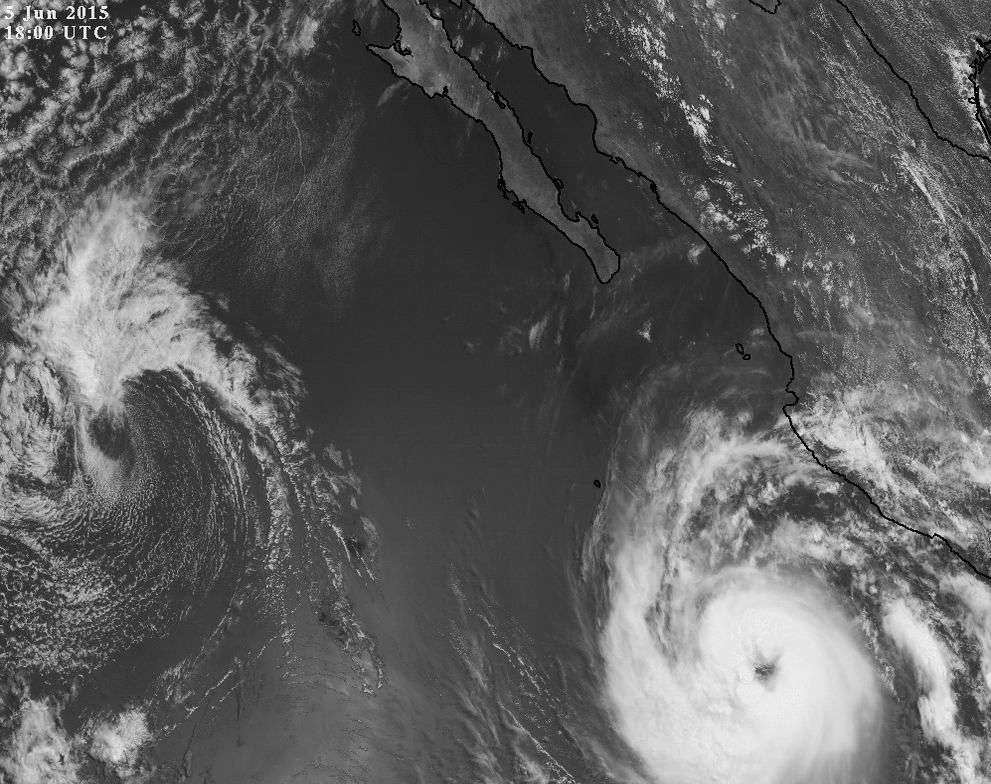
EP, 02, 2015060518, , BEST, 0, 149N, 1072W, 70, 975, HU
Kingarabian wrote:cycloneye wrote:70/975
EP, 02, 2015060518, , BEST, 0, 149N, 1072W, 70, 975, HU
Maybe 80/974. Could be strengthening.

MiamiensisWx wrote:*Cut* Right now, Blanca looks more like a typical Atlantic storm of the past several seasons, and it is definitely no longer a hurricane in my view. Big kudos to the HWRF and GFDL for seeing something that even the NHC dismissed.
CrazyC83 wrote:Maybe not quite a tropical storm, but I think the best track will bring the intensity yesterday down to 65 kt or so (the peak intensity shouldn't change). The latest data provides strong support for an 80 kt initial intensity.


spiral wrote:02E BLANCA 150605 1800 15.0N 107.2W EPAC 80 975
looks absolute crap from dry air 80knts looks a token gift.

Users browsing this forum: No registered users and 45 guests