Global model runs discussion

Moderator: S2k Moderators

Message
Author
User avatar
ROCK
Category 5
Category 5
Posts: 9484
Age: 54
Joined: Tue Aug 17, 2004 7:30 am
Location: Kemah, Texas

Re: Global Model Runs Discussion

#6201 Postby ROCK » Wed Aug 28, 2013 9:15 am

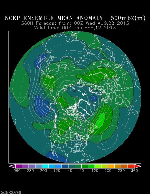
Blown Away wrote:This season has the potential to be an epic fail with regards to predictions...Maybe 1-2 hurricanes in the global models through mid September...No indication at all that high pressure in place to allow more landfalls...Globals have been good this season not showing significant development and it's hard to go against them now...


there are plenty indications...looks at the globals... it doesnt matter if there is an EC trof if a TW is slipping in under it and developing after it....that puts the islands and GOM at risk. If you are just basing your opinion off the GFS runs well that is setting your own self up for failure....anything after 168hr on the GFS is worthless....
0 likes   

CYCLONE MIKE
Category 5
Category 5
Posts: 2183
Joined: Tue Aug 31, 2004 6:04 pm
Location: Gonzales, LA

Re: Global Model Runs Discussion

#6202 Postby CYCLONE MIKE » Wed Aug 28, 2013 9:38 am

Or any model for that matter :lol:
0 likes   

User avatar
NDG
S2K Supporter
S2K Supporter
Posts: 15446
Joined: Sun Jul 09, 2006 10:14 pm
Location: Orlando, FL

#6203 Postby NDG » Wed Aug 28, 2013 9:43 am

True that troughiness in the eastern US would recurve any storms in early September but as we head into the peak of the season and beyond the NCEP ensemble forecast show building ridging once again in the Atlantic.

Image
0 likes   

User avatar
alienstorm
Category 1
Category 1
Posts: 496
Joined: Tue Jul 31, 2007 1:29 pm
Location: Miami Fla western suburb

#6204 Postby alienstorm » Wed Aug 28, 2013 10:55 am

there may be nothing but home grown this season.
0 likes   
Personal Forecast Disclaimer:The posts in this forum are NOT official forecast and should not be used as such. They are just the opinion of the poster and may or may not be backed by sound meteorological data. They are NOT endorsed by any professional institution or storm2k.org. For official information, please refer to the NHC and NWS products.

hurricaneCW
Category 5
Category 5
Posts: 1794
Joined: Wed Mar 03, 2010 6:20 am
Location: Toms River, NJ

Re:

#6205 Postby hurricaneCW » Wed Aug 28, 2013 11:02 am

alienstorm wrote:there may be nothing but home grown this season.


That's far more dangerous than a storm that develops far to the east. Just look at how quickly Fernand was coming together under the right conditions in such a small confined area.
0 likes   

User avatar
Hurricaneman
Category 5
Category 5
Posts: 7351
Age: 45
Joined: Tue Aug 31, 2004 3:24 pm
Location: central florida

Re: Global Model Runs Discussion

#6206 Postby Hurricaneman » Wed Aug 28, 2013 11:36 am

Looks like the 12zGFS develops something in the BOC at 90hrs and stalls it there through 204hrs moving inland as possibly another Fernand type system

The posts in this forum are NOT official forecast and should not be used as such. They are just the opinion of the poster and may or may not be backed by sound meteorological data. They are NOT endorsed by any professional institution or storm2k.org. For official information, please refer to the NHC and NWS products
0 likes   

User avatar
Hammy
Category 5
Category 5
Posts: 5849
Age: 41
Joined: Fri May 25, 2012 5:25 pm
Contact:

#6207 Postby Hammy » Wed Aug 28, 2013 12:32 pm

So the GFS loses the one system it has consistently shown for weeks, just days before its supposed to develop. I'm officially giving up on the models this year. See you all next year on this topic unless things change.
Last edited by Hammy on Wed Aug 28, 2013 4:10 pm, edited 1 time in total.
0 likes   
The above post is not official and should not be used as such. It is the opinion of the poster and may or may not be backed by sound meteorological data. It is not endorsed by any professional institution or storm2k.org. For official information, please refer to the NHC and NWS products.

Dean4Storms
S2K Supporter
S2K Supporter
Posts: 6358
Age: 62
Joined: Sun Aug 31, 2003 1:01 pm
Location: Miramar Bch. FL

#6208 Postby Dean4Storms » Wed Aug 28, 2013 12:44 pm

GGEM is still with the systems in the MDR. I don't think the models will have a full grasp until 5 days in and the MJO expected to begin arriving I suspect we'll have some sudden developers that the models either were on/off with or were clueless altogether.
0 likes   
My opinion and statements DO NOT represent the opinion of the EMA, NHC, NWS, or any other professional agency, organization, or group. For official information, please refer to the NHC and NWS products.

tolakram
Admin
Admin
Posts: 20009
Age: 62
Joined: Sun Aug 27, 2006 8:23 pm
Location: Florence, KY (name is Mark)

Re:

#6209 Postby tolakram » Wed Aug 28, 2013 12:50 pm

Dean4Storms wrote:GGEM is still with the systems in the MDR. I don't think the models will have a full grasp until 5 days in and the MJO expected to begin arriving I suspect we'll have some sudden developers that the models either were on/off with or were clueless altogether.


I agree. The MJO was always forecast to hit next week and we're not really in range for reliable modeling yet. Just like a model flipping from dev to no dev, it can flip the other way as well. The Euro is still showing vorticity and lower pressure, something it had not shown for weeks on end.
0 likes   
M a r k
- - - - -
Join us in chat: Storm2K Chatroom Invite. Android and IOS apps also available.

The posts in this forum are NOT official forecasts and should not be used as such. Posts are NOT endorsed by any professional institution or STORM2K.org. For official information and forecasts, please refer to NHC and NWS products.

User avatar
ROCK
Category 5
Category 5
Posts: 9484
Age: 54
Joined: Tue Aug 17, 2004 7:30 am
Location: Kemah, Texas

Re: Global Model Runs Discussion

#6210 Postby ROCK » Wed Aug 28, 2013 1:17 pm

6Z FIM9- PR about to get smacked....at 168hr

http://fim.noaa.gov/FIM
Last edited by tolakram on Wed Aug 28, 2013 1:24 pm, edited 1 time in total.
Reason: added URL tags
0 likes   

ninel conde

Re:

#6211 Postby ninel conde » Wed Aug 28, 2013 2:17 pm

NDG wrote:True that troughiness in the eastern US would recurve any storms in early September but as we head into the peak of the season and beyond the NCEP ensemble forecast show building ridging once again in the Atlantic.

Image


ive seen that a few times this season but it never seems to pan out. alot of preseason forecasts saying that the east coast was likely to be hit were based on this and i recall people saying because of the very warm water in the north atlantic a ridge would have to dominate the nw atlantic. to be fair, back in june and early july there were 2 times where the bermuda high built in and we had a perfect set up for hits. right now the nw flow is dominating the east coast and western atlantic and i just saw on TWC'S 7 day forecast where we have yet another front coming monday while dallas will hit 99. that tells me the trof/ridge/trof pattern hasnt changed.
0 likes   

tolakram
Admin
Admin
Posts: 20009
Age: 62
Joined: Sun Aug 27, 2006 8:23 pm
Location: Florence, KY (name is Mark)

Re: Global Model Runs Discussion

#6212 Postby tolakram » Wed Aug 28, 2013 2:26 pm

What never seems to pan out?

12Z euro shows development off of Africa in 72 hours, then washes out the system.

Pouch 25 vorticity now weaker and makes it to the Bahamas.

Image

Image

http://www.meteo.psu.edu/ewall/ECMWFTROPATL0.5_12z/ecmwfloop.html
0 likes   
M a r k
- - - - -
Join us in chat: Storm2K Chatroom Invite. Android and IOS apps also available.

The posts in this forum are NOT official forecasts and should not be used as such. Posts are NOT endorsed by any professional institution or STORM2K.org. For official information and forecasts, please refer to NHC and NWS products.

tolakram
Admin
Admin
Posts: 20009
Age: 62
Joined: Sun Aug 27, 2006 8:23 pm
Location: Florence, KY (name is Mark)

Re: Global Model Runs Discussion

#6213 Postby tolakram » Wed Aug 28, 2013 2:30 pm

While I'm here, let me save a few images for the instability. Models showing weak or no development, yet instability is now above normal.

Image

Image
0 likes   
M a r k
- - - - -
Join us in chat: Storm2K Chatroom Invite. Android and IOS apps also available.

The posts in this forum are NOT official forecasts and should not be used as such. Posts are NOT endorsed by any professional institution or STORM2K.org. For official information and forecasts, please refer to NHC and NWS products.

User avatar
Bocadude85
Category 5
Category 5
Posts: 2991
Age: 38
Joined: Mon Apr 18, 2005 2:20 pm
Location: Honolulu,Hi

Re: Re:

#6214 Postby Bocadude85 » Wed Aug 28, 2013 4:41 pm

ninel conde wrote:
NDG wrote:True that troughiness in the eastern US would recurve any storms in early September but as we head into the peak of the season and beyond the NCEP ensemble forecast show building ridging once again in the Atlantic.

Image


ive seen that a few times this season but it never seems to pan out. alot of preseason forecasts saying that the east coast was likely to be hit were based on this and i recall people saying because of the very warm water in the north atlantic a ridge would have to dominate the nw atlantic. to be fair, back in june and early july there were 2 times where the bermuda high built in and we had a perfect set up for hits. right now the nw flow is dominating the east coast and western atlantic and i just saw on TWC'S 7 day forecast where we have yet another front coming monday while dallas will hit 99. that tells me the trof/ridge/trof pattern hasnt changed.


I really do not understand why you bother to post when you never have anything to back up your claims.
0 likes   

HURRICANELONNY
Category 5
Category 5
Posts: 1383
Joined: Wed May 07, 2003 6:48 am
Location: HOLLYWOOD.FL

Re: Re:

#6215 Postby HURRICANELONNY » Wed Aug 28, 2013 4:59 pm

Bocadude85 wrote:
ninel conde wrote:
NDG wrote:True that troughiness in the eastern US would recurve any storms in early September but as we head into the peak of the season and beyond the NCEP ensemble forecast show building ridging once again in the Atlantic.

Image


ive seen that a few times this season but it never seems to pan out. alot of preseason forecasts saying that the east coast was likely to be hit were based on this and i recall people saying because of the very warm water in the north atlantic a ridge would have to dominate the nw atlantic. to be fair, back in june and early july there were 2 times where the bermuda high built in and we had a perfect set up for hits. right now the nw flow is dominating the east coast and western atlantic and i just saw on TWC'S 7 day forecast where we have yet another front coming monday while dallas will hit 99. that tells me the trof/ridge/trof pattern hasnt changed.


I really do not understand why you bother to post when you never have anything to back up your claims.


Amen
0 likes   
hurricanelonny

supercane4867
Category 5
Category 5
Posts: 4966
Joined: Wed Nov 14, 2012 10:43 am

Re: Global Model Runs Discussion

#6216 Postby supercane4867 » Wed Aug 28, 2013 8:08 pm

For entertainment

Image
Image
0 likes   

User avatar
ROCK
Category 5
Category 5
Posts: 9484
Age: 54
Joined: Tue Aug 17, 2004 7:30 am
Location: Kemah, Texas

#6217 Postby ROCK » Wed Aug 28, 2013 10:16 pm

18Z NAVGEM---has a carib storm right past the islands at 144hr

http://www.tropicaltidbits.com/analysis ... _watl.html

00Z NAM---same as the NAV but a little faster.

http://www.tropicaltidbits.com/analysis ... _watl.html
0 likes   

User avatar
boca
Category 5
Category 5
Posts: 6367
Age: 60
Joined: Mon Dec 15, 2003 8:49 am
Location: Boca Raton,FL

Re: Global Model Runs Discussion

#6218 Postby boca » Wed Aug 28, 2013 10:52 pm

I'm watching the models like everyone else and I got caught up in the preseason hype and I'm starting to wonder if this season will take off or bust myself.If this was a El Niño year at least I would know it was going to be quiet but it's hard to predict a colder Indian Ocean or dry air from the Azores High being too far south, too many variables go into a season.
0 likes   

Alyono
Professional-Met
Professional-Met
Posts: 6961
Joined: Fri Apr 26, 2013 3:52 pm
Location: Texas Coast

Re: Global Model Runs Discussion

#6219 Postby Alyono » Wed Aug 28, 2013 11:15 pm

tolakram wrote:While I'm here, let me save a few images for the instability. Models showing weak or no development, yet instability is now above normal.

Image

Image


the moving average is still well below average. We need a few more data points to determine for sure we have above average instability and that this is not a sudden spike
0 likes   

Alyono
Professional-Met
Professional-Met
Posts: 6961
Joined: Fri Apr 26, 2013 3:52 pm
Location: Texas Coast

#6220 Postby Alyono » Wed Aug 28, 2013 11:42 pm

for entertainment purposes only

The GFS does have a significant TC in the western Gulf at about day 14
0 likes   


Return to “2015”

Who is online

Users browsing this forum: No registered users and 2 guests