
ATL: KARL - Post-Tropical - Discussion
Moderator: S2k Moderators
-
cycloneye

- Admin

- Posts: 149395
- Age: 69
- Joined: Thu Oct 10, 2002 10:54 am
- Location: San Juan, Puerto Rico
Re: ATL: TWELVE - Tropical Depression - Discussion
0 likes
Visit the Caribbean-Central America Weather Thread where you can find at first post web cams,radars
and observations from Caribbean basin members Click Here
and observations from Caribbean basin members Click Here
-
johngaltfla

- Category 5

- Posts: 2073
- Joined: Sun Jul 10, 2005 9:17 pm
- Location: Sarasota County, FL
- Contact:
Re: ATL: TWELVE - Tropical Depression - Discussion
Interesting. If it is still south of 20N by the time it passes between 55-60 W this could be a very interesting storm to watch...
0 likes

Re: ATL: TWELVE - Tropical Depression - Discussion
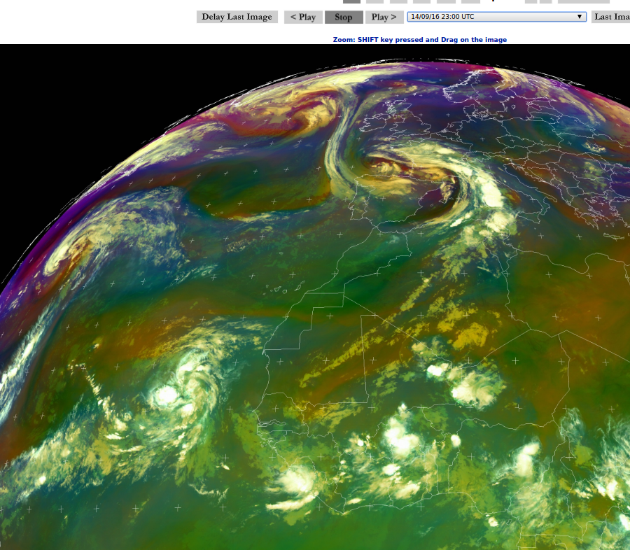
http://oiswww.eumetsat.org/IPPS/html/MS ... /index.htm
this system looks like it has the goods ....so we will keep watching!
0 likes
-
floridasun78
- Category 5
- Posts: 3755
- Joined: Sun May 17, 2009 10:16 pm
- Location: miami fl
Re: ATL: TWELVE - Tropical Depression - Discussion
look models today want turn out to sea when get 55w most models do show weakness let how chance doing weekend
0 likes
-
AutoPenalti
- Category 5
- Posts: 4091
- Age: 29
- Joined: Mon Aug 17, 2015 4:16 pm
- Location: Ft. Lauderdale, Florida
Re: ATL: TWELVE - Tropical Depression - Discussion
We are going to see a lot of windshield wiping from GFS and Euro @140 hours. NHC is currently favoring the Euro, with a ridge building in before 55W and reintensifying at 120 hours. Something to watch indeed if it stays below 20N.
0 likes
The posts in this forum are NOT official forecasts and should not be used as such. They are just the opinion of the poster and may or may not be backed by sound meteorological data. They are NOT endorsed by any professional institution or STORM2K. For official information, please refer to products from the NHC and NWS.
Model Runs Cheat Sheet:
GFS (5:30 AM/PM, 11:30 AM/PM)
HWRF, GFDL, UKMET, NAVGEM (6:30-8:00 AM/PM, 12:30-2:00 AM/PM)
ECMWF (1:45 AM/PM)
TCVN is a weighted averaged
-
gatorcane

- S2K Supporter

- Posts: 23708
- Age: 48
- Joined: Sun Mar 13, 2005 3:54 pm
- Location: Boca Raton, FL
Re: ATL: TWELVE - Tropical Depression - Discussion
johngaltfla wrote:Interesting. If it is still south of 20N by the time it passes between 55-60 W this could be a very interesting storm to watch...
Agreed there is a scenario this could possibly threaten the Bahamas or SE US - the long-range models beyond about 168 hours are showing a pretty big ridge that moves off the Eastern United States coast into the Western Atlantic in the wake of a trough. The ECMWF happens to turn the system to the north before this ridge can build in but it is actually a pretty close call that the ridge does not block it. The ECMWF also shows a much deeper system than the GFS which basically shows this system degenerating into a wave and heading west through the Northern Lesser Antilles as of the 18Z run. If the latter happens and/or the system stays relatively shallow, it could move further west, maybe even into or near the Hebert box and then maybe it could find better conditions over the SW Atlantic under that ridge.
So while chances are it recurves and ends up a fish, it is too early to make that call right now.
Last edited by gatorcane on Wed Sep 14, 2016 8:16 pm, edited 2 times in total.
1 likes
-
GeneratorPower

- S2K Supporter
- Posts: 1648
- Age: 46
- Joined: Sun Dec 18, 2005 11:48 pm
- Location: Huntsville, AL
Re: ATL: TWELVE - Tropical Depression - Discussion
I know we are all struggling with autocorrect but for the newbies, it's the Hebert Box. Not the Herbert Box.
https://en.wikipedia.org/wiki/Hebert_Box
https://en.wikipedia.org/wiki/Hebert_Box
2 likes

Re: ATL: TWELVE - Tropical Depression - Discussion
Looks like this is running into shear already--Probably won't become a tropical storm before the weekend at this point.
0 likes
The above post is not official and should not be used as such. It is the opinion of the poster and may or may not be backed by sound meteorological data. It is not endorsed by any professional institution or storm2k.org. For official information, please refer to the NHC and NWS products.
-
GeneratorPower
- S2K Supporter
- Posts: 1648
- Age: 46
- Joined: Sun Dec 18, 2005 11:48 pm
- Location: Huntsville, AL
Re: ATL: TWELVE - Tropical Depression - Discussion
AutoPenalti wrote:We are going to see a lot of windshield wiping from GFS and Euro @140 hours. NHC is currently favoring the Euro, with a ridge building in before 55W and reintensifying at 120 hours. Something to watch indeed if it stays below 20N.
The ridge in the Atlantic is prone to breaks, weaknesses, and movement. The question really is: will it feel the effects of the ridge keeping it on a westward track at the right times. TD Twelve can scoot past a break or weakness if it remains weak itself, but if it intensifies it will more easily be influenced by the ridge or any breaks therein.
0 likes
-
gatorcane
- S2K Supporter
- Posts: 23708
- Age: 48
- Joined: Sun Mar 13, 2005 3:54 pm
- Location: Boca Raton, FL
Re: ATL: TWELVE - Models
00Z Guidance from SFWMD, a lot of the models are showing a WSW dip:

0 likes
-
cycloneye
- Admin
- Posts: 149395
- Age: 69
- Joined: Thu Oct 10, 2002 10:54 am
- Location: San Juan, Puerto Rico
Re: ATL: TWELVE - Advisories
TROPICAL DEPRESSION TWELVE DISCUSSION NUMBER 3
NWS NATIONAL HURRICANE CENTER MIAMI FL AL122016
1100 PM AST WED SEP 14 2016
The convective pattern of the depression has improved some since the
previous advisory with short curved bands having developed in all
quadrants. In addition, the upper-level outflow has also improved
and become more symmetrical. Satellite intensity estimates range
from 30 kt from TAFB and SAB, 37-41 kt in recent AMSU estimates, and
an ADT value of T2.8/41 kt. Due to the lack of persistent inner-core
convection, the intensity is being maintained at 30 kt.
The initial motion is 280/12 kt. A deep-layer ridge to the north
of the cyclone is expected steer the system west-northwestward and
then westward during the next 48 hours, accompanied by some
decrease in forward speed as the ridge weakens slightly. By 72
hours and beyond, the ridge is forecast to build southward slightly,
forcing the cyclone on a west-southwestward track over warmer
waters. The new forecast track is basically just an update of the
previous advisory track, and lies close to the consensus models.
Some strengthening is expected during the next 24 hours or so. After
that, the cyclone will encounter moderate to strong westerly
vertical wind shear caused by a developing upper-level trough to the
north of the cyclone. The new intensity forecast continues to show
the system weakening back to a depression by 36 hours. On days 4
and 5, some slight re-strengthening is expected when the cyclone
moves over SSTs near 28 deg C and into more favorable mid- and
upper-level environments as shown by the ECMWF and UKMET models.
FORECAST POSITIONS AND MAX WINDS
INIT 15/0300Z 17.6N 27.5W 30 KT 35 MPH
12H 15/1200Z 17.8N 29.4W 35 KT 40 MPH
24H 16/0000Z 18.0N 31.9W 35 KT 40 MPH
36H 16/1200Z 18.1N 34.3W 30 KT 35 MPH
48H 17/0000Z 17.9N 36.6W 30 KT 35 MPH
72H 18/0000Z 17.5N 40.7W 30 KT 35 MPH
96H 19/0000Z 17.4N 44.6W 35 KT 40 MPH
120H 20/0000Z 17.9N 49.0W 40 KT 45 MPH
$$
Forecaster Stewart
0 likes
Visit the Caribbean-Central America Weather Thread where you can find at first post web cams,radars
and observations from Caribbean basin members Click Here
and observations from Caribbean basin members Click Here
-
Hurricaneman

- Category 5
- Posts: 7404
- Age: 45
- Joined: Tue Aug 31, 2004 3:24 pm
- Location: central florida
Re: ATL: TWELVE - Models
I say if the models keep trending towards the lesser Antilles they may have to keep an eye on this as it could be a threat
The posts in this forum are NOT official forecast and should not be used as such. They are just the opinion of the poster and may or may not be backed by sound meteorological data. They are NOT endorsed by any professional institution or STORM2K. For official information, please refer to products from the National Hurricane Center and National Weather Service.
The posts in this forum are NOT official forecast and should not be used as such. They are just the opinion of the poster and may or may not be backed by sound meteorological data. They are NOT endorsed by any professional institution or STORM2K. For official information, please refer to products from the National Hurricane Center and National Weather Service.
0 likes
-
Hurricaneman
- Category 5
- Posts: 7404
- Age: 45
- Joined: Tue Aug 31, 2004 3:24 pm
- Location: central florida
Re: ATL: TWELVE - Models
The 0zGFS has this going over Hispaniola which would be bad for this system, but I believe its being too weak with it and the Euro may have a better handle
The posts in this forum are NOT official forecast and should not be used as such. They are just the opinion of the poster and may or may not be backed by sound meteorological data. They are NOT endorsed by any professional institution or STORM2K. For official information, please refer to products from the National Hurricane Center and National Weather Service.
The posts in this forum are NOT official forecast and should not be used as such. They are just the opinion of the poster and may or may not be backed by sound meteorological data. They are NOT endorsed by any professional institution or STORM2K. For official information, please refer to products from the National Hurricane Center and National Weather Service.
0 likes
Re: ATL: TWELVE - Models
Hurricaneman wrote:The 0zGFS has this going over Hispaniola which would be bad for this system, but I believe its being too weak with it and the Euro may have a better handle
The posts in this forum are NOT official forecast and should not be used as such. They are just the opinion of the poster and may or may not be backed by sound meteorological data. They are NOT endorsed by any professional institution or STORM2K. For official information, please refer to products from the National Hurricane Center and National Weather Service.
I don't think the GFS is handling this too well--a few days ago it wasn't even showing development so there could be some feedback issues or simply poor initialization.
0 likes
The above post is not official and should not be used as such. It is the opinion of the poster and may or may not be backed by sound meteorological data. It is not endorsed by any professional institution or storm2k.org. For official information, please refer to the NHC and NWS products.
-
AutoPenalti
- Category 5
- Posts: 4091
- Age: 29
- Joined: Mon Aug 17, 2015 4:16 pm
- Location: Ft. Lauderdale, Florida
Re: ATL: TWELVE - Models
Looks like it's pulling back on its recurve and it's just going to maintain its westward trajectory from 240+
0 likes
The posts in this forum are NOT official forecasts and should not be used as such. They are just the opinion of the poster and may or may not be backed by sound meteorological data. They are NOT endorsed by any professional institution or STORM2K. For official information, please refer to products from the NHC and NWS.
Model Runs Cheat Sheet:
GFS (5:30 AM/PM, 11:30 AM/PM)
HWRF, GFDL, UKMET, NAVGEM (6:30-8:00 AM/PM, 12:30-2:00 AM/PM)
ECMWF (1:45 AM/PM)
TCVN is a weighted averaged

Re: ATL: TWELVE - Models
Looks like the Carib will open up for possible development of 12L if and when it tracks into it.

0 likes

Re: ATL: TWELVE - Tropical Depression - Discussion
A noticeable southward shift in the track...

0 likes
Igor 2010, Sandy 2012, Fay 2014, Gonzalo 2014, Joaquin 2015, Nicole 2016, Humberto 2019, Imelda 2025
I am only a tropical weather enthusiast. My predictions are not official and may or may not be backed by sound meteorological data. For official information, please refer to the NHC and NWS products.
I am only a tropical weather enthusiast. My predictions are not official and may or may not be backed by sound meteorological data. For official information, please refer to the NHC and NWS products.
Re: ATL: TWELVE - Models
Models are somewhat split down the middle, with some entering the Caribbean and some going north of the Lesser Antilles.
[i mg]http://www.tropicaltidbits.com/storminfo/12L_tracks_latest.png[/img]
Intensity guidances
[im g]http://www.tropicaltidbits.com/storminfo/12L_intensity_latest.png[/img]
[i mg]http://www.tropicaltidbits.com/storminfo/12L_tracks_latest.png[/img]
Intensity guidances
[im g]http://www.tropicaltidbits.com/storminfo/12L_intensity_latest.png[/img]
0 likes
Igor 2010, Sandy 2012, Fay 2014, Gonzalo 2014, Joaquin 2015, Nicole 2016, Humberto 2019, Imelda 2025
I am only a tropical weather enthusiast. My predictions are not official and may or may not be backed by sound meteorological data. For official information, please refer to the NHC and NWS products.
I am only a tropical weather enthusiast. My predictions are not official and may or may not be backed by sound meteorological data. For official information, please refer to the NHC and NWS products.
-
cycloneye
- Admin
- Posts: 149395
- Age: 69
- Joined: Thu Oct 10, 2002 10:54 am
- Location: San Juan, Puerto Rico
Re: ATL: TWELVE - Advisories
TROPICAL DEPRESSION TWELVE DISCUSSION NUMBER 4
NWS NATIONAL HURRICANE CENTER MIAMI FL AL122016
500 AM AST THU SEP 15 2016
AMSR2 microwave data from a few hours ago indicated that the
depression's center was about a degree west of the deep convection
due to 20 kt of westerly shear. Since the cyclone's structure has
not improved, and subjective Dvorak estimates have not changed from
six hours ago, the initial intensity remains 30 kt. The westerly
shear is expected to increase during the next 24 hours, and with a
relatively drier air mass surrounding the cyclone, any strengthening
during the next couple of days now appears less likely. After 48
hours, the shear is forecast to relax to some degree, but the global
models disagree on exactly how much. Nonetheless, if the depression
can survive the next couple of days, the environment should improve
enough to allow for some strengthening by the end of the forecast
period. The new NHC intensity forecast now holds the cyclone as a
30-kt depression for the next 3 days, followed by slight
strengthening on days 4 and 5. This forecast is in best agreement
with the statistical-dynamical SHIPS and LGEM models.
The microwave data indicate that the depression has been moving a
little faster toward the west at 275/14 kt. The Bermuda-Azores
high is expected to steer the depression generally westward across
the tropical Atlantic during the entire 5-day forecast period. A
south-of-due-west motion is even possible on days 2 and 3,
especially if the cyclone remains weak. With the exception of the
GFDL, which shows more strengthening and is an outlier way to the
north of the other models, the guidance envelope is relatively
tight. To account for the apparent north bias of the GFDL, the
updated NHC track forecast is a bit south of the TVCN multi-model
consensus. The new forecast is also a little faster than and south
of the previous forecast, especially on days 4 and 5.
FORECAST POSITIONS AND MAX WINDS
INIT 15/0900Z 17.6N 29.3W 30 KT 35 MPH
12H 15/1800Z 17.8N 31.2W 30 KT 35 MPH
24H 16/0600Z 18.0N 33.7W 30 KT 35 MPH
36H 16/1800Z 17.9N 36.4W 30 KT 35 MPH
48H 17/0600Z 17.6N 39.0W 30 KT 35 MPH
72H 18/0600Z 16.7N 43.8W 30 KT 35 MPH
96H 19/0600Z 16.5N 49.0W 35 KT 40 MPH
120H 20/0600Z 17.0N 53.5W 40 KT 45 MPH
$$
Forecaster Berg
0 likes
Visit the Caribbean-Central America Weather Thread where you can find at first post web cams,radars
and observations from Caribbean basin members Click Here
and observations from Caribbean basin members Click Here
-
wxman57

- Moderator-Pro Met

- Posts: 23173
- Age: 68
- Joined: Sat Jun 21, 2003 8:06 pm
- Location: Houston, TX (southwest)
Re: ATL: TWELVE - Tropical Depression - Discussion
GeneratorPower wrote:I know we are all struggling with autocorrect but for the newbies, it's the Hebert Box. Not the Herbert Box.
https://en.wikipedia.org/wiki/Hebert_Box
That Wikipedia article is wrong. The Hebert Box is NOT a predictor. Paul Hebert noted that most hurricanes that eventually impacted Florida did go through that area. However, just because a storm moves through that area does NOT mean it is likely to hit Florida. As for Twelve, it may be struggling all the way across the Atlantic, as did Hermine.
1 likes
Who is online
Users browsing this forum: No registered users and 26 guests