
ATL: MATTHEW - Post-Tropical - Discussion
Moderator: S2k Moderators
-
Portastorm

- Storm2k Moderator

- Posts: 9955
- Age: 63
- Joined: Fri Jul 11, 2003 9:16 am
- Location: Round Rock, TX
- Contact:
Re: ATL: MATTHEW - Hurricane - Discussion
Just saw this on Twitter. Latest info suggests additional calls coming in from persons asking for help. (smh).
1 likes
Any forecasts under my name are to be taken with a grain of salt. Get your best forecasts from the National Weather Service and National Hurricane Center.
-
tolakram
- Admin

- Posts: 20185
- Age: 62
- Joined: Sun Aug 27, 2006 8:23 pm
- Location: Florence, KY (name is Mark)
Re: ATL: MATTHEW - Hurricane - Discussion
hipshot wrote:
Mark, are these pictures from Twitter? If so, how do I view the whole think on my desktop?
Try clicking on the text, or click on the link above.
0 likes
M a r k
- - - - -
Join us in chat: Storm2K Chatroom Invite. Android and IOS apps also available.
The posts in this forum are NOT official forecasts and should not be used as such. Posts are NOT endorsed by any professional institution or STORM2K.org. For official information and forecasts, please refer to NHC and NWS products.
-
JtSmarts

- S2K Supporter

- Posts: 1442
- Age: 40
- Joined: Thu Jul 10, 2003 1:29 pm
- Location: Columbia, South Carolina
Re: ATL: MATTHEW - Hurricane - Discussion
Portastorm wrote:Just saw this on Twitter. Latest info suggests additional calls coming in from persons asking for help. (smh).
Wow, I can't imagine how bad it would have been if he actually did go fully inland and the coast was exposed to that wicked northeast quadrant.
0 likes
-
northjaxpro

- S2K Supporter
- Posts: 8900
- Joined: Mon Sep 27, 2010 11:21 am
- Location: Jacksonville, FL
Re: ATL: MATTHEW - Hurricane - Discussion
windnrain wrote:Matthew has gotten closer to shore since last night.
Inside of the eye is only 5 miles offshore.

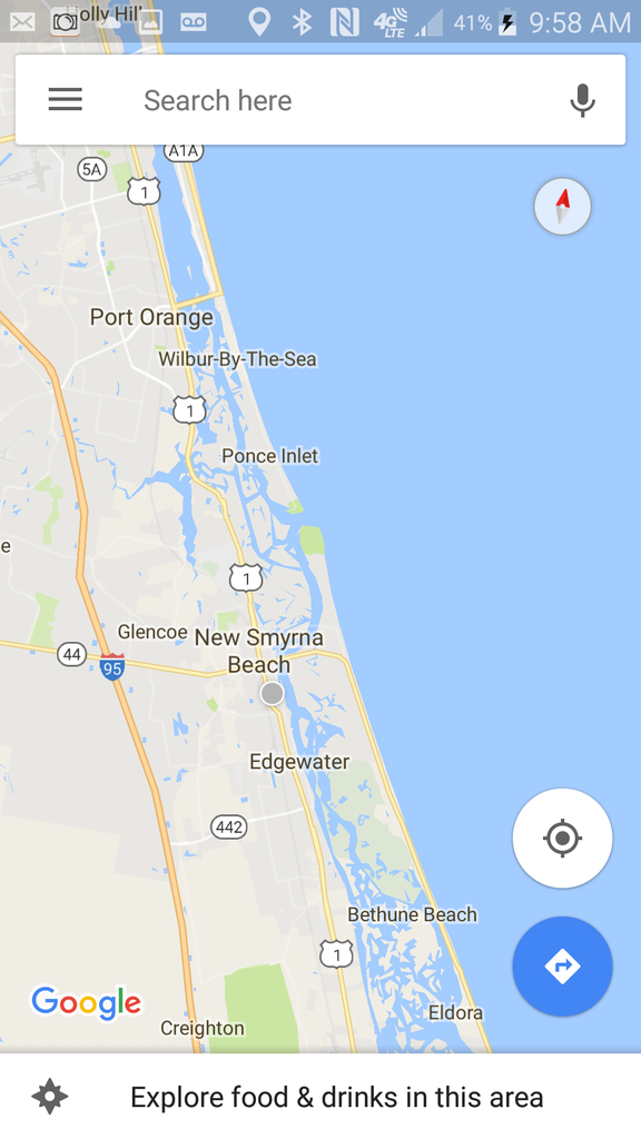
It has indeed come closer. I would say that it is within as close as only being within as close within 10 miles off shore and the the case can be made the western eyewall is at New Smyrna Beach right now.
Last edited by northjaxpro on Fri Oct 07, 2016 8:22 am, edited 1 time in total.
1 likes
NEVER, EVER SAY NEVER in the tropics and weather in general, and most importantly, with life itself!!
________________________________________________________________________________________
Fay 2008 Beryl 2012 Debby 2012 Colin 2016 Hermine 2016 Julia 2016 Matthew 2016 Irma 2017 Dorian 2019
________________________________________________________________________________________
Fay 2008 Beryl 2012 Debby 2012 Colin 2016 Hermine 2016 Julia 2016 Matthew 2016 Irma 2017 Dorian 2019
-
terstorm1012

- S2K Supporter
- Posts: 1314
- Age: 44
- Joined: Fri Sep 10, 2004 5:36 pm
- Location: Millersburg, PA
Re: ATL: MATTHEW - Hurricane - Discussion
have there been any reports from Freeport? I read on another forum (wunderground) there's been absolutely no contact. I figured people here might have better sources.
0 likes
my posts in this forum are NOT official forecast and should not be used as such. They are just my opinion (to which I welcome challenges!) and may or may not be backed by sound meteorological data. They are NOT endorsed by any professional institution or storm2k.org. For official information, please refer to the NHC and NWS products
-
tolakram
- Admin
- Posts: 20185
- Age: 62
- Joined: Sun Aug 27, 2006 8:23 pm
- Location: Florence, KY (name is Mark)
Re: ATL: MATTHEW - Hurricane - Discussion
Radar estimated precip is really piling up.

1 likes
M a r k
- - - - -
Join us in chat: Storm2K Chatroom Invite. Android and IOS apps also available.
The posts in this forum are NOT official forecasts and should not be used as such. Posts are NOT endorsed by any professional institution or STORM2K.org. For official information and forecasts, please refer to NHC and NWS products.
- - - - -
Join us in chat: Storm2K Chatroom Invite. Android and IOS apps also available.
The posts in this forum are NOT official forecasts and should not be used as such. Posts are NOT endorsed by any professional institution or STORM2K.org. For official information and forecasts, please refer to NHC and NWS products.

Re: ATL: MATTHEW - Hurricane - Discussion
Hey Daytona...you are not off the hook, the angular momentum looks like you are going to get into the eyewall. Batten down the hatches...
0 likes
-
SEASON_CANCELED

- Category 3

- Posts: 887
- Joined: Mon Jul 06, 2009 5:17 am
- Location: 8 Bit Charlie Sheen
Re: ATL: MATTHEW - Hurricane - Discussion
Just saw denis phillips say tens of people reportedly trying to call for help in the ormund beach area. ceilings on houses are gone and people were exposed to the storm. Blockwalls are starting to fall.
:smh:
:smh:
Last edited by SEASON_CANCELED on Fri Oct 07, 2016 8:39 am, edited 2 times in total.
0 likes
i am a big stupid ugly moron with an ugly face and a big butt and my butt stinks and i like to kiss my own butt

Re: ATL: MATTHEW - Hurricane - Discussion
tolakram wrote:hipshot wrote:
Mark, are these pictures from Twitter? If so, how do I view the whole think on my desktop?
Try clicking on the text, or click on the link above.
Thanks, when my question was echoed back, it opened up fully for some reason.
0 likes
-
ConvergenceZone
.gif)
- Category 5

- Posts: 5241
- Joined: Fri Jul 29, 2005 1:40 am
- Location: Northern California
Re: ATL: MATTHEW - Hurricane - Discussion
I know it's been said already, but man this would have been so much worse if this would have been closer to the coast. We really lucked out compared to how bad it could have been
3 likes
-
EquusStorm
- Category 5
- Posts: 1649
- Age: 35
- Joined: Thu Nov 07, 2013 1:04 pm
- Location: Jasper, AL
- Contact:
Re: ATL: MATTHEW - Hurricane - Discussion
I honestly can't feel synpathy for anyone right along the coast in the clear danger zone who refused to evacuate in the face of a storm predicted to be as dangerous as this and then call for help when, surprise, the storm causes mayhem. But I do feel bad for emergency managers who have to respond to people not smart enough to get out of town...
5 likes
Colors of lost purpose on the canvas of irrelevance
Not a meteorologist, in fact more of an idiot than anything. You should probably check with the NHC or a local NWS office for official information.
Not a meteorologist, in fact more of an idiot than anything. You should probably check with the NHC or a local NWS office for official information.

Re: ATL: MATTHEW - Hurricane - Discussion
We are ready and waiting here in Charleston. The storm surge is what everyone is most worried about. I'm about 15 miles from the shoreline so I'm sure at best I will see tropical storm winds, especially if the storm continues to weaken as it moves north. Still not sure if we will see a landfall before Matthew takes the northeast turn. We are in nowcast mode.
2 likes
-
terrapintransit

- Category 1

- Posts: 275
- Age: 51
- Joined: Tue Sep 04, 2007 8:08 pm
- Location: Williamsport, Pa
Re: ATL: MATTHEW - Hurricane - Discussion
There are reports and warnings of a potential 11 ft storm surge into Jacksonville. Has anyone else heard this yet?
0 likes
Aaron
-
terstorm1012
- S2K Supporter
- Posts: 1314
- Age: 44
- Joined: Fri Sep 10, 2004 5:36 pm
- Location: Millersburg, PA
Re: ATL: MATTHEW - Hurricane - Discussion
terrapintransit wrote:There are reports and warnings of a potential 11 ft storm surge into Jacksonville. Has anyone else heard this yet?
the forecast is for 7-11 feet, depending on the tide and track of the hurricane.
0 likes
my posts in this forum are NOT official forecast and should not be used as such. They are just my opinion (to which I welcome challenges!) and may or may not be backed by sound meteorological data. They are NOT endorsed by any professional institution or storm2k.org. For official information, please refer to the NHC and NWS products
Re: ATL: MATTHEW - Hurricane - Discussion
Good info for those in Hampton Roads and Obx. Storm has been trending closer to us and mets are finally starting to take note. Let's keep an eye on this.

http://wavy.com/blog/2016/10/07/blog-ma ... s-weekend/
"This was the track from this morning, but the models have been trending more northward. They take it a little closer to Hatteras by Sunday. So I think the track will shift a little northward later today. This does have some impacts on our forecast. The wind shouldn’t be bad here on Saturday. However, the wind will probably be pretty strong across the region by Sunday morning. I think we could see some gusts above 60mph down towards Hatteras. Here is the wind forecast for that time."
2 likes
-
AdamFirst

- S2K Supporter
- Posts: 2490
- Age: 36
- Joined: Thu Aug 14, 2008 10:54 am
- Location: Port Saint Lucie, FL
Re: ATL: MATTHEW - Hurricane - Discussion
On my way back into Port Saint Lucie I saw a few small trees uprooted and leaning, lots of loose brances, a few shredded billboards on the Turnpike. My house still has power though! 
With that being said, it's looking like Melbourne-north is under the gun...Jacksonville, brace yourselves
With that being said, it's looking like Melbourne-north is under the gun...Jacksonville, brace yourselves
1 likes
Dolphins Marlins Canes Golden Panthers HEAT
Andrew 1992 - Irene 1999 - Frances 2004 - Jeanne 2004 - Wilma 2005 - Fay 2008 - Isaac 2012 - Matthew 2016 - Irma 2017 - Dorian 2019 - Ian 2022 - Nicole 2022 - Milton 2024
Andrew 1992 - Irene 1999 - Frances 2004 - Jeanne 2004 - Wilma 2005 - Fay 2008 - Isaac 2012 - Matthew 2016 - Irma 2017 - Dorian 2019 - Ian 2022 - Nicole 2022 - Milton 2024
-
Stangfriik
- Tropical Storm

- Posts: 114
- Joined: Tue Jul 26, 2005 2:25 pm
- Location: Daytona Beach, Florida
- Contact:
Re: ATL: MATTHEW - Hurricane - Discussion
Just got out highest gust by far. Small branches covering the backyard. The street is littered with palm branches. A smaller branch on a van across the street
We are 2 blocks east of river by new
We are 2 blocks east of river by new

0 likes
-
northjaxpro
- S2K Supporter
- Posts: 8900
- Joined: Mon Sep 27, 2010 11:21 am
- Location: Jacksonville, FL
Re: ATL: MATTHEW - Hurricane - Discussion
terrapintransit wrote:There are reports and warnings of a potential 11 ft storm surge into Jacksonville. Has anyone else heard this yet?
Yeah I have been closely monitoring this. Yes storm surge projection in Jax is expected to be from 7-11 feet. Especially worried about that surfe in the St. Johns River and its tributaries.
1 likes
NEVER, EVER SAY NEVER in the tropics and weather in general, and most importantly, with life itself!!
________________________________________________________________________________________
Fay 2008 Beryl 2012 Debby 2012 Colin 2016 Hermine 2016 Julia 2016 Matthew 2016 Irma 2017 Dorian 2019
________________________________________________________________________________________
Fay 2008 Beryl 2012 Debby 2012 Colin 2016 Hermine 2016 Julia 2016 Matthew 2016 Irma 2017 Dorian 2019

Re: ATL: MATTHEW - Hurricane - Discussion
I have alot of friends and family in Palm Coast that are posting pictures of the salt water canals already up to the tops of the seawalls.
0 likes
-
terrapintransit
- Category 1
- Posts: 275
- Age: 51
- Joined: Tue Sep 04, 2007 8:08 pm
- Location: Williamsport, Pa
Re: ATL: MATTHEW - Hurricane - Discussion
And the bend back north slowly continues..
Vdogg wrote:Good info for those in Hampton Roads and Obx. Storm has been trending closer to us and mets are finally starting to take note. Let's keep an eye on this.
http://wavy.com/blog/2016/10/07/blog-ma ... s-weekend/
"This was the track from this morning, but the models have been trending more northward. They take it a little closer to Hatteras by Sunday. So I think the track will shift a little northward later today. This does have some impacts on our forecast. The wind shouldn’t be bad here on Saturday. However, the wind will probably be pretty strong across the region by Sunday morning. I think we could see some gusts above 60mph down towards Hatteras. Here is the wind forecast for that time."
0 likes
Aaron
Who is online
Users browsing this forum: No registered users and 22 guests