ATL: MATTHEW - Post-Tropical - Discussion
Moderator: S2k Moderators
-
tropicwatch

- Category 5

- Posts: 3426
- Age: 62
- Joined: Sat Jun 02, 2007 10:01 am
- Location: The Villages, Florida
- Contact:
Re: ATL: MATTHEW - Hurricane - Discussion
6 likes
Tropicwatch
Agnes 72', Eloise 75, Elena 85', Kate 85', Charley 86', Florence 88', Beryl 94', Dean 95', Erin 95', Opal 95', Earl 98', Georges 98', Ivan 2004', Arlene 2005', Dennis 2005', Ida 2009' Debby 2012' Irma 2017' Michael 2018'
Agnes 72', Eloise 75, Elena 85', Kate 85', Charley 86', Florence 88', Beryl 94', Dean 95', Erin 95', Opal 95', Earl 98', Georges 98', Ivan 2004', Arlene 2005', Dennis 2005', Ida 2009' Debby 2012' Irma 2017' Michael 2018'
-
AutoPenalti
- Category 5
- Posts: 4091
- Age: 29
- Joined: Mon Aug 17, 2015 4:16 pm
- Location: Ft. Lauderdale, Florida
Re: ATL: MATTHEW - Hurricane - Discussion
panamatropicwatch wrote::uarrow: Probably because the NHC is smarter than Joe.
That, and/or NHC and models can't really forecast intensity that well in advance.
0 likes
The posts in this forum are NOT official forecasts and should not be used as such. They are just the opinion of the poster and may or may not be backed by sound meteorological data. They are NOT endorsed by any professional institution or STORM2K. For official information, please refer to products from the NHC and NWS.
Model Runs Cheat Sheet:
GFS (5:30 AM/PM, 11:30 AM/PM)
HWRF, GFDL, UKMET, NAVGEM (6:30-8:00 AM/PM, 12:30-2:00 AM/PM)
ECMWF (1:45 AM/PM)
TCVN is a weighted averaged
-
dukeblue219
- S2K Supporter

- Posts: 556
- Joined: Fri Sep 30, 2016 3:52 pm
Re: ATL: MATTHEW - Hurricane - Discussion
panamatropicwatch wrote:dukeblue219 wrote:Recon just found 125 knots on the SFMR (not flagged, either) in the NW quadrant.
The one I am seeing is flagged.
Time: 00:50:30Z
Coordinates: 16.950N 74.833W
Acft. Static Air Press: 702.2 mb
Acft. Geopotential Hgt: 2,738 m (8,983 ft)
Extrap. Sfc. Press: 965.6 mb (28.52 inHg)
Flt. Lvl. Wind (30s): From 57° at 119 kts (From the ENE at 136.9 mph)
Air Temp: 13.2°C (55.8°F)
Dew Pt: 13.2°C (55.8°F)
Peak (10s) Flt. Lvl. Wind: 127 kts (146.1 mph)
SFMR Peak (10s) Sfc. Wind: 125 kts* (143.8 mph*)
SFMR Rain Rate: 14 mm/hr* (0.55 in/hr*)
( * ) Denotes suspect data
The 00:50:00 line isn't flagged like 00:50:30 is.
0 likes

Re: ATL: MATTHEW - Hurricane - Discussion
panamatropicwatch wrote::uarrow: Probably because the NHC is smarter than Joe.
This time, no
They are doing the same thing they did in the Caribbean. Blindly following the LGEM and DSHP
1 likes
-
jlauderdal
- S2K Supporter
- Posts: 7240
- Joined: Wed May 19, 2004 5:46 am
- Location: NE Fort Lauderdale
- Contact:
Re: ATL: MATTHEW - Hurricane - Discussion
wxtrackercody1 min
A dropsonde in the NW eyewall of #Matthew just measured 166kt/191 mph at 886ft. Insanely strong winds just aloft.
A dropsonde in the NW eyewall of #Matthew just measured 166kt/191 mph at 886ft. Insanely strong winds just aloft.
2 likes
-
Medtronic15

- Tropical Depression

- Posts: 53
- Age: 45
- Joined: Fri Jul 01, 2016 5:25 am
- Location: Texas,USA
Re: ATL: MATTHEW - Hurricane - Discussion
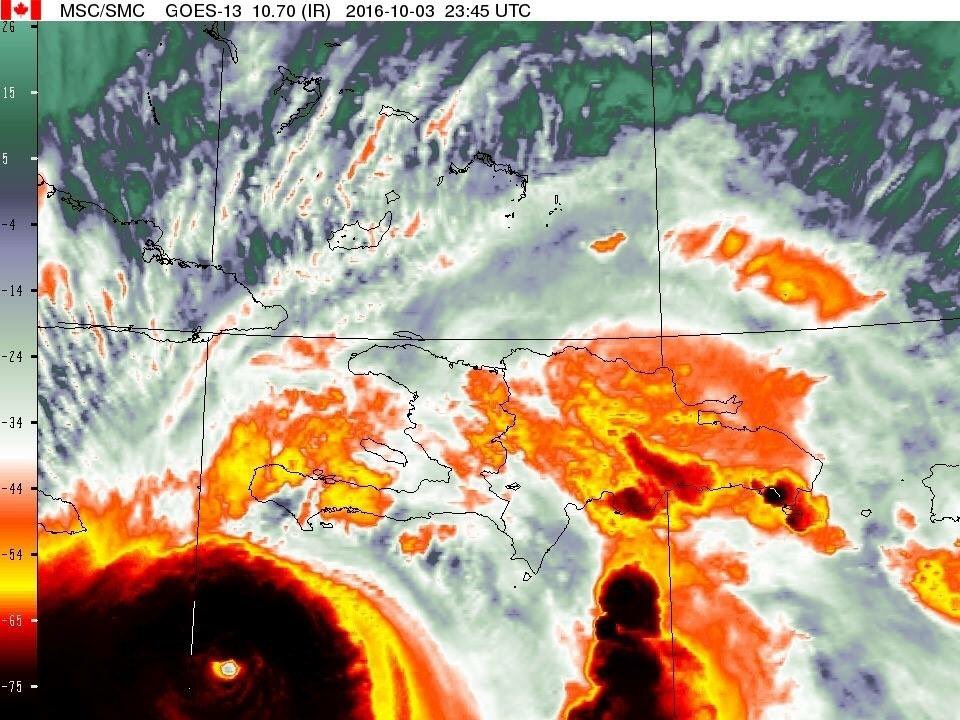
Another close up #Matthew
0 likes
The posts in this forum are NOT official forecast and should not be used as such. They are just the opinion of the poster and may or may not be backed by sound meteorological data. They are NOT endorsed by any professional institution or STORM2K. For official information, please refer to products from the NHC and NWS.

Re: ATL: MATTHEW - Hurricane - Discussion
There must be a massive eyewall hot tower firing now that is masking the eye.
Just checked a weather station near Port Salut and currently reporting 3 mph winds.
Calm before the storm.
http://www.wunderground.com/cgi-bin/fin ... =IPORTSAL2
Just checked a weather station near Port Salut and currently reporting 3 mph winds.
Calm before the storm.
http://www.wunderground.com/cgi-bin/fin ... =IPORTSAL2
0 likes

Re: ATL: MATTHEW - Hurricane - Discussion
I don't know if it helped it not. During Katrina I had the patio door on the back of my 2 floor apartment open because it was too hot inside. The door waS on back with wind blowing to the front. I lost n o Windows but all other apartments at least 1. I had always been told to crack Windows for a tornado but then everyone said no. I have no clue and the door was not open except for the cool breeze.
0 likes
-
DelrayMorris

- S2K Supporter
- Posts: 95
- Joined: Sat Sep 06, 2003 11:51 pm
- Location: Delray Beach, FL
Re: ATL: MATTHEW - Hurricane - Discussion
SouthFLTropics wrote:A couple of thought tonight: first and foremost thought and prayers go out to Haiti and the people on the Tiburon peninsula. I fear the news coming out of there is going to be devastating.
Other thought that crossed my mind tonight was that I can already feel my homeowner's insurance rates rising. Between Hermine and now Matthew, it's bound to happen.
Thousands will lose their lives. My heart goes out to them tonight...and tomorrow.
And yes, it was $3000 this year... I can't imagine next year's rates... and yes, I feel enormously guilty thinking about both at the same time.
1 likes
-
HurricaneBelle

- S2K Supporter
- Posts: 1209
- Joined: Sun Aug 27, 2006 6:12 pm
- Location: Clearwater, FL
Re: ATL: MATTHEW - Hurricane - Discussion
Michele B wrote:Good for Haiti, but looks like Jamaica may have made a mistake dropping TS/Hurr warnings.
Jamaica didn't drop its warnings, it just downgraded from a hurricane warning to a TS warning as the hurricane-force winds are only within 30-40 miles of the center which is passing much more than that to their east.
1 likes
-
AdamFirst

- S2K Supporter
- Posts: 2490
- Age: 36
- Joined: Thu Aug 14, 2008 10:54 am
- Location: Port Saint Lucie, FL
Re: ATL: MATTHEW - Hurricane - Discussion
Man, that looks intense. The tiny eye reminds me of Wilma.
1 likes
Dolphins Marlins Canes Golden Panthers HEAT
Andrew 1992 - Irene 1999 - Frances 2004 - Jeanne 2004 - Wilma 2005 - Fay 2008 - Isaac 2012 - Matthew 2016 - Irma 2017 - Dorian 2019 - Ian 2022 - Nicole 2022 - Milton 2024
Andrew 1992 - Irene 1999 - Frances 2004 - Jeanne 2004 - Wilma 2005 - Fay 2008 - Isaac 2012 - Matthew 2016 - Irma 2017 - Dorian 2019 - Ian 2022 - Nicole 2022 - Milton 2024
-
tropicwatch
- Category 5
- Posts: 3426
- Age: 62
- Joined: Sat Jun 02, 2007 10:01 am
- Location: The Villages, Florida
- Contact:
Re: ATL: MATTHEW - Hurricane - Discussion
dukeblue219 wrote:
The 00:50:00 line isn't flagged like 00:50:30 is.
Missed that one sorry.
0 likes
Tropicwatch
Agnes 72', Eloise 75, Elena 85', Kate 85', Charley 86', Florence 88', Beryl 94', Dean 95', Erin 95', Opal 95', Earl 98', Georges 98', Ivan 2004', Arlene 2005', Dennis 2005', Ida 2009' Debby 2012' Irma 2017' Michael 2018'
Agnes 72', Eloise 75, Elena 85', Kate 85', Charley 86', Florence 88', Beryl 94', Dean 95', Erin 95', Opal 95', Earl 98', Georges 98', Ivan 2004', Arlene 2005', Dennis 2005', Ida 2009' Debby 2012' Irma 2017' Michael 2018'
-
AJC3

- Admin

- Posts: 4155
- Age: 62
- Joined: Tue Aug 31, 2004 7:04 pm
- Location: Ballston Spa, New York
- Contact:
Re: ATL: MATTHEW - Hurricane - Discussion
Michele B wrote:Frank P wrote:sponger wrote:
They are talking about keeping a window on the opposite side open to relieve pressure so your house won't pop. Anyone want to take stab at verifying if that is a good idea?
If you don't want your house to pop you better have a plethora of hurricane straps connecting all the framing members, from the ground up to the crown of the roof... and all points in between... most houses are not tight enough for it to just pop from having all the windows closed...... usually a failure of the roof structure, or window, or garage door fails allowing the wind to breach the house, causing massive wind damage in the case of a major storm...
No. It's not wind, it's pressure differential.
When the storm approaches and the barometric pressure drops, but your house is buttoned up, and still has (relatively) high pressure locked up inside it can "bow" the windows - or maybe even the walls! The house will try to EVEN UP the pressure, lower it, if you will, so pressurize with what is outside....which will blow the windows (and maybe even the roof).y
You DO NOT WANT THE STORM INSIDE YOUR HOUSE; this is the reason you only open a window ON THE OPPOSITE SIDE. NO WIND COMING IN. Just enough to allow the higher pressure to escape.
I can't even begin to tell you how much bad advice you're giving, poor actions you've taken, and bad meteorology you're espousing.
1. If the wind was blowing so hard as to make glass windows or sliders bow in then they should have been covered by hurricane shutters or plywood. An uncovered window or glass door is an open invitation for debris to come through it. Once that happens, you run the risk of ceiling/roof failure. The last thing you should have been doing in that situation is running around doing stuff to your windows. Never open windows in a hurricane. Never.
2. It's not the barometric pressure. It's the force of the wind. There are enough cracks, crevices, vents and ducts in your house to where pressure will be equalized. It's a house. Not a jet airliner.
15 likes
Re: ATL: MATTHEW - Hurricane - Discussion
Product: Air Force Vortex Message (URNT12 KNHC)
Transmitted: 4th day of the month at 1:03Z
Agency: United States Air Force
Aircraft: Lockheed WC-130J Hercules with reg. number AF97-5306
Storm Number & Year: 14 in 2016
Storm Name: Matthew (flight in the North Atlantic basin)
Mission Number: 18
Observation Number: 10
A. Time of Center Fix: 4th day of the month at 0:45:40Z
B. Center Fix Coordinates: 16°44'N 74°38'W (16.7333N 74.6333W)
B. Center Fix Location: 169 statute miles (272 km) to the ESE (122°) from Kingston, Jamaica.
C. Minimum Height at Standard Level: 2,536m (8,320ft) at 700mb
D. Estimated (by SFMR or visually) Maximum Surface Wind Inbound: 98kts (~ 112.8mph)
E. Location of the Estimated Maximum Surface Wind Inbound: 14 nautical miles (16 statute miles) to the SE (142°) of center fix
F. Maximum Flight Level Wind Inbound: From 223° at 128kts (From the SW at ~ 147.3mph)
G. Location of Maximum Flight Level Wind Inbound: 16 nautical miles (18 statute miles) to the SE (141°) of center fix
H. Minimum Sea Level Pressure: 936mb (27.64 inHg)
I. Maximum Flight Level Temp & Pressure Altitude Outside Eye: 10°C (50°F) at a pressure alt. of 3,055m (10,023ft)
J. Maximum Flight Level Temp & Pressure Altitude Inside Eye: 17°C (63°F) at a pressure alt. of 3,049m (10,003ft)
K. Dewpoint Temp (collected at same location as temp inside eye): 12°C (54°F)
K. Sea Surface Temp (collected at same location as temp inside eye): Not Available
L. Eye Character: Closed
M. Eye Shape: Elliptical (oval shaped)
M. Orientation of Major Axis in Elliptical Eye: 120° to 300° (ESE to WNW)
M. Length of Major Axis in Elliptical Eye: 25 nautical miles (29 statute miles)
M. Length of Minor Axis in Elliptical Eye: 15 nautical miles (17 statute miles)
N. Fix Determined By: Penetration, Radar, Wind and Pressure
N. Fix Level: 700mb
O. Navigational Fix Accuracy: 0.02 nautical miles
O. Meteorological Accuracy: 2 nautical miles
Remarks Section:
Maximum Flight Level Wind: 129kts (~ 148.5mph) which was observed 15 nautical miles (17 statute miles) to the ENE (71°) from the flight level center at 23:37:30Z
Dropsonde Surface Wind at Center: From 225° at 9kts (From the SW at 10mph)
Maximum Flight Level Temp: 18°C (64°F) which was observed 9 nautical miles to the SE/SSE (146°) from the flight level center
0 likes
-
AModestLion
- Tropical Wave

- Posts: 7
- Joined: Mon Oct 03, 2016 6:26 pm
Re: ATL: MATTHEW - Hurricane - Discussion
New here, been following for days. After Sandy (I'm in Lehigh Valley, PA, but still got 80 MPH gusts and lost power for about a week), I became a bit obsessed and fearful of these things. Being a bit selfish worrying about my friends and family up the N/E coast, but I am severely scared and sad for the people this directly impacts NOW.
Everyone is doing an awesome job following and posting. I may need to take a good day or two break, but worried what I might find.
Everyone is doing an awesome job following and posting. I may need to take a good day or two break, but worried what I might find.
5 likes

Re: ATL: MATTHEW - Hurricane - Discussion
Prayers for Haiti. Matthew is a powerhouse and is wrapping up a little tighter.
2 likes
The following post is NOT an official forecast and should not be used as such. It is just the opinion of the poster and may or may not be backed by sound meteorological data. It is NOT endorsed by any professional institution including storm2k.org For Official Information please refer to the NHC and NWS products.
-
terstorm1012

- S2K Supporter
- Posts: 1314
- Age: 44
- Joined: Fri Sep 10, 2004 5:36 pm
- Location: Millersburg, PA
Re: ATL: MATTHEW - Hurricane - Discussion
I have an incredibly sick feeling watching Matthew approach Haiti. It is just like Patricia, when I woke up and heard it'd bombed out at 215 miles an hour. I almost cried.
9 likes
my posts in this forum are NOT official forecast and should not be used as such. They are just my opinion (to which I welcome challenges!) and may or may not be backed by sound meteorological data. They are NOT endorsed by any professional institution or storm2k.org. For official information, please refer to the NHC and NWS products
-
johngaltfla

- Category 5
- Posts: 2073
- Joined: Sun Jul 10, 2005 9:17 pm
- Location: Sarasota County, FL
- Contact:
Re: ATL: MATTHEW - Hurricane - Discussion
terstorm1012 wrote:I have an incredibly sick feeling watching Matthew approach Haiti. It is just like Patricia, when I woke up and heard it'd bombed out at 215 miles an hour. I almost cried.
I fear the worst. Few if any structures are prepared and constructed for a Cat 3, much less a potential Cat 5.
0 likes
-
SouthFLTropics

- Category 5
- Posts: 4258
- Age: 50
- Joined: Thu Aug 14, 2003 8:04 am
- Location: Port St. Lucie, Florida
Re: ATL: MATTHEW - Hurricane - Discussion
Well folks, long time S2K'ers, fellow Floridians, newbies on the board. It's been quite some time since we've done this but I'm really getting the feeling that this is the real deal for us here in Florida. Many of us have been here on the board a long time and remember the countless storms that we've all been through. I was a member on the old GoPBI page and came over to S2K when it started. Many of us are like family here and have indirectly known each other for a long time. I want to take the time to thank all the members and mets that provide valuable info as well as the administrators and moderators for the site. Hurricane season wouldn't be the same without S2K and I always feel a step ahead by being a member on the board. Good luck to everyone while we start preps.
19 likes
Fourth Generation Florida Native
Personal Storm History: David 79, Andrew 92, Erin 95, Floyd 99, Irene 99, Frances 04, Jeanne 04, Wilma 05, Matthew 16, Irma 17, Ian 22, Nicole 22, Milton 24
Personal Storm History: David 79, Andrew 92, Erin 95, Floyd 99, Irene 99, Frances 04, Jeanne 04, Wilma 05, Matthew 16, Irma 17, Ian 22, Nicole 22, Milton 24
-
weathaguyry

- Category 5
- Posts: 1273
- Age: 22
- Joined: Wed Jun 15, 2016 5:16 am
- Location: Long Island, NY
Re: ATL: MATTHEW - Hurricane - Discussion
Wow! awfully quiet around here, there hasn't been a comment in the past four minutes  (lol) anyway, I think that Haiti will be absolutely devastated in the short term, in the longer term, this could really hit the Bahamas hard, and if I were the NHC, I'd initiate Hurricane Watches in Broward and Miami Dade at 11:00, and maybe some TS watches in the counties northward. In the long long term, I know a lot of people are interested in this, and so am I, so I will take a guess. Skirts FL coast as cat 4 cane, makes landfall in OBX with 130mph winds, makes second landfall in eastern LI/Rhode Island with 90mph winds as a hybrid system, just my two cents though.
2 likes
My posts are only my opinions and NOT official forecasts. For official forecasts, consult the National Hurricane Center or the National Weather Service.
Irene 11', Sandy 12', Fay 20’, Isaias 20’, Elsa 21’, Henri 21’, Ida 21’
Irene 11', Sandy 12', Fay 20’, Isaias 20’, Elsa 21’, Henri 21’, Ida 21’
Who is online
Users browsing this forum: No registered users and 27 guests