1900hurricane wrote:

The merging eyewall looks like it's on the verge of maxing out the microwave scale
Moderator: S2k Moderators
1900hurricane wrote:


CrazyC83 wrote:dukeblue219 wrote:Eyewall dropsonde is in, transmitted 2308Z, splashed in 168 KNOT surface wind gusts. Good lord.
If that is legit, the intensity could be 170 kt. Would be a basin record.

1900hurricane wrote:The eye is really torching now based on pretty much any IR/WV band you can pick on GOES-16.


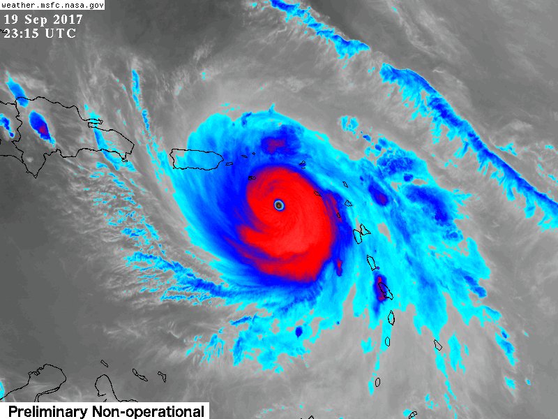
PandaCitrus wrote:It's going to be very close but looking more possible based on that long radar loop that st. Croix will narrowly miss the northern eyewall with the Cat 5 winds. They may get Cat 2/3 winds. Its going to be razor close. Wobble watching all evening. 10 miles or less margin for error between total destruction and moderate damage.
Hurrilurker wrote:CrazyC83 wrote:dukeblue219 wrote:Eyewall dropsonde is in, transmitted 2308Z, splashed in 168 KNOT surface wind gusts. Good lord.
If that is legit, the intensity could be 170 kt. Would be a basin record.
That's basically high-end F3 tornado wind speeds, only much larger and lasting much longer.


stephen23 wrote:Hurrilurker wrote:CrazyC83 wrote:
If that is legit, the intensity could be 170 kt. Would be a basin record.
That's basically high-end F3 tornado wind speeds, only much larger and lasting much longer.
That would be equivalent to an EF-4 on new enhanced scale
CrazyC83 wrote:Could this close off a CDG ring and head off into insanity in terms of intensity?

Users browsing this forum: No registered users and 123 guests


