
I think this is a strong TD if not TS at this point.
Seeing a new VHT firing off right over the CoC and spinning around.
If this dissipates, I am eating my hat.
ATL: FOUR - Remnants - Discussion
Moderator: S2k Moderators
-
Aric Dunn
- Category 5

- Posts: 21238
- Age: 43
- Joined: Sun Sep 19, 2004 9:58 pm
- Location: Ready for the Chase.
- Contact:
Re: ATL: FOUR - Remnants - Discussion
GCANE wrote:I think this is a strong TD if not TS at this point.
Seeing a new VHT firing off right over the CoC and spinning around.
If this dissipates, I am eating my hat.
I agree. from everything I can see and find. the data is pointing at a TD already.
1 likes
Note: If I make a post that is brief. Please refer back to previous posts for the analysis or reasoning. I do not re-write/qoute what my initial post said each time.
If there is nothing before... then just ask
Space & Atmospheric Physicist, Embry-Riddle Aeronautical University,
I believe the sky is falling...
If there is nothing before... then just ask
Space & Atmospheric Physicist, Embry-Riddle Aeronautical University,
I believe the sky is falling...
-
wxman57

- Moderator-Pro Met

- Posts: 23119
- Age: 68
- Joined: Sat Jun 21, 2003 8:06 pm
- Location: Houston, TX (southwest)
Re: ATL: FOUR - Remnants - Discussion
The LLC, if it is even present, is too weak/disorganized to classify this system as a depression. No ASCAT hit in the last day or so (of course). Pressures are pretty high around. Found a report of 1015.8mb not far SW of the convection. Still a strong tropical wave today.
0 likes
-
SouthDadeFish

- Professional-Met

- Posts: 2835
- Joined: Thu Sep 23, 2010 2:54 pm
- Location: Miami, FL
- Contact:
Re: ATL: FOUR - Remnants - Discussion
I am convinced the posters of Storm2k have single-handedly encouraged this little-swirl-that-could into a potential redevelopment 
Seriously though, this is the best this disturbance has looked in quite some time. I'm very surprised NHC hasn't at least mentioned this in the TWO yet. There is a clearly a good deal of low-level turning, but it's on the NW edge of the convection. Shear increases quickly to the north and the evolution of the spatial pattern of the vertical wind shear is something to keep an eye on. The vort max is close to being exposed again.
Seriously though, this is the best this disturbance has looked in quite some time. I'm very surprised NHC hasn't at least mentioned this in the TWO yet. There is a clearly a good deal of low-level turning, but it's on the NW edge of the convection. Shear increases quickly to the north and the evolution of the spatial pattern of the vertical wind shear is something to keep an eye on. The vort max is close to being exposed again.
0 likes
Re: ATL: FOUR - Remnants - Discussion
A few other folks on twitter are calling out ye old TD#4.
https://twitter.com/TropicalTidbits/status/884402888893763584
https://twitter.com/MJVentrice/status/884399403343253504
https://twitter.com/cfhc/status/884406089516711938
https://twitter.com/Jackson_Dill/status/884378694189535232
https://twitter.com/TropicalTidbits/status/884402888893763584
https://twitter.com/MJVentrice/status/884399403343253504
https://twitter.com/cfhc/status/884406089516711938
https://twitter.com/Jackson_Dill/status/884378694189535232
Last edited by BobHarlem on Mon Jul 10, 2017 8:49 am, edited 1 time in total.
1 likes
Re: ATL: FOUR - Remnants - Discussion
not a closed low, but most certainly better organized.
1 likes
-
Blown Away

- S2K Supporter

- Posts: 10253
- Joined: Wed May 26, 2004 6:17 am
Re: ATL: FOUR - Remnants - Discussion
Hazardous Weather Outlook
National Weather Service Melbourne FL
525 AM EDT Mon Jul 10 2017
THIS HAZARDOUS WEATHER OUTLOOK IS FOR EAST CENTRAL FLORIDA.
.DAYS TWO THROUGH SEVEN...TUESDAY THROUGH SUNDAY.
The highest storm coverage will shift to the interior through
midweek. A higher coverage of showers and storms is forecast late
in the week as a tropical wave pushes across the peninsula and
into the Gulf of Mexico.
$$
Bragaw
I edited their info, Open link for complete forecast: http://forecast.weather.gov/wwamap/wwat ... =hazardous weather outlook
0 likes
Hurricane Eye Experience: David 79, Irene 99, Frances 04, Jeanne 04, Wilma 05… Hurricane Brush Experience: Andrew 92, Erin 95, Floyd 99, Matthew 16, Irma 17, Ian 22, Nicole 22…
-
Aric Dunn
- Category 5
- Posts: 21238
- Age: 43
- Joined: Sun Sep 19, 2004 9:58 pm
- Location: Ready for the Chase.
- Contact:
Re: ATL: FOUR - Remnants - Discussion
SouthDadeFish wrote:I am convinced the posters of Storm2k have single-handedly encouraged this little-swirl-that-could into a potential redevelopment
Seriously though, this is the best this disturbance has looked in quite some time. I'm very surprised NHC hasn't at least mentioned this in the TWO yet. There is a clearly a good deal of low-level turning, but it's on the NW edge of the convection. Shear increases quickly to the north and the evolution of the spatial pattern of the vertical wind shear is something to keep an eye on. The vort max is close to being exposed again.
not encouraged just carefully watched
besides how many sheared systems get classified ? lol nearly all of them once they get close enough to land.. there is more than enough evidence to at least send a plane. we have all seen worse circulation get classified when they can barely even find a west wind.. cindy for instance the recon data was barely able to find any sort of a structure to the wind field. but it gets classified because of model support. They would not have much issues finding a much more defined wind field than cindy .. but not even a mention because no model support.
1 likes
Note: If I make a post that is brief. Please refer back to previous posts for the analysis or reasoning. I do not re-write/qoute what my initial post said each time.
If there is nothing before... then just ask
Space & Atmospheric Physicist, Embry-Riddle Aeronautical University,
I believe the sky is falling...
If there is nothing before... then just ask
Space & Atmospheric Physicist, Embry-Riddle Aeronautical University,
I believe the sky is falling...
-
TheStormExpert
Re: ATL: FOUR - Remnants - Discussion
You'd think the NHC would certainly give this at least a 10% for the next 2-days in the 2pm TWO.
0 likes
-
gatorcane

- S2K Supporter
- Posts: 23703
- Age: 47
- Joined: Sun Mar 13, 2005 3:54 pm
- Location: Boca Raton, FL
Re: ATL: FOUR - Remnants - Discussion
I can't believe this is not an invest yet. What am I missing?
0 likes

Re: ATL: FOUR - Remnants - Discussion
Aric Dunn wrote:SouthDadeFish wrote:I am convinced the posters of Storm2k have single-handedly encouraged this little-swirl-that-could into a potential redevelopment
Seriously though, this is the best this disturbance has looked in quite some time. I'm very surprised NHC hasn't at least mentioned this in the TWO yet. There is a clearly a good deal of low-level turning, but it's on the NW edge of the convection. Shear increases quickly to the north and the evolution of the spatial pattern of the vertical wind shear is something to keep an eye on. The vort max is close to being exposed again.
not encouraged just carefully watched
besides how many sheared systems get classified ? lol nearly all of them once they get close enough to land.. there is more than enough evidence to at least send a plane. we have all seen worse circulation get classified when they can barely even find a west wind.. cindy for instance the recon data was barely able to find any sort of a structure to the wind field. but it gets classified because of model support. They would not have much issues finding a much more defined wind field than cindy .. but not even a mention because no model support.
yes i agree and its pretty close to the bahamas could it show up in their 2pm update today? thanks
0 likes
-
Aric Dunn
- Category 5
- Posts: 21238
- Age: 43
- Joined: Sun Sep 19, 2004 9:58 pm
- Location: Ready for the Chase.
- Contact:
Re: ATL: FOUR - Remnants - Discussion
By the way.. thanks for always coming in and giving your 2 cents SouthDadeFish and not dropping a useless one liner like some do.
0 likes
Note: If I make a post that is brief. Please refer back to previous posts for the analysis or reasoning. I do not re-write/qoute what my initial post said each time.
If there is nothing before... then just ask
Space & Atmospheric Physicist, Embry-Riddle Aeronautical University,
I believe the sky is falling...
If there is nothing before... then just ask
Space & Atmospheric Physicist, Embry-Riddle Aeronautical University,
I believe the sky is falling...
Re: ATL: FOUR - Remnants - Discussion
joey wrote:yes i agree and its pretty close to the bahamas could it show up in their 2pm update today? thanks
If it keeps up the look it has currently all morning, I'd be shocked if it wasn't mentioned @ 2PM.
https://twitter.com/MJVentrice/status/884410440910077952
Last edited by BobHarlem on Mon Jul 10, 2017 9:03 am, edited 2 times in total.
1 likes
-
Aric Dunn
- Category 5
- Posts: 21238
- Age: 43
- Joined: Sun Sep 19, 2004 9:58 pm
- Location: Ready for the Chase.
- Contact:
Re: ATL: FOUR - Remnants - Discussion
gatorcane wrote:I can't believe this is not an invest yet. What am I missing?
maybe your missing ignorance lol ? which is a good thing
Last edited by Aric Dunn on Mon Jul 10, 2017 8:57 am, edited 1 time in total.
0 likes
Note: If I make a post that is brief. Please refer back to previous posts for the analysis or reasoning. I do not re-write/qoute what my initial post said each time.
If there is nothing before... then just ask
Space & Atmospheric Physicist, Embry-Riddle Aeronautical University,
I believe the sky is falling...
If there is nothing before... then just ask
Space & Atmospheric Physicist, Embry-Riddle Aeronautical University,
I believe the sky is falling...
-
AtlanticWind

- S2K Supporter
- Posts: 1898
- Age: 67
- Joined: Sun Aug 08, 2004 9:57 pm
- Location: Plantation,Fla
Re: ATL: FOUR - Remnants - Discussion
The big question, will the 12z models pick up on this?
1 likes
-
Aric Dunn
- Category 5
- Posts: 21238
- Age: 43
- Joined: Sun Sep 19, 2004 9:58 pm
- Location: Ready for the Chase.
- Contact:
Re: ATL: FOUR - Remnants - Discussion
AtlanticWind wrote:The big question, will the 12z models pick up on this?
not if they keep overdoing the dry air..
0 likes
Note: If I make a post that is brief. Please refer back to previous posts for the analysis or reasoning. I do not re-write/qoute what my initial post said each time.
If there is nothing before... then just ask
Space & Atmospheric Physicist, Embry-Riddle Aeronautical University,
I believe the sky is falling...
If there is nothing before... then just ask
Space & Atmospheric Physicist, Embry-Riddle Aeronautical University,
I believe the sky is falling...
Re: ATL: FOUR - Remnants - Discussion
After a few hours of visible satellite this morning, it looks like we have a closed low-level low. Can clearly track westerlies on the south side of the low. We don't know for sure if it's closed at the surface yet, but it's probably close if it isn't. Not well defined enough for advisories, but I'm quite surprised this has yet to receive any mention from the guys at NHC.
3 likes
-
Aric Dunn
- Category 5
- Posts: 21238
- Age: 43
- Joined: Sun Sep 19, 2004 9:58 pm
- Location: Ready for the Chase.
- Contact:
Re: ATL: FOUR - Remnants - Discussion
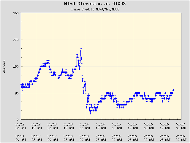
winds are still wsw at the bouy near the system.
2 likes
Note: If I make a post that is brief. Please refer back to previous posts for the analysis or reasoning. I do not re-write/qoute what my initial post said each time.
If there is nothing before... then just ask
Space & Atmospheric Physicist, Embry-Riddle Aeronautical University,
I believe the sky is falling...
If there is nothing before... then just ask
Space & Atmospheric Physicist, Embry-Riddle Aeronautical University,
I believe the sky is falling...
-
Blown Away
- S2K Supporter
- Posts: 10253
- Joined: Wed May 26, 2004 6:17 am
Re: ATL: FOUR - Remnants - Discussion
Area Forecast Discussion
National Weather Service Miami FL
811 AM EDT Mon Jul 10 2017
.WEDNESDAY THROUGH FRIDAY: The Western Atlantic ridge axis will
strengthen and expanded westward into the Deep South mid to late
week with deep easterly flow prevailing. Subsidence in between
the waves on Wednesday will hold down rain chances, with the
activity that initiates along the east coast seabreeze quickly
moving west with the flow.
The next significant wave, the remnants of the former TD 4, will
track across the area on Thursday, with the slower ECMWF not moving
the wave through until later on Friday. PWATs look to rise to well
over 2 inches with the wave, leading to numerous showers with
embedded thunderstorms, some likely heavy, through the day Thursday
and possibly lingering into Friday.
Excerpt from NWS Miami about former TD4.
1 likes
Hurricane Eye Experience: David 79, Irene 99, Frances 04, Jeanne 04, Wilma 05… Hurricane Brush Experience: Andrew 92, Erin 95, Floyd 99, Matthew 16, Irma 17, Ian 22, Nicole 22…
Who is online
Users browsing this forum: No registered users and 46 guests