ATL: FLORENCE - Models

Moderator: S2k Moderators

Message
Author
hohnywx
Category 2
Category 2
Posts: 508
Age: 34
Joined: Sun Jul 19, 2009 8:34 pm
Location: Hastings-on-Hudson, NY

Re: ATL: FLORENCE - Models

#1101 Postby hohnywx » Thu Sep 06, 2018 11:22 am

stormlover2013 wrote:
txwatcher91 wrote:12z CMC is a NC landfall. UK looks like a NC landfall. GFS trending south in line with this path. Doesn't look good for NC right now and it's only 6-7 days out which is getting into the more reliable model range.


More reliable model range isn't till 3-4 days.


and more reliable than that is 1-2 days...but the point remains that we are getting into a window where the wild swings are going to be narrower and seen less often.
2 likes   

User avatar
Steve
S2K Supporter
S2K Supporter
Posts: 9621
Joined: Sat Apr 05, 2003 11:41 pm
Location: Not a state-caster

Re: ATL: FLORENCE - Models

#1102 Postby Steve » Thu Sep 06, 2018 11:22 am

https://www.tropicaltidbits.com/analysi ... 612&fh=138

Yeah. Ridge in, escape route closed at 138 hours (5.75 days from 7:00am CDT this morning). It will be a landfall for the GFS unless there is a stall and loop for a few days yet to come.
Image
0 likes   

AxaltaRacing24
Category 5
Category 5
Posts: 1753
Age: 25
Joined: Wed Jul 27, 2016 11:14 am
Location: Jupiter, FL

Re: ATL: FLORENCE - Models

#1103 Postby AxaltaRacing24 » Thu Sep 06, 2018 11:24 am

This is a scary run following an increasing west trend.
0 likes   

User avatar
Steve
S2K Supporter
S2K Supporter
Posts: 9621
Joined: Sat Apr 05, 2003 11:41 pm
Location: Not a state-caster

Re: ATL: FLORENCE - Models

#1104 Postby Steve » Thu Sep 06, 2018 11:25 am

Nevertheless, GFS turns the system right into the ridge and advances it north to where it's east of the VA Coast 18 hours later. Something's dreadfully wrong with this model and the physics it sometimes shows. It's a shame too, because if they can ever figure that out, maybe it becomes a better model. But for the better part of the last 20 years, GFS and its forerunners just can't handle ridging in the Atlantic. Year after year after year after year after year it suffers the same recurve bias and breaks down strong ridges too quick.
Last edited by Steve on Thu Sep 06, 2018 11:26 am, edited 1 time in total.
2 likes   

plasticup

Re: ATL: FLORENCE - Models

#1105 Postby plasticup » Thu Sep 06, 2018 11:25 am

Image

Um, is this a major hurricane in Manhattan? 932 mb would typically be a Category 4.
Last edited by plasticup on Thu Sep 06, 2018 11:27 am, edited 1 time in total.
1 likes   

tolakram
Admin
Admin
Posts: 20011
Age: 62
Joined: Sun Aug 27, 2006 8:23 pm
Location: Florence, KY (name is Mark)

Re: ATL: FLORENCE - Models

#1106 Postby tolakram » Thu Sep 06, 2018 11:26 am

Same curve as the 6Z, just further west. Escape route open.

Image
0 likes   
M a r k
- - - - -
Join us in chat: Storm2K Chatroom Invite. Android and IOS apps also available.

The posts in this forum are NOT official forecasts and should not be used as such. Posts are NOT endorsed by any professional institution or STORM2K.org. For official information and forecasts, please refer to NHC and NWS products.

Airboy
Category 1
Category 1
Posts: 439
Joined: Wed Jul 27, 2011 10:41 am

Re: ATL: FLORENCE - Models

#1107 Postby Airboy » Thu Sep 06, 2018 11:27 am

Going for NY?
1 likes   
Personal Forecast Disclaimer:
The posts in this forum are NOT official forecast and should not be used as such. They are just the opinion of the poster and may or may not be backed by sound meteorological data. They are NOT endorsed by any professional institution or storm2k.org. For official information, please refer to the NHC and NWS products.

AxaltaRacing24
Category 5
Category 5
Posts: 1753
Age: 25
Joined: Wed Jul 27, 2016 11:14 am
Location: Jupiter, FL

Re: ATL: FLORENCE - Models

#1108 Postby AxaltaRacing24 » Thu Sep 06, 2018 11:28 am

plasticup wrote:Image

Um, is this a major hurricane in Manhattan? 932 mb would typically be a Category 4.

Yes. This is what is called a “doomsday” model run.
0 likes   

dspguy
Tropical Depression
Tropical Depression
Posts: 61
Joined: Wed Sep 06, 2017 2:26 pm
Location: Charleston, SC

Re: ATL: FLORENCE - Models

#1109 Postby dspguy » Thu Sep 06, 2018 11:29 am

MacTavish wrote:Gordon remnants are going to be a major key player after day 4.

Do you mind elaborating on why this is the case? I'm usually just a board lurker and usually feel silly asking meteorological questions that other board members probably all know the answer to.
0 likes   

User avatar
Steve
S2K Supporter
S2K Supporter
Posts: 9621
Joined: Sat Apr 05, 2003 11:41 pm
Location: Not a state-caster

Re: ATL: FLORENCE - Models

#1110 Postby Steve » Thu Sep 06, 2018 11:29 am

GFS = mostly useless at this time. This is absurd.

https://www.tropicaltidbits.com/analysi ... 612&fh=168
0 likes   

hohnywx
Category 2
Category 2
Posts: 508
Age: 34
Joined: Sun Jul 19, 2009 8:34 pm
Location: Hastings-on-Hudson, NY

Re: ATL: FLORENCE - Models

#1111 Postby hohnywx » Thu Sep 06, 2018 11:32 am

plasticup wrote:Image

Um, is this a major hurricane in Manhattan? 932 mb would typically be a Category 4.


Manhattan? The storm is at the latitude of Delaware in that photo?

Thankfully, the storm recurves but it gets a little too close for comfort for the tri-state.
2 likes   

User avatar
chris_fit
Category 5
Category 5
Posts: 3222
Age: 42
Joined: Wed Sep 10, 2003 11:58 pm
Location: Tampa Bay Area, FL

Re: ATL: FLORENCE - Models

#1112 Postby chris_fit » Thu Sep 06, 2018 11:32 am

Steve wrote:GFS = mostly useless at this time. This is absurd.

https://www.tropicaltidbits.com/analysi ... 612&fh=168


Take a look at 186 hours - Stalling off the coast NY/NJ
1 likes   

User avatar
Blown Away
S2K Supporter
S2K Supporter
Posts: 10147
Joined: Wed May 26, 2004 6:17 am

Re: ATL: FLORENCE - Models

#1113 Postby Blown Away » Thu Sep 06, 2018 11:32 am

12z GFS @275 miles W of 06z at @186 hrs...

Ridging much stronger on this run... May be a trend as the models get closer in?
Last edited by Blown Away on Thu Sep 06, 2018 11:34 am, edited 2 times in total.
1 likes   
Hurricane Eye Experience: David 79, Irene 99, Frances 04, Jeanne 04, Wilma 05... EYE COMING MY WAY IN 2024…
Hurricane Brush Experience: Andrew 92, Erin 95, Floyd 99, Matthew 16, Irma 17, Ian 22, Nicole 22…

User avatar
FLpanhandle91
Category 5
Category 5
Posts: 1033
Age: 34
Joined: Mon Sep 13, 2010 3:50 pm
Location: Fort Walton Beach, FL

Re: ATL: FLORENCE - Models

#1114 Postby FLpanhandle91 » Thu Sep 06, 2018 11:34 am

Steve wrote:GFS = mostly useless at this time. This is absurd.

https://www.tropicaltidbits.com/analysi ... 612&fh=168


Not entirely. Intensity? Maybe. But the angle of the ridge axis would allow an opening up the east coast like that.
0 likes   

User avatar
Steve
S2K Supporter
S2K Supporter
Posts: 9621
Joined: Sat Apr 05, 2003 11:41 pm
Location: Not a state-caster

Re: ATL: FLORENCE - Models

#1115 Postby Steve » Thu Sep 06, 2018 11:35 am

How can the freakin' CMC understand that a ridge blocks an advancing storm and turns clockwise while the GFS can't? I mean how much money have we dumped into it going back to the MRF days. We should get our tax money back for this!

Canadian = reasonable
https://www.tropicaltidbits.com/analysi ... 612&fh=144

GFS = ridiculous
https://www.tropicaltidbits.com/analysi ... 612&fh=156

What I will say for the GFS's depiction is that if the system stalled out or advanced slowly northward, it would indeed intensify and probably be the strongest system to threaten the NJ/NY coasts in a long, long time (maybe decades even). We'll see how that plays out. But for now, the GFS is out to lunch.
1 likes   

User avatar
chris_fit
Category 5
Category 5
Posts: 3222
Age: 42
Joined: Wed Sep 10, 2003 11:58 pm
Location: Tampa Bay Area, FL

Re: ATL: FLORENCE - Models

#1116 Postby chris_fit » Thu Sep 06, 2018 11:36 am

Landfall

Image
0 likes   

plasticup

Re: ATL: FLORENCE - Models

#1117 Postby plasticup » Thu Sep 06, 2018 11:37 am

FLpanhandle91 wrote:
Steve wrote:GFS = mostly useless at this time. This is absurd.

https://www.tropicaltidbits.com/analysi ... 612&fh=168


Not entirely. Intensity? Maybe. But the angle of the ridge axis would allow an opening up the east coast like that.


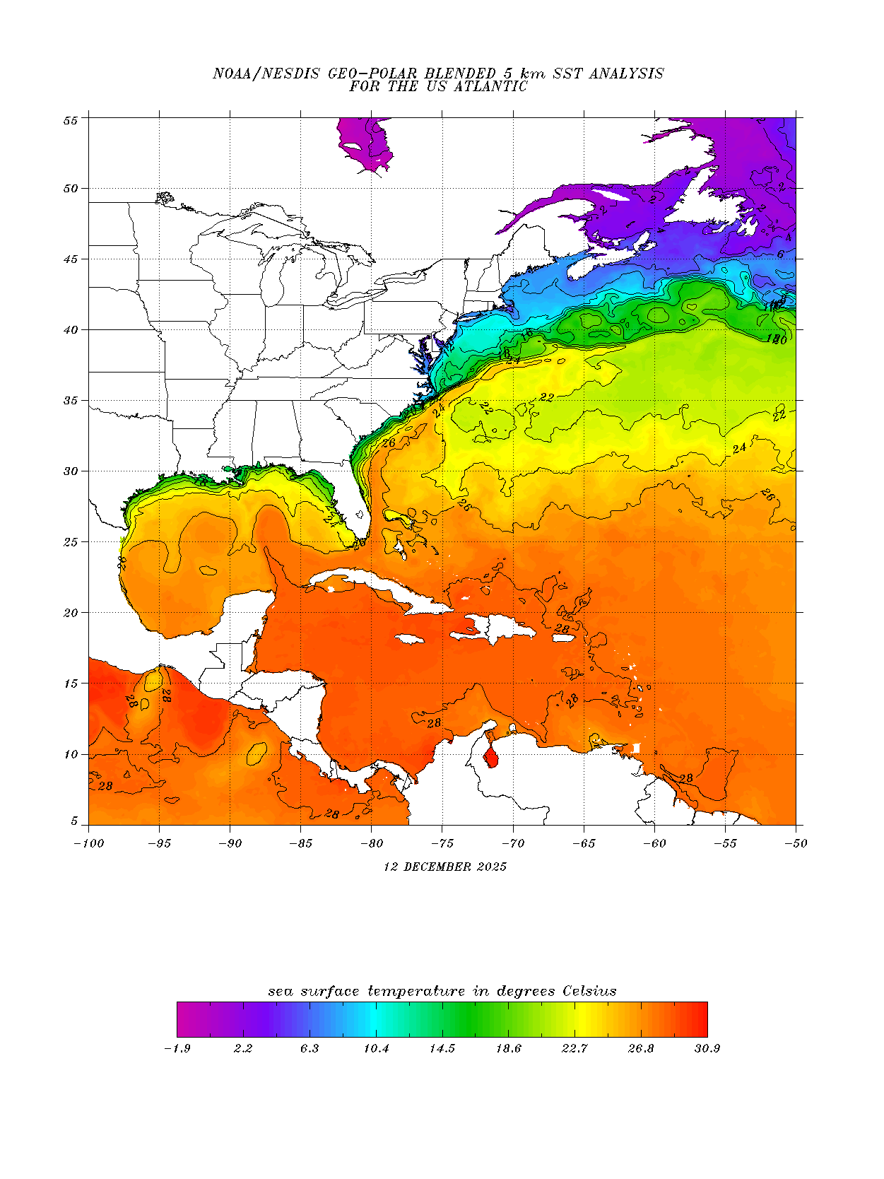
The gulf stream is warmer off NYC than it is near Puerto Rico:
Image
1 likes   

User avatar
Steve
S2K Supporter
S2K Supporter
Posts: 9621
Joined: Sat Apr 05, 2003 11:41 pm
Location: Not a state-caster

Re: ATL: FLORENCE - Models

#1118 Postby Steve » Thu Sep 06, 2018 11:39 am

FLpanhandle91 wrote:
Steve wrote:GFS = mostly useless at this time. This is absurd.

https://www.tropicaltidbits.com/analysi ... 612&fh=168


Not entirely. Intensity? Maybe. But the angle of the ridge axis would allow an opening up the east coast like that.


I gotta disagree 100% FLpanhandle91. If anything, it may have the intensity close to being right. The angle it depicts on the ridge won't be right anyway. But there's no way it barrels into it like that. The height lines are too tall, and it would have to retreat even though GFS shows it building in as the storm arrives. It would never make it north of the VA Capes to begin with the scenario it depicts. I'm not usually a big GFS basher, but when it's bad, it's bad.
0 likes   

User avatar
FLpanhandle91
Category 5
Category 5
Posts: 1033
Age: 34
Joined: Mon Sep 13, 2010 3:50 pm
Location: Fort Walton Beach, FL

Re: ATL: FLORENCE - Models

#1119 Postby FLpanhandle91 » Thu Sep 06, 2018 11:39 am

plasticup wrote:
FLpanhandle91 wrote:
Steve wrote:GFS = mostly useless at this time. This is absurd.

https://www.tropicaltidbits.com/analysi ... 612&fh=168


Not entirely. Intensity? Maybe. But the angle of the ridge axis would allow an opening up the east coast like that.


The gulf stream is warmer off NYC than it is near Puerto Rico:
Image


Yes I am aware. I was more just emphasizing the fact that intensity is going to be less certain right now and that we need to focus on the steering currents. I know SST's up the east coast are up to 5 degrees above average right now.
1 likes   

User avatar
Blown Away
S2K Supporter
S2K Supporter
Posts: 10147
Joined: Wed May 26, 2004 6:17 am

Re: ATL: FLORENCE - Models

#1120 Postby Blown Away » Thu Sep 06, 2018 11:40 am

Image
Landfall NY/Long Island... :eek:
0 likes   
Hurricane Eye Experience: David 79, Irene 99, Frances 04, Jeanne 04, Wilma 05... EYE COMING MY WAY IN 2024…
Hurricane Brush Experience: Andrew 92, Erin 95, Floyd 99, Matthew 16, Irma 17, Ian 22, Nicole 22…


Return to “2018”

Who is online

Users browsing this forum: No registered users and 3 guests