ATL: GORDON - Post-Tropical

Moderator: S2k Moderators

Message
Author
jlauderdal
S2K Supporter
S2K Supporter
Posts: 6813
Joined: Wed May 19, 2004 5:46 am
Location: NE Fort Lauderdale
Contact:

Re: RE: Re: RE: Re: ATL: INVEST 91L - Discussion

#121 Postby jlauderdal » Sun Sep 02, 2018 12:24 pm

tgenius wrote:
jlauderdal wrote:That seems very reasonable, really need some some mid and low level obs..as you know, we have seen very impressive sat presentations and nada at the surface
Aric Dunn wrote:
From the current level of organization .. I would wager on this becoming a TC sooner rather than later.

The shear has dropped to well within a developmental standpoint. not to stop it from now till the gulf..


Sent from my SM-G950U using Tapatalk


Gotta get that generator going buddy! ;)


it ran well for 36 hours after irma, tested it out in june too...its ready
1 likes   

User avatar
cycloneye
Admin
Admin
Posts: 139600
Age: 67
Joined: Thu Oct 10, 2002 10:54 am
Location: San Juan, Puerto Rico

Re: ATL: INVEST 91L - Discussion

#122 Postby cycloneye » Sun Sep 02, 2018 12:24 pm

I go with 90%/90% at 2 PM TWO.
3 likes   
Visit the Caribbean-Central America Weather Thread where you can find at first post web cams,radars
and observations from Caribbean basin members Click Here

User avatar
Hypercane_Kyle
Category 5
Category 5
Posts: 2902
Joined: Sat Mar 07, 2015 7:58 pm
Location: Cape Canaveral, FL

Re: ATL: INVEST 91L - Discussion

#123 Postby Hypercane_Kyle » Sun Sep 02, 2018 12:25 pm

MississippiWx wrote:
Hypercane_Kyle wrote:
MississippiWx wrote::uarrow: Aric, you can see the low level clouds in that part of Cuba starting to get sucked to the east on the close-up.


Maybe I'm going blind but I can't see it.


You can't see it on the gif Aric just posted? If not, maybe you are going blind. Lol.


It was posted right as I was posting, lol. Forum's going fast today.

I see what you're talking about, but if it was a sign of low-level turning, wouldn't the cumulus clouds be vectoring from the NW-SE if the surface low were to be in the convection? Looks to me more like a seabreeze from the other coast.
0 likes   
My posts are my own personal opinion, defer to the National Hurricane Center (NHC) and other NOAA products for decision making during hurricane season.

Dean4Storms
S2K Supporter
S2K Supporter
Posts: 6356
Age: 61
Joined: Sun Aug 31, 2003 1:01 pm
Location: Miramar Bch. FL

Re: ATL: INVEST 91L - Discussion

#124 Postby Dean4Storms » Sun Sep 02, 2018 12:28 pm

This isn’t far from developing a surface reflection if not there already. I see no storm outflows to the west or south of this now so at least 3k ft or more above the surface we have a circulation in my opinion. If the current trend holds the rest of today this could become TD7 sometime tonight.
2 likes   

User avatar
HurricaneBrain
S2K Supporter
S2K Supporter
Posts: 432
Joined: Thu Jun 30, 2011 2:07 pm
Location: Beaumont, TX

Re: ATL: INVEST 91L - Discussion

#125 Postby HurricaneBrain » Sun Sep 02, 2018 12:30 pm

I say 70%/90%
cycloneye wrote:I go with 90%/90% at 2 PM TWO.
0 likes   

Dean4Storms
S2K Supporter
S2K Supporter
Posts: 6356
Age: 61
Joined: Sun Aug 31, 2003 1:01 pm
Location: Miramar Bch. FL

Re: ATL: INVEST 91L - Discussion

#126 Postby Dean4Storms » Sun Sep 02, 2018 12:30 pm

ForexTidbits wrote:ASCAT scan shows a weak circulation on the south west edge.

Image


Also note the elongation from WNW to ESE.....can easily see that on hi res visible. The MLC is displaced a good bit east of this elongated circulation. Very disorganized currently.
Last edited by Dean4Storms on Sun Sep 02, 2018 12:32 pm, edited 1 time in total.
1 likes   

User avatar
CyclonicFury
Category 5
Category 5
Posts: 1977
Age: 25
Joined: Sun Jul 02, 2017 12:32 pm
Location: NC
Contact:

Re: ATL: INVEST 91L - Discussion

#127 Postby CyclonicFury » Sun Sep 02, 2018 12:31 pm

HurricaneBrain wrote:I say 70%/90%
cycloneye wrote:I go with 90%/90% at 2 PM TWO.

I say 60%/80%.
2 likes   
NCSU B.S. in Meteorology Class of 2021. Tropical weather blogger at http://www.cyclonicfury.com. My forecasts and thoughts are NOT official, for official forecasts please consult the National Hurricane Center.

User avatar
MississippiWx
S2K Supporter
S2K Supporter
Posts: 1535
Joined: Sat Aug 14, 2010 1:44 pm
Location: Hattiesburg, Mississippi

Re: ATL: INVEST 91L - Discussion

#128 Postby MississippiWx » Sun Sep 02, 2018 12:31 pm

Hypercane_Kyle wrote:
MississippiWx wrote:
Hypercane_Kyle wrote:
Maybe I'm going blind but I can't see it.


You can't see it on the gif Aric just posted? If not, maybe you are going blind. Lol.


It was posted right as I was posting, lol. Forum's going fast today.

I see what you're talking about, but if it was a sign of low-level turning, wouldn't the cumulus clouds be vectoring from the NW-SE if the surface low were to be in the convection? Looks to me more like a seabreeze from the other coast.


That's a good point. However, seabreeze doesn't move west to east like these clouds are doing. I'm not quite sure if these clouds are completely at the boundary layer yet, but they are close. I think this system is working its way from the top down to the surface through persistent convection.
0 likes   
This post is not an official forecast and should not be used as such. It is just the opinion of MississippiWx and may or may not be backed by sound meteorological data. It is not endorsed by any professional institution including storm2k.org. For Official Information please refer to the NHC and NWS products.

User avatar
WAcyclone
Category 1
Category 1
Posts: 350
Joined: Sat Jul 01, 2017 1:56 pm
Location: Perth, Western Australia

Re: ATL: INVEST 91L - Discussion

#129 Postby WAcyclone » Sun Sep 02, 2018 12:32 pm

1 likes   

Aric Dunn
Category 5
Category 5
Posts: 21228
Age: 41
Joined: Sun Sep 19, 2004 9:58 pm
Location: Ready for the Chase.
Contact:

Re: ATL: INVEST 91L - Discussion

#130 Postby Aric Dunn » Sun Sep 02, 2018 12:32 pm

Dean4Storms wrote:
ForexTidbits wrote:ASCAT scan shows a weak circulation on the south west edge.

Image


Also note the elongation from WNW to ESE.....can easily see that on hi res visible.


yeah that is fairly typical. it will likely migrate back up into the convection over time. it is well on its way.
1 likes   
Note: If I make a post that is brief. Please refer back to previous posts for the analysis or reasoning. I do not re-write/qoute what my initial post said each time.
If there is nothing before... then just ask :)

Space & Atmospheric Physicist, Embry-Riddle Aeronautical University,
I believe the sky is falling...

User avatar
Evil Jeremy
S2K Supporter
S2K Supporter
Posts: 5459
Age: 31
Joined: Mon Apr 10, 2006 2:10 pm
Location: Los Angeles, CA

Re: ATL: INVEST 91L - Discussion

#131 Postby Evil Jeremy » Sun Sep 02, 2018 12:33 pm

I would go with 70%/90%, and it's time to expand the GTWO bubble to include SFL.
1 likes   
Frances 04 / Jeanne 04 / Katrina 05 / Wilma 05 / Fay 08 / Debby 12 / Andrea 13 / Colin 16 / Hermine 16 / Matthew 16 / Irma 17

User avatar
galaxy401
Category 5
Category 5
Posts: 2300
Age: 29
Joined: Sat Aug 25, 2012 9:04 pm
Location: Casa Grande, Arizona

Re: ATL: INVEST 91L - Discussion

#132 Postby galaxy401 » Sun Sep 02, 2018 12:34 pm

As a couple others are saying, I also think 70/90% in the next outlook.
1 likes   
Got my eyes on moving right into Hurricane Alley: Florida.

Dean4Storms
S2K Supporter
S2K Supporter
Posts: 6356
Age: 61
Joined: Sun Aug 31, 2003 1:01 pm
Location: Miramar Bch. FL

Re: ATL: INVEST 91L - Discussion

#133 Postby Dean4Storms » Sun Sep 02, 2018 12:36 pm

Aric Dunn wrote:
Dean4Storms wrote:
ForexTidbits wrote:ASCAT scan shows a weak circulation on the south west edge.

Image


Also note the elongation from WNW to ESE.....can easily see that on hi res visible.


yeah that is fairly typical. it will likely migrate back up into the convection over time. it is well on its way.


The MLC is well east of that elongated circulation.
1 likes   

User avatar
gatorcane
S2K Supporter
S2K Supporter
Posts: 23499
Age: 46
Joined: Sun Mar 13, 2005 3:54 pm
Location: Boca Raton, FL

Re: ATL: INVEST 91L - Discussion

#134 Postby gatorcane » Sun Sep 02, 2018 12:37 pm

Shear dropping quickly. The GFS runs from last week thought there would be a swath of high shear over Southern Florida and the Bahamas but that didn’t pan out:

Image
Last edited by gatorcane on Sun Sep 02, 2018 12:38 pm, edited 2 times in total.
2 likes   

User avatar
Haris
Category 5
Category 5
Posts: 1808
Joined: Mon Nov 27, 2017 8:19 pm
Location: ( Bee Cave) West Austin, Texas

Re: ATL: INVEST 91L - Discussion

#135 Postby Haris » Sun Sep 02, 2018 12:38 pm

I say 70/90
1 likes   
Weather geek and a storm spotter in West Austin. Not a degreed meteorologist. Big snow fan. Love rain and cold! Despise heat!

User avatar
tarheelprogrammer
S2K Supporter
S2K Supporter
Posts: 1793
Joined: Mon Mar 28, 2016 9:25 pm
Location: Raleigh, NC area (Garner, NC)

Re: ATL: INVEST 91L - Discussion

#136 Postby tarheelprogrammer » Sun Sep 02, 2018 12:40 pm

I go with this is already a TD like I said earlier. I stick with it :D 8-)
1 likes   
My posts are not official forecasts. They are just my opinion and may or may not be backed by sound meteorological data. They are NOT endorsed by any professional institution or storm2k.org. For official information, please refer to the NHC and NWS products.

User avatar
gatorcane
S2K Supporter
S2K Supporter
Posts: 23499
Age: 46
Joined: Sun Mar 13, 2005 3:54 pm
Location: Boca Raton, FL

Re: ATL: INVEST 91L - Discussion

#137 Postby gatorcane » Sun Sep 02, 2018 12:40 pm

No doubt it is organizing. Take a look:

https://www.tropicaltidbits.com/sat/sat ... roduct=vis
2 likes   

User avatar
Evil Jeremy
S2K Supporter
S2K Supporter
Posts: 5459
Age: 31
Joined: Mon Apr 10, 2006 2:10 pm
Location: Los Angeles, CA

Re: ATL: INVEST 91L - Discussion

#138 Postby Evil Jeremy » Sun Sep 02, 2018 12:43 pm

ZCZC MIATWOAT ALL
TTAA00 KNHC DDHHMM

Tropical Weather Outlook
NWS National Hurricane Center Miami FL
200 PM EDT Sun Sep 2 2018

For the North Atlantic...Caribbean Sea and the Gulf of Mexico:

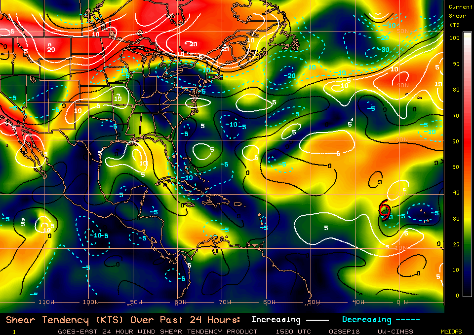
The National Hurricane Center is issuing advisories on Tropical
Storm Florence, located several hundred miles west of the Cabo
Verde Islands.

1. Thunderstorm activity associated with a tropical wave located
between north-central Cuba and the central Bahamas is gradually
becoming better organized, and upper-level winds are also becoming
more favorable. A tropical depression is likely to form during the
next day or so while the system moves west-northwestward across the
northwestern Bahamas, southern Florida, and the Florida Keys. The
system is forecast to emerge over the southeastern Gulf of Mexico by
early Tuesday and move toward the north-central Gulf Coast Tuesday
night and Wednesday. This system will produce locally heavy rains
and gusty winds across the central and northwestern Bahamas,
southern Florida, and the Florida Keys during the next day or two. A
tropical storm watch could be issued for portions of the northern
Gulf Coast tonight. Interests in these areas should monitor the
progress of this system. For more information, see products from
your local weather forecast office and High Seas Forecasts issued by
the National Weather Service. An Air Force Reserve reconnaissance
aircraft is scheduled to investigate the system tomorrow.

* Formation chance through 48 hours...high...70 percent.
* Formation chance through 5 days...high...90 percent.
1 likes   
Frances 04 / Jeanne 04 / Katrina 05 / Wilma 05 / Fay 08 / Debby 12 / Andrea 13 / Colin 16 / Hermine 16 / Matthew 16 / Irma 17

User avatar
HurricaneBrain
S2K Supporter
S2K Supporter
Posts: 432
Joined: Thu Jun 30, 2011 2:07 pm
Location: Beaumont, TX

Re: ATL: INVEST 91L - Discussion

#139 Postby HurricaneBrain » Sun Sep 02, 2018 12:44 pm

Up to 70/90
0 likes   

jlauderdal
S2K Supporter
S2K Supporter
Posts: 6813
Joined: Wed May 19, 2004 5:46 am
Location: NE Fort Lauderdale
Contact:

Re: ATL: INVEST 91L - Discussion

#140 Postby jlauderdal » Sun Sep 02, 2018 12:44 pm

Evil Jeremy wrote:I would go with 70%/90%, and it's time to expand the GTWO bubble to include SFL.
my peeps in sofla on this board are gunning hard for that red circle to be overhead :eek:
0 likes   


Return to “2018”

Who is online

Users browsing this forum: No registered users and 14 guests