
ATL: KIRK - Remnants - Discussion
Moderator: S2k Moderators
-
Condor

- Tropical Depression

- Posts: 86
- Joined: Wed Sep 12, 2018 3:10 pm
- Location: International Space Station
Re: ATL: KIRK - Tropical Storm - Discussion
1 likes
The following post is NOT an official forecast and should not be used as such. It is just the opinion of the poster and may or may not be backed by sound meteorological data. It is NOT endorsed by any professional institution including storm2k.org For Official Information please refer to the NHC and NWS products.
Re: ATL: KIRK - Tropical Storm - Discussion
5:00 PM AST Sat Sep 22
Location: 8.6°N 24.8°W
Moving: WNW at 15 mph
Min pressure: 1005 mb
Max sustained: 40 mph

INIT 22/2100Z 8.6N 24.8W 35 KT 40 MPH
12H 23/0600Z 9.1N 27.1W 40 KT 45 MPH
24H 23/1800Z 9.5N 31.2W 45 KT 50 MPH
36H 24/0600Z 9.7N 35.7W 50 KT 60 MPH
48H 24/1800Z 9.8N 40.2W 50 KT 60 MPH
72H 25/1800Z 10.5N 48.0W 50 KT 60 MPH
96H 26/1800Z 11.5N 54.0W 45 KT 50 MPH
120H 27/1800Z 13.0N 59.0W 40 KT 45 MPH
Location: 8.6°N 24.8°W
Moving: WNW at 15 mph
Min pressure: 1005 mb
Max sustained: 40 mph
INIT 22/2100Z 8.6N 24.8W 35 KT 40 MPH
12H 23/0600Z 9.1N 27.1W 40 KT 45 MPH
24H 23/1800Z 9.5N 31.2W 45 KT 50 MPH
36H 24/0600Z 9.7N 35.7W 50 KT 60 MPH
48H 24/1800Z 9.8N 40.2W 50 KT 60 MPH
72H 25/1800Z 10.5N 48.0W 50 KT 60 MPH
96H 26/1800Z 11.5N 54.0W 45 KT 50 MPH
120H 27/1800Z 13.0N 59.0W 40 KT 45 MPH
0 likes
-
Condor
- Tropical Depression
- Posts: 86
- Joined: Wed Sep 12, 2018 3:10 pm
- Location: International Space Station
Re: ATL: KIRK - Tropical Storm - Discussion

1 likes
The following post is NOT an official forecast and should not be used as such. It is just the opinion of the poster and may or may not be backed by sound meteorological data. It is NOT endorsed by any professional institution including storm2k.org For Official Information please refer to the NHC and NWS products.


Re: ATL: KIRK - Tropical Storm - Discussion
Hammy wrote:chaser1 wrote:Hammy, I saw those ASCAT plots you posted but boy....., even if there are one or two wind barbs actually showing 35 Kt's. that's a pretty minimal showing for data when you consider it being the solo one pass and without any additional corroborating data. I generally stand on the side of "call it as you see it" but there's something to be said for continuity too. Zero argument on it's being upgraded to a T.D. but I don't see where 6-12 hours of additional observation would've hurt prior to NHC's early upgrade to T.S. It's not as if T.S. conditions were going to threaten those in the islands to the north. This coming from someone who believed 97L should have been earlier upgraded (even if it were the size of a large waterspout lol). At least with that feature, I thought a very small tight core feature was discernible and a continuous feature that persisted for well more then a day.
I would say the call was good here especially since weaker side of the circulation was caught, but agree there is some inconsistency with when it's applied. Personally I'd like to see an across the board standard of going with the highest available measurement (unless the strongest wind is outright missed) in all cases when using ASCAT.
Definitely some application of greater consistency would be good. Reason I feel the call was not good is that at best it's reliant on one or two wind barbs at most, and based on a singular ASCAT pass. Minus any other surface corroborating data (ships reports, buoys, or wayward flung seagulls
1 likes
Andy D
(For official information, please refer to the NHC and NWS products.)
(For official information, please refer to the NHC and NWS products.)
-
AutoPenalti
- Category 5

- Posts: 4091
- Age: 29
- Joined: Mon Aug 17, 2015 4:16 pm
- Location: Ft. Lauderdale, Florida
Re: ATL: KIRK - Tropical Storm - Discussion
I'm curious to see if Kirk can hold out for a few days as he enters the Lesser Antilles, shear would be dropping a bit and I wonder if maybe an anti-cyclone can try to build over him.
0 likes
The posts in this forum are NOT official forecasts and should not be used as such. They are just the opinion of the poster and may or may not be backed by sound meteorological data. They are NOT endorsed by any professional institution or STORM2K. For official information, please refer to products from the NHC and NWS.
Model Runs Cheat Sheet:
GFS (5:30 AM/PM, 11:30 AM/PM)
HWRF, GFDL, UKMET, NAVGEM (6:30-8:00 AM/PM, 12:30-2:00 AM/PM)
ECMWF (1:45 AM/PM)
TCVN is a weighted averaged
Re: ATL: KIRK - Tropical Storm - Discussion
Great supporting evidence why those particular regions are not currently favorable for development to occur. Unfortunately Doc, the Captain (Kirk) is in an altogether galactic 2,500 miles to the east of those present (a lot of extra emphasis on the word "present") shear conditions.
1 likes
Andy D
(For official information, please refer to the NHC and NWS products.)
(For official information, please refer to the NHC and NWS products.)
Re: ATL: KIRK - Tropical Storm - Discussion
AutoPenalti wrote:I'm curious to see if Kirk can hold out for a few days as he enters the Lesser Antilles, shear would be dropping a bit and I wonder if maybe an anti-cyclone can try to build over him.
Kirk is an overall broad envelope type system. I think far more important as to whether Kirk can "hold out", is whether the storm can "build up". A strong core supported by large convective CDO is more apt to have good outflow in all directions and aid toward moistening the environment around it, thus better capable of impacting it's immediate environment as opposed to simply becoming a victim of it. Kirk to Engine room, "raise shields".
4 likes
Andy D
(For official information, please refer to the NHC and NWS products.)
(For official information, please refer to the NHC and NWS products.)
-
Condor
- Tropical Depression
- Posts: 86
- Joined: Wed Sep 12, 2018 3:10 pm
- Location: International Space Station
Re: ATL: KIRK - Tropical Storm - Discussion
chaser1 wrote:
Great supporting evidence why those particular regions are not currently favorable for development to occur. Unfortunately Doc, the Captain (Kirk) is in an altogether galactic 2,500 miles to the east of those present (a lot of extra emphasis on the word "present") shear conditions.
Also has favourable conditions leading up to reaching the present high amount of shear around the lesser Antilles. We will have to keep an eye out and see how this changes over the next couple days. The current models show reaching that area around Tuesday so this will give the development plenty of time to strengthen. As we all know conditions can change drastically in 24 hours.
1 likes
The following post is NOT an official forecast and should not be used as such. It is just the opinion of the poster and may or may not be backed by sound meteorological data. It is NOT endorsed by any professional institution including storm2k.org For Official Information please refer to the NHC and NWS products.
-
Condor
- Tropical Depression
- Posts: 86
- Joined: Wed Sep 12, 2018 3:10 pm
- Location: International Space Station
Re: ATL: KIRK - Tropical Storm - Discussion
0 likes
The following post is NOT an official forecast and should not be used as such. It is just the opinion of the poster and may or may not be backed by sound meteorological data. It is NOT endorsed by any professional institution including storm2k.org For Official Information please refer to the NHC and NWS products.
Re: ATL: KIRK - Tropical Storm - Discussion

5 likes
Andy D
(For official information, please refer to the NHC and NWS products.)
(For official information, please refer to the NHC and NWS products.)

Re: ATL: KIRK - Tropical Storm - Discussion
All I can say is, if this is a TS, then 98L surely was as well.
1 likes
Kendall -> SLO -> PBC
Memorable Storms: Katrina (for its Florida landfall...) Wilma Matthew Irma
Memorable Storms: Katrina (for its Florida landfall...) Wilma Matthew Irma
-
AutoPenalti
- Category 5
- Posts: 4091
- Age: 29
- Joined: Mon Aug 17, 2015 4:16 pm
- Location: Ft. Lauderdale, Florida
Re: ATL: KIRK - Tropical Storm - Discussion
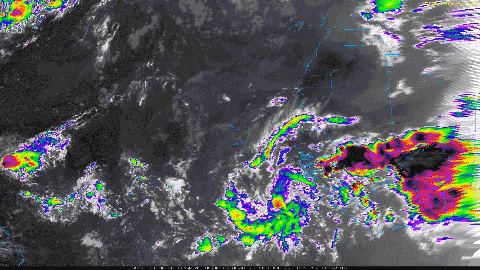
chaser1 wrote::uarrow: Been looking at the above IR loop for over 10 minutes..... i think i may be trippin'
Seems to be trying it's best to wrap convection around the LLC
0 likes
The posts in this forum are NOT official forecasts and should not be used as such. They are just the opinion of the poster and may or may not be backed by sound meteorological data. They are NOT endorsed by any professional institution or STORM2K. For official information, please refer to products from the NHC and NWS.
Model Runs Cheat Sheet:
GFS (5:30 AM/PM, 11:30 AM/PM)
HWRF, GFDL, UKMET, NAVGEM (6:30-8:00 AM/PM, 12:30-2:00 AM/PM)
ECMWF (1:45 AM/PM)
TCVN is a weighted averaged
-
storm_in_a_teacup

- Category 1

- Posts: 496
- Age: 33
- Joined: Wed Aug 16, 2017 5:01 pm
- Location: Huntsville, Alabama (originally from Houston)
- Contact:
Re: ATL: INVEST 99L - Discussion
AnnularCane wrote:storm_in_a_teacup wrote:Hurricane Andrew wrote:She is chomping on that SAL...look at the outflow boundary, and the sand you can see on the visible.
Don’t assume its gender yet. You are fully aware they’re not mature enough to be sexed unless they’re tropical storm strength
Yep, as it turns out, this is no "she." Congrats, it's a boy!
Wait speaking of which is this the tropical storm people were saying was going to form from the remnants of Florence?
0 likes
I know I can't straddle the atmosphere...just a tiny storm in your teacup, girl.
-
Hurricaneman

- Category 5
- Posts: 7404
- Age: 45
- Joined: Tue Aug 31, 2004 3:24 pm
- Location: central florida
Re: ATL: INVEST 99L - Discussion
storm_in_a_teacup wrote:AnnularCane wrote:storm_in_a_teacup wrote:
Don’t assume its gender yet. You are fully aware they’re not mature enough to be sexed unless they’re tropical storm strength
Yep, as it turns out, this is no "she." Congrats, it's a boy!
Wait speaking of which is this the tropical storm people were saying was going to form from the remnants of Florence?
Nope, that’s 98L this system formed right off of Africa
2 likes
Re: ATL: KIRK - Tropical Storm - Discussion
"Spock, find me if you can......"
0 likes
Andy D
(For official information, please refer to the NHC and NWS products.)
(For official information, please refer to the NHC and NWS products.)
-
AutoPenalti
- Category 5
- Posts: 4091
- Age: 29
- Joined: Mon Aug 17, 2015 4:16 pm
- Location: Ft. Lauderdale, Florida
Re: ATL: KIRK - Tropical Storm - Discussion
At this point it just looks like an open wave.
0 likes
The posts in this forum are NOT official forecasts and should not be used as such. They are just the opinion of the poster and may or may not be backed by sound meteorological data. They are NOT endorsed by any professional institution or STORM2K. For official information, please refer to products from the NHC and NWS.
Model Runs Cheat Sheet:
GFS (5:30 AM/PM, 11:30 AM/PM)
HWRF, GFDL, UKMET, NAVGEM (6:30-8:00 AM/PM, 12:30-2:00 AM/PM)
ECMWF (1:45 AM/PM)
TCVN is a weighted averaged
-
Aric Dunn
- Category 5
- Posts: 21238
- Age: 43
- Joined: Sun Sep 19, 2004 9:58 pm
- Location: Ready for the Chase.
- Contact:
Re: ATL: KIRK - Tropical Storm - Discussion

0 likes
Note: If I make a post that is brief. Please refer back to previous posts for the analysis or reasoning. I do not re-write/qoute what my initial post said each time.
If there is nothing before... then just ask
Space & Atmospheric Physicist, Embry-Riddle Aeronautical University,
I believe the sky is falling...
If there is nothing before... then just ask
Space & Atmospheric Physicist, Embry-Riddle Aeronautical University,
I believe the sky is falling...
-
Condor
- Tropical Depression
- Posts: 86
- Joined: Wed Sep 12, 2018 3:10 pm
- Location: International Space Station
Re: ATL: KIRK - Tropical Storm - Discussion
chaser1 wrote::uarrow: Been looking at the above IR loop for over 10 minutes..... i think i may be trippin'
Everytime I get the loop from the COD it does that I dont know why lol
0 likes
The following post is NOT an official forecast and should not be used as such. It is just the opinion of the poster and may or may not be backed by sound meteorological data. It is NOT endorsed by any professional institution including storm2k.org For Official Information please refer to the NHC and NWS products.
-
Condor
- Tropical Depression
- Posts: 86
- Joined: Wed Sep 12, 2018 3:10 pm
- Location: International Space Station
Re: ATL: KIRK - Tropical Storm - Discussion
https://weather.cod.edu/satrad/exper/?parms=global-capeverde-14-48-1-100-1&checked=latlon-map&colorbar=undefined
For anyone looking to watch a decent IR of him developing over the past 24 hours
For anyone looking to watch a decent IR of him developing over the past 24 hours
2 likes
The following post is NOT an official forecast and should not be used as such. It is just the opinion of the poster and may or may not be backed by sound meteorological data. It is NOT endorsed by any professional institution including storm2k.org For Official Information please refer to the NHC and NWS products.
Re: ATL: KIRK - Tropical Storm - Discussion

Looks open to me
0 likes
Kendall -> SLO -> PBC
Memorable Storms: Katrina (for its Florida landfall...) Wilma Matthew Irma
Memorable Storms: Katrina (for its Florida landfall...) Wilma Matthew Irma
Who is online
Users browsing this forum: No registered users and 481 guests