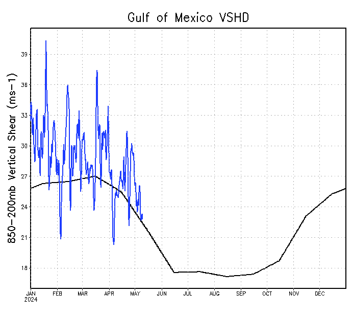
Subtropical jet usually still kicking through the Gulf of Mexico this time of year, making tropical development difficult and/or messy. May formations prefer western Atlantic and Caribbean. Shear running slightly below average for this time of year.

https://twitter.com/MichaelRLowry/status/999030348934770691