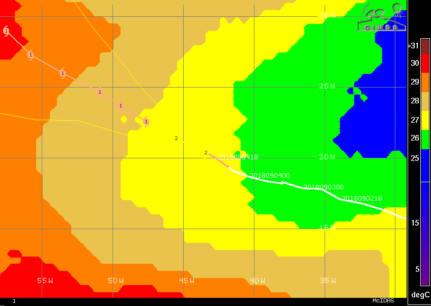
My take based on the 12Z model consensus:
- IF Florence gets to north of 30N before 60 W late this weekend, it stays OTS.
- IF Florence gets to 60W and is then not north of 30N, all bets are off for the SE US and Bermuda.
ATL: FLORENCE - Post-Tropical - Discussion
Moderator: S2k Moderators
Re: ATL: FLORENCE - Hurricane - Discussion
2 likes
Personal Forecast Disclaimer:
The posts in this forum are NOT official forecasts and should not be used as such. They are just the opinion of the poster and may or may not be backed by sound meteorological data. They are NOT endorsed by any professional institution or storm2k.org. For official information, please refer to the NHC and NWS products.
The posts in this forum are NOT official forecasts and should not be used as such. They are just the opinion of the poster and may or may not be backed by sound meteorological data. They are NOT endorsed by any professional institution or storm2k.org. For official information, please refer to the NHC and NWS products.
-
Hurricaneman

- Category 5

- Posts: 7404
- Age: 45
- Joined: Tue Aug 31, 2004 3:24 pm
- Location: central florida
Re: ATL: FLORENCE - Hurricane - Discussion
AxaltaRacing24 wrote:Kazmit wrote:I remember the GFS got some heat for showing Florence instensifying while the Euro kept it weak. Looks like the GFS may be right after all.
It was showing a solid cat 2 by now though.
The GFS did come closer to the correct strength than the Euro so maybe it wasn’t completely off it’s rocker but the mid range intensity is probably complete garbage
0 likes


Re: ATL: FLORENCE - Hurricane - Discussion
Based on the NHC forecast, Florence could add another 6-7 units the next 5 days on top of the 4 units processed.
0 likes
The above post and any post by Ntxw is NOT an official forecast and should not be used as such. It is just the opinion of the poster and may or may not be backed by sound meteorological data. It is NOT endorsed by any professional institution including Storm2k. For official information, please refer to NWS products.
Help support Storm2K!

-
cycloneye

- Admin

- Posts: 149467
- Age: 69
- Joined: Thu Oct 10, 2002 10:54 am
- Location: San Juan, Puerto Rico
Re: ATL: FLORENCE - Hurricane - Discussion
Up to cat 2 on 00z Best Track.
AL, 06, 2018090500, , BEST, 0, 204N, 434W, 85, 976, HU
1 likes
Visit the Caribbean-Central America Weather Thread where you can find at first post web cams,radars
and observations from Caribbean basin members Click Here
and observations from Caribbean basin members Click Here
-
TheDreamTraveler

- Category 2

- Posts: 645
- Joined: Sun Aug 22, 2010 3:10 am
- Location: PA
Re: ATL: FLORENCE - Hurricane - Discussion
Here's Levi Cowan's take on Florence and the models for tonight
https://www.youtube.com/watch?v=L2BdB7_G1-E&t=2m38s
https://www.youtube.com/watch?v=L2BdB7_G1-E&t=2m38s
0 likes

Re: ATL: FLORENCE - Hurricane - Discussion
cycloneye wrote:Up to cat 2 on 00z Best Track.AL, 06, 2018090500, , BEST, 0, 204N, 434W, 85, 976, HU
Can't say this was expected at all.
3 likes
The above post is not official and should not be used as such. It is the opinion of the poster and may or may not be backed by sound meteorological data. It is not endorsed by any professional institution or storm2k.org. For official information, please refer to the NHC and NWS products.
-
StruThiO

- Category 3

- Posts: 821
- Age: 26
- Joined: Fri Sep 15, 2017 5:51 am
- Location: Currently Portland, OR. Raised in Jax, FL.
Re: ATL: FLORENCE - Hurricane - Discussion
Raw t number of 5.3. maybe pushing major hurricane strength??
1 likes
-
gatorcane

- S2K Supporter

- Posts: 23708
- Age: 48
- Joined: Sun Mar 13, 2005 3:54 pm
- Location: Boca Raton, FL
Re: ATL: FLORENCE - Hurricane - Discussion
I am also surprised how strong Florence is getting. Thought it would be weaker given the relatively cooler SSTs and more stable environment where it is at now.
3 likes

Re: ATL: FLORENCE - Hurricane - Discussion
gatorcane wrote:I am also surprised how strong Florence is getting. Thought it would be weaker given the relatively cooler SSTs and more stable environment where it is at now.
Hopefully Florence will gain more latitude with it continuing to strengthen. The thought was that with some stronger shear and cooler SSTs the storm would weaken or at least maintain it's strength but Florence has other ideas.
1 likes
-
toad strangler

- S2K Supporter
- Posts: 4546
- Joined: Sun Jul 28, 2013 3:09 pm
- Location: Earth
- Contact:
Re: ATL: FLORENCE - Hurricane - Discussion
This should mean more poleward movement especially with weak 500 mb steering ATM
1 likes
My Weather Station
https://www.wunderground.com/dashboard/pws/KFLPORTS603
https://www.wunderground.com/dashboard/pws/KFLPORTS603
-
EquusStorm
- Category 5
- Posts: 1649
- Age: 35
- Joined: Thu Nov 07, 2013 1:04 pm
- Location: Jasper, AL
- Contact:
Re: ATL: FLORENCE - Hurricane - Discussion
Eye might be trying to clear on IR. Unreal. Forecast to be a <70mph TS in marginal conditions and now not too far off from making a run for major. I really don't envy the difficulty encountered by those responsible for officially forecasting these storms that seem to defy sense.
2 likes
Colors of lost purpose on the canvas of irrelevance
Not a meteorologist, in fact more of an idiot than anything. You should probably check with the NHC or a local NWS office for official information.
Not a meteorologist, in fact more of an idiot than anything. You should probably check with the NHC or a local NWS office for official information.
-
StruThiO
- Category 3
- Posts: 821
- Age: 26
- Joined: Fri Sep 15, 2017 5:51 am
- Location: Currently Portland, OR. Raised in Jax, FL.
Re: ATL: FLORENCE - Hurricane - Discussion
EquusStorm wrote:Eye might be trying to clear on IR. Unreal. Forecast to be a <70mph TS in marginal conditions. . .
Yep. Supposedly hostile environment in a supposedly hostile year and the first Cape verde storm of peak season is already showing off.
2 likes
Re: ATL: FLORENCE - Hurricane - Discussion
It's not too surprising we are seeing an uptick. Florence is moving into warmer water now that it is starting to move out of the MDR (above 20N). In a few days it will be in sufficiently warm SSTs to sustain a major pretty easily if not already.
7 likes
The above post and any post by Ntxw is NOT an official forecast and should not be used as such. It is just the opinion of the poster and may or may not be backed by sound meteorological data. It is NOT endorsed by any professional institution including Storm2k. For official information, please refer to NWS products.
Help support Storm2K!
Help support Storm2K!
-
cycloneye
- Admin
- Posts: 149467
- Age: 69
- Joined: Thu Oct 10, 2002 10:54 am
- Location: San Juan, Puerto Rico
Re: ATL: FLORENCE - Advisories
Hurricane Florence Discussion Number 23
NWS National Hurricane Center Miami FL AL062018
1100 PM AST Tue Sep 04 2018
GOES-16 imagery shows that the eye of Florence has become better
defined during the last several hours, with even some mesovortices
in the eye present on the shortwave infrared channel. Satellite
intensity estimates continue to rise, and the initial wind speed is
set to 85 kt, just below the latest TAFB estimate of 90 kt.
Florence remains on a west-northwestward course at 300/10 kt. This
general course is expected to continue through 36 or 48 hours while
the hurricane remains near the southwestern edge of the subtropical
ridge. After that time, the forecast becomes more uncertain,
depending on the presence of a narrow mid-level ridge over the
north-central Atlantic Ocean. A look at the ensemble guidance
shows a bifurcation developing by day 5, with the ECMWF favoring
a more northward turn, and the UKMET ensembles showing a stronger
ridge and a continuation of a west-northwest track. The new NHC
forecast is adjusted westward at long range, in line with the
corrected-consensus aids, but don't be surprised if this forecast
undergoes some large changes in the next few cycles, given the
split in the guidance.
This intensity forecast is also difficult. Florence certainly has
exceeded expectations during the last day or so, with the hurricane
on the verge of rapidly intensifying during the last 24 hours
despite a marginal environment. Some more strengthening is
called for in the short term to reflect the current trend.
However, the global models continue to insist that southwesterly
shear will increase over the next couple of days which, in
combination with considerable dry air aloft, should cause some
weakening. Later tomorrow, a slow weakening trend should begin and
continue through 48 hours, although not weakening as much as shown
in the past advisory. This can't be considered a high-confidence
prediction in light of what Florence has done so far. On Friday, an
upper-level low could cut off to the south of the cyclone, which
would lessen the shear near Florence, and the hurricane should be
moving over steadily increasing SSTs. Restrengthening is forecast at
long range, and it wouldn't be surprising if the new NHC prediction
turns out to be too low. It is best to be conservative, however,
since the track uncertainty is increasing by the end of the
forecast.
FORECAST POSITIONS AND MAX WINDS
INIT 05/0300Z 20.7N 43.9W 85 KT 100 MPH
12H 05/1200Z 21.5N 45.5W 90 KT 105 MPH
24H 06/0000Z 22.6N 47.6W 80 KT 90 MPH
36H 06/1200Z 23.7N 49.4W 70 KT 80 MPH
48H 07/0000Z 24.7N 50.9W 65 KT 75 MPH
72H 08/0000Z 26.0N 53.5W 65 KT 75 MPH
96H 09/0000Z 27.3N 55.8W 70 KT 80 MPH
120H 10/0000Z 29.0N 57.5W 80 KT 90 MPH
$$
Forecaster Blake
0 likes
Visit the Caribbean-Central America Weather Thread where you can find at first post web cams,radars
and observations from Caribbean basin members Click Here
and observations from Caribbean basin members Click Here
-
cycloneye
- Admin
- Posts: 149467
- Age: 69
- Joined: Thu Oct 10, 2002 10:54 am
- Location: San Juan, Puerto Rico
Re: ATL: FLORENCE - Hurricane - Discussion
New forecast is to remain as hurricane when it weakens a little.Will add much more ACE than anticipated.
INIT 05/0300Z 20.7N 43.9W 85 KT 100 MPH
12H 05/1200Z 21.5N 45.5W 90 KT 105 MPH
24H 06/0000Z 22.6N 47.6W 80 KT 90 MPH
36H 06/1200Z 23.7N 49.4W 70 KT 80 MPH
48H 07/0000Z 24.7N 50.9W 65 KT 75 MPH
72H 08/0000Z 26.0N 53.5W 65 KT 75 MPH
96H 09/0000Z 27.3N 55.8W 70 KT 80 MPH
120H 10/0000Z 29.0N 57.5W 80 KT 90 MPH
12H 05/1200Z 21.5N 45.5W 90 KT 105 MPH
24H 06/0000Z 22.6N 47.6W 80 KT 90 MPH
36H 06/1200Z 23.7N 49.4W 70 KT 80 MPH
48H 07/0000Z 24.7N 50.9W 65 KT 75 MPH
72H 08/0000Z 26.0N 53.5W 65 KT 75 MPH
96H 09/0000Z 27.3N 55.8W 70 KT 80 MPH
120H 10/0000Z 29.0N 57.5W 80 KT 90 MPH
1 likes
Visit the Caribbean-Central America Weather Thread where you can find at first post web cams,radars
and observations from Caribbean basin members Click Here
and observations from Caribbean basin members Click Here

Re: ATL: FLORENCE - Hurricane - Discussion
They also mention that their forecast for reintensification could be conservative. I think it's quite likely that we could see a major out of this.
1 likes
Igor 2010, Sandy 2012, Fay 2014, Gonzalo 2014, Joaquin 2015, Nicole 2016, Humberto 2019, Imelda 2025
I am only a tropical weather enthusiast. My predictions are not official and may or may not be backed by sound meteorological data. For official information, please refer to the NHC and NWS products.
I am only a tropical weather enthusiast. My predictions are not official and may or may not be backed by sound meteorological data. For official information, please refer to the NHC and NWS products.
-
galaxy401

- Category 5
- Posts: 2446
- Age: 30
- Joined: Sat Aug 25, 2012 9:04 pm
- Location: Casa Grande, Arizona
Re: ATL: FLORENCE - Hurricane - Discussion
This part of the discussion is interesting. They mention the split in the models.
A look at the ensemble guidance
shows a bifurcation developing by day 5, with the ECMWF favoring
a more northward turn, and the UKMET ensembles showing a stronger
ridge and a continuation of a west-northwest track. The new NHC
forecast is adjusted westward at long range, in line with the
corrected-consensus aids, but don't be surprised if this forecast
undergoes some large changes in the next few cycles, given the
split in the guidance.
Last edited by galaxy401 on Tue Sep 04, 2018 10:07 pm, edited 1 time in total.
3 likes
Got my eyes on moving right into Hurricane Alley: Florida.
Re: ATL: FLORENCE - Hurricane - Discussion
cycloneye wrote:New forecast is to remain as hurricane when it weakens a little.Will add much more ACE than anticipated.INIT 05/0300Z 20.7N 43.9W 85 KT 100 MPH
12H 05/1200Z 21.5N 45.5W 90 KT 105 MPH
24H 06/0000Z 22.6N 47.6W 80 KT 90 MPH
36H 06/1200Z 23.7N 49.4W 70 KT 80 MPH
48H 07/0000Z 24.7N 50.9W 65 KT 75 MPH
72H 08/0000Z 26.0N 53.5W 65 KT 75 MPH
96H 09/0000Z 27.3N 55.8W 70 KT 80 MPH
120H 10/0000Z 29.0N 57.5W 80 KT 90 MPH
That 5 day forecast, my math has roughly ~8 units
2 likes
The above post and any post by Ntxw is NOT an official forecast and should not be used as such. It is just the opinion of the poster and may or may not be backed by sound meteorological data. It is NOT endorsed by any professional institution including Storm2k. For official information, please refer to NWS products.
Help support Storm2K!
Help support Storm2K!
-
TheStormExpert
Re: ATL: FLORENCE - Hurricane - Discussion
galaxy401 wrote:This part of the discussion is interesting. They mention the split in the models.A look at the ensemble guidance
shows a bifurcation developing by day 5, with the ECMWF favoring
a more northward turn, and the UKMET ensembles showing a stronger
ridge and a continuation of a west-northwest track. The new NHC
forecast is adjusted westward at long range, in line with the
corrected-consensus aids, but don't be surprised if this forecast
undergoes some large changes in the next few cycles, given the
split in the guidance.
Large changes is some strong wording!
2 likes

Re: ATL: FLORENCE - Hurricane - Discussion
I think also that the models are also taking Florence's forward speed into account as well as the upper air pattern and how fast she'll be at the certain latitude (near or at 30N and 60W ?) caught by the trough or the ridge. Also, the pace Florence is intensifying is impressive.
0 likes
The posts or stuff said are NOT an official forecast. Please look to the NHC and NWS for official forecasts and products.
Floyd-1999, Frances-2004, Jeanne-2004, Fay-2008, Beryl-2012, Debby-2012, Colin-2016, Hermine-2016, Julia-2016, Matthew-2016, Irma-2017, Elsa-2021, Idalia-2023, Debby-2024, Helene-2024.
Go Gators! Go Jags!
Floyd-1999, Frances-2004, Jeanne-2004, Fay-2008, Beryl-2012, Debby-2012, Colin-2016, Hermine-2016, Julia-2016, Matthew-2016, Irma-2017, Elsa-2021, Idalia-2023, Debby-2024, Helene-2024.
Go Gators! Go Jags!
Who is online
Users browsing this forum: No registered users and 47 guests