Up to 52kt sustained and a peak gust of 69 kt at Cape Lookout.
Update: 57 kts sustained at 1900Z.
https://www.ndbc.noaa.gov/station_page.php?station=CLKN7
ATL: FLORENCE - Post-Tropical - Discussion
Moderator: S2k Moderators
Re: ATL: FLORENCE - Hurricane - Discussion
Last edited by bjackrian on Thu Sep 13, 2018 2:26 pm, edited 1 time in total.
0 likes
-
craptacular
- Category 2

- Posts: 581
- Joined: Wed Aug 02, 2006 9:17 pm
- Location: The Mad City, WI
Re: ATL: FLORENCE - Hurricane - Discussion
artist wrote:craptacular wrote:chris_fit wrote:When is next recon?
Scheduled to take off shortly (3pm EDT) and get first center fix at 4:30pm EDT. They are operating on a schedule so that there shouldn't be more than 3 hours between the last fix of one flight and the first fix of the next flight.
They are already on their way in. Another waiting for takeoff.
I should have been more clear. The one that was already airborne (Mission 15) is the NOAA Gulfstream flying around at high levels to get atmospheric data around Florence. The one that just took off (Mission 16) is the AF Hercules that will fly through the eye at lower levels (700mb, ~9-10K feet) and provide the center fixes and min pressures.
Last edited by craptacular on Thu Sep 13, 2018 2:27 pm, edited 1 time in total.
1 likes
Re: ATL: FLORENCE - Hurricane - Discussion
Man, Flo's looking a lot better on Radar than it did earlier today.
0 likes
-
Condor

- Tropical Depression

- Posts: 86
- Joined: Wed Sep 12, 2018 3:10 pm
- Location: International Space Station
Re: ATL: FLORENCE - Hurricane - Discussion
Eyes right in the middle of the gulf stream at the moment
0 likes
The following post is NOT an official forecast and should not be used as such. It is just the opinion of the poster and may or may not be backed by sound meteorological data. It is NOT endorsed by any professional institution including storm2k.org For Official Information please refer to the NHC and NWS products.
Re: ATL: FLORENCE - Hurricane - Discussion
southerngale wrote:http://i64.tinypic.com/2vd1tls.jpg
Storm surge getting fairly high now in Oriental https://t.co/fDFocF7TFQ
Mark Sudduth
Before shot

Time lapse of the above here.
3 likes

Re: ATL: FLORENCE - Hurricane - Discussion
Eye tightening up on RAD - starting to get wrap around bands on east side. Frictional interaction with land combined with gulf stream seems to be deepening Flo.
https://www.wunderground.com/weather-radar/united-states/nc/morehead-city/mhx/?region=clt
https://www.wunderground.com/weather-radar/united-states/nc/morehead-city/mhx/?region=clt
0 likes
-
meriland29

- Category 2
- Posts: 770
- Joined: Thu Aug 03, 2017 11:05 am
Re: ATL: FLORENCE - Hurricane - Discussion
Are winds around her COC picking up? So hard to tell when the energy spreads out too instead.
0 likes

Re: ATL: FLORENCE - Hurricane - Discussion
Last 2 hours if it has moved 5 miles is probably a lot.

1 likes

Re: ATL: FLORENCE - Hurricane - Discussion
NC_Cyclone wrote:Wow, in an hour the outer eyewall has almost entirely closed off. Radar indicates this thing is tightening rapidly. May see some explosive growth this afternoon with the outer wall taking over
Storm is still a bit of a mess. Its seems to be too late for explosive growth. Its going to be unpleasant regardless of whether or not the winds change by 5-10 mph. Interested in expert opinions if they disagree.
I am not an expert. Heck, I'm not an intermediate. Please refer to the NHC products when making decisions.
0 likes
-
sittingduck

- S2K Supporter

- Posts: 112
- Joined: Mon Aug 13, 2007 3:16 pm
- Location: venice florida
Re: ATL: FLORENCE - Hurricane - Discussion
If you haven't looked lately - the flag is getting shredded and the waves are wild
https://www.youtube.com/watch?v=deG4Nxk ... e=youtu.be
https://www.youtube.com/watch?v=deG4Nxk ... e=youtu.be
1 likes

Re: ATL: FLORENCE - Hurricane - Discussion
ronjon wrote:Eye tightening up on RAD - starting to get wrap around bands on east side. Frictional interaction with land combined with gulf stream seems to be deepening Flo.
https://www.wunderground.com/weather-radar/united-states/nc/morehead-city/mhx/?region=clt
I remember this happened with Ike in 2008 right before landfall. I also heard that due to the energy becoming more concentrated, the storm surge was a bit lower than it would have otherwise. Is this true?
0 likes
-
galaxy401

- Category 5

- Posts: 2446
- Age: 30
- Joined: Sat Aug 25, 2012 9:04 pm
- Location: Casa Grande, Arizona
Re: ATL: FLORENCE - Hurricane - Discussion
Outer rainbands are about to hit Wilmington. It's just the beginning for them. Could last a long time.
0 likes
Got my eyes on moving right into Hurricane Alley: Florida.
-
chris_fit

- Category 5
- Posts: 3261
- Age: 43
- Joined: Wed Sep 10, 2003 11:58 pm
- Location: Tampa Bay Area, FL
Re: ATL: FLORENCE - Hurricane - Discussion
Recon up in the air - It defintely looks like she got her act together some more - recon will confirm within an hour
1 likes
-
gfsperpendicular

- Category 1

- Posts: 383
- Age: 21
- Joined: Mon Jun 19, 2017 3:04 pm
- Location: Northern Virginia
Re: ATL: FLORENCE - Hurricane - Discussion
Inner eyewall looks to be completed now. The outer eyewall is still very prominent and won't have time to contract before landfall which will just make things worse if I understand correctly. Bad situation for surge and rain.
0 likes
I'm not sleeping, I'm waiting for the 0900 UTC advisory!
#1 CMC stan
#1 CMC stan
Re: ATL: FLORENCE - Hurricane - Discussion
Here come the possible tornadic cells rotating around on the northern quadrant towards shore.

0 likes
-
NC_Cyclone
- Tropical Low

- Posts: 30
- Joined: Thu Sep 06, 2018 10:28 am
Re: ATL: FLORENCE - Hurricane - Discussion
Zarniwoop wrote:NC_Cyclone wrote:Wow, in an hour the outer eyewall has almost entirely closed off. Radar indicates this thing is tightening rapidly. May see some explosive growth this afternoon with the outer wall taking over
Storm is still a bit of a mess. Its seems to be too late for explosive growth. Its going to be unpleasant regardless of whether or not the winds change by 5-10 mph. Interested in expert opinions if they disagree.
I am not an expert. Heck, I'm not an intermediate. Please refer to the NHC products when making decisions.
Yeah has TONS of work to do. But radar presentation looks way more impressive instead of the ragged dry air storm.
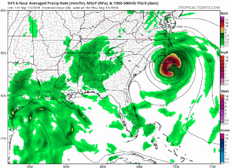
Looks like precip is very expansive. More so than most models. I think this is due to the weakening creating a “looser” storm and allowing the bands to spread out instead of being very tight.
This could result in some increase flooding threat inland
0 likes


-
Condor
- Tropical Depression
- Posts: 86
- Joined: Wed Sep 12, 2018 3:10 pm
- Location: International Space Station
Re: ATL: FLORENCE - Hurricane - Discussion
0 likes
The following post is NOT an official forecast and should not be used as such. It is just the opinion of the poster and may or may not be backed by sound meteorological data. It is NOT endorsed by any professional institution including storm2k.org For Official Information please refer to the NHC and NWS products.
Who is online
Users browsing this forum: No registered users and 108 guests