ATL: FLORENCE - Models
Moderator: S2k Moderators
-
WilmingtonSandbar
- S2K Supporter

- Posts: 505
- Joined: Sun Aug 29, 2010 12:11 pm
- Location: Southport, NC
Re: ATL: FLORENCE - Models
I was wrong. Not east of Bermuda. Poor Bermuda on this run.
0 likes
Diana X2 (look it up), Bertha, Fran, Bonnie, Floyd, Dennis, Charley, Ophelia, Ernesto, Irene, Matthew, And Florence
-
AxaltaRacing24
- Category 5

- Posts: 1774
- Age: 25
- Joined: Wed Jul 27, 2016 11:14 am
- Location: Jupiter, FL
Re: ATL: FLORENCE - Models
919 mb strike as it continues to move NW to the east coast. @144 hrs.
0 likes
-
Aric Dunn
- Category 5

- Posts: 21238
- Age: 43
- Joined: Sun Sep 19, 2004 9:58 pm
- Location: Ready for the Chase.
- Contact:
Re: ATL: FLORENCE - Models
Florence just nailed with some pretty heavy shear. nearly opened up the SW eye in like a 4 hour period. should weaken a good deal. that may help it turn sooner.
anyone check the intensity on the UKMET. did it have a weaker hurricane ?
anyone check the intensity on the UKMET. did it have a weaker hurricane ?
1 likes
Note: If I make a post that is brief. Please refer back to previous posts for the analysis or reasoning. I do not re-write/qoute what my initial post said each time.
If there is nothing before... then just ask
Space & Atmospheric Physicist, Embry-Riddle Aeronautical University,
I believe the sky is falling...
If there is nothing before... then just ask
Space & Atmospheric Physicist, Embry-Riddle Aeronautical University,
I believe the sky is falling...
-
PandaCitrus
- Category 1

- Posts: 424
- Joined: Mon Sep 04, 2017 2:44 pm
-
txwatcher91
- Category 5

- Posts: 1498
- Joined: Tue Aug 02, 2005 2:29 pm
- tarheelprogrammer
- S2K Supporter

- Posts: 1793
- Joined: Mon Mar 28, 2016 9:25 pm
- Location: Raleigh, NC area (Garner, NC)
Re: ATL: FLORENCE - Models
Aric Dunn wrote:Florence just nailed with some pretty heavy shear. nearly opened up the SW eye in like a 4 hour period. should weaken a good deal. that may help it turn sooner.
anyone check the intensity on the UKMET. did it have a weaker hurricane ?
Why would it turn sooner to the N if it is weaker?
0 likes
My posts are not official forecasts. They are just my opinion and may or may not be backed by sound meteorological data. They are NOT endorsed by any professional institution or storm2k.org. For official information, please refer to the NHC and NWS products.
-
Aric Dunn
- Category 5

- Posts: 21238
- Age: 43
- Joined: Sun Sep 19, 2004 9:58 pm
- Location: Ready for the Chase.
- Contact:
Re: ATL: FLORENCE - Models
tarheelprogrammer wrote:Aric Dunn wrote:Florence just nailed with some pretty heavy shear. nearly opened up the SW eye in like a 4 hour period. should weaken a good deal. that may help it turn sooner.
anyone check the intensity on the UKMET. did it have a weaker hurricane ?
Why would it turn sooner to the N if it is weaker?
to the west not north..
1 likes
Note: If I make a post that is brief. Please refer back to previous posts for the analysis or reasoning. I do not re-write/qoute what my initial post said each time.
If there is nothing before... then just ask
Space & Atmospheric Physicist, Embry-Riddle Aeronautical University,
I believe the sky is falling...
If there is nothing before... then just ask
Space & Atmospheric Physicist, Embry-Riddle Aeronautical University,
I believe the sky is falling...
- FLpanhandle91
- Category 5

- Posts: 1039
- Age: 34
- Joined: Mon Sep 13, 2010 3:50 pm
- Location: Fort Walton Beach, FL
Re: ATL: FLORENCE - Models


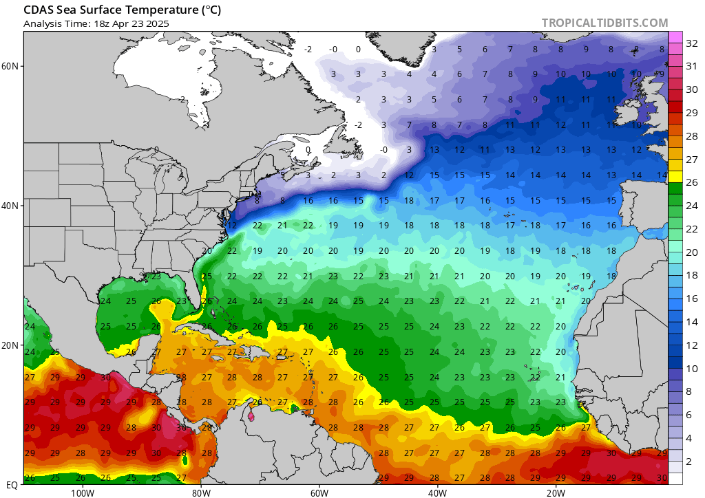
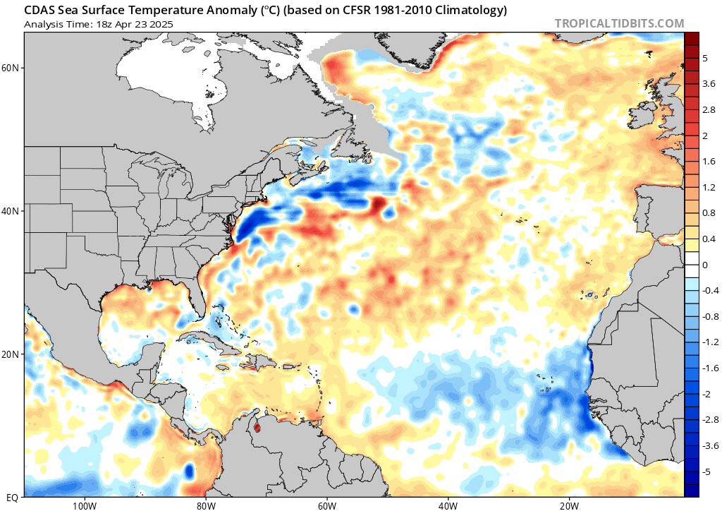
Plenty of unseasonably warm water to support a significant storm. Especially near thr coast.
0 likes
-
AxaltaRacing24
- Category 5

- Posts: 1774
- Age: 25
- Joined: Wed Jul 27, 2016 11:14 am
- Location: Jupiter, FL
Re: ATL: FLORENCE - Models
txwatcher91 wrote:CMC looks like a NC hit this run.
These models just did not back down on this scenario today. Hopefully, that changes.
Last edited by AxaltaRacing24 on Wed Sep 05, 2018 11:19 pm, edited 1 time in total.
0 likes
- tarheelprogrammer
- S2K Supporter

- Posts: 1793
- Joined: Mon Mar 28, 2016 9:25 pm
- Location: Raleigh, NC area (Garner, NC)
Re: ATL: FLORENCE - Models
Aric Dunn wrote:tarheelprogrammer wrote:Aric Dunn wrote:Florence just nailed with some pretty heavy shear. nearly opened up the SW eye in like a 4 hour period. should weaken a good deal. that may help it turn sooner.
anyone check the intensity on the UKMET. did it have a weaker hurricane ?
Why would it turn sooner to the N if it is weaker?
to the west not north..
Oh, okay thanks.
0 likes
My posts are not official forecasts. They are just my opinion and may or may not be backed by sound meteorological data. They are NOT endorsed by any professional institution or storm2k.org. For official information, please refer to the NHC and NWS products.
-
WilmingtonSandbar
- S2K Supporter

- Posts: 505
- Joined: Sun Aug 29, 2010 12:11 pm
- Location: Southport, NC
Re: ATL: FLORENCE - Models
Looks like that high that is hanging out over New York and bringing all the heat is betraying them and moving out. Leaving a weakness for Florence to go into. If it doesn't recurve, this run looks like it could be bad for them again.
1 likes
Diana X2 (look it up), Bertha, Fran, Bonnie, Floyd, Dennis, Charley, Ophelia, Ernesto, Irene, Matthew, And Florence
- SFLcane
- S2K Supporter

- Posts: 10281
- Age: 48
- Joined: Sat Jun 05, 2010 1:44 pm
- Location: Lake Worth Florida
Re: ATL: FLORENCE - Models
Aric Dunn wrote:Florence just nailed with some pretty heavy shear. nearly opened up the SW eye in like a 4 hour period. should weaken a good deal. that may help it turn sooner.
anyone check the intensity on the UKMET. did it have a weaker hurricane ?
Yes it did on the 12z run
0 likes
-
PandaCitrus
- Category 1

- Posts: 424
- Joined: Mon Sep 04, 2017 2:44 pm
Re: ATL: FLORENCE - Models
txwatcher91 wrote:CMC looks like a NC hit this run.
There’s a lot more ridging on the CMC compared to the GFS.
1 likes
- Bocadude85
- Category 5

- Posts: 2991
- Age: 39
- Joined: Mon Apr 18, 2005 2:20 pm
- Location: Honolulu,Hi
Re: ATL: FLORENCE - Models
New 0z UKMET ends at 25N 73W moving due west
https://www.sfwmd.gov/weather-radar/hurricane-model-plots
https://www.sfwmd.gov/weather-radar/hurricane-model-plots
0 likes
-
Aric Dunn
- Category 5

- Posts: 21238
- Age: 43
- Joined: Sun Sep 19, 2004 9:58 pm
- Location: Ready for the Chase.
- Contact:
Re: ATL: FLORENCE - Models
Bocadude85 wrote:New 0z UKMET ends at 25N 73W moving due west
https://www.sfwmd.gov/weather-radar/hurricane-model-plots
anyone the ukmet intensity for 00z ?
0 likes
Note: If I make a post that is brief. Please refer back to previous posts for the analysis or reasoning. I do not re-write/qoute what my initial post said each time.
If there is nothing before... then just ask
Space & Atmospheric Physicist, Embry-Riddle Aeronautical University,
I believe the sky is falling...
If there is nothing before... then just ask
Space & Atmospheric Physicist, Embry-Riddle Aeronautical University,
I believe the sky is falling...
- Hypercane_Kyle
- Category 5

- Posts: 3465
- Joined: Sat Mar 07, 2015 7:58 pm
- Location: Cape Canaveral, FL
Re: ATL: FLORENCE - Models
Oh, so it's going to be one of those pure horror runs, then. Good thing it's still 174 hours out.
Last edited by Hypercane_Kyle on Wed Sep 05, 2018 11:25 pm, edited 1 time in total.
4 likes
My posts are my own personal opinion, defer to the National Hurricane Center (NHC) and other NOAA products for decision making during hurricane season.
-
PandaCitrus
- Category 1

- Posts: 424
- Joined: Mon Sep 04, 2017 2:44 pm
Re: ATL: FLORENCE - Models
New 0z UKMET ends at 25N 73W moving due west
UKMET is basically a Hurricane Andrew Part II scenario.
1 likes
- SFLcane
- S2K Supporter

- Posts: 10281
- Age: 48
- Joined: Sat Jun 05, 2010 1:44 pm
- Location: Lake Worth Florida
Re: ATL: FLORENCE - Models
Bocadude85 wrote:New 0z UKMET ends at 25N 73W moving due west
https://www.sfwmd.gov/weather-radar/hurricane-model-plots
Woah....
0 likes
- Hurricaneman
- Category 5

- Posts: 7404
- Age: 45
- Joined: Tue Aug 31, 2004 3:24 pm
- Location: central florida
Re: ATL: FLORENCE - Models
Hypercane_Kyle wrote:Oh, so it's going to be one of those pure horror runs, then.
This may be if the GFS is right the worst hurricane New England has seen since 1938 but as always this solution could change
1 likes
Who is online
Users browsing this forum: No registered users and 129 guests


