ATL: INVEST 94L - Discussion

Moderator: S2k Moderators

Message
Author
Ken711
Category 5
Category 5
Posts: 1064
Joined: Tue Aug 28, 2012 12:48 pm

Re: ATL: INVEST 94L - Discussion

#101 Postby Ken711 » Fri Sep 06, 2019 8:15 pm

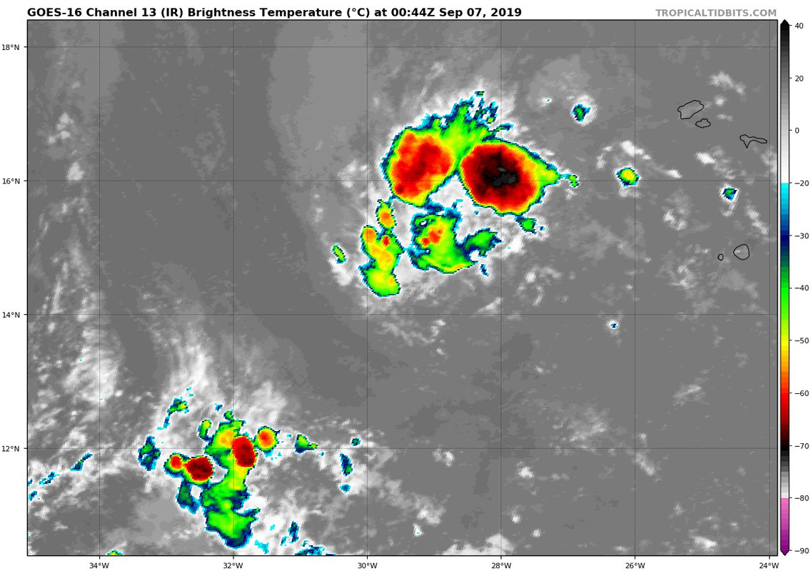
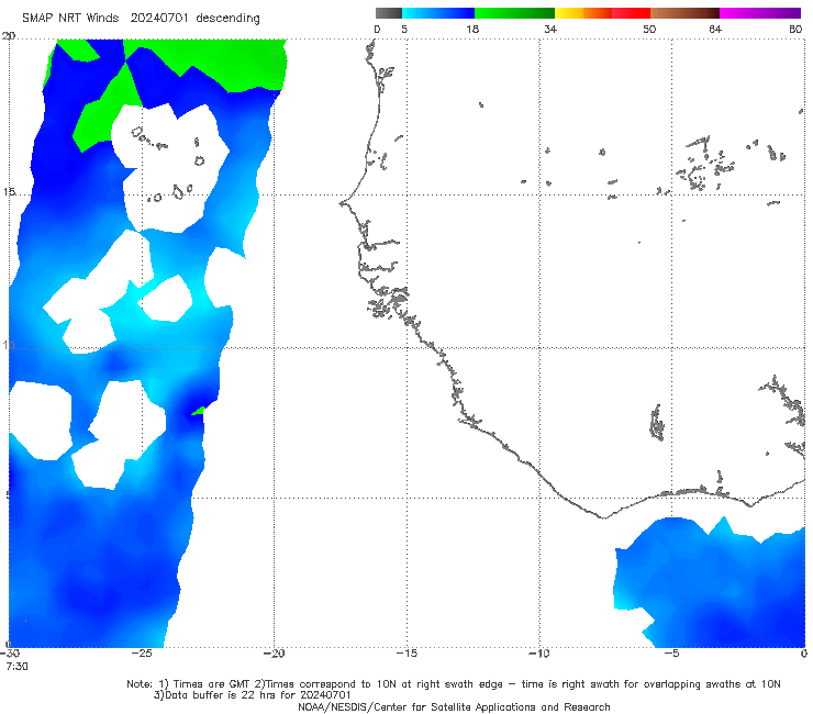
gatorcane wrote:I can certainly see why the GFS shows this invest getting squashed by the next wave rolling off Africa :eek:

And the name Imelda is about as bad as Irma

https://i.postimg.cc/hGgKvzbX/goes16-ir-eatl-201909062034.jpg


Don't need another I storm like Irma that's for sure.
2 likes   

User avatar
gatorcane
S2K Supporter
S2K Supporter
Posts: 23499
Age: 46
Joined: Sun Mar 13, 2005 3:54 pm
Location: Boca Raton, FL

Re: ATL: INVEST 94L - Discussion

#102 Postby gatorcane » Fri Sep 06, 2019 8:39 pm

Convection is increasing and it is losing latitude:

Image

Path of deceasing shear lies ahead:

Image
6 likes   

User avatar
Abdullah
Category 1
Category 1
Posts: 285
Joined: Sat Sep 08, 2018 4:28 pm
Location: Miramar, FL

Re: ATL: INVEST 94L - Discussion

#103 Postby Abdullah » Fri Sep 06, 2019 8:45 pm

TheStormExpert wrote:
DioBrando wrote:
bqknight wrote:Convection is firing a bit now actually. The wave behind it is coming offshore too now. Would be surprised if one of the two don't develop.

I'm wondering if:
1) 94L becomes Imelda due to slow development and the wave behind it becomes Humberto instead
2) Twin majors

I think 94L becomes Humberto, and the future 95L (wave behind it) becomes the infamous “I” storm Imelda. Humberto is weak and short-lived while Imelda becomes a significant storm, just my two cents.


I think it'll be more of the other way around, with Humberto becoming a stronger storm, and Imelda being weaker. The reason "I" storms are infamous is because statistics help their number. In this season, we haven't had so many storms. The peak of the hurricane season is only in 4 days, so I think "H" might get it this time.
2 likes   

User avatar
DioBrando
Category 4
Category 4
Posts: 917
Age: 27
Joined: Sun Aug 12, 2018 12:45 pm

Re: ATL: INVEST 94L - Discussion

#104 Postby DioBrando » Fri Sep 06, 2019 8:50 pm

Abdullah wrote:
TheStormExpert wrote:
DioBrando wrote:I'm wondering if:
1) 94L becomes Imelda due to slow development and the wave behind it becomes Humberto instead
2) Twin majors

I think 94L becomes Humberto, and the future 95L (wave behind it) becomes the infamous “I” storm Imelda. Humberto is weak and short-lived while Imelda becomes a significant storm, just my two cents.


I think it'll be more of the other way around, with Humberto becoming a stronger storm, and Imelda being weaker. The reason "I" storms are infamous is because statistics help their number. In this season, we haven't had so many storms. The peak of the hurricane season is only in 4 days, so I think "H" might get it this time.

I'm totally agreeing with you on this.
1 likes   
blonde stacey (xe/xem/xir)

User avatar
FireRat
Category 5
Category 5
Posts: 1151
Age: 37
Joined: Sun Sep 26, 2010 11:38 pm
Location: North Carolina

Re: ATL: INVEST 94L - Discussion

#105 Postby FireRat » Fri Sep 06, 2019 11:38 pm

I second that thought as well, 'H' might have its chance. Crazy how the big one this year was the 'D'. Very hard to see another beast like the D word this year, hopefully.
2 likes   
Georges '98, Irene '99, Frances '04, Jeanne '04, Katrina '05, Wilma '05, Gustav '08, Isaac '12, Matthew '16, Florence '18, Michael '18, Ian '22

Aric Dunn
Category 5
Category 5
Posts: 21228
Age: 41
Joined: Sun Sep 19, 2004 9:58 pm
Location: Ready for the Chase.
Contact:

Re: ATL: INVEST 94L - Discussion

#106 Postby Aric Dunn » Sat Sep 07, 2019 1:43 am

Models are clearly not doing well with the actual systems right now.. This same thing happened with dorian.. they kept trying to merge it and trap it in the ITCZ among other issues... .

The one thing different here is that 94L is a very distinct system already separated from the ITCZ.


Its is very likey that convection continues to pulse slowing gaining in coverage over the next 48hrs at which point we will all be looking and waiting for the NHC to upgrade it.
9 likes   
Note: If I make a post that is brief. Please refer back to previous posts for the analysis or reasoning. I do not re-write/qoute what my initial post said each time.
If there is nothing before... then just ask :)

Space & Atmospheric Physicist, Embry-Riddle Aeronautical University,
I believe the sky is falling...

sma10
Category 5
Category 5
Posts: 1709
Joined: Tue Aug 02, 2005 1:13 pm

Re: ATL: INVEST 94L - Discussion

#107 Postby sma10 » Sat Sep 07, 2019 1:55 am

Aric Dunn wrote:Models are clearly not doing well with the actual systems right now.. This same thing happened with dorian.. they kept trying to merge it and trap it in the ITCZ among other issues... .

The one thing different here is that 94L is a very distinct system already separated from the ITCZ.


Its is very likey that convection continues to pulse slowing gaining in coverage over the next 48hrs at which point we will all be looking and waiting for the NHC to upgrade it.


Aric, i agree that this has a very high chance, but we might have to wait several days for it to come together. But while we're staring way out there, what do you think about that sneak attack forming in the bahamas in a few days?
2 likes   

User avatar
SFLcane
S2K Supporter
S2K Supporter
Posts: 9627
Age: 46
Joined: Sat Jun 05, 2010 1:44 pm
Location: Lake Worth Florida

Re: ATL: INVEST 94L - Discussion

#108 Postby SFLcane » Sat Sep 07, 2019 6:36 am

Looking pretty good this morning despite all the model support has dropped.
0 likes   

User avatar
GCANE
S2K Supporter
S2K Supporter
Posts: 10787
Joined: Mon Oct 22, 2007 8:03 am

Re: ATL: INVEST 94L - Discussion

#109 Postby GCANE » Sat Sep 07, 2019 7:18 am

Latest WINDSAT, CIMSS 850mb Vort, Earth Nullschool Surface Winds.

Image

Image

Image
1 likes   

User avatar
GCANE
S2K Supporter
S2K Supporter
Posts: 10787
Joined: Mon Oct 22, 2007 8:03 am

Re: ATL: INVEST 94L - Discussion

#110 Postby GCANE » Sat Sep 07, 2019 7:25 am

Moderate mid-level dry air, 15 knt shear.
Massive TPW pool.
Need to wait until about 50W before it does anything.
If it does, it could be a killer.

Image

Image
2 likes   

User avatar
Abdullah
Category 1
Category 1
Posts: 285
Joined: Sat Sep 08, 2018 4:28 pm
Location: Miramar, FL

Re: ATL: INVEST 94L - Discussion

#111 Postby Abdullah » Sat Sep 07, 2019 7:29 am

That looks like the right side of the storm being centered around 14°N 25.5°W on this ASCAT pass
Image
0 likes   

User avatar
Buck
Category 5
Category 5
Posts: 1128
Joined: Fri Sep 10, 2004 12:04 pm
Location: Atlanta, GA

Re: ATL: INVEST 94L - Discussion

#112 Postby Buck » Sat Sep 07, 2019 7:31 am

1. A broad area of low pressure associated with a tropical wave is
producing disorganized showers and thunderstorms a few hundred
miles west of the Cabo Verde Islands. Gradual development of this
system is possible, and a tropical depression could form by the
middle of next week while the system moves westward across the
eastern and central tropical Atlantic Ocean.
* Formation chance through 48 hours...low...10 percent.
* Formation chance through 5 days...medium...60 percent.
2 likes   

User avatar
Abdullah
Category 1
Category 1
Posts: 285
Joined: Sat Sep 08, 2018 4:28 pm
Location: Miramar, FL

Re: ATL: INVEST 94L - Discussion

#113 Postby Abdullah » Sat Sep 07, 2019 7:33 am

WindSAT also shows a, what seems to me as, a healthy NorthWestern Side. It looks as if it's almost closed off
Image
1 likes   

User avatar
Abdullah
Category 1
Category 1
Posts: 285
Joined: Sat Sep 08, 2018 4:28 pm
Location: Miramar, FL

Re: ATL: INVEST 94L - Discussion

#114 Postby Abdullah » Sat Sep 07, 2019 7:35 am

SMAP seems to be going the opposite direction with this thing...
Image
0 likes   

User avatar
Abdullah
Category 1
Category 1
Posts: 285
Joined: Sat Sep 08, 2018 4:28 pm
Location: Miramar, FL

Re: ATL: INVEST 94L - Discussion

#115 Postby Abdullah » Sat Sep 07, 2019 7:36 am

ASMR also begs to differ
Image
0 likes   

User avatar
GCANE
S2K Supporter
S2K Supporter
Posts: 10787
Joined: Mon Oct 22, 2007 8:03 am

Re: ATL: INVEST 94L - Discussion

#116 Postby GCANE » Sat Sep 07, 2019 8:51 am

UKMET & GFS had this initialized yesterday.
CMC initializes this today.
All tracking straight west.
A bit puzzled the long-term prob was dropped a notch.
0 likes   

User avatar
GCANE
S2K Supporter
S2K Supporter
Posts: 10787
Joined: Mon Oct 22, 2007 8:03 am

Re: ATL: INVEST 94L - Discussion

#117 Postby GCANE » Sat Sep 07, 2019 9:07 am

CCKW looks favorable now, but forecast to go down hill quickly.

Image

Image
1 likes   

crm6360
Tropical Depression
Tropical Depression
Posts: 57
Joined: Thu Aug 09, 2007 10:46 pm

Re: ATL: INVEST 94L - Discussion

#118 Postby crm6360 » Sat Sep 07, 2019 9:09 am

GCANE wrote:Moderate mid-level dry air, 15 knt shear.
Massive TPW pool.
Need to wait until about 50W before it does anything.
If it does, it could be a killer.

Statements like these are unnecessary when we don’t even have a developing system. The world could end tomorrow, too.
1 likes   

hipshot
Category 1
Category 1
Posts: 468
Joined: Tue Jul 06, 2010 9:18 pm
Location: Dallas, Texas

Re: ATL: INVEST 94L - Discussion

#119 Postby hipshot » Sat Sep 07, 2019 9:12 am

GCANE wrote:CCKW looks favorable now, but forecast to go down hill quickly.

https://i.imgur.com/0MaLdSF.png

https://i.imgur.com/PqiNeBI.png


Could you give me a laymen's explanation of what these last 4 images mean. I haven't seen these before.
Thks.
1 likes   

User avatar
cycloneye
Admin
Admin
Posts: 139601
Age: 67
Joined: Thu Oct 10, 2002 10:54 am
Location: San Juan, Puerto Rico

Re: ATL: INVEST 94L - Discussion

#120 Postby cycloneye » Sat Sep 07, 2019 9:20 am

ASCAT has a fairly well defined circulation but is on the SE part due to some shear.

Image
3 likes   
Visit the Caribbean-Central America Weather Thread where you can find at first post web cams,radars
and observations from Caribbean basin members Click Here


Return to “2019”

Who is online

Users browsing this forum: No registered users and 6 guests