ATL: DORIAN - Post-Tropical - Discussion
Moderator: S2k Moderators
-
AutoPenalti
- Category 5

- Posts: 4091
- Age: 29
- Joined: Mon Aug 17, 2015 4:16 pm
- Location: Ft. Lauderdale, Florida
Re: ATL: DORIAN - Tropical Storm - Discussion
What has impressed me the most is that the cloud structure, with that buzz-saw look, is so well defined that it will only take just a bit of moisture and relaxing shear for it to rapidly intensify.
Last edited by AutoPenalti on Tue Aug 27, 2019 9:40 am, edited 1 time in total.
0 likes
The posts in this forum are NOT official forecasts and should not be used as such. They are just the opinion of the poster and may or may not be backed by sound meteorological data. They are NOT endorsed by any professional institution or STORM2K. For official information, please refer to products from the NHC and NWS.
Model Runs Cheat Sheet:
GFS (5:30 AM/PM, 11:30 AM/PM)
HWRF, GFDL, UKMET, NAVGEM (6:30-8:00 AM/PM, 12:30-2:00 AM/PM)
ECMWF (1:45 AM/PM)
TCVN is a weighted averaged
-
Aric Dunn
- Category 5
- Posts: 21238
- Age: 43
- Joined: Sun Sep 19, 2004 9:58 pm
- Location: Ready for the Chase.
- Contact:
Re: ATL: DORIAN - Tropical Storm - Discussion
panamatropicwatch wrote:Correct its not a reforming in the normal sense. But rather from being disrupted by the various peaks as discussed esrlier.
Localized drops in pressure caused the center to "morph" rather than an actual reform. Its not a coincidence that it is west of martinique either.
Aric, according to the map I am looking at the HH has the center west of St. Lucia the island just south of Martinique.
http://tropicwatch.info/dorian082720191424.jpg
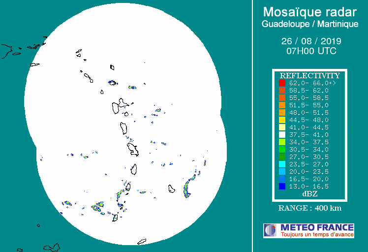
Not for long.. check radar. And look closer at the surface obs.. its forming.. and or formed west of martinique.
It is very clear.
1 likes
Note: If I make a post that is brief. Please refer back to previous posts for the analysis or reasoning. I do not re-write/qoute what my initial post said each time.
If there is nothing before... then just ask
Space & Atmospheric Physicist, Embry-Riddle Aeronautical University,
I believe the sky is falling...
If there is nothing before... then just ask
Space & Atmospheric Physicist, Embry-Riddle Aeronautical University,
I believe the sky is falling...
-
Aric Dunn
- Category 5
- Posts: 21238
- Age: 43
- Joined: Sun Sep 19, 2004 9:58 pm
- Location: Ready for the Chase.
- Contact:
Re: ATL: DORIAN - Tropical Storm - Discussion
Radar is looking 10 times more impressive.. keep watch now..
5 likes
Note: If I make a post that is brief. Please refer back to previous posts for the analysis or reasoning. I do not re-write/qoute what my initial post said each time.
If there is nothing before... then just ask
Space & Atmospheric Physicist, Embry-Riddle Aeronautical University,
I believe the sky is falling...
If there is nothing before... then just ask
Space & Atmospheric Physicist, Embry-Riddle Aeronautical University,
I believe the sky is falling...
-
SFLcane

- S2K Supporter

- Posts: 10281
- Age: 48
- Joined: Sat Jun 05, 2010 1:44 pm
- Location: Lake Worth Florida
Re: ATL: DORIAN - Tropical Storm - Discussion
So it emerges from the caribbean but never makes to hurricane status before FL.. Maybe conditions are not that favorable afterall in the bahamas
0 likes
-
tropicwatch

- Category 5
- Posts: 3426
- Age: 62
- Joined: Sat Jun 02, 2007 10:01 am
- Location: Panama City Florida
- Contact:
Re: ATL: DORIAN - Tropical Storm - Discussion
Aric Dunn wrote:panamatropicwatch wrote:Correct its not a reforming in the normal sense. But rather from being disrupted by the various peaks as discussed esrlier.
Localized drops in pressure caused the center to "morph" rather than an actual reform. Its not a coincidence that it is west of martinique either.
Aric, according to the map I am looking at the HH has the center west of St. Lucia the island just south of Martinique.
http://tropicwatch.info/dorian082720191424.jpg
Not for long.. check radar. And look closer at the surface obs.. its forming.. and or formed west of martinique.
It is very clear.
Yep I see it
1 likes
Tropicwatch
Agnes 72', Eloise 75, Elena 85', Kate 85', Charley 86', Florence 88', Beryl 94', Dean 95', Erin 95', Opal 95', Earl 98', Georges 98', Ivan 2004', Arlene 2005', Dennis 2005', Ida 2009' Debby 2012' Irma 2017' Michael 2018'
Agnes 72', Eloise 75, Elena 85', Kate 85', Charley 86', Florence 88', Beryl 94', Dean 95', Erin 95', Opal 95', Earl 98', Georges 98', Ivan 2004', Arlene 2005', Dennis 2005', Ida 2009' Debby 2012' Irma 2017' Michael 2018'
-
AxaltaRacing24
- Category 5
- Posts: 1774
- Age: 25
- Joined: Wed Jul 27, 2016 11:14 am
- Location: Jupiter, FL
Re: ATL: DORIAN - Tropical Storm - Discussion
SFLcane wrote:So it emerges from the caribbean but never makes to hurricane status before FL.. Maybe conditions are not that favorable afterall in the bahamas
They are favorable. But the nhc is being extremely conservative. Warm waters, low shear, and much less dry air. But we cannot make calls on final intensity when the storm hasn’t even gotten there yet. could be anywhere from a weak ts or a major.
Last edited by AxaltaRacing24 on Tue Aug 27, 2019 9:47 am, edited 1 time in total.
3 likes
-
Evil Jeremy

- S2K Supporter
- Posts: 5463
- Age: 32
- Joined: Mon Apr 10, 2006 2:10 pm
- Location: Los Angeles, CA
Re: ATL: DORIAN - Tropical Storm - Discussion
SFLcane wrote:So it emerges from the caribbean but never makes to hurricane status before FL.. Maybe conditions are not that favorable afterall in the bahamas
Are you referring to the current NHC intensity forecast? If this makes it past Hispaniola with some kind of structure, with 48+ hours over the Gulf Stream, I wouldn't bank on this staying a Tropical Storm. From the NHC perspective though, there's too many short term variables to confidently forecast a Hurricane. It really will come down to interaction with Hispaniola over the next 36 hours. I haven't seen any meteorologists suggest unfavorable conditions in the Bahamas.
3 likes
Frances 04 / Jeanne 04 / Katrina 05 / Wilma 05 / Fay 08 / Debby 12 / Andrea 13 / Colin 16 / Hermine 16 / Matthew 16 / Irma 17
-
SFLcane
- S2K Supporter
- Posts: 10281
- Age: 48
- Joined: Sat Jun 05, 2010 1:44 pm
- Location: Lake Worth Florida
Re: ATL: DORIAN - Tropical Storm - Discussion
AxaltaRacing24 wrote:SFLcane wrote:So it emerges from the caribbean but never makes to hurricane status before FL.. Maybe conditions are not that favorable afterall in the bahamas
They are favorable. But the nhc is being extremely conservative. Warm waters, low shear, and much less dry air. But we cannot make calls on final intensity when the storm hasn’t even gotten there yet. could be anywhere from a weak ts or a major.
Yeah I am not sure I agree with that intensity forecast. If it doesn't die (big if), should intensify more in the Bahamas
1 likes
-
eastcoastFL

- Category 5
- Posts: 3996
- Age: 44
- Joined: Thu Apr 12, 2007 12:29 pm
- Location: Palm City, FL
Re: ATL: DORIAN - Tropical Storm - Discussion
My local forecast
SaturdayTropical storm conditions possible. Showers and thunderstorms likely. Partly sunny, with a high near 87. Chance of precipitation is 60%.
Saturday NightShowers and thunderstorms likely. Mostly cloudy, with a low around 77. Windy, with an east wind 10 to 20 mph becoming north 25 to 35 mph in the evening. Winds could gust as high as 50 mph. Chance of precipitation is 60%.
0 likes
Personal Forecast Disclaimer:
The posts in this forum are NOT official forecast and should not be used as such. They are just the opinion of the poster and may or may not be backed by sound meteorological data. They are NOT endorsed by any professional institution or storm2k.org. For official information, please refer to the NHC and NWS products.
The posts in this forum are NOT official forecast and should not be used as such. They are just the opinion of the poster and may or may not be backed by sound meteorological data. They are NOT endorsed by any professional institution or storm2k.org. For official information, please refer to the NHC and NWS products.
-
AxaltaRacing24
- Category 5
- Posts: 1774
- Age: 25
- Joined: Wed Jul 27, 2016 11:14 am
- Location: Jupiter, FL
Re: ATL: DORIAN - Tropical Storm - Discussion
SFLcane wrote:AxaltaRacing24 wrote:SFLcane wrote:So it emerges from the caribbean but never makes to hurricane status before FL.. Maybe conditions are not that favorable afterall in the bahamas
They are favorable. But the nhc is being extremely conservative. Warm waters, low shear, and much less dry air. But we cannot make calls on final intensity when the storm hasn’t even gotten there yet. could be anywhere from a weak ts or a major.
Yeah I am not sure I agree with that intensity forecast. If it doesn't die (big if), should intensify more in the Bahamas
I feel that they are keeping intensity low due to the uncertainty. If it survives Hispaniola looking decently alive, then this will likely become at least a cat 1 hurricane
1 likes
-
otowntiger
- Category 5
- Posts: 1932
- Joined: Tue Aug 31, 2004 7:06 pm
Re: ATL: DORIAN - Tropical Storm - Discussion
Agreed. It would require a very unlikely rapid intensification cycle at some point in the Caribbean or Bahamas for anything similar to occur. IN my opinion of course.Frank2 wrote:This is definityely NOT an Irma or Maria - both were intense hurricanes at this point in their track: http://bmcnoldy.rsmas.miami.edu/tropics ... t-guad.gif
0 likes

Re: ATL: DORIAN - Tropical Storm - Discussion
So are those NE to SW winds part of the shear it's about to track into?
https://weather.cod.edu/satrad/?parms=meso-meso2-13-48-1-100-1&checked=map&colorbar=undefined
https://weather.cod.edu/satrad/?parms=meso-meso2-13-48-1-100-1&checked=map&colorbar=undefined
0 likes
Personal Forecast Disclaimer:
The posts in this forum are NOT official forecast and should not be used as such. They are just the opinion of the poster and may or may not be backed by sound meteorological data. They are NOT endorsed by any professional institution or storm2k.org. For official information, please refer to the NHC and NWS products.
The posts in this forum are NOT official forecast and should not be used as such. They are just the opinion of the poster and may or may not be backed by sound meteorological data. They are NOT endorsed by any professional institution or storm2k.org. For official information, please refer to the NHC and NWS products.
-
TheStormExpert
Re: ATL: DORIAN - Tropical Storm - Discussion
Snippet from the 11am discussion concerning the large uncertainty in intensity in the 4-5 day range. 
However, the models continue to
indicate that the upper-level flow pattern and shear conditions are
expected to remain favorable for strengthening throughout the
forecast period, so it is uncertain why the dynamical models are not
showing more development and strengthening when compared to the more
robust statistical SHIPS intensity models, especially at days 4 and
5 when Dorian will be moving over SSTs greater than 29 deg C and
into a fairly moist environment. For now, the official intensity
forecast remains basically midway between the stronger SHIPS model
and the much weaker global and regional models. Given the large
spread in the guidance, there is lower than normal confidence in the
intensity forecast, especially on days 4 an 5.
2 likes
-
kevin mathis

- Tropical Depression

- Posts: 56
- Joined: Tue Sep 20, 2005 9:39 pm
- Location: Tampa Bay
Re: ATL: DORIAN - Tropical Storm - Discussion
SFLcane wrote:AxaltaRacing24 wrote:SFLcane wrote:So it emerges from the caribbean but never makes to hurricane status before FL.. Maybe conditions are not that favorable afterall in the bahamas
They are favorable. But the nhc is being extremely conservative. Warm waters, low shear, and much less dry air. But we cannot make calls on final intensity when the storm hasn’t even gotten there yet. could be anywhere from a weak ts or a major.
Yeah I am not sure I agree with that intensity forecast. If it doesn't die (big if), should intensify more in the Bahamas
Let us not forget...The NHC, by there own admission, struggles with intensity. They were chasing Michael the whole time. Originally forecast to be just a TS at landfall. Then they chased the intensity up and up as the storm ran past their prediction. They are great scientist, but they speak of even their own limitations in forecasting mother nature.
4 likes
-
toad strangler

- S2K Supporter
- Posts: 4546
- Joined: Sun Jul 28, 2013 3:09 pm
- Location: Earth
- Contact:
-
northjaxpro

- S2K Supporter
- Posts: 8900
- Joined: Mon Sep 27, 2010 11:21 am
- Location: Jacksonville, FL
Re: ATL: DORIAN - Tropical Storm - Discussion
It is now official, as of the 11 a.m. advisory from NHC the entire Florida East Coast is now in the cone of uncertainty.
3 likes
NEVER, EVER SAY NEVER in the tropics and weather in general, and most importantly, with life itself!!
________________________________________________________________________________________
Fay 2008 Beryl 2012 Debby 2012 Colin 2016 Hermine 2016 Julia 2016 Matthew 2016 Irma 2017 Dorian 2019
________________________________________________________________________________________
Fay 2008 Beryl 2012 Debby 2012 Colin 2016 Hermine 2016 Julia 2016 Matthew 2016 Irma 2017 Dorian 2019
-
stormhunter7

- Category 2

- Posts: 763
- Joined: Mon May 26, 2008 3:13 pm
- Location: Panama City Beach, Florida
- Contact:
Re: ATL: DORIAN - Tropical Storm - Discussion
Definitely looks like dry air came into center after crossing island. Also notice it's starting to fire feeder bands on southern side.
http://www.barbadosweather.org/Composite/kidbuuComposite_Lionel_displayer.php?Product=Reflectivity&Sector=EC_Bar&Composite=Sabre&ANISP=700&MAPP=1&PlanetOfTheApes=1566917918
http://www.barbadosweather.org/Composite/kidbuuComposite_Lionel_displayer.php?Product=Reflectivity&Sector=EC_Bar&Composite=Sabre&ANISP=700&MAPP=1&PlanetOfTheApes=1566917918
0 likes
The following post is NOT an official forecast and should not be used as such. It is just the opinion of the poster and may or may not be backed by sound meteorological data. It is NOT endorsed by any professional institution including storm2k.org For Official Information please refer to the NHC and NWS products. http://www.nhc.noaa.gov
-
SFLcane
- S2K Supporter
- Posts: 10281
- Age: 48
- Joined: Sat Jun 05, 2010 1:44 pm
- Location: Lake Worth Florida
Re: ATL: DORIAN - Tropical Storm - Discussion
Never really intensifies in the Bahamas considering the fuel and favorable conditions. Not sure the reasoning behind this. A 65mph TS near haiti you would think there was room for further intensification.
0 likes
-
Emmett_Brown

- Category 5
- Posts: 1433
- Joined: Wed Aug 24, 2005 9:10 pm
- Location: Sarasota FL
Re: ATL: DORIAN - Tropical Storm - Discussion
northjaxpro wrote:It is now official, as of the 11 a.m. advisory from NHC the entire Florida East Coast is now in the cone of uncertainty.
We've been coned!!
7 likes
-
SouthFLTropics

- Category 5
- Posts: 4258
- Age: 50
- Joined: Thu Aug 14, 2003 8:04 am
- Location: Port St. Lucie, Florida
Re: ATL: DORIAN - Tropical Storm - Discussion
Just got an alert on my phone from WPTV Channel 5 that said Dorian not expected to become a hurricane. Alerts like that drive me crazy because it just makes the public complacent. Think they might should have added “at this time, but things can change”.
7 likes
Fourth Generation Florida Native
Personal Storm History: David 79, Andrew 92, Erin 95, Floyd 99, Irene 99, Frances 04, Jeanne 04, Wilma 05, Matthew 16, Irma 17, Ian 22, Nicole 22, Milton 24
Personal Storm History: David 79, Andrew 92, Erin 95, Floyd 99, Irene 99, Frances 04, Jeanne 04, Wilma 05, Matthew 16, Irma 17, Ian 22, Nicole 22, Milton 24
Who is online
Users browsing this forum: No registered users and 7 guests