Texashawk wrote:I guess I’m still a little concerned in Texas since my met explained that the trough has lessened its effect and if Barry gets a lot stronger then the high pressure to the east which has been the dominant steering mechanism will be less so. Now that it finaly seems to be getting its act together, could it still continue on a WNW and affect LC/Golden Triangle more directly?
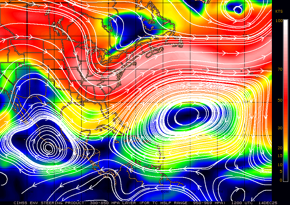
This is very true. the trough door is closed. only thing steering this is the low to mid level ridge to its east because it's stronger then the ridge to its NW.,,,
and if that ridge to the east weakens any then the track will shift probably due west or even SW.