90 hr HWRF: 958 mb Cat 5?
edit was looking at 850 hpa, whoops
ATL: DORIAN - Models
Moderator: S2k Moderators
-
p1nheadlarry

- Category 2

- Posts: 672
- Age: 34
- Joined: Wed Jan 29, 2014 2:42 pm
- Location: SR County FL
Re: ATL: DORIAN - Models
Last edited by p1nheadlarry on Wed Aug 28, 2019 12:58 pm, edited 1 time in total.
0 likes
--;->#GoNoles--;->.
-
lsuhurricane
- Category 1

- Posts: 270
- Joined: Tue Aug 15, 2017 2:53 pm

-
Evil Jeremy

- S2K Supporter

- Posts: 5463
- Age: 32
- Joined: Mon Apr 10, 2006 2:10 pm
- Location: Los Angeles, CA
Re: ATL: DORIAN - Models
mcheer23 wrote:12z GFS ensembles….

Concentrated on South Florida
EDIT: And oh boy, GoM watch out
1 likes
Frances 04 / Jeanne 04 / Katrina 05 / Wilma 05 / Fay 08 / Debby 12 / Andrea 13 / Colin 16 / Hermine 16 / Matthew 16 / Irma 17
-
p1nheadlarry
- Category 2
- Posts: 672
- Age: 34
- Joined: Wed Jan 29, 2014 2:42 pm
- Location: SR County FL
Re: ATL: DORIAN - Models
Seeing those orange plots in the gulf are not cool
2 likes
--;->#GoNoles--;->.

Re: ATL: DORIAN - Models
jdray wrote:tolakram wrote:GFS slows it down, so again a flooding nightmare after the initial hit.
https://i.imgur.com/psPKAle.png
Bad scenario for flooding.
24 hour rainfall totals in NE Florida could be 15+ inches.
My daughter is getting married at 5:30 pm on Sunday in Callahan (NE FL). The Plan is outside for the ceremony and then inside for the reception (we have a Rain Plan - that was to deal with afternoon thunderstorms - not a dang hurricane). Monitoring Dorian closely here. My home flooded with TS Fay in 2018 and Irma in 2018. We are a bit stressed here between wedding prep plus storm prep. I was really liking the recurve scenario that some models were showing yesterday...can we vote that back in? Or maybe have Dorian take his slow sweet time and visit later on Monday?
1 likes
Re: ATL: DORIAN - Models
gatorcane wrote:HWRF and HMON shift south.
Let's see what the Euro says. Not liking the trend for South Florida.
1 likes
-
gatorcane

- S2K Supporter
- Posts: 23708
- Age: 48
- Joined: Sun Mar 13, 2005 3:54 pm
- Location: Boca Raton, FL
Re: ATL: DORIAN - Models
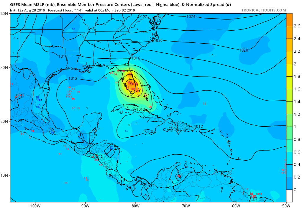
The GFS OP is north of the majority of these ensembles. Could portend more south shifts by the GFS. Alot of those runs are now over Southern Florida.
1 likes
-
AdamFirst

- S2K Supporter
- Posts: 2490
- Age: 36
- Joined: Thu Aug 14, 2008 10:54 am
- Location: Port Saint Lucie, FL
Re: ATL: DORIAN - Models
gatorcane wrote:HWRF and HMON shift south.
I'm curious why the HMON disintegrates the storm. It's pretty much gone when it reaches PBC.
0 likes
Dolphins Marlins Canes Golden Panthers HEAT
Andrew 1992 - Irene 1999 - Frances 2004 - Jeanne 2004 - Wilma 2005 - Fay 2008 - Isaac 2012 - Matthew 2016 - Irma 2017 - Dorian 2019 - Ian 2022 - Nicole 2022 - Milton 2024
Andrew 1992 - Irene 1999 - Frances 2004 - Jeanne 2004 - Wilma 2005 - Fay 2008 - Isaac 2012 - Matthew 2016 - Irma 2017 - Dorian 2019 - Ian 2022 - Nicole 2022 - Milton 2024

Re: ATL: DORIAN - Models
12 HWRF 945 mb into Vero Beach- Melbourne
https://www.tropicaltidbits.com/analysis/models/?model=hwrf®ion=05L&pkg=mslp_pcpn_frzn&runtime=2019082812&fh=96
https://www.tropicaltidbits.com/analysis/models/?model=hwrf®ion=05L&pkg=mslp_pcpn_frzn&runtime=2019082812&fh=96
0 likes
-
Blown Away

- S2K Supporter
- Posts: 10253
- Joined: Wed May 26, 2004 6:17 am
Re: ATL: DORIAN - Models
I’m afraid of the 12z Euro coming up. 
0 likes
Hurricane Eye Experience: David 79, Irene 99, Frances 04, Jeanne 04, Wilma 05… Hurricane Brush Experience: Andrew 92, Erin 95, Floyd 99, Matthew 16, Irma 17, Ian 22, Nicole 22…
-
p1nheadlarry
- Category 2
- Posts: 672
- Age: 34
- Joined: Wed Jan 29, 2014 2:42 pm
- Location: SR County FL
Re: ATL: DORIAN - Models
Blown Away wrote:I’m afraid of the 12z Euro coming up.
Everyone watching with a FL drivers license/Ontario license plate is afraid of the 12z Euro.
7 likes
--;->#GoNoles--;->.
-
StPeteMike

- Category 2
- Posts: 656
- Joined: Thu Jun 07, 2018 11:26 pm
Re: ATL: DORIAN - Models
Blown Away wrote:I’m afraid of the 12z Euro coming up.
I don’t think it’s going to be pretty.
0 likes
The above post is not official and should not be used as such. It is the opinion of the poster and may or may not be backed by sound meteorological data. It is not endorsed by any professional institution or storm2k.org. For official information, please refer to the NHC and NWS products.
-
AdamFirst
- S2K Supporter
- Posts: 2490
- Age: 36
- Joined: Thu Aug 14, 2008 10:54 am
- Location: Port Saint Lucie, FL
Re: ATL: DORIAN - Models

12z EURO initialized
0 likes
Dolphins Marlins Canes Golden Panthers HEAT
Andrew 1992 - Irene 1999 - Frances 2004 - Jeanne 2004 - Wilma 2005 - Fay 2008 - Isaac 2012 - Matthew 2016 - Irma 2017 - Dorian 2019 - Ian 2022 - Nicole 2022 - Milton 2024
Andrew 1992 - Irene 1999 - Frances 2004 - Jeanne 2004 - Wilma 2005 - Fay 2008 - Isaac 2012 - Matthew 2016 - Irma 2017 - Dorian 2019 - Ian 2022 - Nicole 2022 - Milton 2024
-
stauglocal
- Tropical Low

- Posts: 29
- Joined: Fri Jun 03, 2011 8:31 am
Re: ATL: DORIAN - Models
Blown Away wrote:I’m afraid of the 12z Euro coming up.
I think everyone on the east coast of Florida feels the same way.
2 likes
-
AdamFirst
- S2K Supporter
- Posts: 2490
- Age: 36
- Joined: Thu Aug 14, 2008 10:54 am
- Location: Port Saint Lucie, FL
Re: ATL: DORIAN - Models
HWRF has sub 940s heading right for Vero Beach (99hr)...deepening still over the Gulf Stream
0 likes
Dolphins Marlins Canes Golden Panthers HEAT
Andrew 1992 - Irene 1999 - Frances 2004 - Jeanne 2004 - Wilma 2005 - Fay 2008 - Isaac 2012 - Matthew 2016 - Irma 2017 - Dorian 2019 - Ian 2022 - Nicole 2022 - Milton 2024
Andrew 1992 - Irene 1999 - Frances 2004 - Jeanne 2004 - Wilma 2005 - Fay 2008 - Isaac 2012 - Matthew 2016 - Irma 2017 - Dorian 2019 - Ian 2022 - Nicole 2022 - Milton 2024
-
supercane4867
- Category 5

- Posts: 4966
- Joined: Wed Nov 14, 2012 10:43 am
Re: ATL: DORIAN - Models
Rapid deepening over the Gulf Stream on 12z HWRF. Very high-end CAT4
0 likes

Re: ATL: DORIAN - Models
LCfromFL wrote:jdray wrote:tolakram wrote:GFS slows it down, so again a flooding nightmare after the initial hit.
https://i.imgur.com/psPKAle.png
Bad scenario for flooding.
24 hour rainfall totals in NE Florida could be 15+ inches.
My daughter is getting married at 5:30 pm on Sunday in Callahan (NE FL). The Plan is outside for the ceremony and then inside for the reception (we have a Rain Plan - that was to deal with afternoon thunderstorms - not a dang hurricane). Monitoring Dorian closely here. My home flooded with TS Fay in 2018 and Irma in 2018. We are a bit stressed here between wedding prep plus storm prep. I was really liking the recurve scenario that some models were showing yesterday...can we vote that back in? Or maybe have Dorian take his slow sweet time and visit later on Monday?
Can’t imagine how you all feel. Prepare for the worst. Will pray for the best and congrats to you all..
0 likes
-
Aric Dunn
- Category 5
- Posts: 21238
- Age: 43
- Joined: Sun Sep 19, 2004 9:58 pm
- Location: Ready for the Chase.
- Contact:
Re: ATL: DORIAN - Models
Well 12z euro initialized in entirely the wrong spot... grrrr
0 likes
Note: If I make a post that is brief. Please refer back to previous posts for the analysis or reasoning. I do not re-write/qoute what my initial post said each time.
If there is nothing before... then just ask
Space & Atmospheric Physicist, Embry-Riddle Aeronautical University,
I believe the sky is falling...
If there is nothing before... then just ask
Space & Atmospheric Physicist, Embry-Riddle Aeronautical University,
I believe the sky is falling...
Who is online
Users browsing this forum: No registered users and 43 guests