Vdogg wrote:
If it keeps doing that it'll miss the Bahamas slightly to the North.
The core might miss but rain impacts won't.
Moderator: S2k Moderators
Vdogg wrote:
If it keeps doing that it'll miss the Bahamas slightly to the North.

ronyan wrote:Vdogg wrote:
If it keeps doing that it'll miss the Bahamas slightly to the North.
The core might miss but rain impacts won't.


NotSparta wrote:Dorian's likely intensifying again, going for a W ring
https://uploads.disquscdn.com/images/2604554504a18270aff6d231069aee63cdeef8158b86932bbfec1fc30a5469df.gif
hurricaneCW wrote:ronyan wrote:Vdogg wrote:If it keeps doing that it'll miss the Bahamas slightly to the North.
The core might miss but rain impacts won't.
Many models actually have it turning more west over the next 24hrs so they could definitely get the core, certainly the southern eyewall.


NotSparta wrote:Dorian's likely intensifying again, going for a W ring
https://uploads.disquscdn.com/images/2604554504a18270aff6d231069aee63cdeef8158b86932bbfec1fc30a5469df.gif
Kohlecane wrote:Are there any models or maps showing potential Storm surge??

GCANE wrote:https://youtu.be/Hue3IzgkVRA
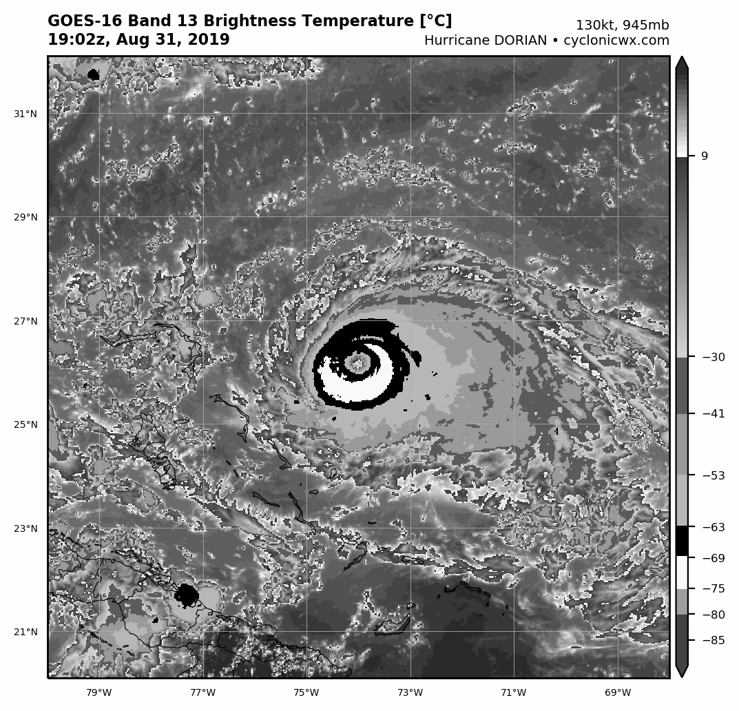
Aric Dunn wrote:Satellite presentation has only improved.. very likely a Cat 5..
chaser1 wrote:Aric Dunn wrote:Satellite presentation has only improved.. very likely a Cat 5..
Agreed. Perhaps has been one for a few hours now


northjaxpro wrote:TheDreamTraveler wrote:I think we're on the cusp of this becoming a category 5 any moment now. Somebody else mentioned that this would be the 4th year in a row with a cat 5 in the atlantic basin too.
I agree. It may be already a Cat 5.
NotSparta wrote:Dorian's likely intensifying again, going for a W ring
https://uploads.disquscdn.com/images/2604554504a18270aff6d231069aee63cdeef8158b86932bbfec1fc30a5469df.gif


Users browsing this forum: No registered users and 35 guests


